Major Hurricane Erick Makes Landfall as a Category 3

Major Hurricane Erick made landfall in extreme western Oaxaca, Mexico on Thursday June 19 around 5:30 am CT. Maximum sustained winds are estimated at 125 mph, with a central pressure of 950 mb.
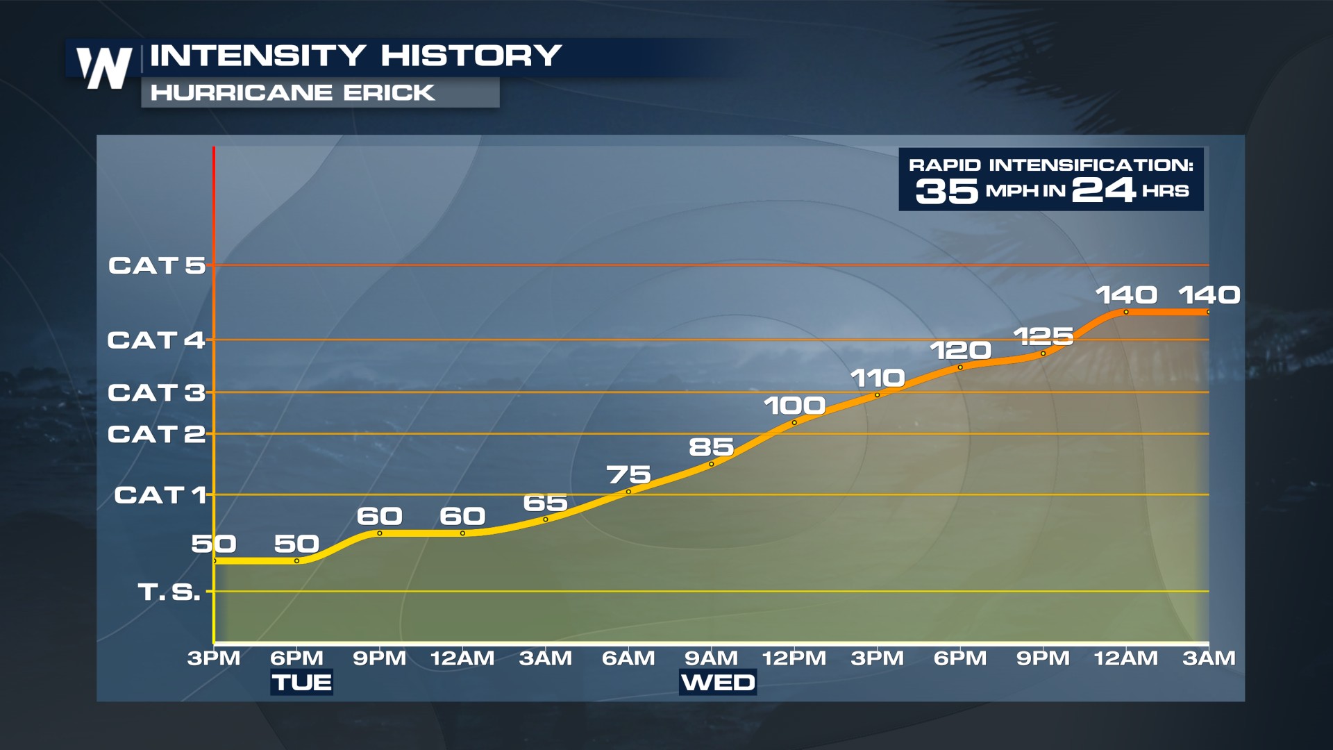
Erick was a category 4 storm as it approached the southern coast of Mexico with winds maxing out at 140 mph. Erick underwent rapid intensification, a term used for storms that increase wind speeds of 35 mph in 24 hours. In 24 hours, Erick increased by 65 mph in 24 hours.
 Erick is a now post tropical system as it continues to bring the threat of more flash flooding and mudslides in Mexico! Some of the moisture from Erick could move northward into the Desert SW next week!
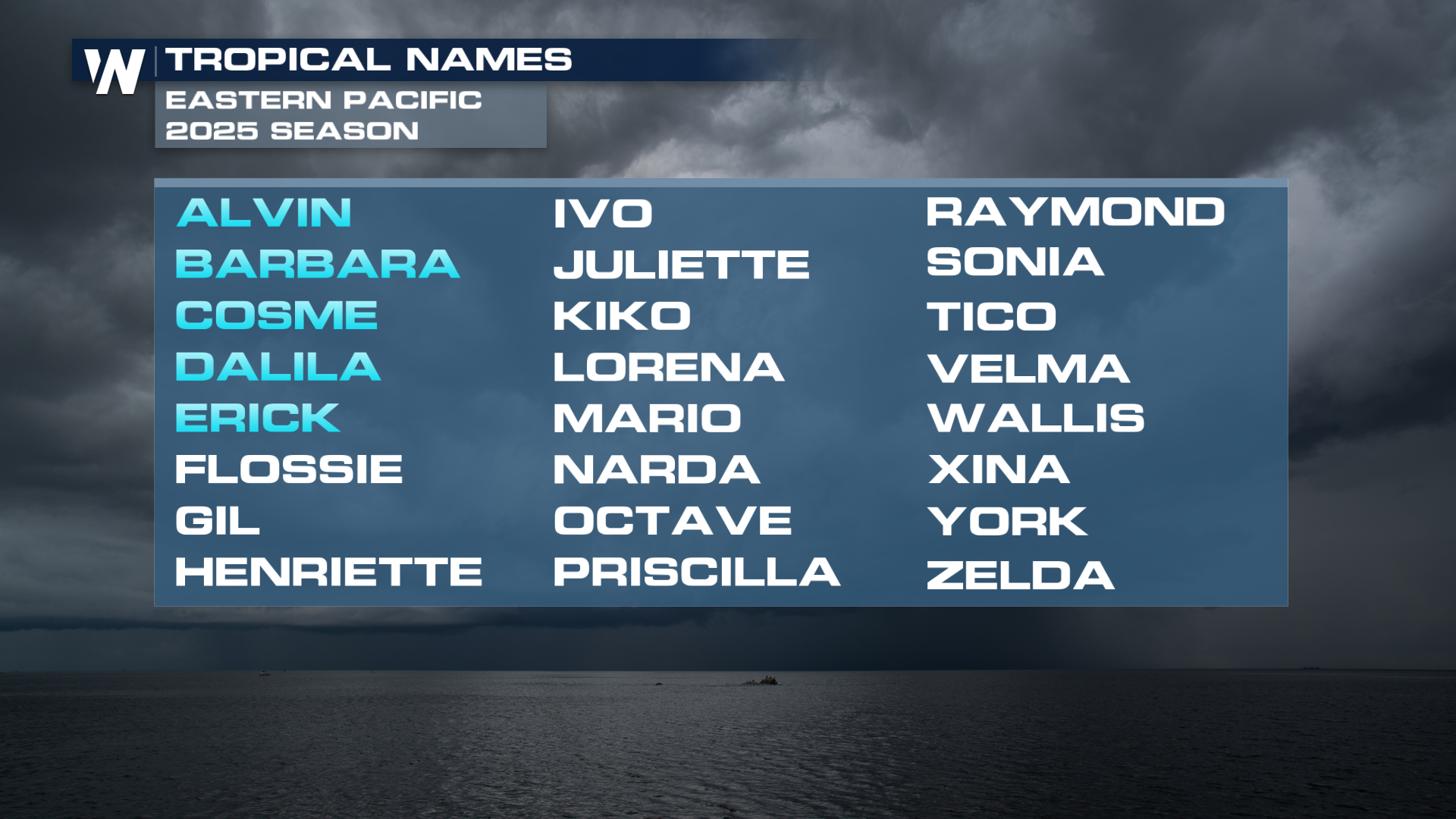 The 2025 Eastern Pacific hurricane season is off to a record-breaking start, with five named storms: Alvin, Barbara, Cosme, Dalila, and now Erick. This level of early activity is well ahead of the seasonal average, which typically sees the first named storm by June 10, the second by June 24, and the third by July 6. Dalila forming on the 13th marked the fastest four storms to be named in the basin since record keeping began, beating 1974, which saw Dolores form by the 14th of June.
ATLANTIC
The Atlantic hurricane season, which began on June 1, has remained quiet with no named storms forming so far. This lack of activity is being attributed to three key atmospheric factors: persistent wind shear, marginally warm water temperatures, and the presence of Saharan dust.
 The Saharan dust, which often travels westward from Africa, can suppress tropical development by introducing dry, stable air into the atmosphere. In addition, wind shear is disrupting the organization of tropical waves and disturbances, preventing them from developing into more significant systems. While sea surface temperatures are warm enough to support storm formation, they are not as favorable as in recent years, further limiting activity.
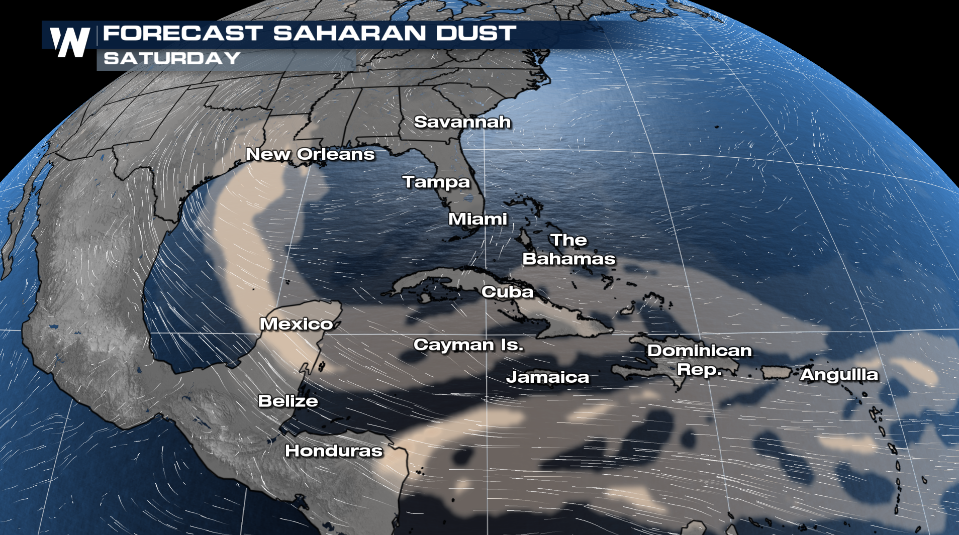
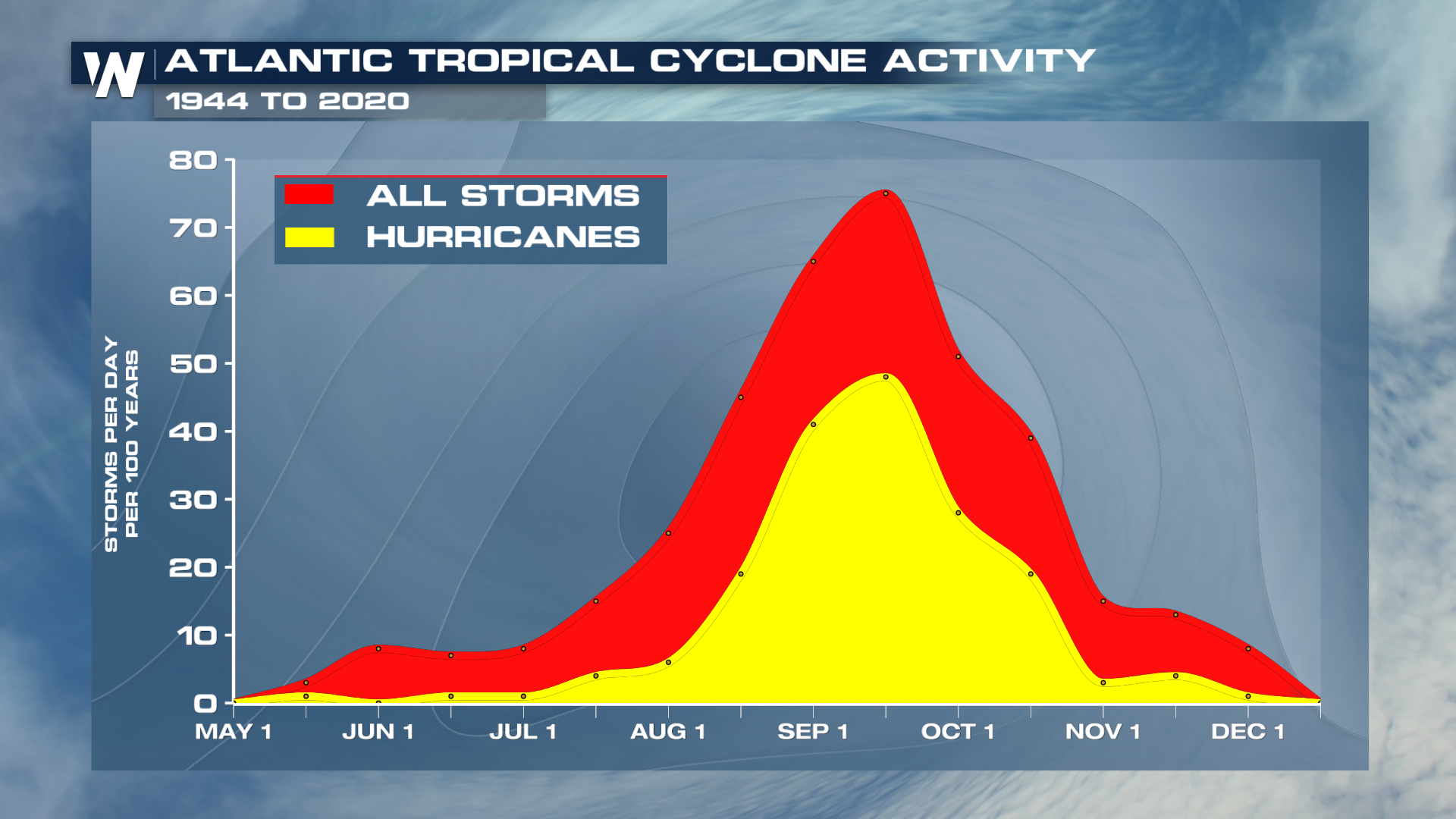
Although the Atlantic is off to a slow start, this is not unusual for June. Historically, tropical activity in the Atlantic does not typically ramp up until later in the summer, particularly in August and September, with the peak occurring around the 15th of September.
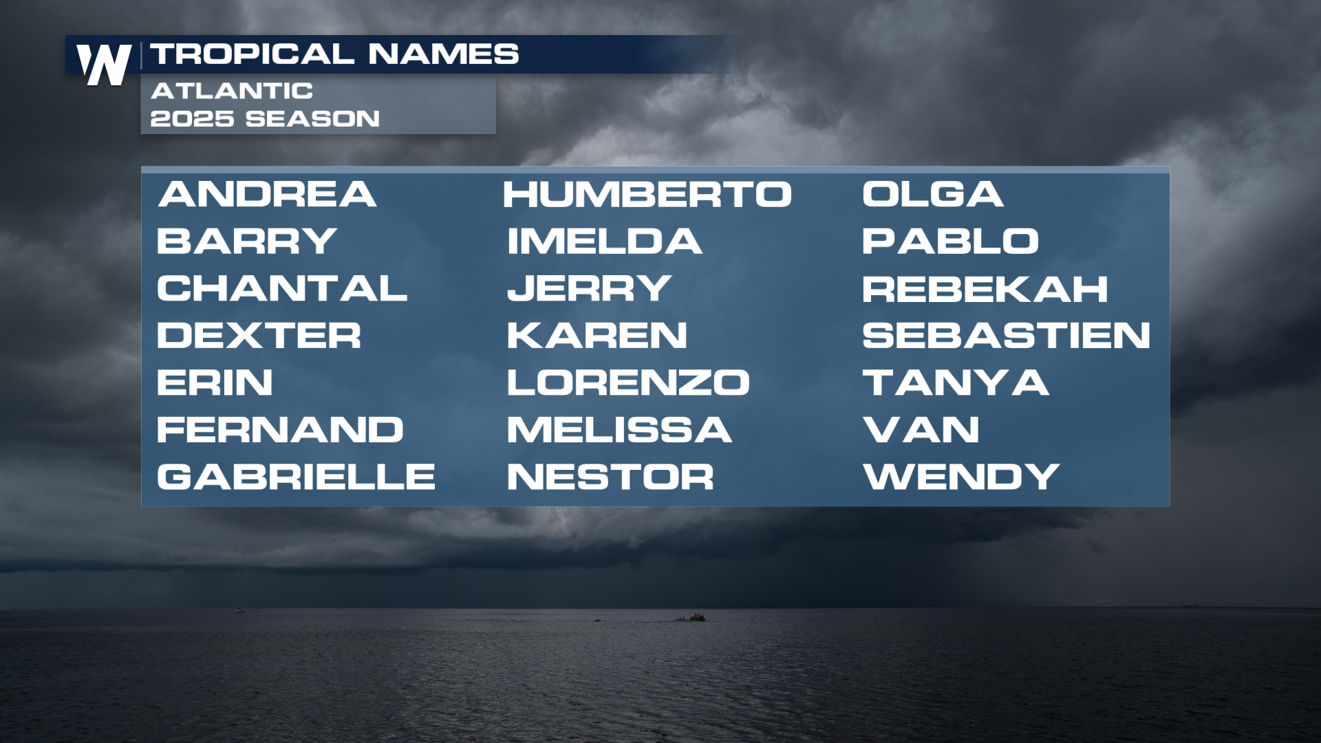
 For now, the quiet beginning to the season is considered perfectly normal. The early season will more often see more tropical storms than hurricanes, but hurricanes can form and impact the United States, so it's always best to be prepared. Andrea is the first name on the list in the Atlantic in 2025.
NOAA and Colorado State are expecting an above-average season in the Atlantic Basin. Click here to read more.


