Multi-Day Severe Weather Threat Across the Plains

There will be plenty of energy and instability across the plains, allowing strong storms to persist. The Storm Prediction Center (SPC) has severe outlooks in place through Saturday. These storms will pose a significant threat, including the possibility of a few tornadoes, hail over two inches in size, and wind gusts over 75 mph.
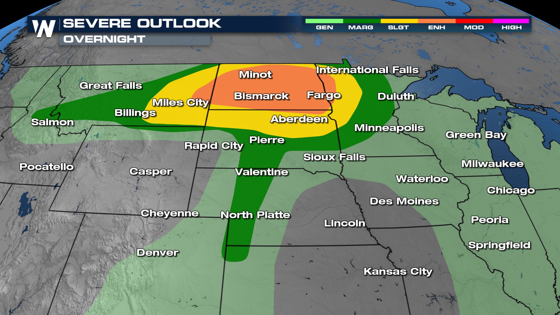
Overnight
Severe storms will be possible the next few days as a frontal boundary taps into unstable air. There is an enhanced risk for severe storms early Friday morning. The main threats will be tornadoes, strong, damaging winds, and large hailstones.
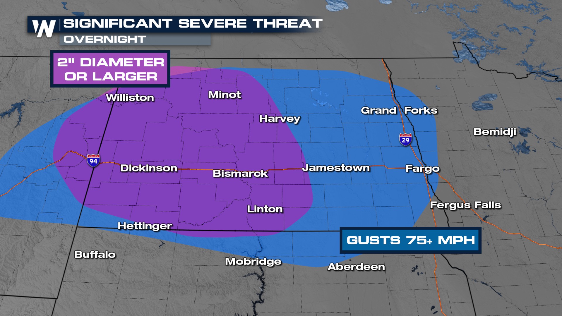 There will be multiple rounds of storms through the overnight hours and additional storms on Friday as multiple systems move through. It will be important to have multiple ways to receive weather alerts in case warnings are issued.
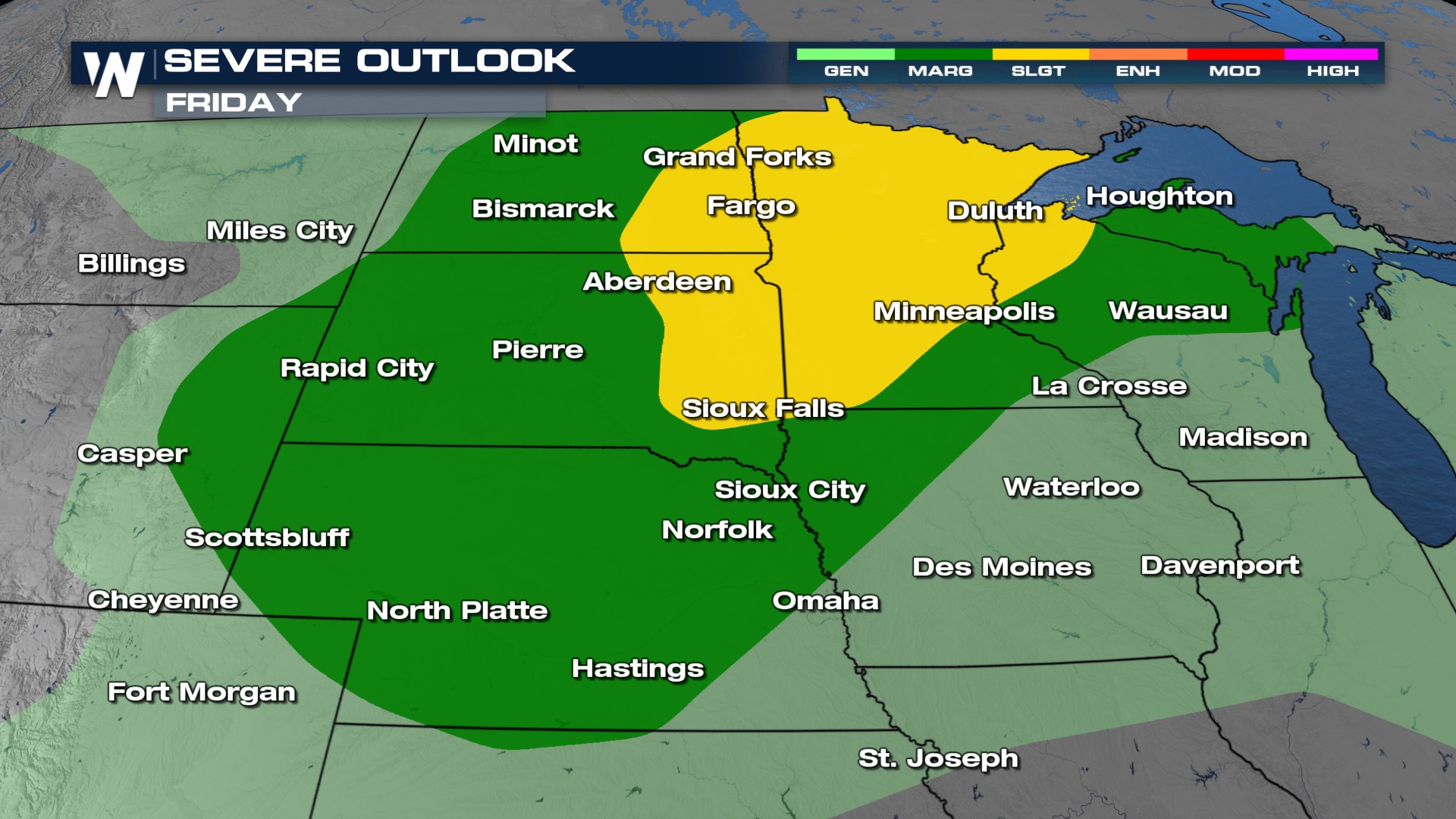
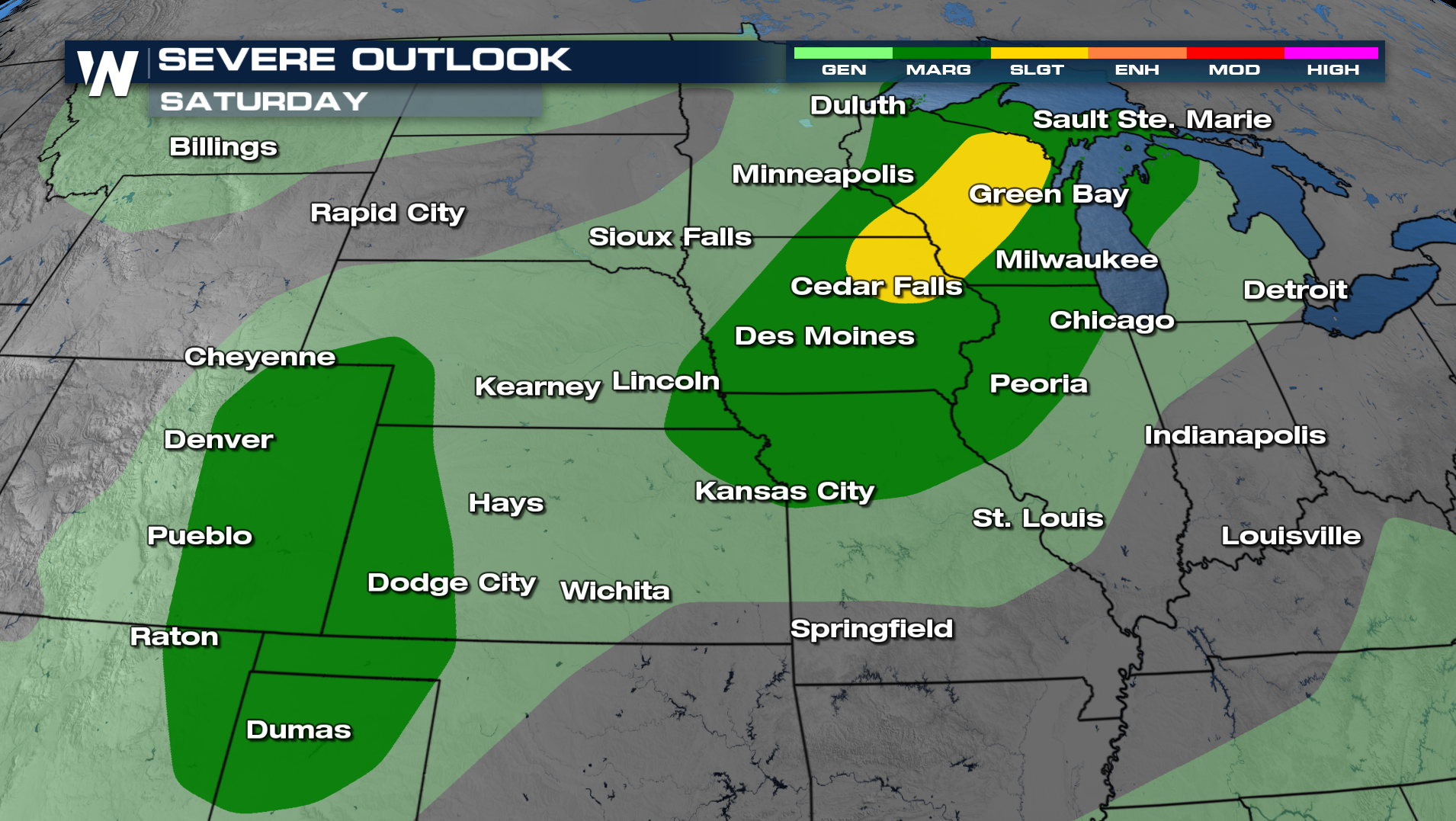
Friday - Saturday
On Friday and Saturday, the Storm Prediction Center issued severe outlooks for severe storms. Damaging winds and hail will be the primary concerns. Stay inside as these storms pass and park your car in a garage or carport, if possible. Saturday already has a slight risk of severe weather across Wisconsin and Iowa.
Stay with WeatherNation for the latest updates throughout the next few days on-air and online.


