Northeast Braces for Severe Storms and Possible Widespread Flooding

The Northeast will finally get some relief from the hot temperatures as a slow moving front will bring rain. However, some of the storms ahead of the front will be severe, with the primary threat being damaging winds. The Storm Prediction Center has issued a slight risk (level 2 out of 5) for Philadelphia, Baltimore, charlotte, and Washington. Flooding will also be a concern Wednesday morning as the frontal boundary passes.
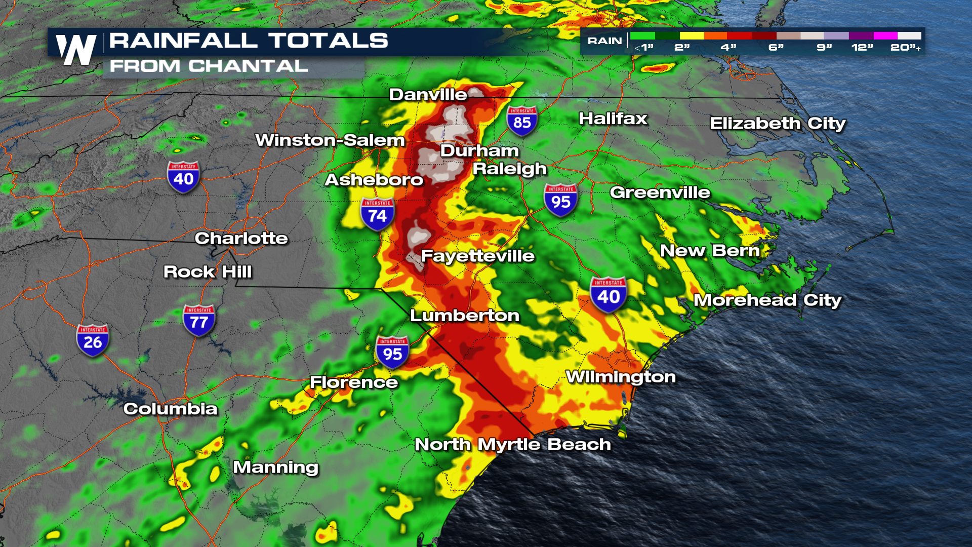
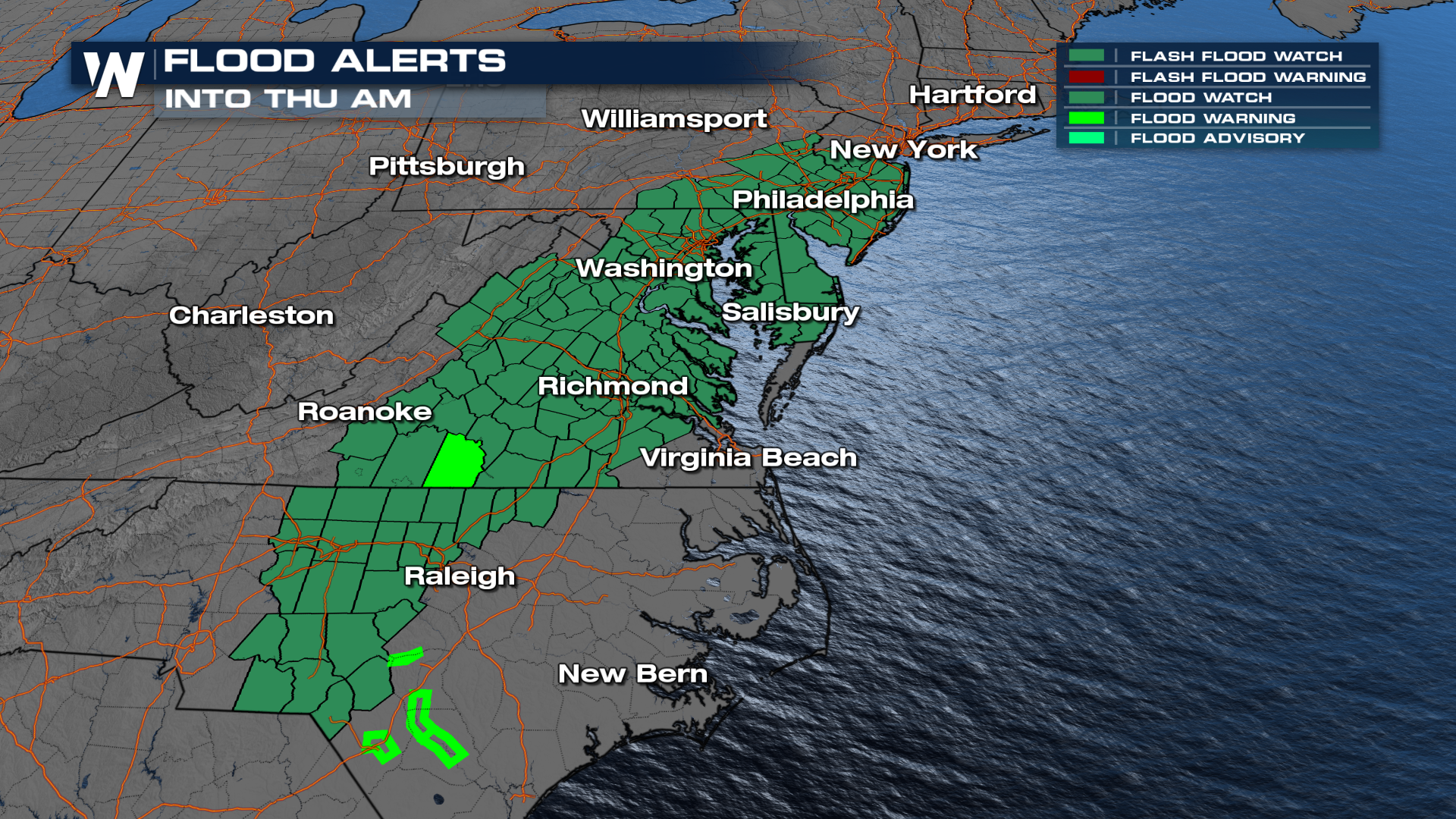 The flood watches come after Chantal, a Tropical Storm that produced heavy rainfall across the Carolinas, therefore some of these areas are already saturated.
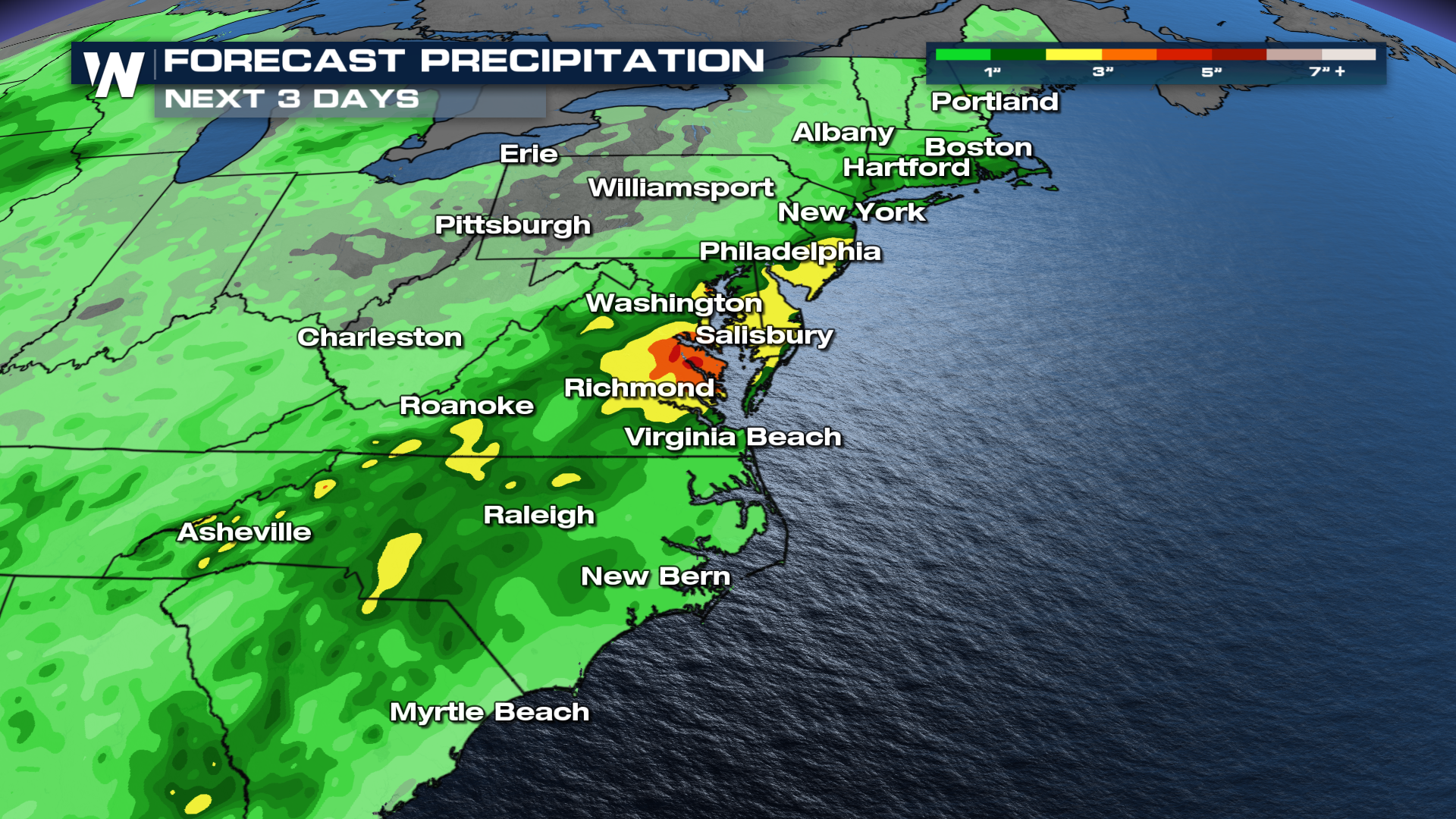
The forecast calls for an additional 3-4 inches of rainfall in the next 3 days for locations in central Virginia. Also, 2-3 inches of rainfall will be possible from Delaware to the Jersey Shore and across central North Carolina. Multiple waves of storms and high rainfall rates mean flash flooding is possible.
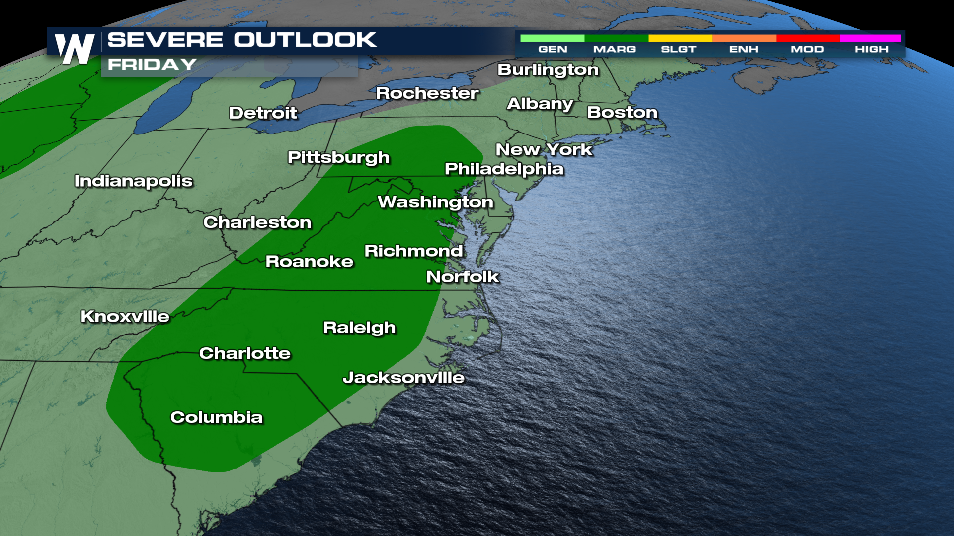
Severe Outlooks
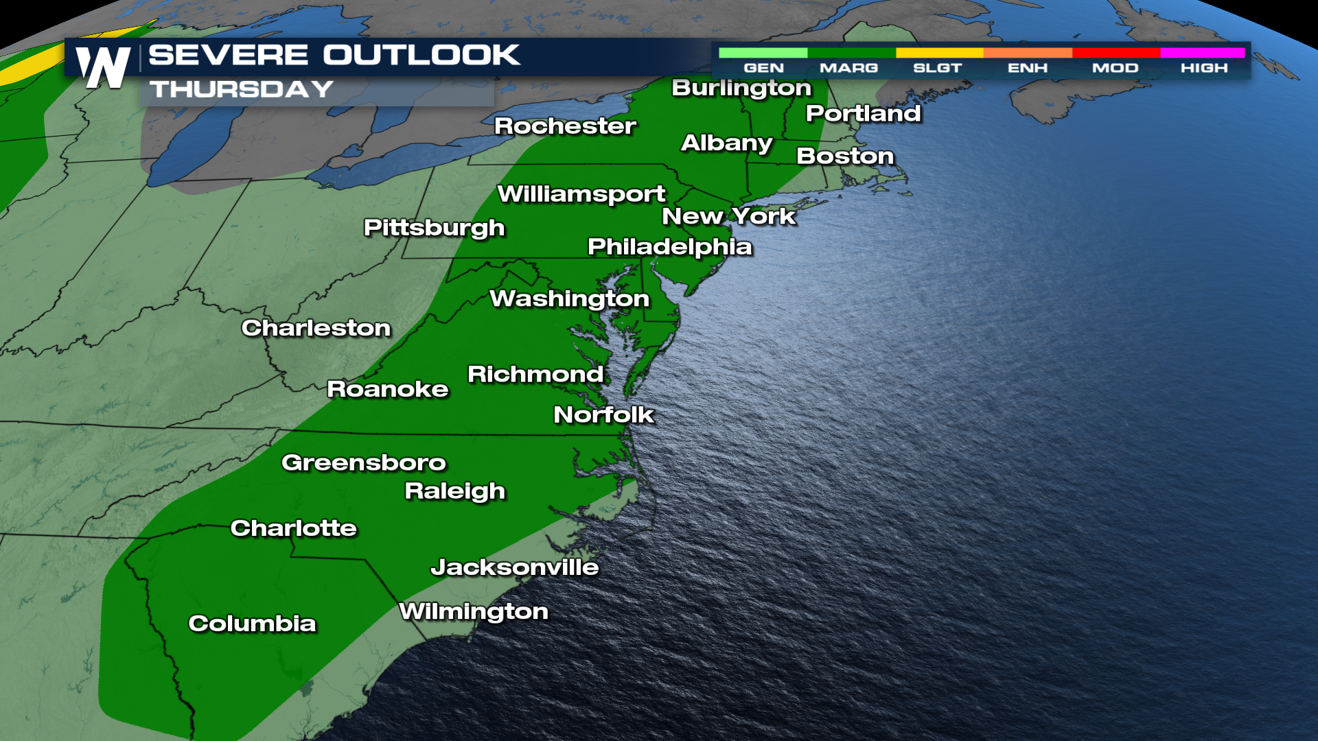
Severe weather outlooks have been issued for the next three days as a cold front moves into this hot and unstable air mass. With the loss of daytime heating, the severe threat is now marginal. On Wednesday, as the front slides east, the risk is SLIGHT (level 2 out of 5) for severe storms across the Carolinas, Virginia, Maryland, and Delaware. On Thursday, the SPC expanded the MARGINAL risk from New England through Georgia.
 Friday the SPC keeps a MARGINAL risk around for Washington, Roanoke, and Columbia.
Timing
Storms will happen along and ahead of the frontal boundary. Over the next few days, strong to severe storms can develop, and during peak heating is when the risk for damaging winds and large hail will be the greatest.
Tune into WeatherNation :10 the hour for the Eastern Regional Forecast for more details.


