Humidity and Downpours Returning to the Midwest

It was nice while it lasted. Comfortable air with dew point temperatures in the 40s and 50s is vanishing, getting pushed out by a muggy and humid air mass making its way north from the Gulf of Mexico. We can't blame the muggy air mass, however. The cause of this is an upper-level low-pressure system that is moving north toward the Great Lakes this weekend. This upper-level low is producing showers, downpours, and a few thunderstorms across the Midwest.
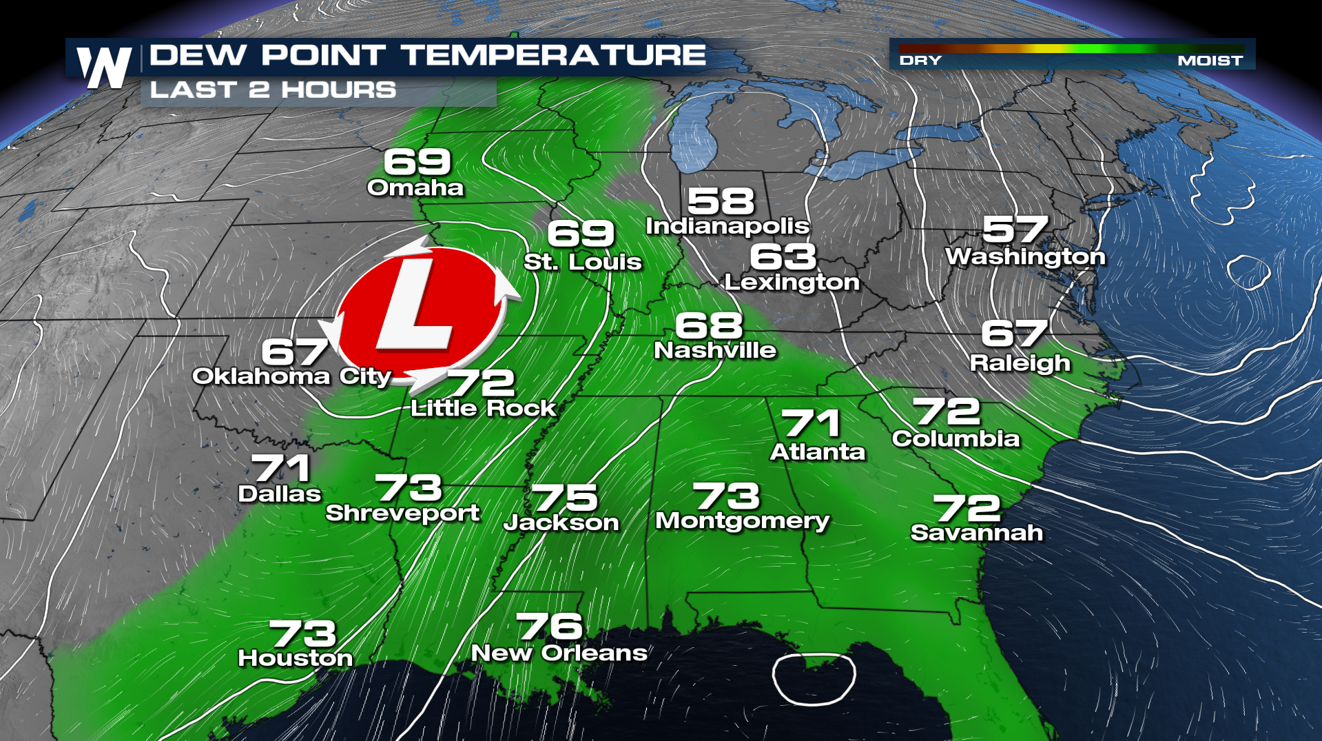 The weekend began with dew point temperatures in the 50s and low 60s across parts of the Midwest, the Great Lakes, and the mid-Atlantic. Those numbers represent very comfortable air, especially for late July and mid-summer. The dew point measures the moisture in the air. The lower the number, the less muggy it feels, and vice-versa. The weekend will end with dew point temperatures in the upper 60s to low 70s, which brings a muggy and humid environment.
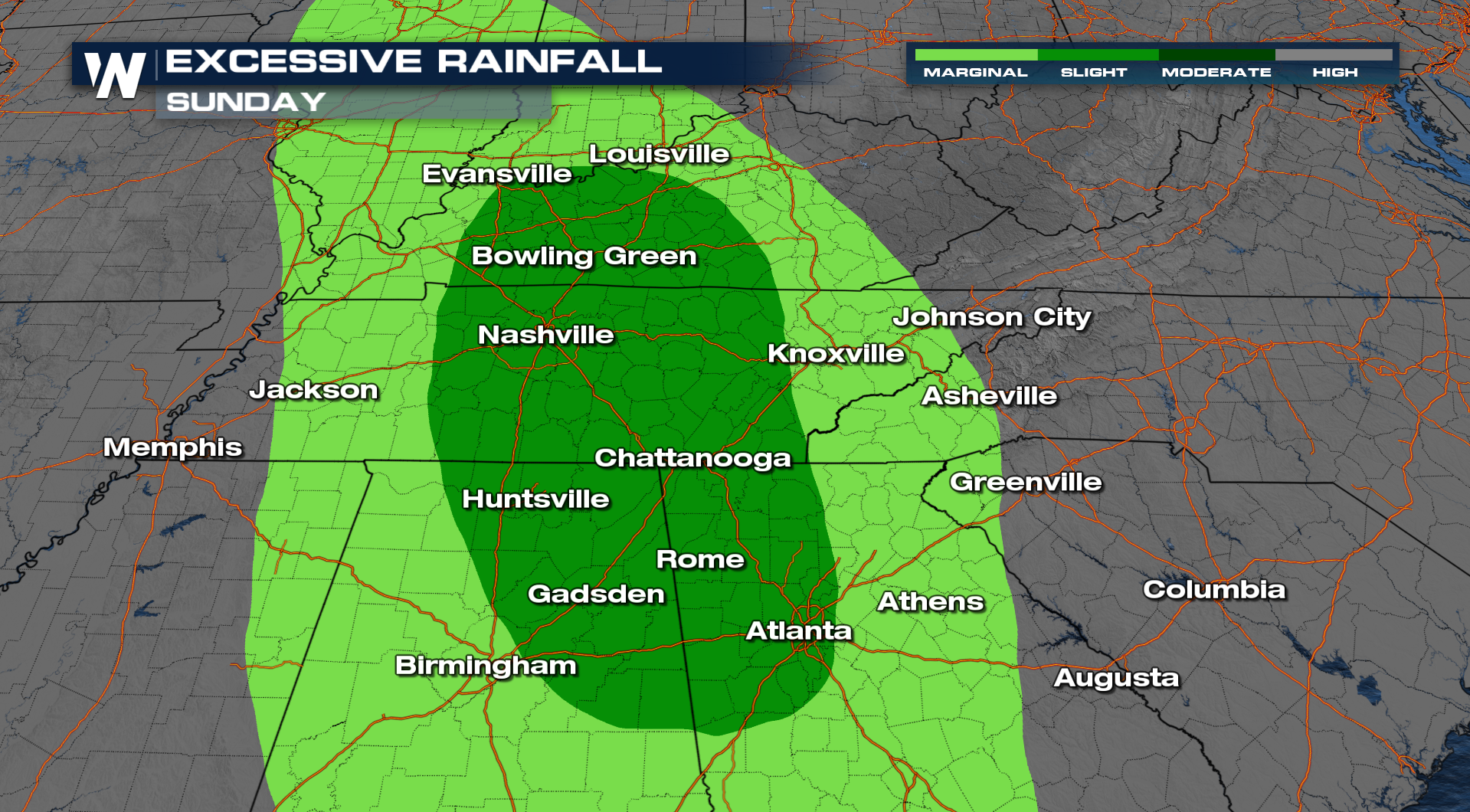
Showers and storms will continue this afternoon, as an area of low pressure moves through. There will be isolated heavy rainfall embedded within these storms, which has led to excessive rainfall outlooks being issued.
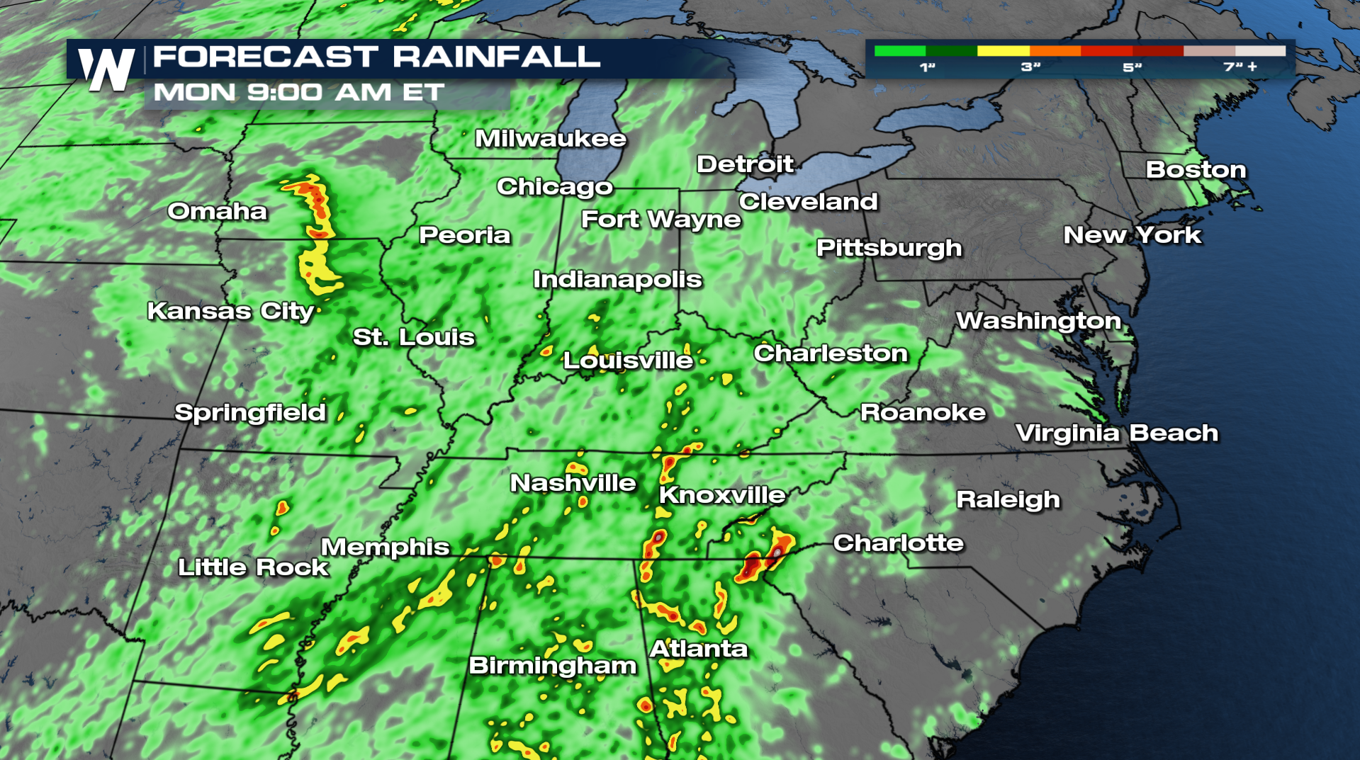 Rainfall amounts could be 2-4 inches in parts of Mississippi, Alabama, Georgia, Tennessee, North Carolina, Kentucky, and the Ohio River Valley. Flooding will be possible this afternoon across cities such as Evansville, Louisville, Bowling Green, Nashville, Chattanooga, Huntsville, Atlanta, and Birmingham.
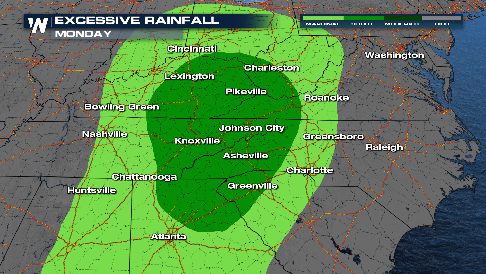
 On Monday, the upper-level low will continue moving to the north-northeast. It'll pull the highest axis of moisture and drop it, in the form of showers and thunderstorms, over the lower Appalachian Mountains, Cumberland Plateau, and Ohio River Valley. Cities such as Lexington, Charleston, Johnson City, Knoxville, Asheville, and Greenville could get flooding.
 If you do encounter heavy rain, give yourself extra travel time, don't drive through flooded roads, and seek higher ground in the event of quickly rising water.


