Rapidan Dam Facing Imminent Failure in Minnesota

The situation is dire in Mankato, MN, south of Minneapolis where the Rapidan Dam faces imminent failure. Over 18" of rain in the past month has saturated soils, leading to high-running rivers, creeks, and streams in recent days. The power of that water has overwhelmed the over 100-year-old dam which sits about 100 miles outside of Mankato. There are flash flood warnings in place downstream. Part of the dam has already collapsed but more failure is anticipated as waters continue to rush through.
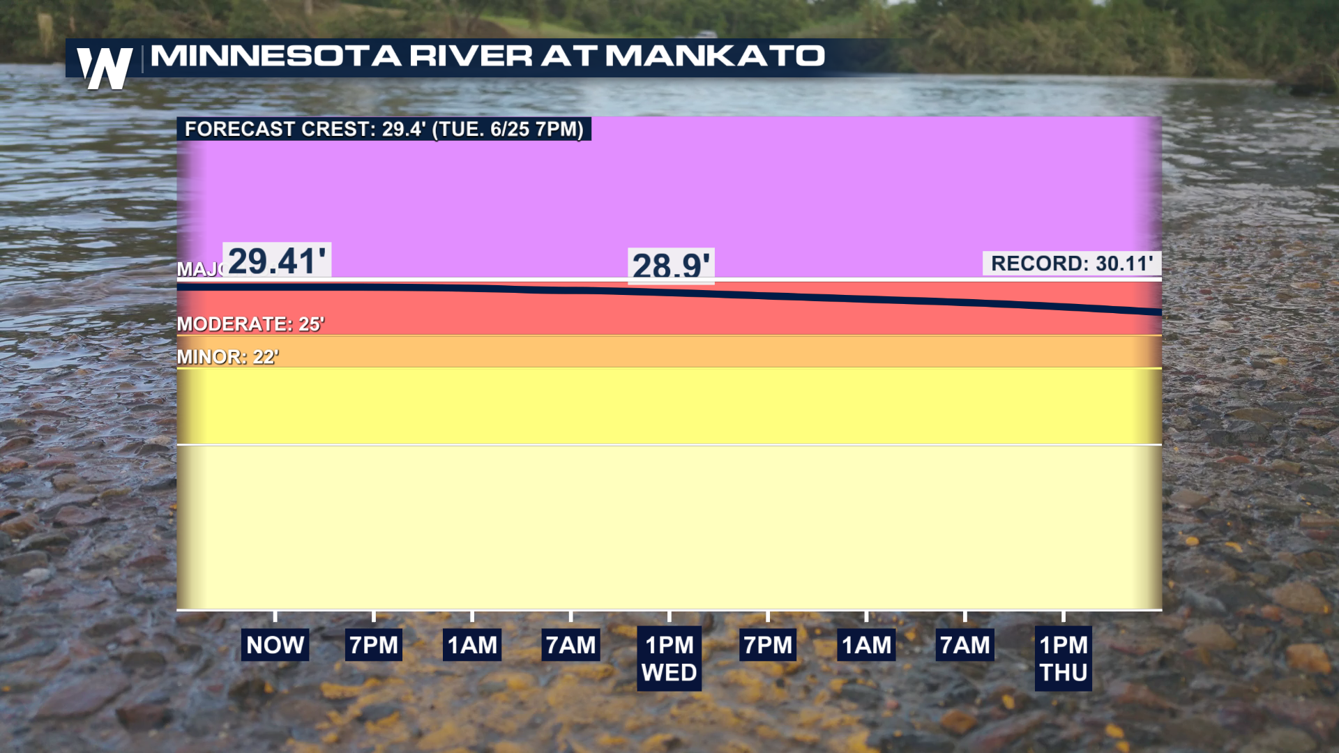
The Minnesota River at Mankato crested in the MODERATE flood stage at 29.43 feet, just inches away from the record, MAJOR, flood stage of 30.1 feet on Tuesday evening.
According to emergency management officials, county residents in Le Sueur County who live in low-lying areas should continue to monitor the threat, but official evacuation orders have not yet been issued.
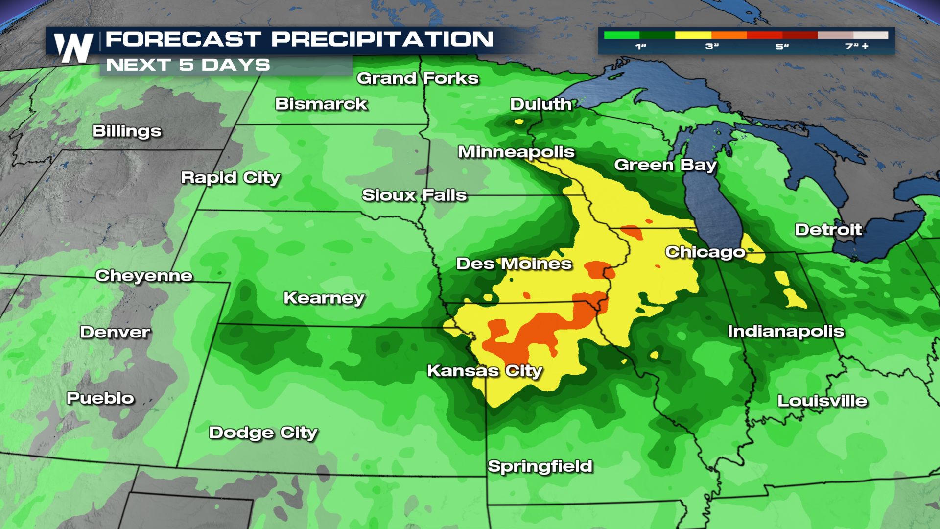
Nearly a foot of rain has fallen around the Sioux Falls, SD area in the last 7 days. Rock Valley is about 45 miles southeast of Sioux Falls, so the town has likely seen at least 10" of rain in a 48-hour timeframe, in addition to the levee breaking. Much of Minnesota, South Dakota, Iowa, and Wisconsin have received upwards of 6" of rain, with more to come. With all of this rainfall, it leads to a multitude of excessively high rivers across the Midwest, especially in Sioux Land.
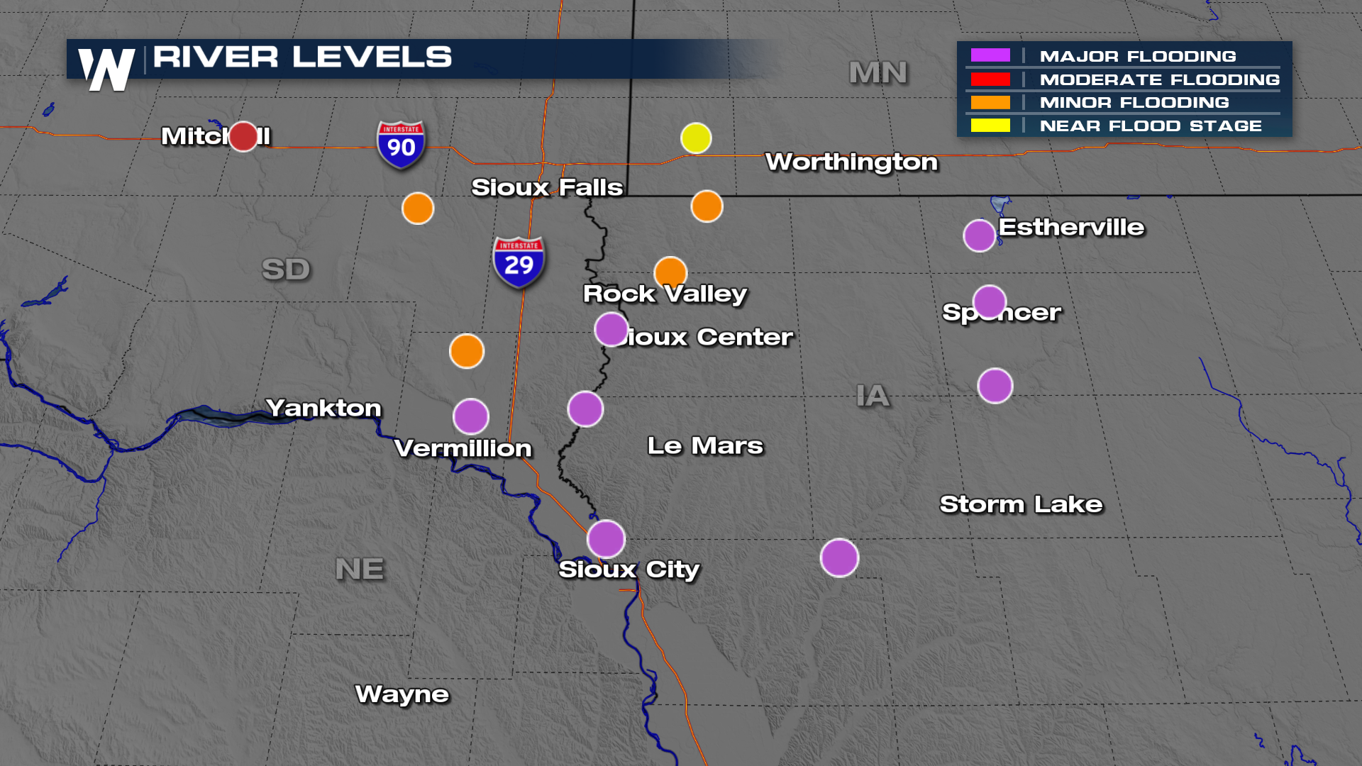 Two dozen miles of Interstate 29 were closed over the weekend due to flooding and the state of South Dakota is slowly trying to reopen the roadway. Late Sunday, a train bridge that connects Sioux City, IA to North Sioux City, SD collapsed into the Big Sioux River below. At a nearby flood gauge, the Big Sioux River at Sioux City was reporting nearly 45 feet for several hours, smashing the previous record crest of 37.7 feet in 2014.
In McCook Lake, SD along I-29 in the eastern portion of the state, flood waters have destroyed infrastructure and homes in the town.
A levee break along the Rock River in Iowa caused a quick evacuation order to be issued for the town of Rock Valley. The National Guard was flown out to assist with the multiple water rescues that happened. Below is drone footage of the town during the floods. The last thing much of the Great Plains needs is more moisture, and unfortunately, we have just that in our forecast.
More trough activity is targeting the Central U.S., indicating a chance of seeing an additional 2-4+" of rain in some spots over the next 5 days. A severe storm threat accompanies a lot of these rain chances. Keeping all of that in mind, be ready for more flooding concerns in the days ahead and be ready to heed any and all weather alerts issued.