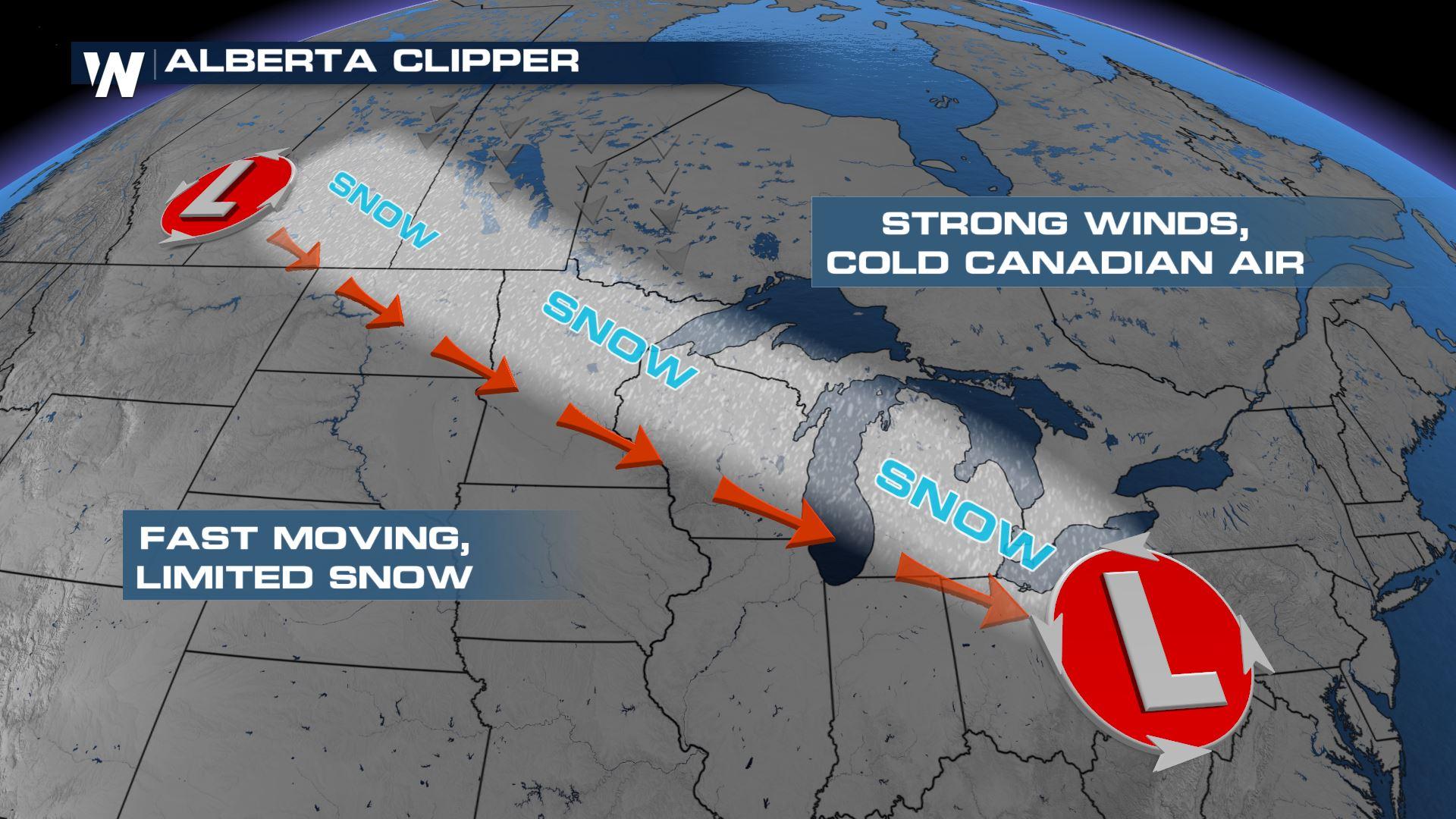
Another Clipper Brings Snow to the Rockies and Great Lakes
Special Stories
23 Apr 2021 4:00 AM
Here we go again. Another clipper system is set to cross the northern tier of the country Thursday through Saturday morning with light to moderate snow and gusty winds. Minor impacts to travel are possible throughout the Rocky Mountains through Saturday morning.
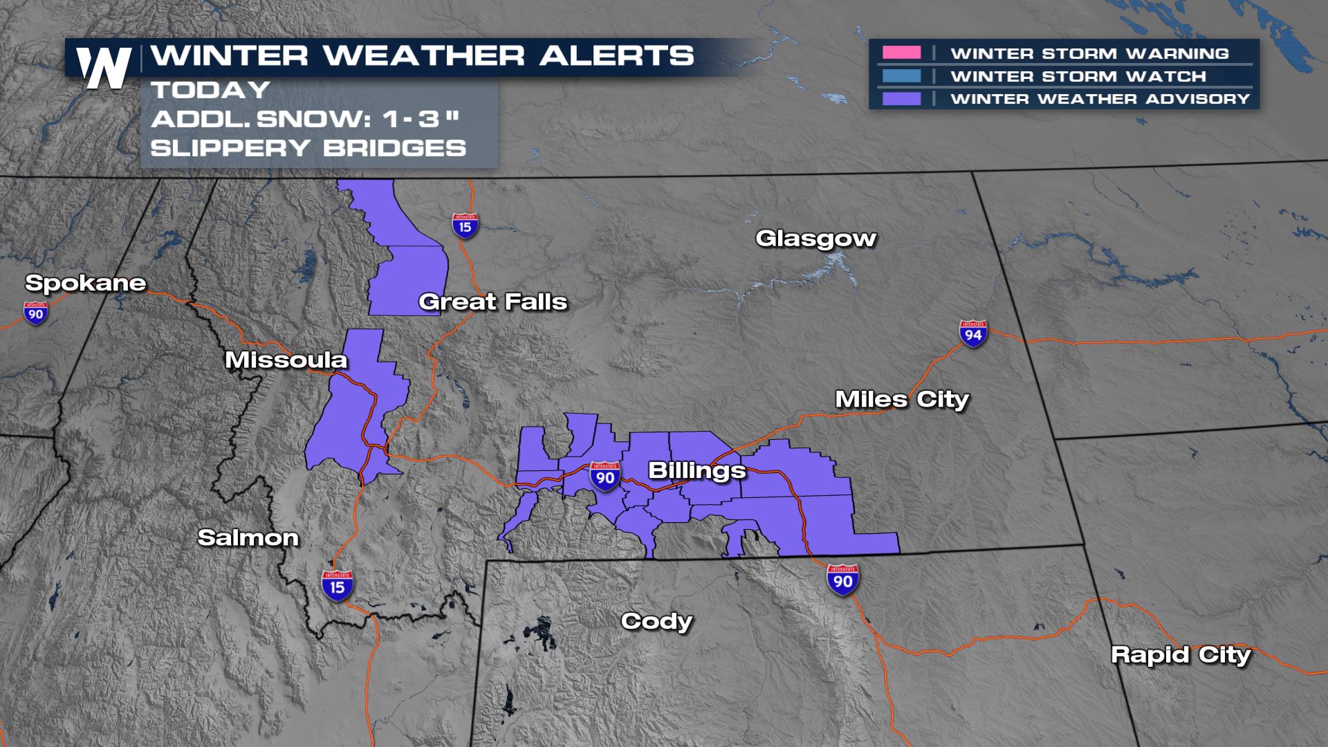 Winter weather advisories are in effect into Friday afternoon across portions of the Northern Rockies in Montana. Some heavy snow is possible along with wind gusts that could reduce visibility. Precipitation will follow the cold front as it moves south through Montana on Thursday, with scattered showers and a few thunderstorms possible to the southwest into Eastern Oregon and Idaho.
Snow is expected to continue to move south across Montana into Wyoming Friday morning, while some rain falls across the Great Lakes.
Winter weather advisories are in effect into Friday afternoon across portions of the Northern Rockies in Montana. Some heavy snow is possible along with wind gusts that could reduce visibility. Precipitation will follow the cold front as it moves south through Montana on Thursday, with scattered showers and a few thunderstorms possible to the southwest into Eastern Oregon and Idaho.
Snow is expected to continue to move south across Montana into Wyoming Friday morning, while some rain falls across the Great Lakes.
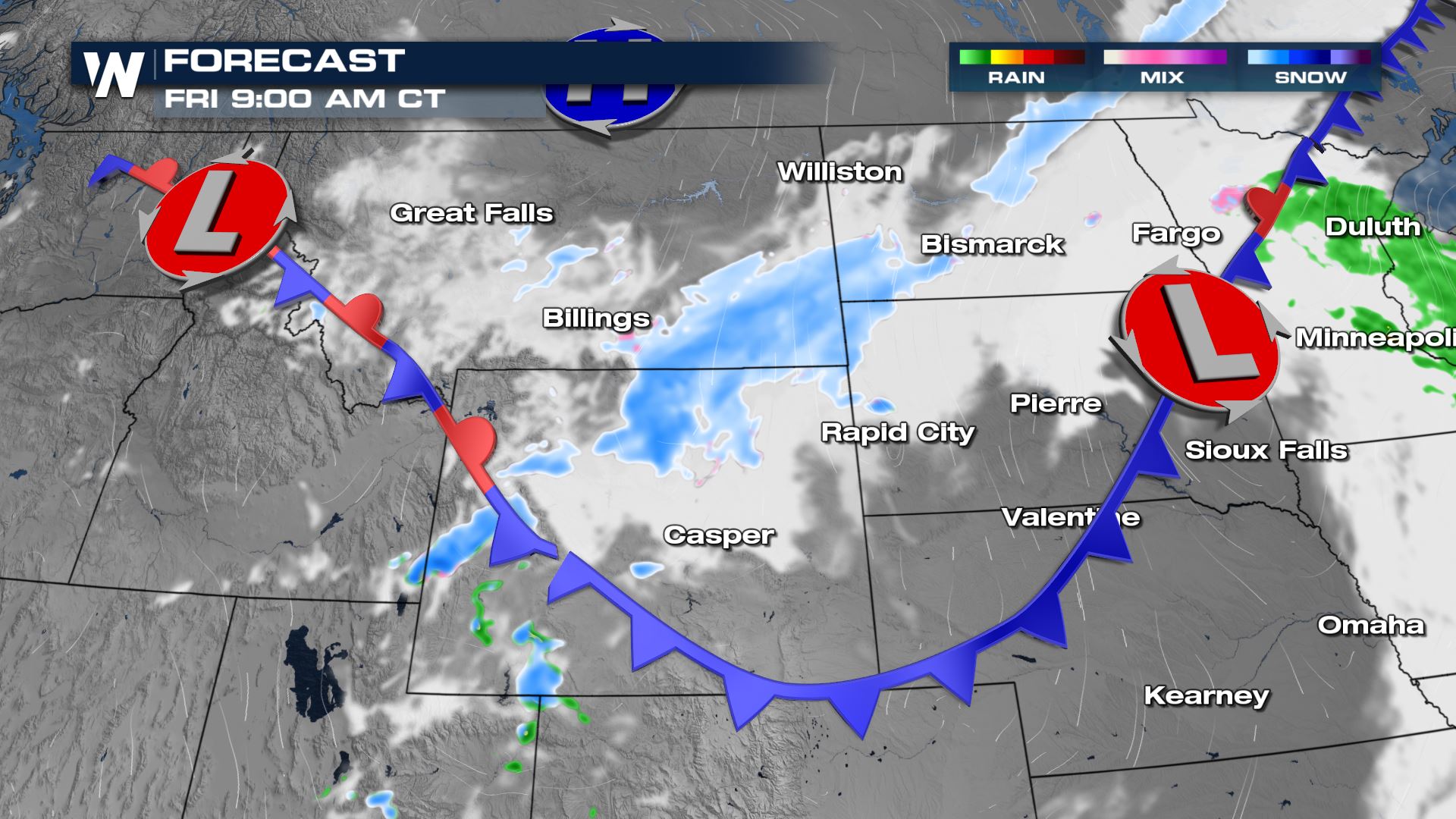
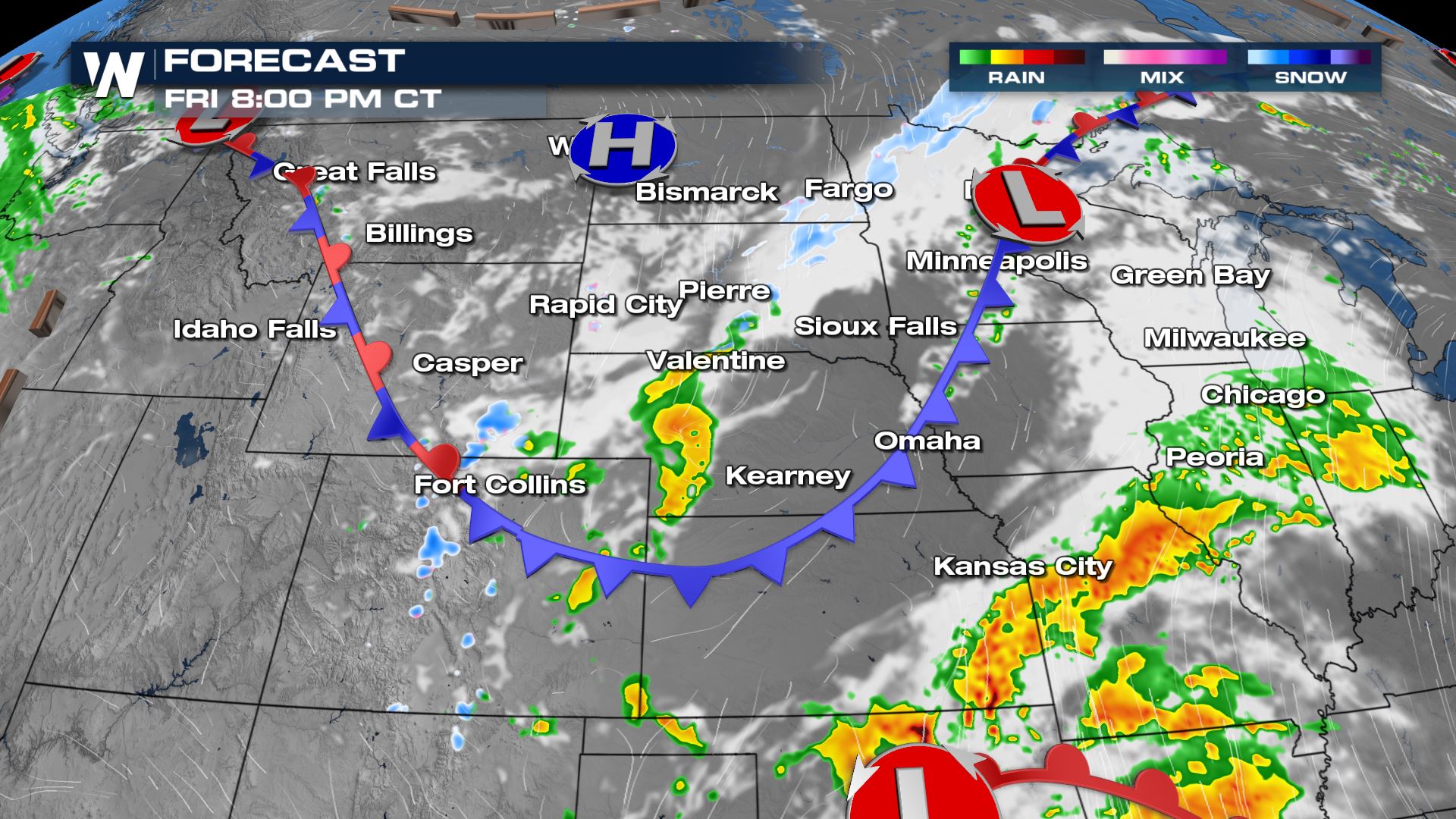
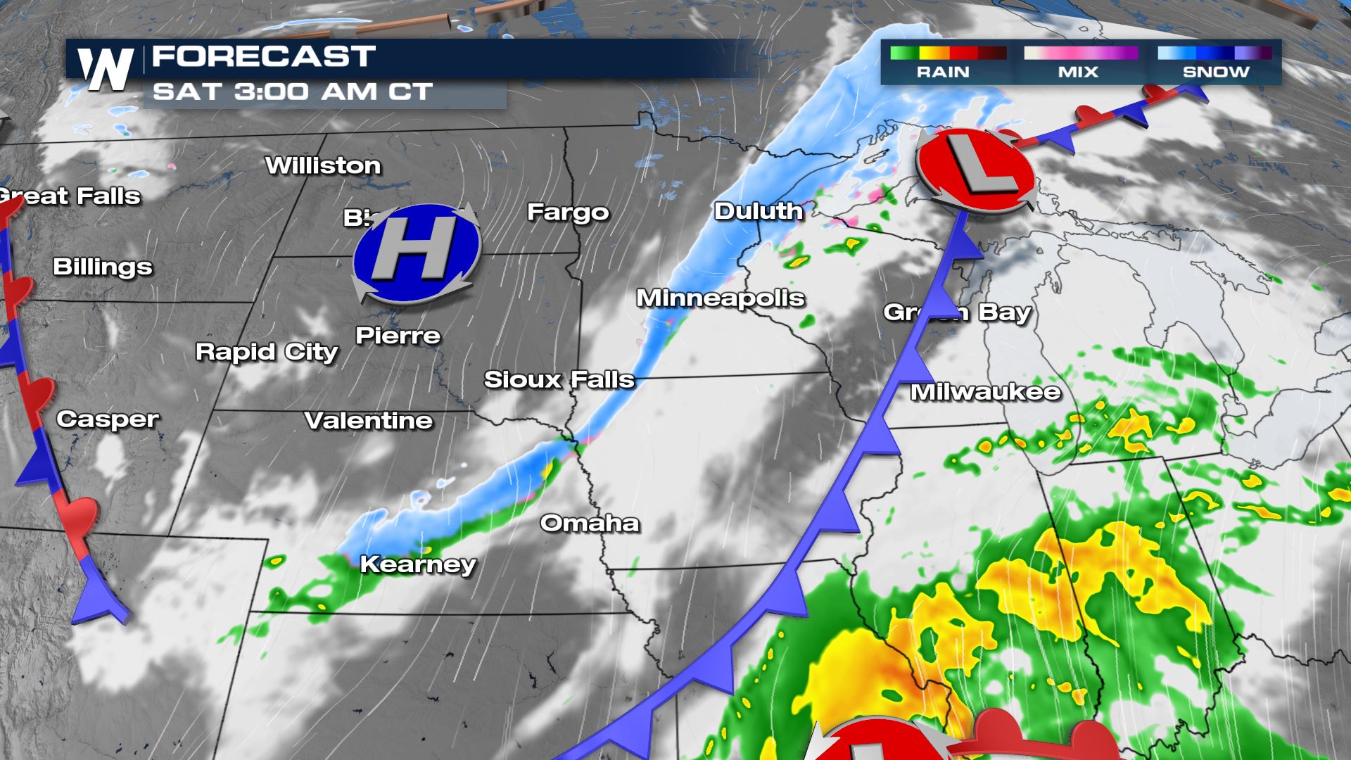 Precipitation will not be as widespread during the Friday afternoon timeframe as the front crosses the Northern Plains, but chances for light snow will increase behind the front Friday night into Saturday morning, primarily across the Upper-Midwest.
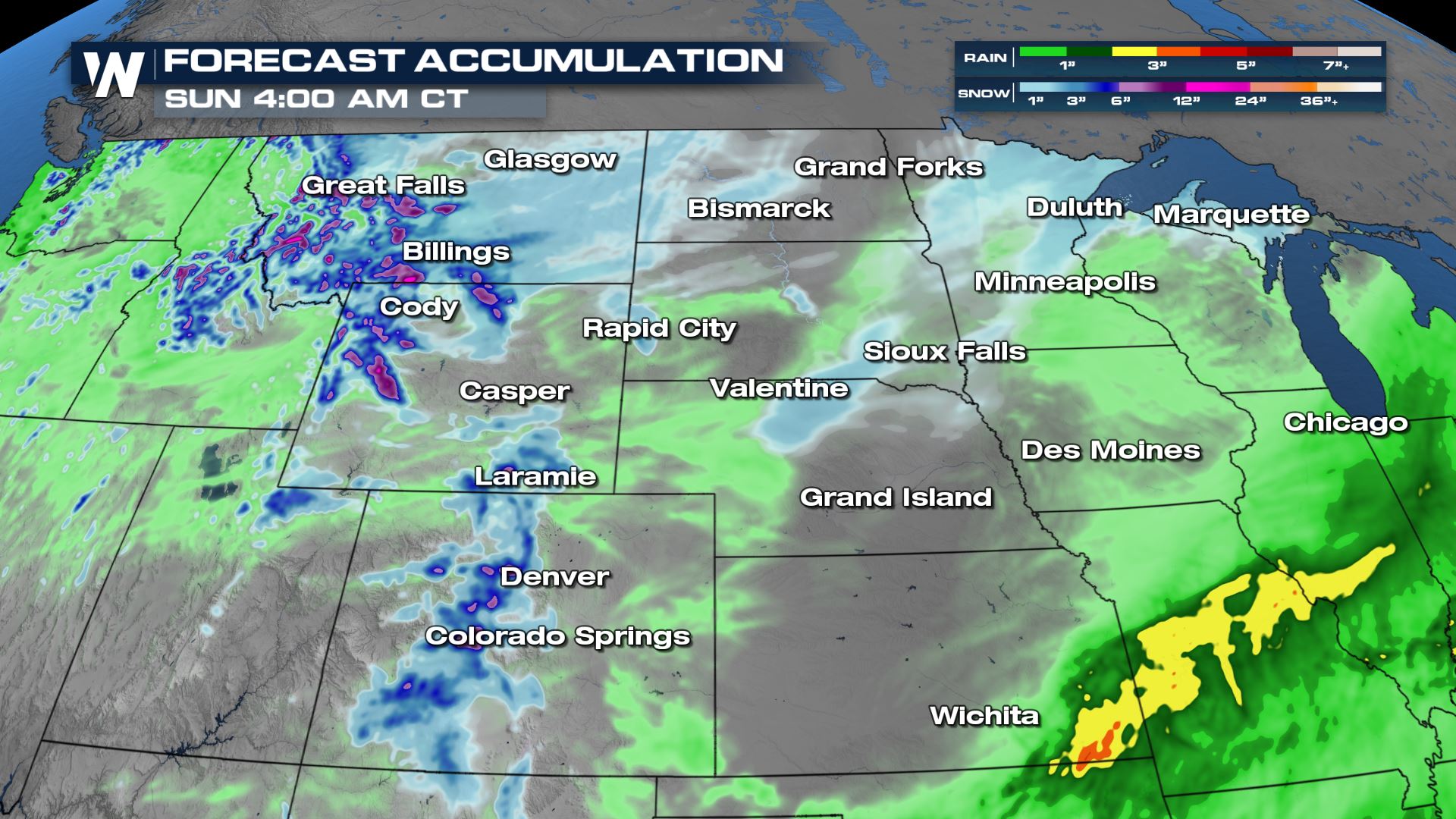 Heavy snow is expected through the higher elevations of the Northern Rockies, with over a foot possible into the higher peaks of the Wind River Range in Wyoming. Lighter snow potential is possible across the Black Hills, the Northern Plains, Colorado's Front Range and the Upper-Midwest where 1-3 inches can generally be expected.
Stay with WeatherNation on-air and online for updates.
Heavy snow is expected through the higher elevations of the Northern Rockies, with over a foot possible into the higher peaks of the Wind River Range in Wyoming. Lighter snow potential is possible across the Black Hills, the Northern Plains, Colorado's Front Range and the Upper-Midwest where 1-3 inches can generally be expected.
Stay with WeatherNation on-air and online for updates.
Winter weather advisories are in effect into Friday afternoon across portions of the Northern Rockies in Montana. Some heavy snow is possible along with wind gusts that could reduce visibility. Precipitation will follow the cold front as it moves south through Montana on Thursday, with scattered showers and a few thunderstorms possible to the southwest into Eastern Oregon and Idaho.
Snow is expected to continue to move south across Montana into Wyoming Friday morning, while some rain falls across the Great Lakes.
Precipitation will not be as widespread during the Friday afternoon timeframe as the front crosses the Northern Plains, but chances for light snow will increase behind the front Friday night into Saturday morning, primarily across the Upper-Midwest.
Heavy snow is expected through the higher elevations of the Northern Rockies, with over a foot possible into the higher peaks of the Wind River Range in Wyoming. Lighter snow potential is possible across the Black Hills, the Northern Plains, Colorado's Front Range and the Upper-Midwest where 1-3 inches can generally be expected.
Stay with WeatherNation on-air and online for updates.All Weather News
More
More Storms for the East Through Monday
A low-pressure system that moved through the
2 Aug 2026 10:40 PM

Wildfire Outbreak in the Pacific Northwest
SPOKANE, WA - On Saturday, August 1st, the Ol
2 Aug 2026 10:35 PM


After Reaching Category 5, Genevieve Weakens in the Pacific
PacificGenevieve formed on last Friday south
2 Aug 2026 6:25 PM

Flooding, Severe Storms Target the Midwest Again
After an active week of storms across the nor
1 Aug 2026 1:40 AM

Flooding Risk Increases as Heavy Rain Targets the Tri-State Area
Tuesday, heavy rainfall moved across the Nort
30 Jul 2026 12:25 AM

Severe Weather: Energy From the Midwest Now in the Southeast
UPPER MIDWEST - Through Monday, dangerous tor
29 Jul 2026 10:30 PM