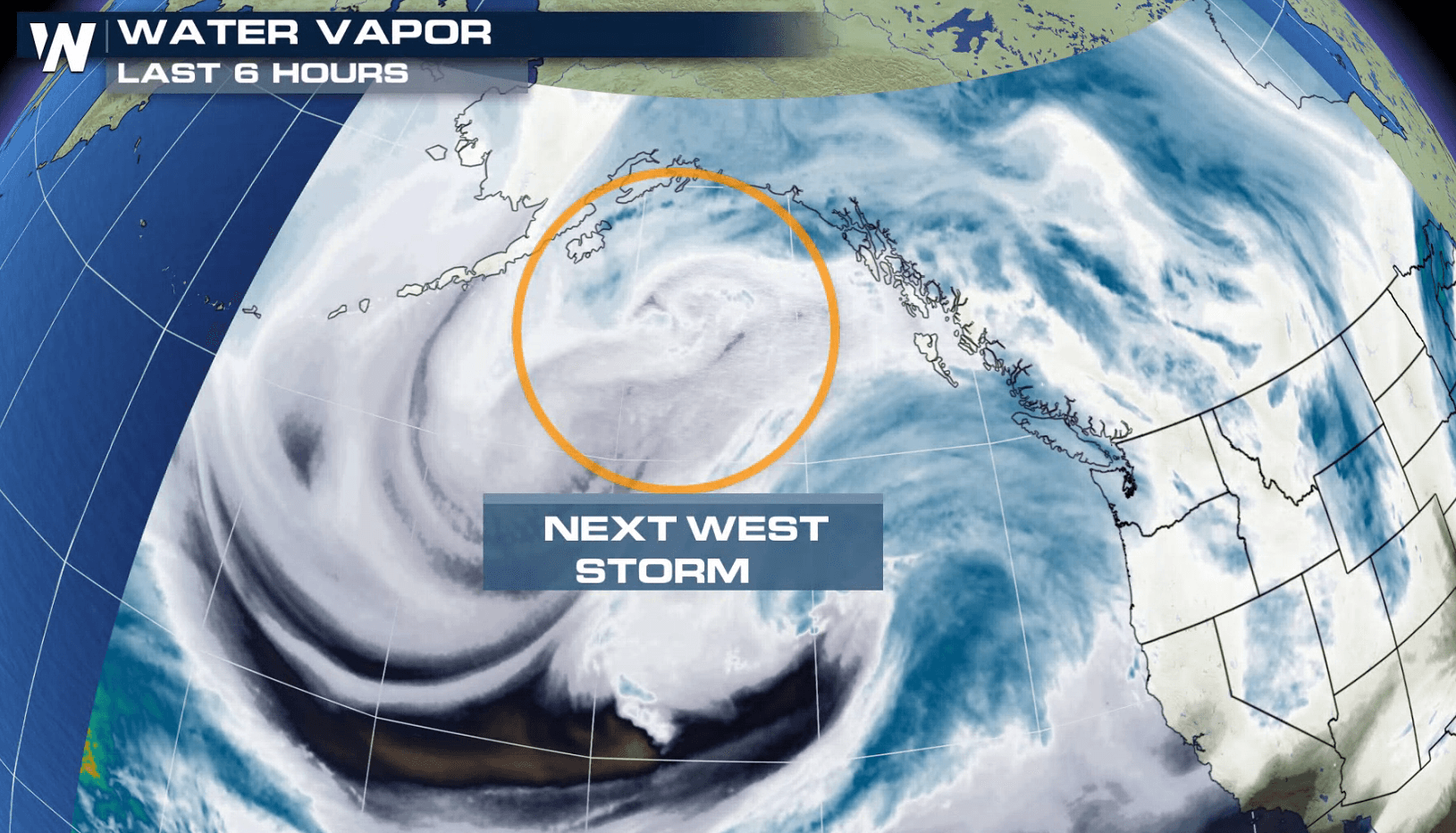
Another System Ready to Move into the West
Special Stories
22 Jan 2018 5:03 PM
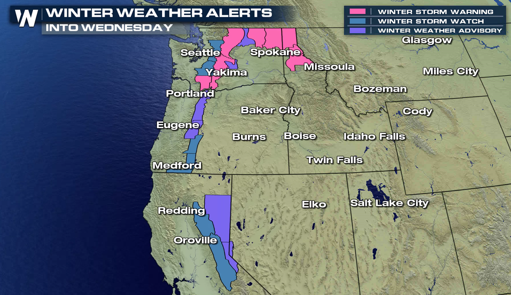
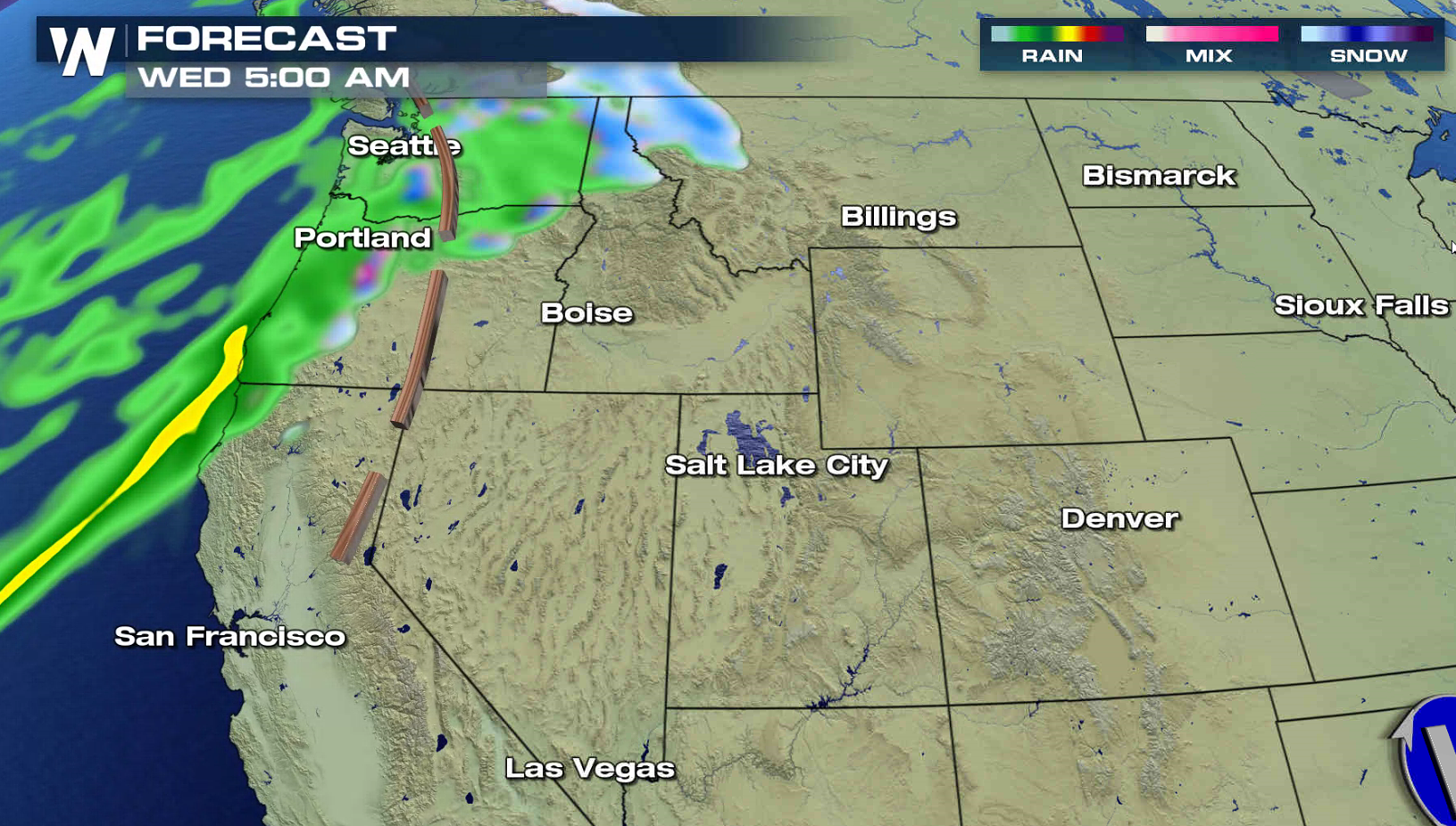
As a intense low dumps big snows and produces blizzard conditions in the Plains, another system is ready to move into the nation. Winter storm alerts have already been issued for the Cascades and Sierra Nevada. 1 to 2 feet of snow is possible in most of the higher elevations, with several feet possible over the highest peaks. Wind gusts of 40 to 60 mph are possible, which will create blowing and drifting snow and white out conditions.
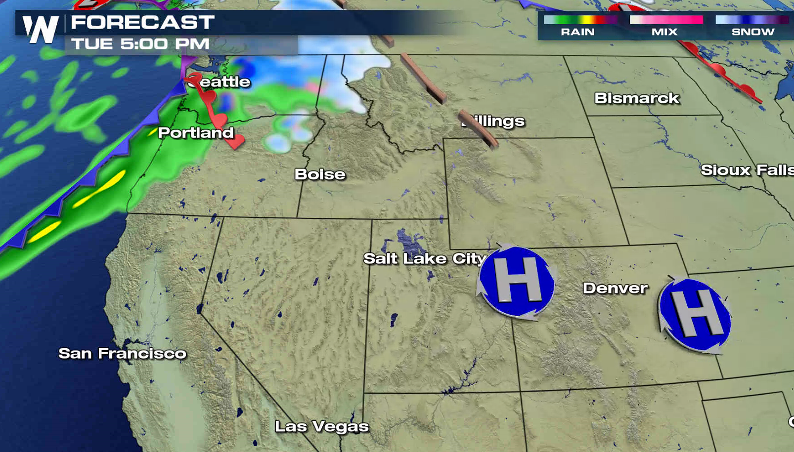
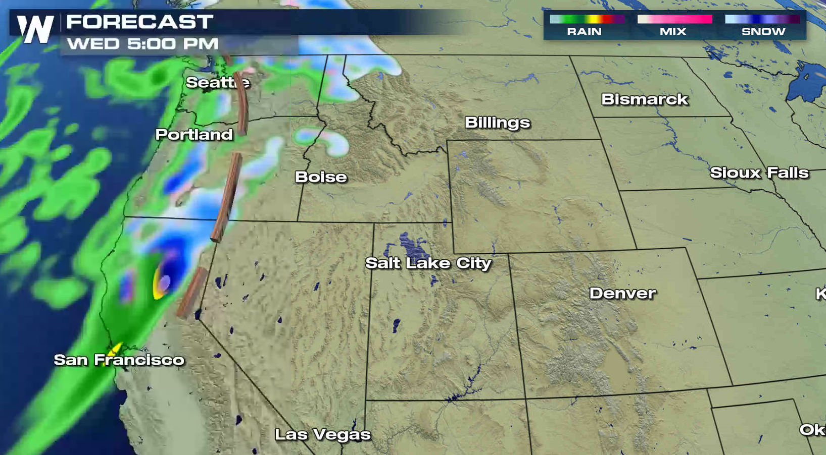
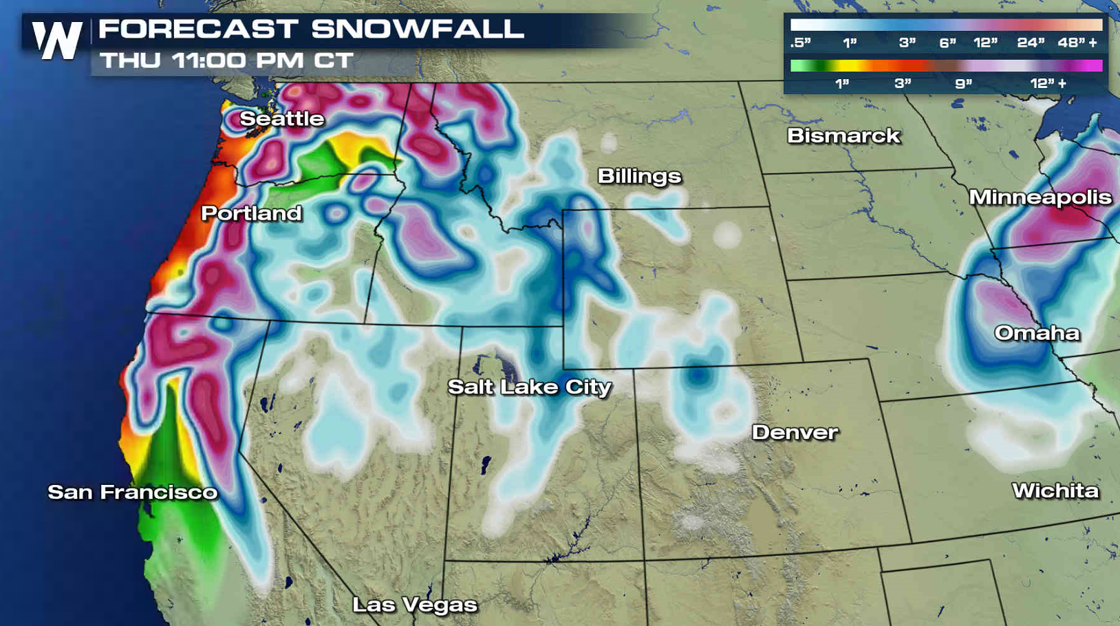 The storm system will slide into the Pacific Northwest on Tuesday, bringing the first wave of snow. The snow will spread into the southern Cascades and Sierra Nevada by Wednesday. Travel will be difficult as the snow becomes heavy.
 For WeatherNation: Meteorologist Mace Michaels
The storm system will slide into the Pacific Northwest on Tuesday, bringing the first wave of snow. The snow will spread into the southern Cascades and Sierra Nevada by Wednesday. Travel will be difficult as the snow becomes heavy.
For WeatherNation: Meteorologist Mace MichaelsAll Weather News
More
Heavy Rain Returns to Texas This Weekend
It's been a week since the devastating floods
12 Jul 2025 3:10 AM

Medium Range Tropics Forecast Favors Gulf, CSU Updates Seasonal Forecast
While the Atlantic appears quiet, conditions
12 Jul 2025 3:05 AM

Elevated Tornado Risk Targets the Midwest Friday
Friday was another busy day with severe weath
12 Jul 2025 3:00 AM

Storms Return From the Front Range to Texas
Moisture is moving back into the Central and
12 Jul 2025 2:50 AM

Timeline: How Catastrophic Flooding Unfolded in Texas Hill Country
TEXAS - Catastrophic flooding devastated port
11 Jul 2025 10:00 AM

Severe Thunderstorms Expected Across the East Coast
The severe weather and flood threat continues
11 Jul 2025 2:35 AM

Ruidoso Flash Flooding - Record Crest for the Rio Ruidoso River
A slow-moving monsoonal thunderstorm develope
10 Jul 2025 1:55 AM