Slight Risk For Severe Storms Overnight

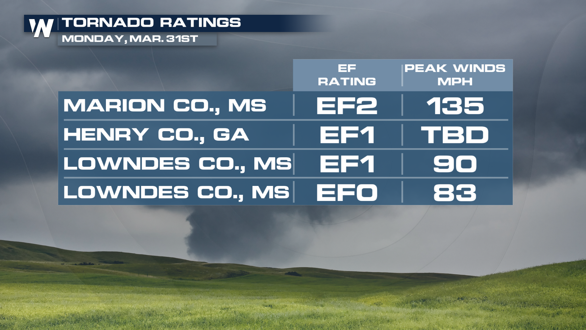
All modes of severe weather were seen Monday across the south, southeast, and northeast. Multiple tornadoes were confirmed in Mississippi and Georgia. Marion County, MS, confirmed an EF2 tornado that occurred this morning at 6:10 am. The path length of this tornado was 7.4 miles, with peak winds of 135 mph. The National Weather Service will continue to survey damage over the next few days, as this system moves offshore overnight, but more rounds of severe weather are expected this week.
Severe Weather Outlook
After another busy day, the severe threat has dropped to a general thunderstorm risk for most of the south. An isolated marginal and slight risk remains overnight for portions of Eastern Virginia and North Carolina as the cold front pushes east and offshore.
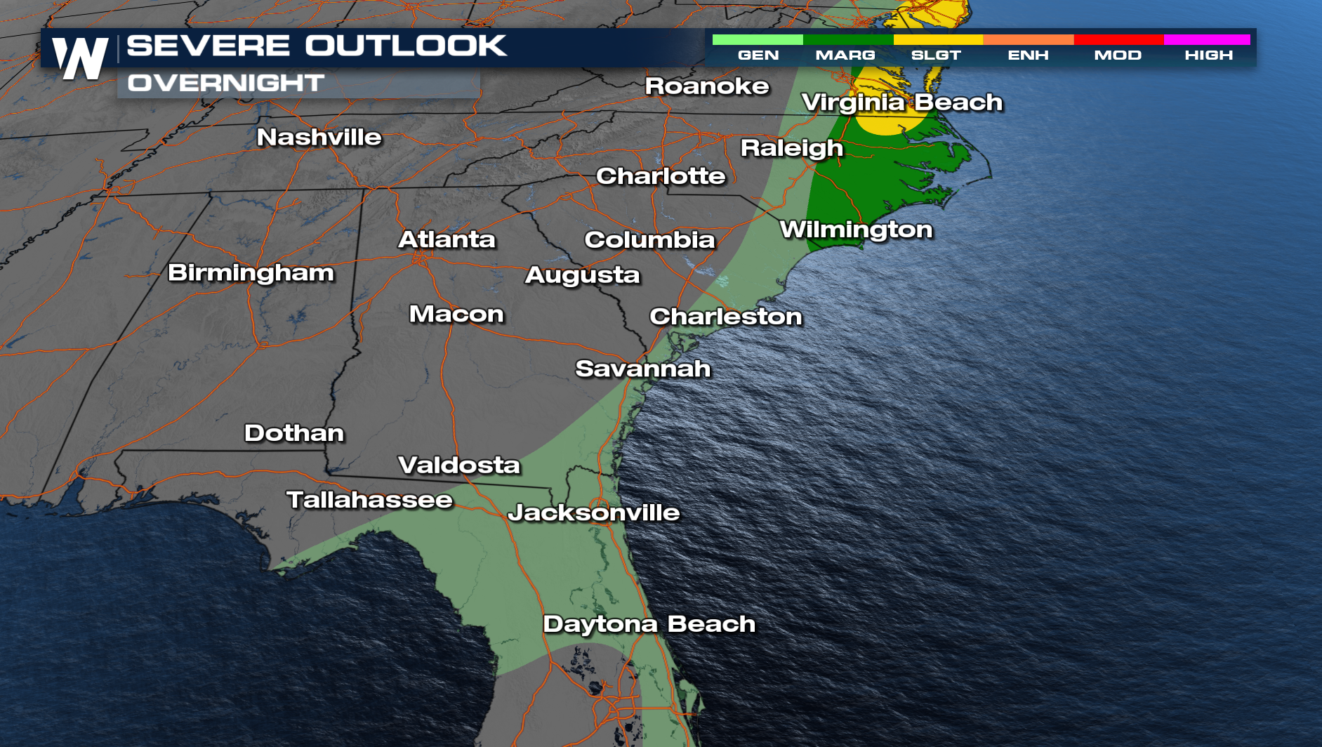 On the northern side of the front, a SLIGHT risk extends through Philadelphia down to Virginia Beach through the overnight hours.
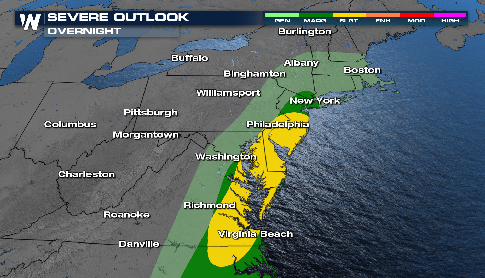
Forecast Timing
A few storms will linger through the overnight hours with the potential to be strong to severe, with tomorrow morning's commute being dry for most.
Stay with WeatherNation for the latest.


