New Year Kicking Off To An Icy Start
Special Stories
1 Jan 2021 5:00 AM
The year is starting snowy and icy for many across the Central Plains, Midwest, and (eventually) the Northeast as a potent low pressure system reaches far and wide.
https://twitter.com/WeatherNation/status/1344973397789454337
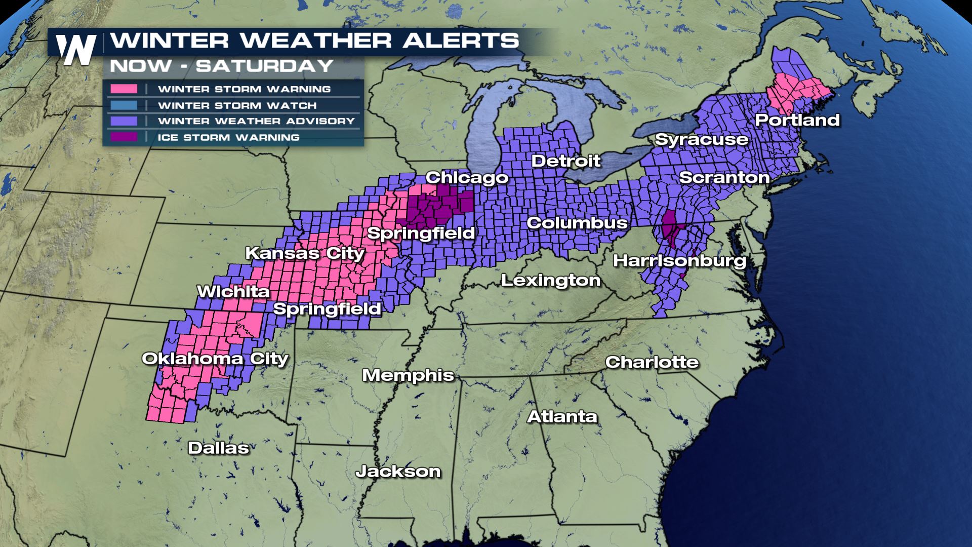
 Winter weather alerts are in effect from the Plains to Maine, and just about everywhere in between! Travel is discouraged today and tonight around this storm system because the snow, ice and wind will create hazardous and difficult travel conditions. Also, the heavy rain and thunderstorms will create ponding on roadways and very slick conditions.
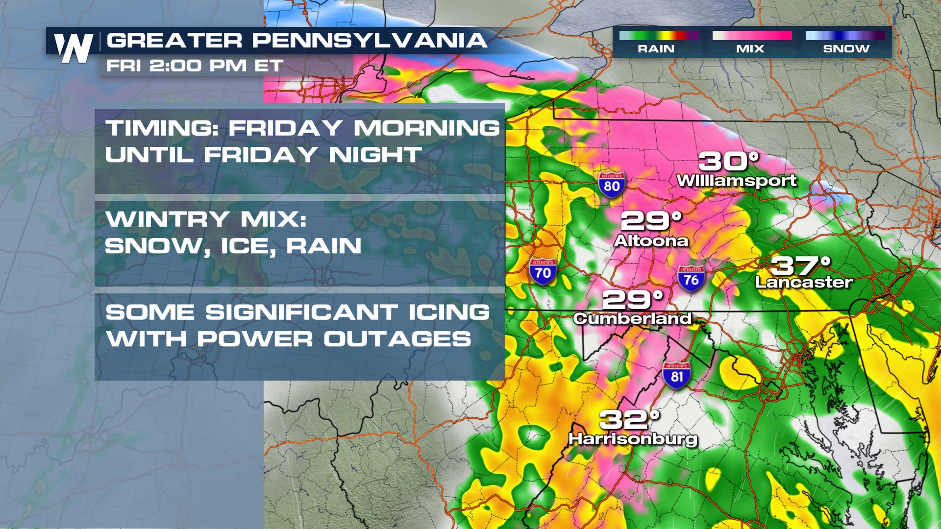
 Meanwhile up to the northeast in Illinois and the greater Midwest area, significant icing will be possible with scattered power outages and downed trees. Charge up any essential electronics you have, in case you have a loss of power.
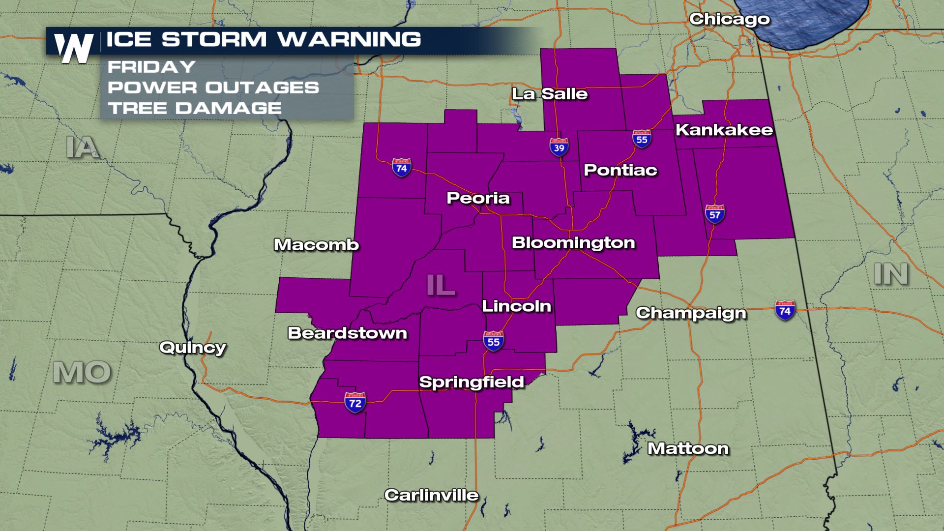 A rare ice storm warning has been issued for central/northern Illinois for power outages and downed trees due to freezing rain. This will impact Interstates 72, 55, 74, 39, and 57 and travel is discouraged through this area today.
 Next we take you to the Appalachian region where it will be the same story; snow, ice, and rain. This is also an area that can expect to get some pockets of significant icing as the storm rolls in.
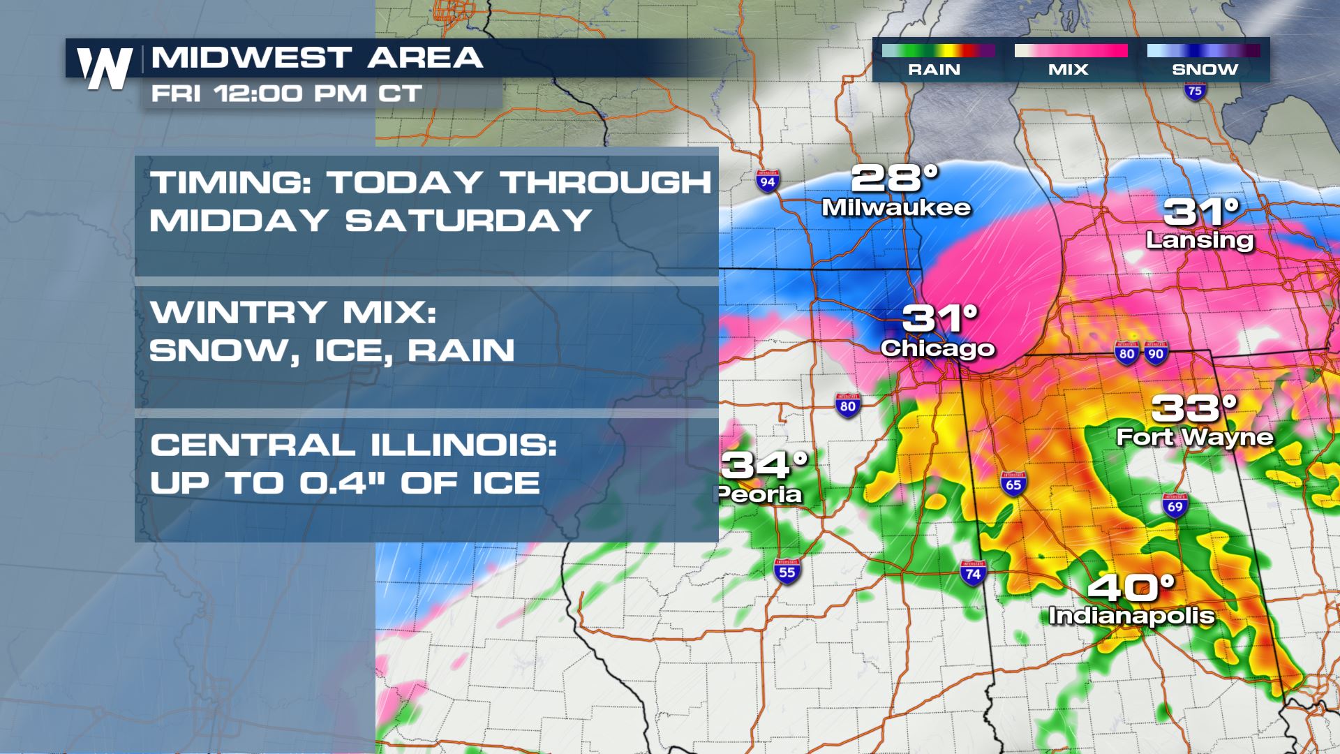
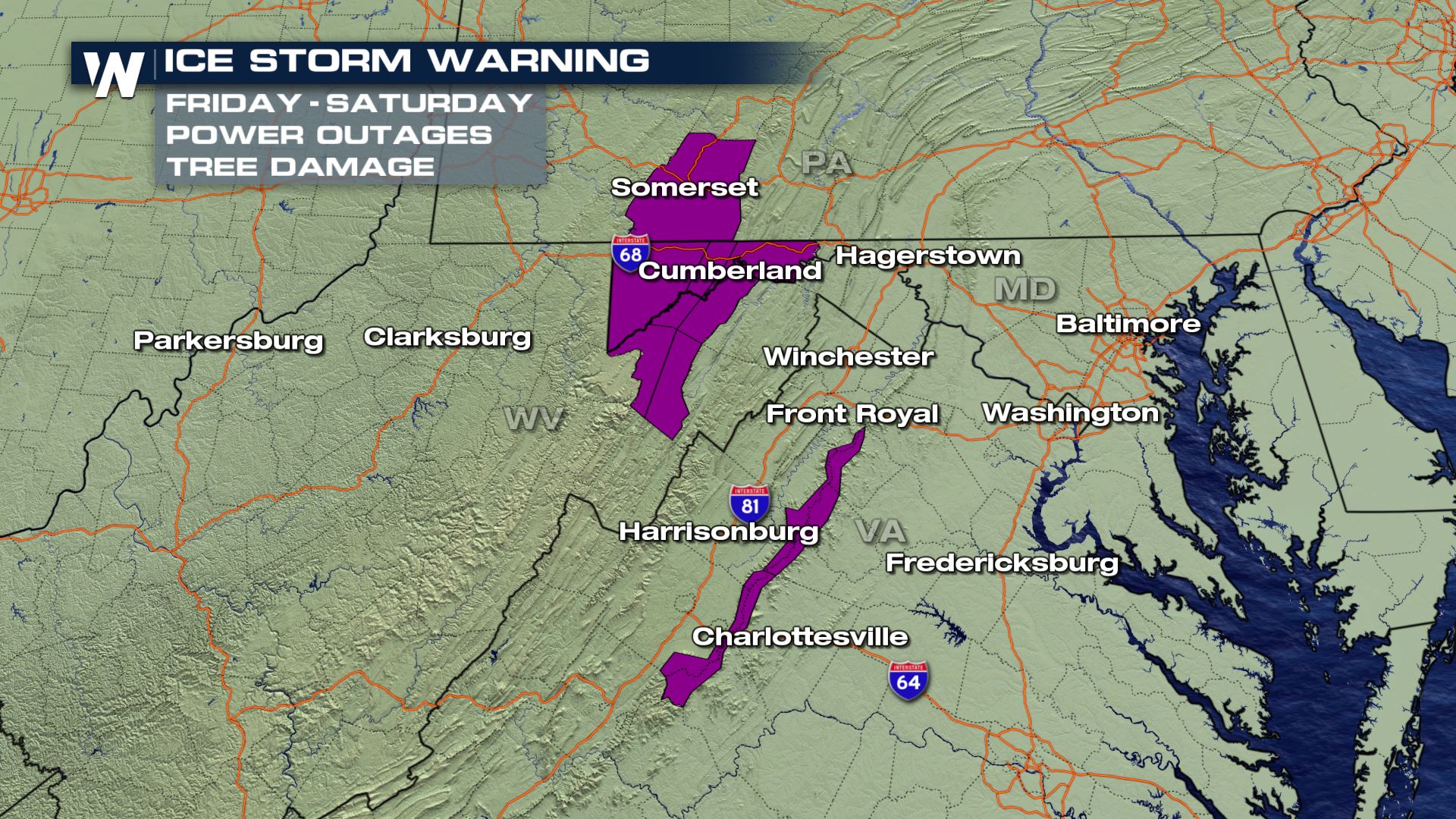 The precipitation will continue through the overnight hours and into early Saturday before tapering off by around sunrise Saturday.
 For the latest forecast and track be sure to check back in with WeatherNation or stream us live 24/7 on all of our streaming platforms!
Forecast
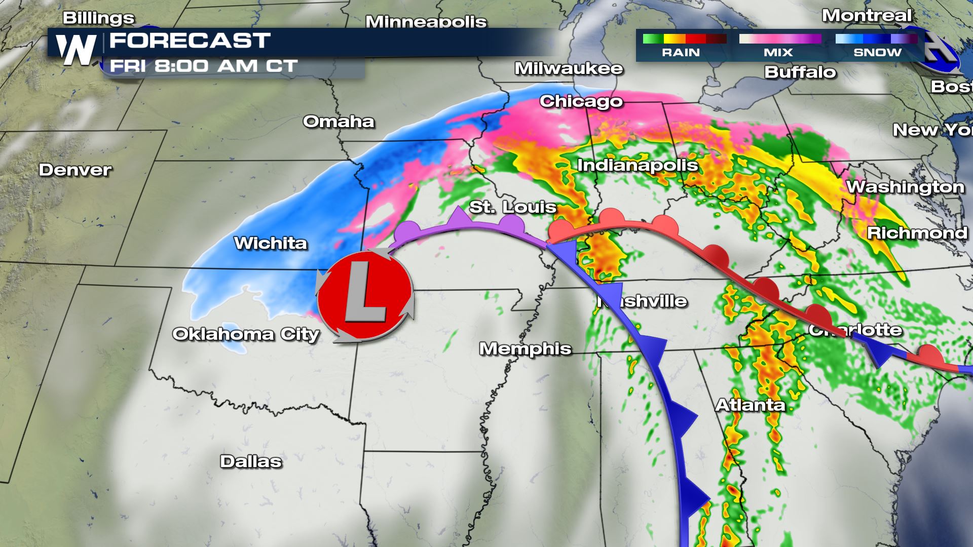
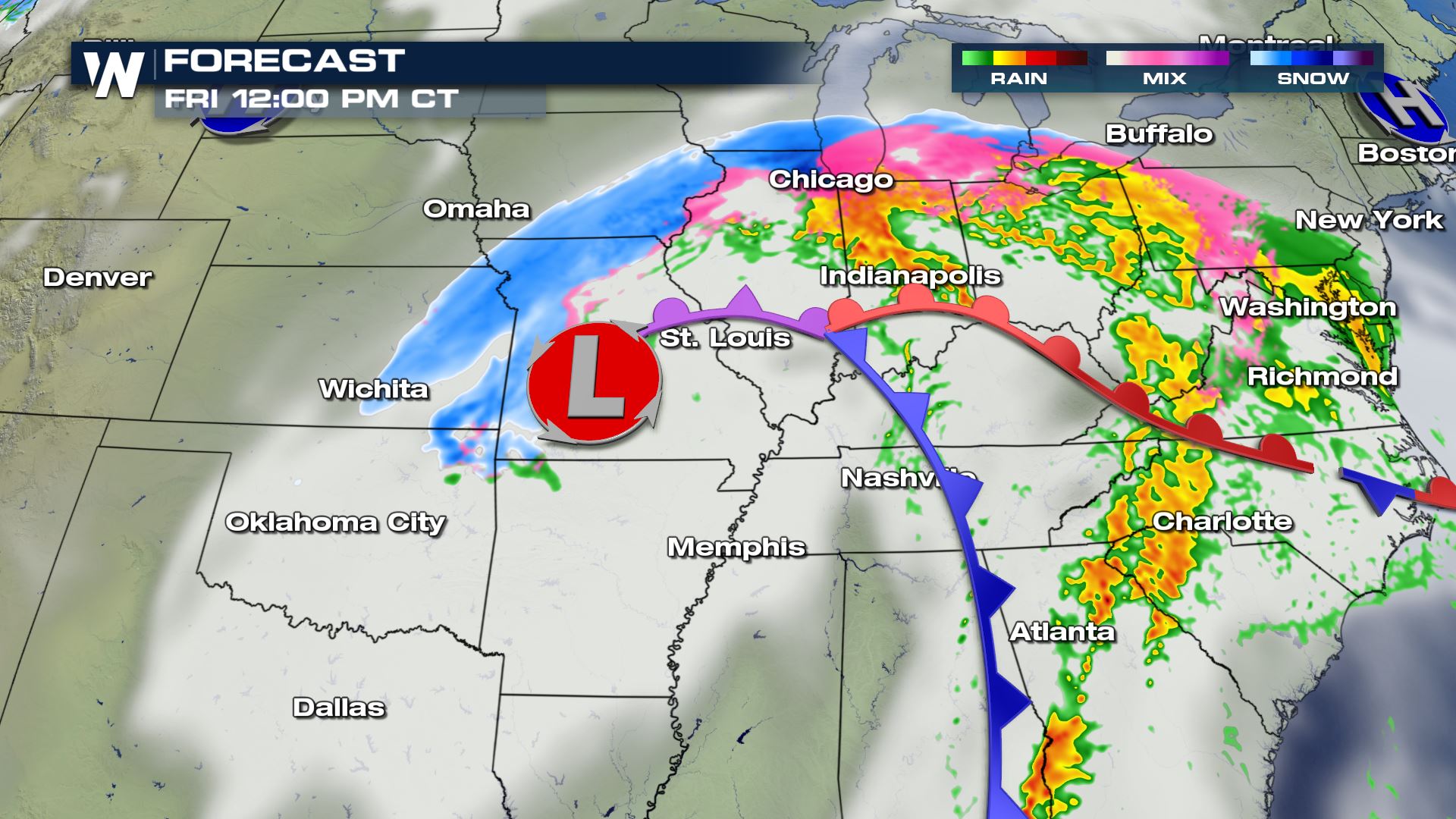
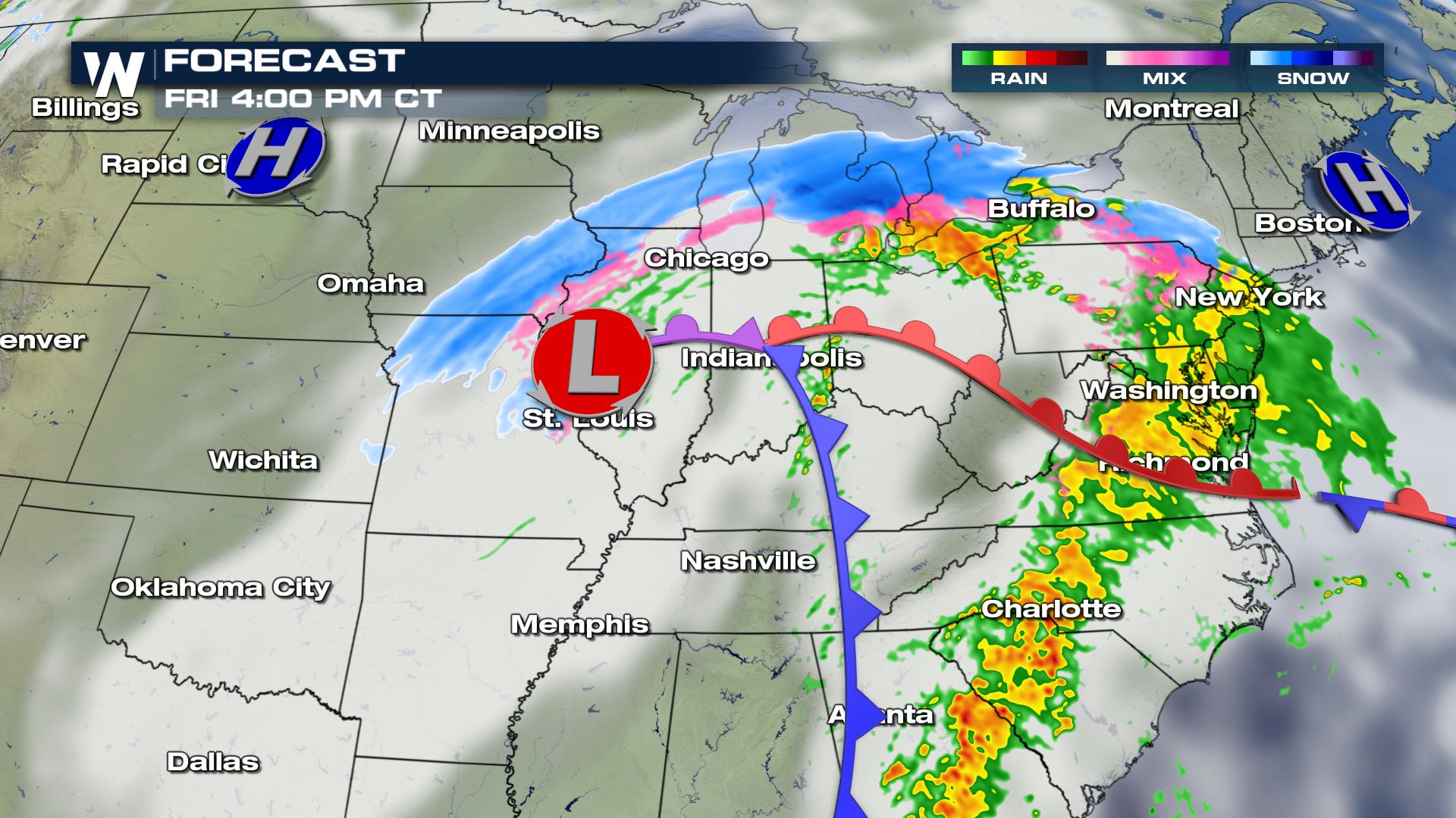
The area of low pressure will continue to move northeast through Missouri, the Ohio Valley, and gradually lift northeast through the Appalachians today, tonight, and Saturday. It will bring snow, sleet, freezing rain, and rain along with it. It will depend on your location and elevation in regard to what kind of precipitation you will get, plus how much of each you will receive. Here is a time line for the broader picture through this afternoon.
Winter weather alerts are in effect from the Plains to Maine, and just about everywhere in between! Travel is discouraged today and tonight around this storm system because the snow, ice and wind will create hazardous and difficult travel conditions. Also, the heavy rain and thunderstorms will create ponding on roadways and very slick conditions.
Region by Region
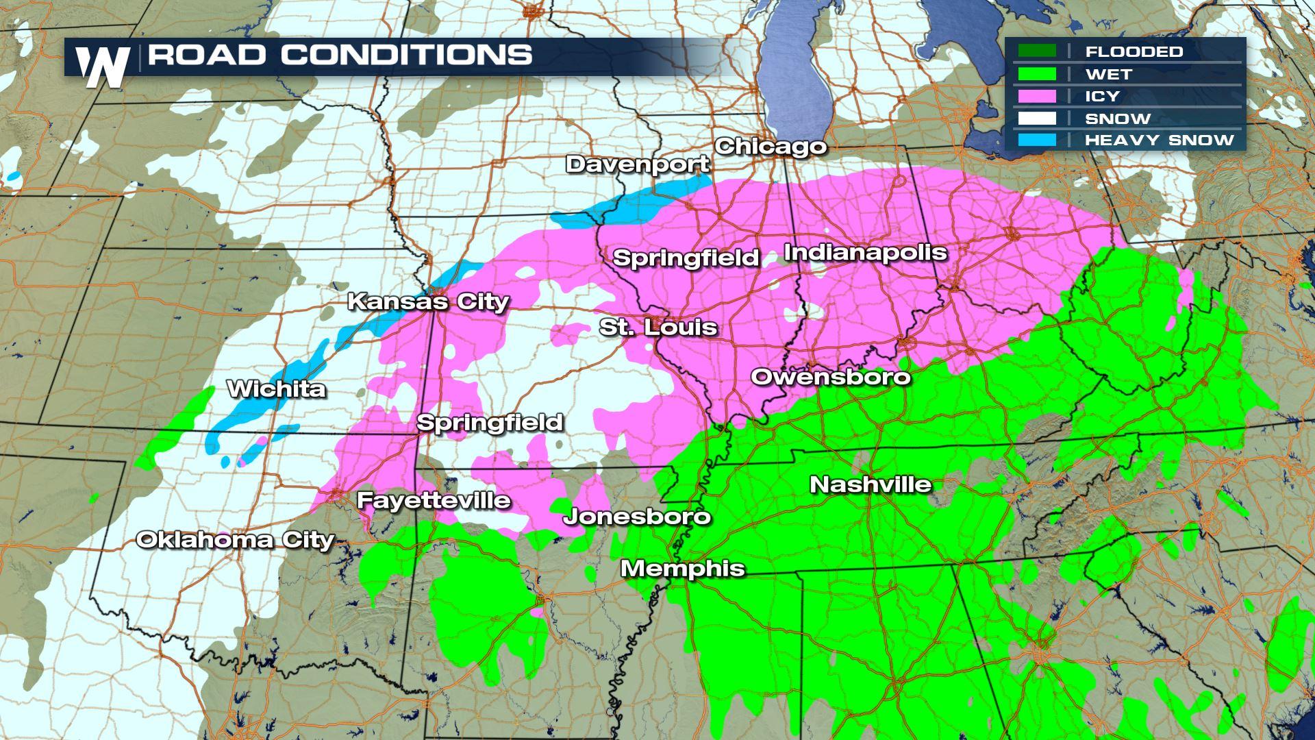
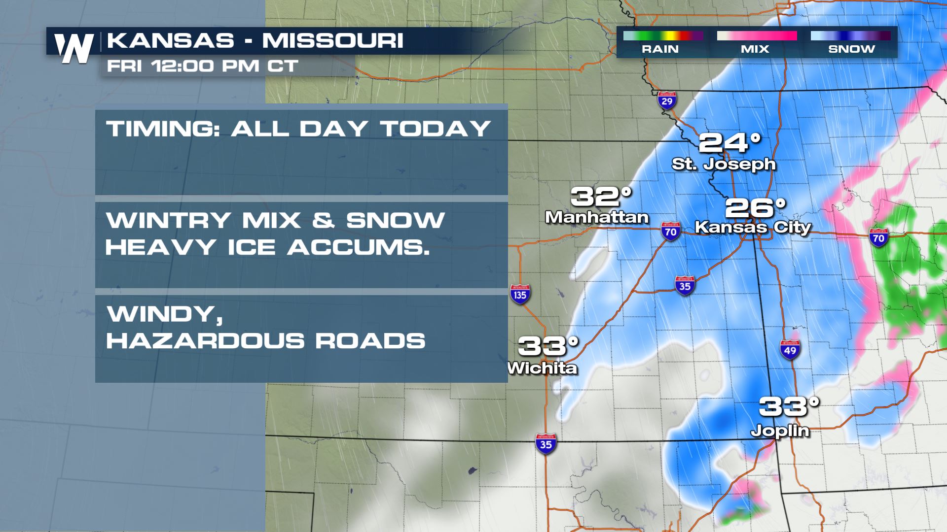
We will now take you region by region to show you a closer look at the timing and kinds of precipitation we can expect. In Kansas and Missouri, the snow and freezing rain will likely last through much of today. The snow will be more likely closer to the I-29 and I-49 corridors (and to the west of those corridors) while areas farther east on I-70 will get more freezing rain and rain.
Meanwhile up to the northeast in Illinois and the greater Midwest area, significant icing will be possible with scattered power outages and downed trees. Charge up any essential electronics you have, in case you have a loss of power.
A rare ice storm warning has been issued for central/northern Illinois for power outages and downed trees due to freezing rain. This will impact Interstates 72, 55, 74, 39, and 57 and travel is discouraged through this area today.
Next we take you to the Appalachian region where it will be the same story; snow, ice, and rain. This is also an area that can expect to get some pockets of significant icing as the storm rolls in.
The precipitation will continue through the overnight hours and into early Saturday before tapering off by around sunrise Saturday.
For the latest forecast and track be sure to check back in with WeatherNation or stream us live 24/7 on all of our streaming platforms!All Weather News
More
Pacific Northwest Fires Bringing Down the Air Quality
Conditions have been real dry out west. We've
21 Jul 2026 11:05 AM

Flash Flooding and Severe Weather for the Carolinas This Week
Another stalled front in the Carolinas is for
21 Jul 2026 10:40 AM

Another Round of Storms Targets the Northeast
Another cold front is dropping east and will
21 Jul 2026 10:25 AM

Tropics: Tropical Storm Bertha Forms In the Atlantic, Eastern Pacific Active
In the Atlantic basin, we are keeping a very
21 Jul 2026 10:00 AM

Another Round of Severe Weather for the Upper Midwest and Great Lakes
The upper-level low train continues to keep t
21 Jul 2026 1:45 AM

Air Quality Improvements in the Forecast
Wildfires burning in Northwestern Ontario, Ca
20 Jul 2026 7:20 PM

Monsoon Moisture Brings Weekend Flood Threat
The monsoon has returned to the southwestern
19 Jul 2026 1:30 AM