Strong Winds and Heavy Rain with Autumn Nor'Easter
Top Stories
27 Oct 2021 6:00 AM
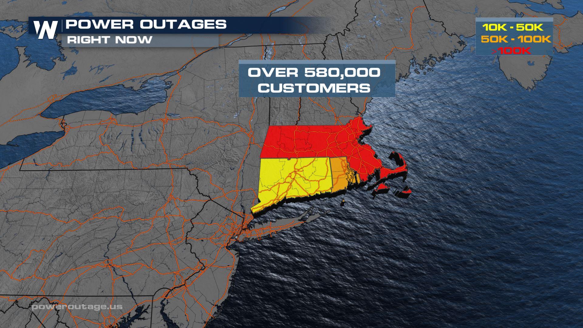
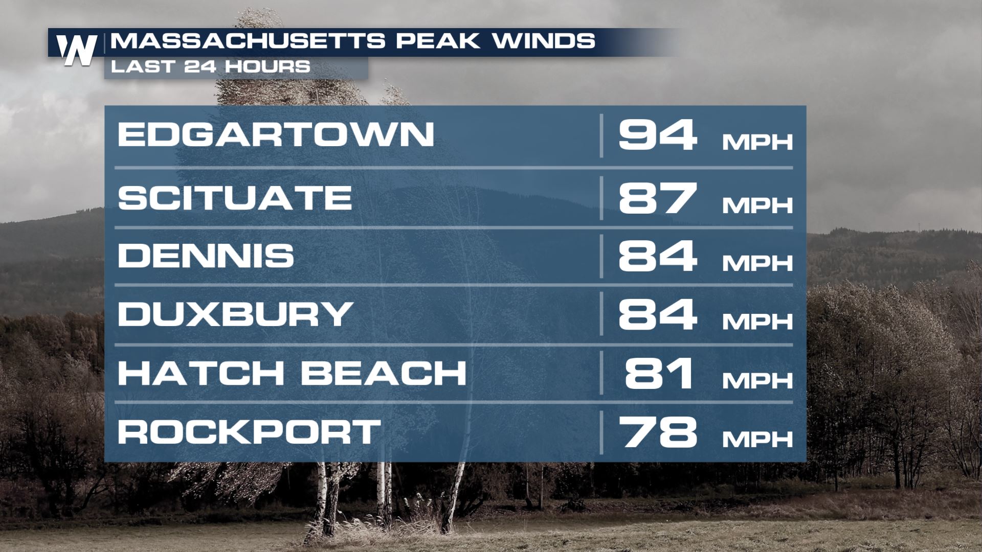
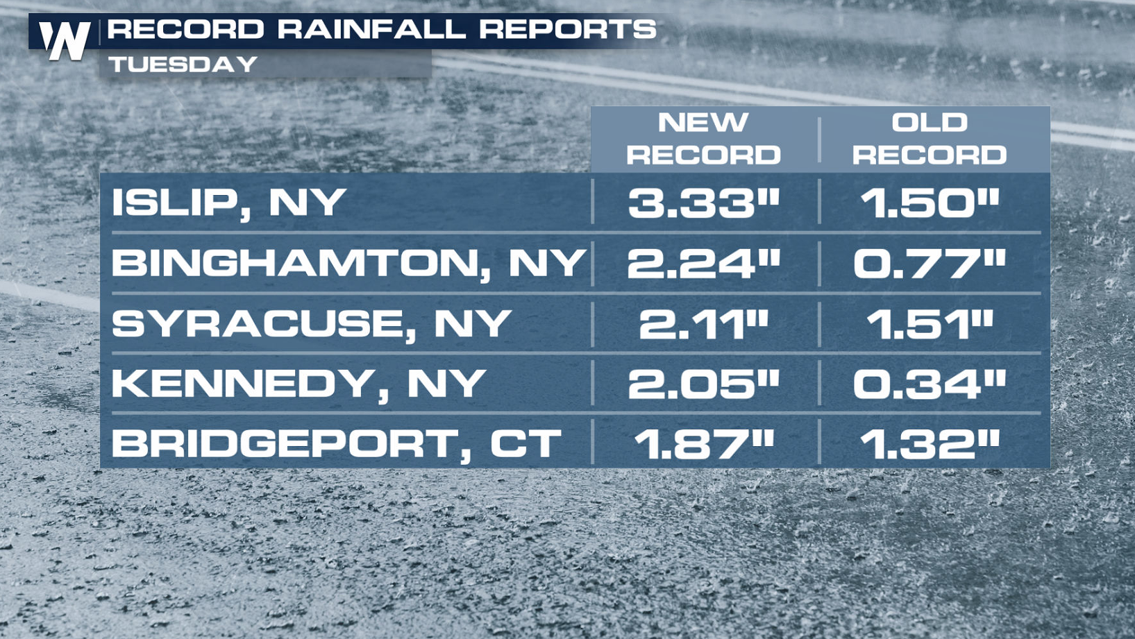
The Northeast continues to be battered by an autumn Nor'easter, producing very heavy rain and strong wind gusts. Winds have been clocked higher than 80 mph already, along with rainfall totals in excess of 3 inches in some areas. Massive power outages have been reported throughout New England (above).
 https://twitter.com/WeatherNation/status/1453028649351798787
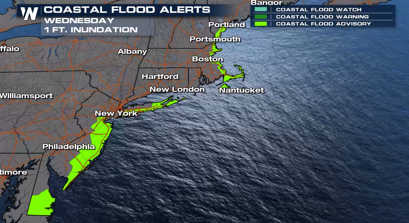
 Flooding is possible for coastal areas. The combination of heavy rain, high tides and the onshore flow are leading to the flooding of low lying areas and some roadways along the coast.
 Keep it on WeatherNation for the very latest information on this evolving storm system for the Northeast.
https://twitter.com/WeatherNation/status/1453028649351798787
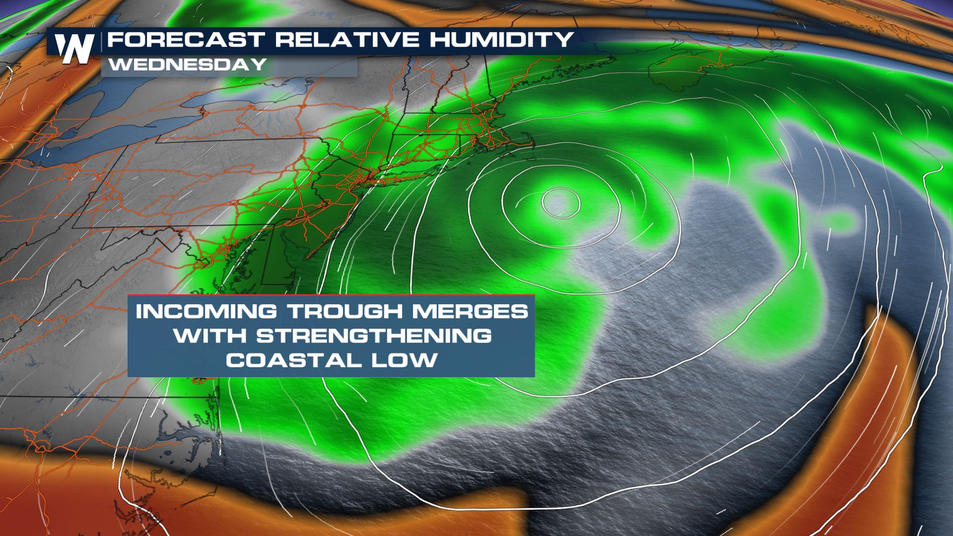
Nor'easter Set-Up
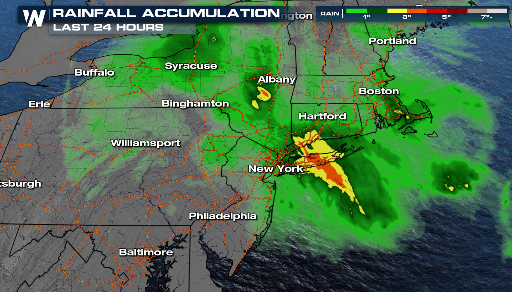
We are continuing to track heavy rain across the Northeast with the Nor'easter that formed off the Atlantic coast. The deepening low has been slow to move away from the coast, producing very strong east to northeast winds on top of the risk of heavy rain.
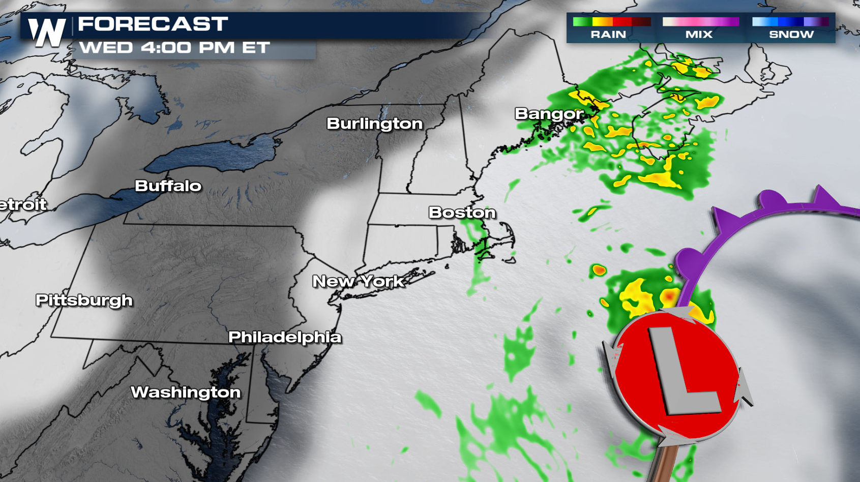
Forecast
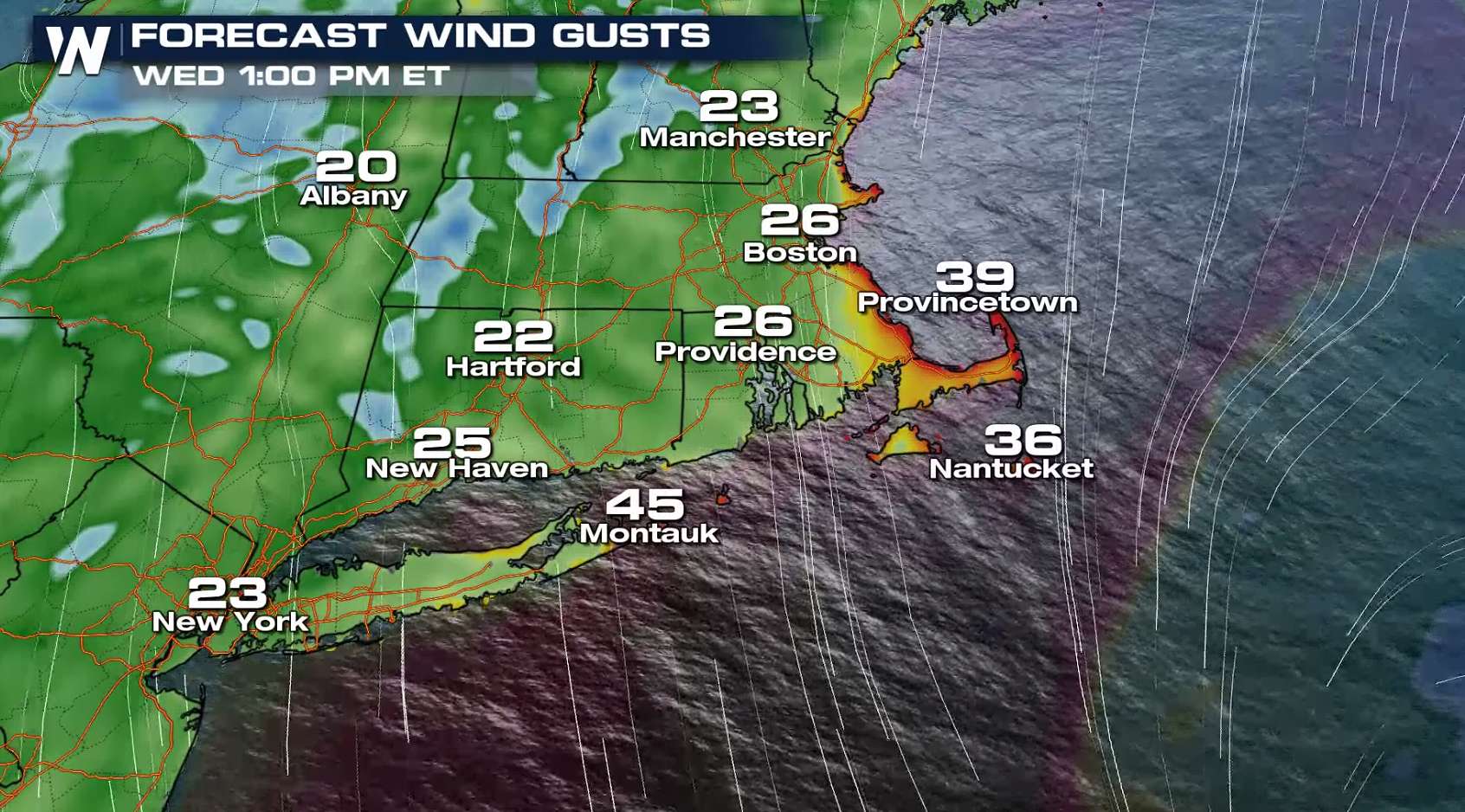
The wind will remain strong throughout the day, but rainfall will gradually diminish this afternoon (Wednesday) as the Nor'easter slowly pushes eastward away from the coast.
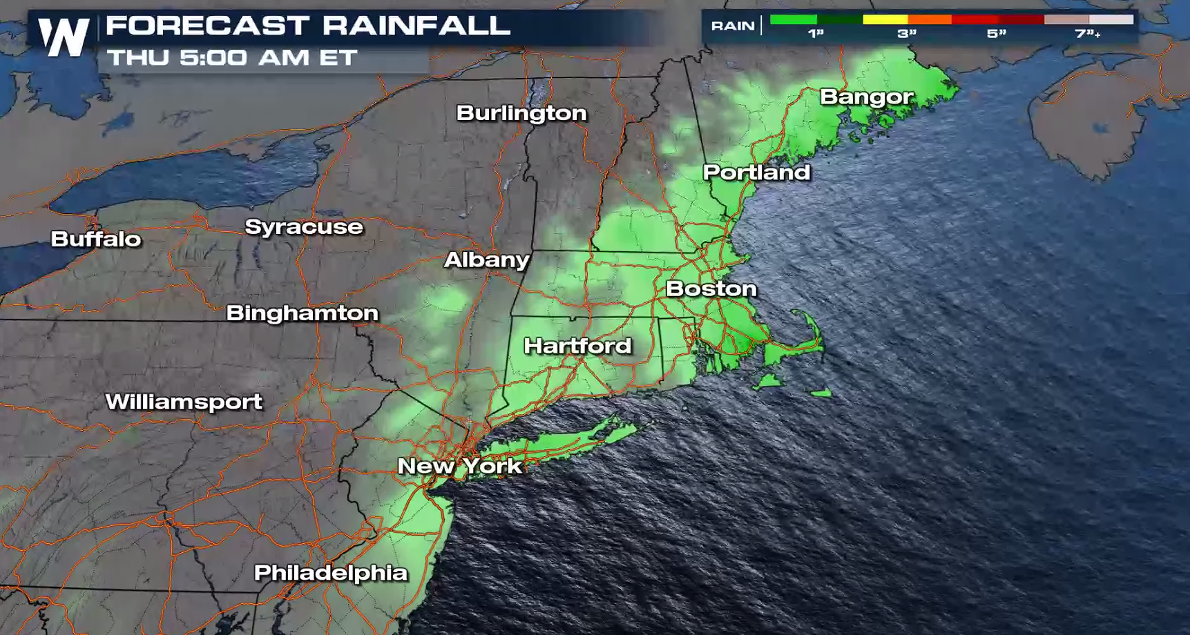
Flood Threat
The heavy rain leads to a risk for flooding in Rhode Island and Massachusetts, where an additional inch of rainfall will be possible. If you are in a low lying area, you will want to have a plan in place to head to higher ground.
Flooding is possible for coastal areas. The combination of heavy rain, high tides and the onshore flow are leading to the flooding of low lying areas and some roadways along the coast.
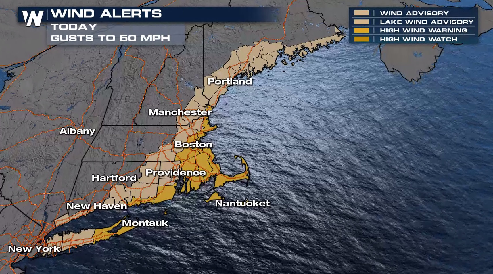
Wind Risk
The flooding rain is a big risk with this set-up, but we don't want to ignore the damaging wind threat. Wind alerts remain in effect for gusts over 50 mph today (Wednesday).
Keep it on WeatherNation for the very latest information on this evolving storm system for the Northeast.All Weather News
More
Southeast Flood Risk Lingers Near Stalled Front
A stalled boundary over the Carolinas will ke
24 Jul 2026 12:35 PM

Severe Chances Return for the Midwest
The upcoming stretch of hot temperatures will
24 Jul 2026 12:25 PM

Tropics: Fausto Heads to Hawaii, Bertha Breaks Apart
BerthaBertha has dissipated after moving inla
24 Jul 2026 11:50 AM

Hot & Smoky w/ a Chance of Lightning
Conditions have been really dry out west. We'
24 Jul 2026 11:15 AM

Very Hot Temperatures For the Western and Central United States
Are you over the summer heat yet? Well, more
24 Jul 2026 9:20 AM

Another Round of Storms Targets the Northeast
Tuesday brought severe weather again across p
23 Jul 2026 1:15 AM

Another Round of Severe Weather for the Upper Midwest and Great Lakes
The upper-level low train continues to keep t
21 Jul 2026 1:45 AM