Blocking High Pressure Sets Up Record Heat
Top Stories
22 May 2021 12:30 PM
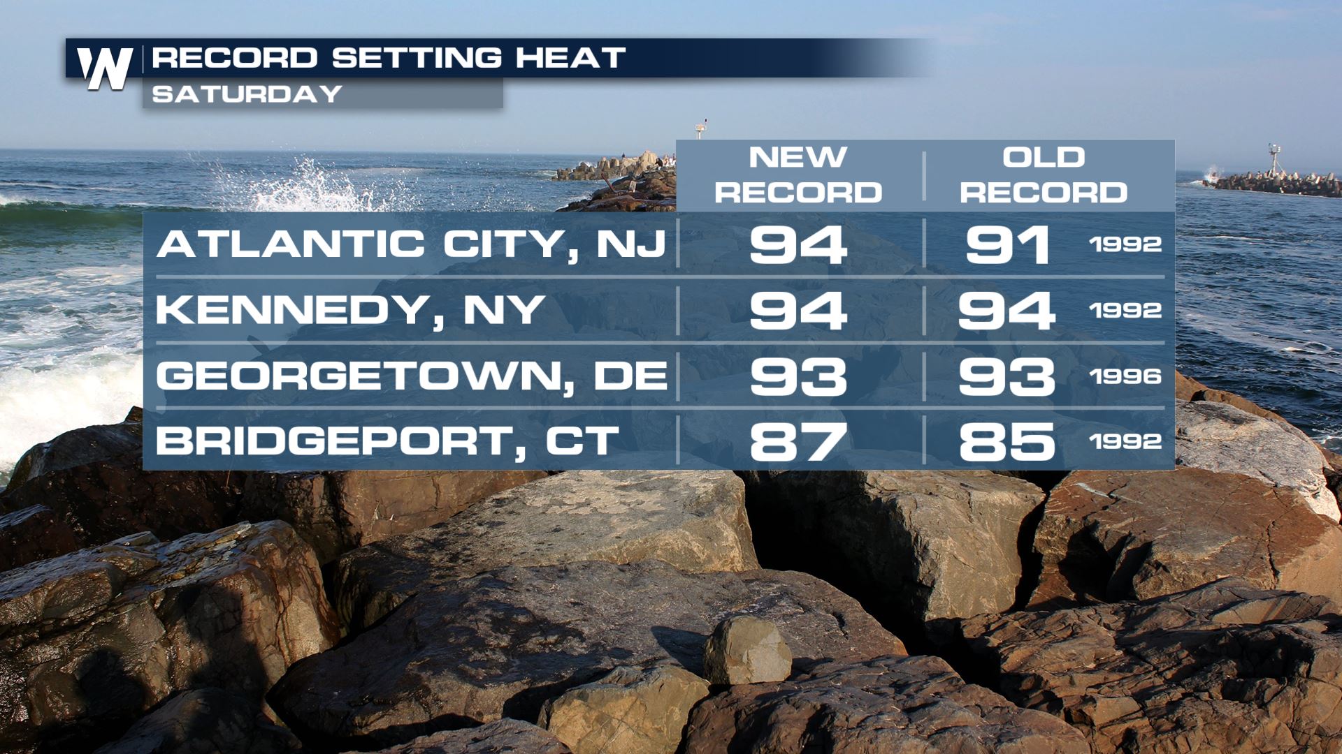
A blocking ridge strengthening over the Eastern U.S. through the beginning of next week will lead to increasing heat and humidity from north to south. The sinking air mass will also limit the amount of thunderstorm activity, keeping quiet weather in the forecast for many. We set a few new records in the northeast on Saturday, soaring into the 80s and 90s in many spots!
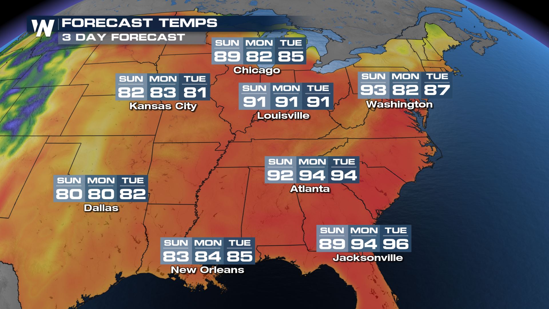
 The temperature trend shows highs going into the upper 80s and nearing 90 degrees, in several cities, by the weekend. The core of the warm air near the high will be near the coast, but the edge of the ridge will push as far west as Chicago and Kansas City through Sunday.
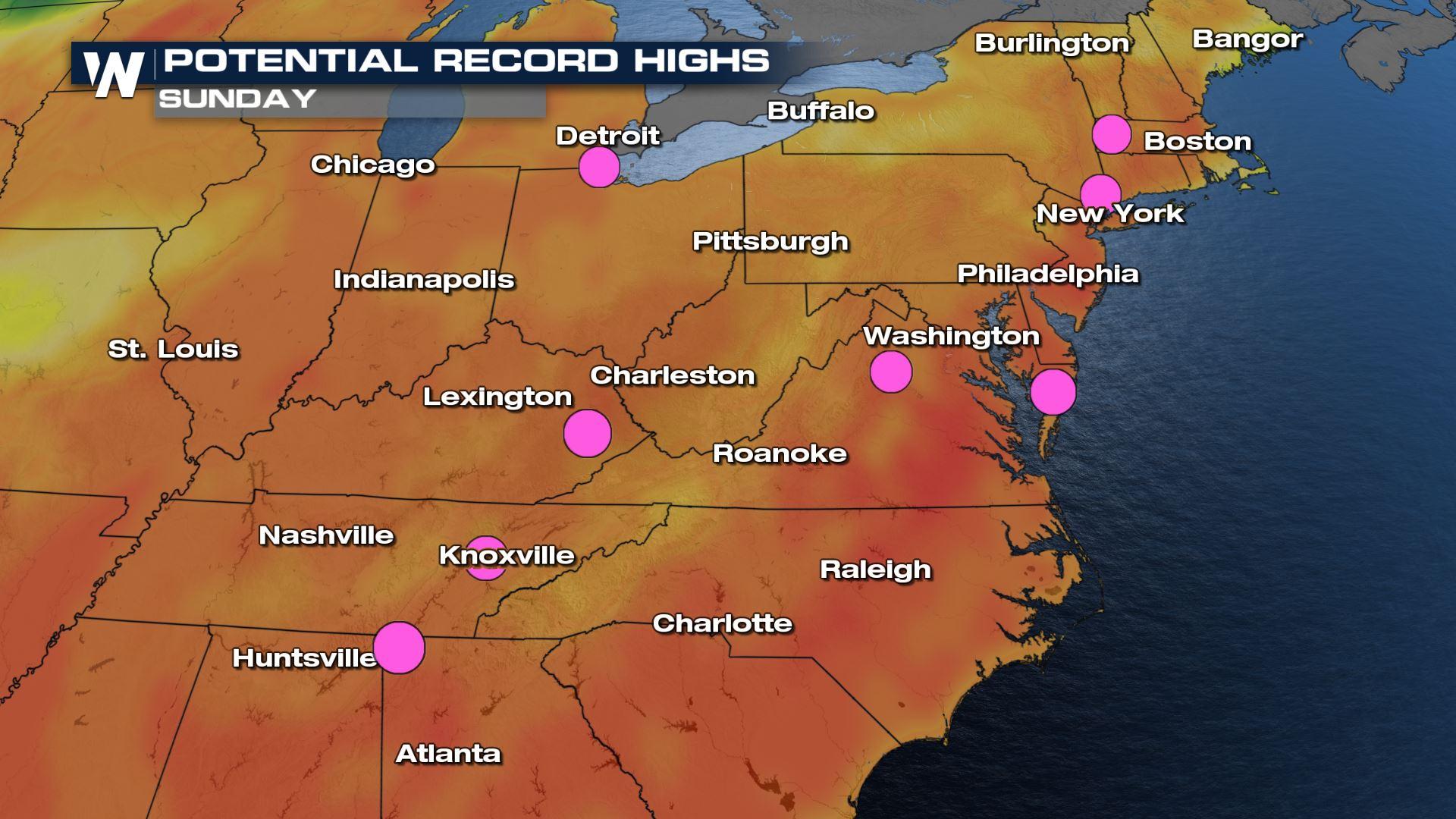
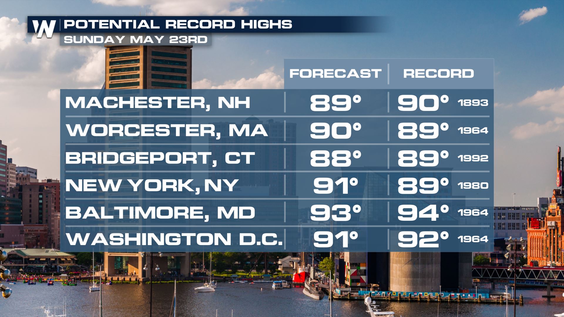
 On Sunday, with 90s in the forecast, there could be records broken from the Great Lakes down into the midsouth.
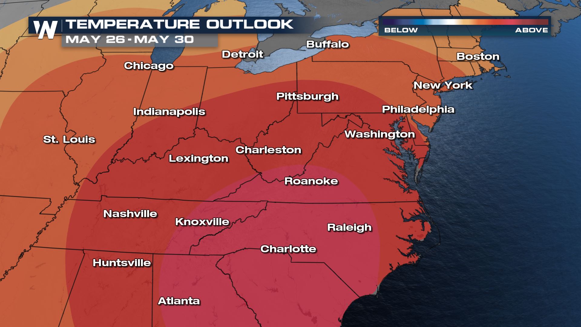
 High confidence remains in the forecast for above average temperatures through the end of May. Darker colors indicate level of confidence, not departure from average.
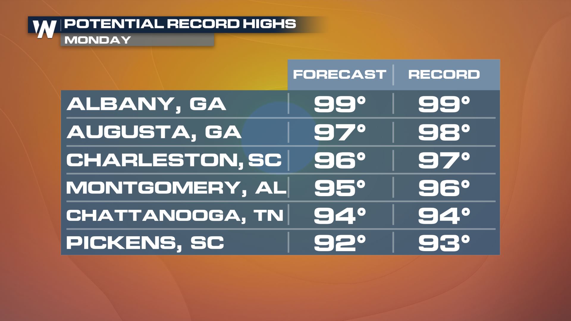
 Even more records farther south could be tied or broken by the afternoon on Monday May 24th. Many of the temperatures these days will be in the middle and upper 90s before factoring in humidity!
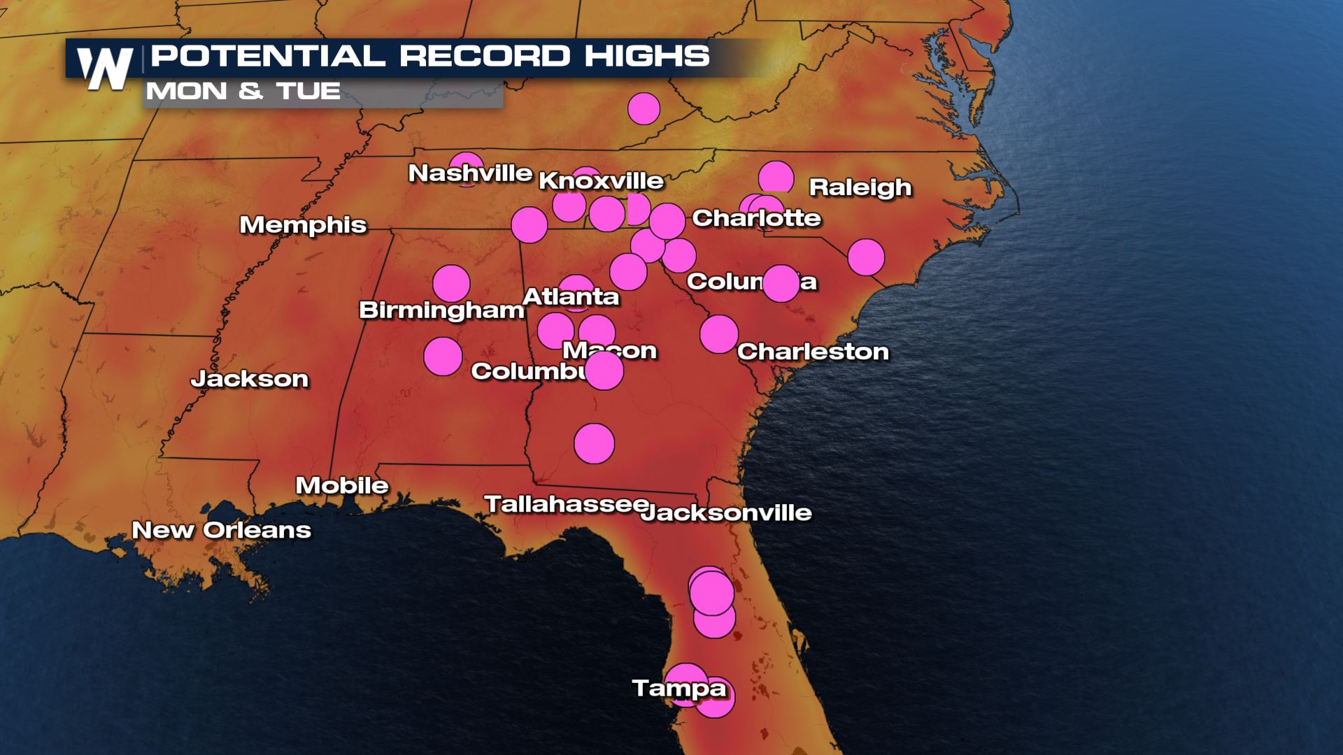 A few of those cities included are looking to reach into the upper 90s and the first triple digit mark isn't out of the question! Albany, GA, Columbia, SC and Augusta, GA will all be very close to the century mark early next week, and tying or breaking record highs.
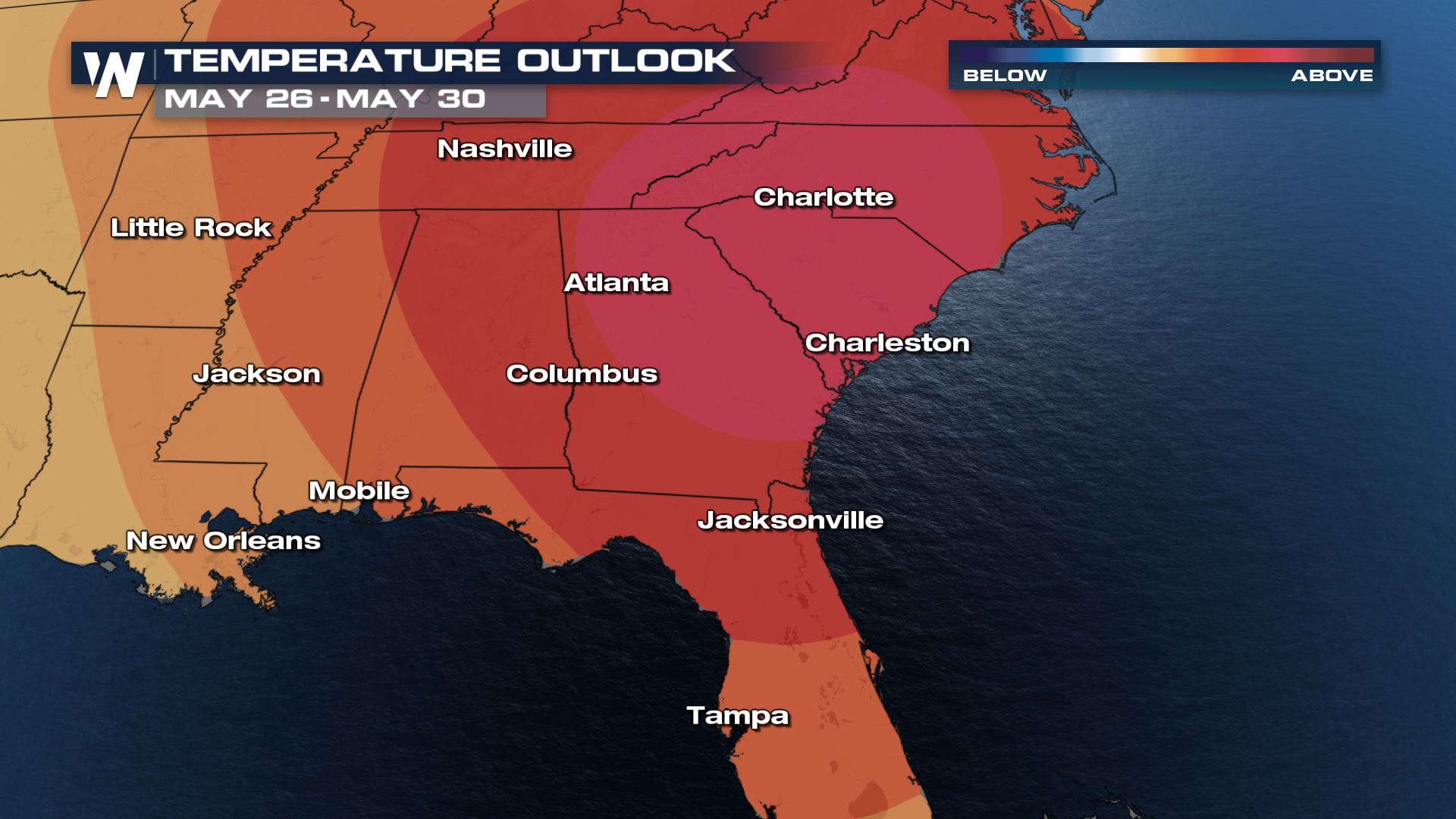
 Similar to the Northeast and Mid-Atlantic, there is high confidence that the Southeast will stay above average through the end of May.
 Summer heat is here! Stay with WeatherNation for updates on this and all other top weather stories. We're streaming 24/7 0n many digital platforms.
The temperature trend shows highs going into the upper 80s and nearing 90 degrees, in several cities, by the weekend. The core of the warm air near the high will be near the coast, but the edge of the ridge will push as far west as Chicago and Kansas City through Sunday.
On Sunday, with 90s in the forecast, there could be records broken from the Great Lakes down into the midsouth.
High confidence remains in the forecast for above average temperatures through the end of May. Darker colors indicate level of confidence, not departure from average.
Even more records farther south could be tied or broken by the afternoon on Monday May 24th. Many of the temperatures these days will be in the middle and upper 90s before factoring in humidity!
A few of those cities included are looking to reach into the upper 90s and the first triple digit mark isn't out of the question! Albany, GA, Columbia, SC and Augusta, GA will all be very close to the century mark early next week, and tying or breaking record highs.
Similar to the Northeast and Mid-Atlantic, there is high confidence that the Southeast will stay above average through the end of May.
Summer heat is here! Stay with WeatherNation for updates on this and all other top weather stories. We're streaming 24/7 0n many digital platforms.All Weather News
More
Wildfire Outbreak in the Pacific Northwest
SPOKANE, WA - On Saturday, August 1st, the Ol
3 Aug 2026 1:55 AM

More Storms for the East Through Monday
A low-pressure system that moved through the
3 Aug 2026 1:50 AM


After Reaching Category 5, Genevieve Weakens in the Pacific
PacificGenevieve formed last Friday south of
3 Aug 2026 12:30 AM

Flooding, Severe Storms Target the Midwest Again
After an active week of storms across the nor
1 Aug 2026 1:40 AM

Flooding Risk Increases as Heavy Rain Targets the Tri-State Area
Tuesday, heavy rainfall moved across the Nort
30 Jul 2026 12:25 AM

Severe Weather: Energy From the Midwest Now in the Southeast
UPPER MIDWEST - Through Monday, dangerous tor
29 Jul 2026 10:30 PM