Brief Heavy Snow for the Northern Plains and Upper Midwest
Special Stories
28 Feb 2021 8:32 AM
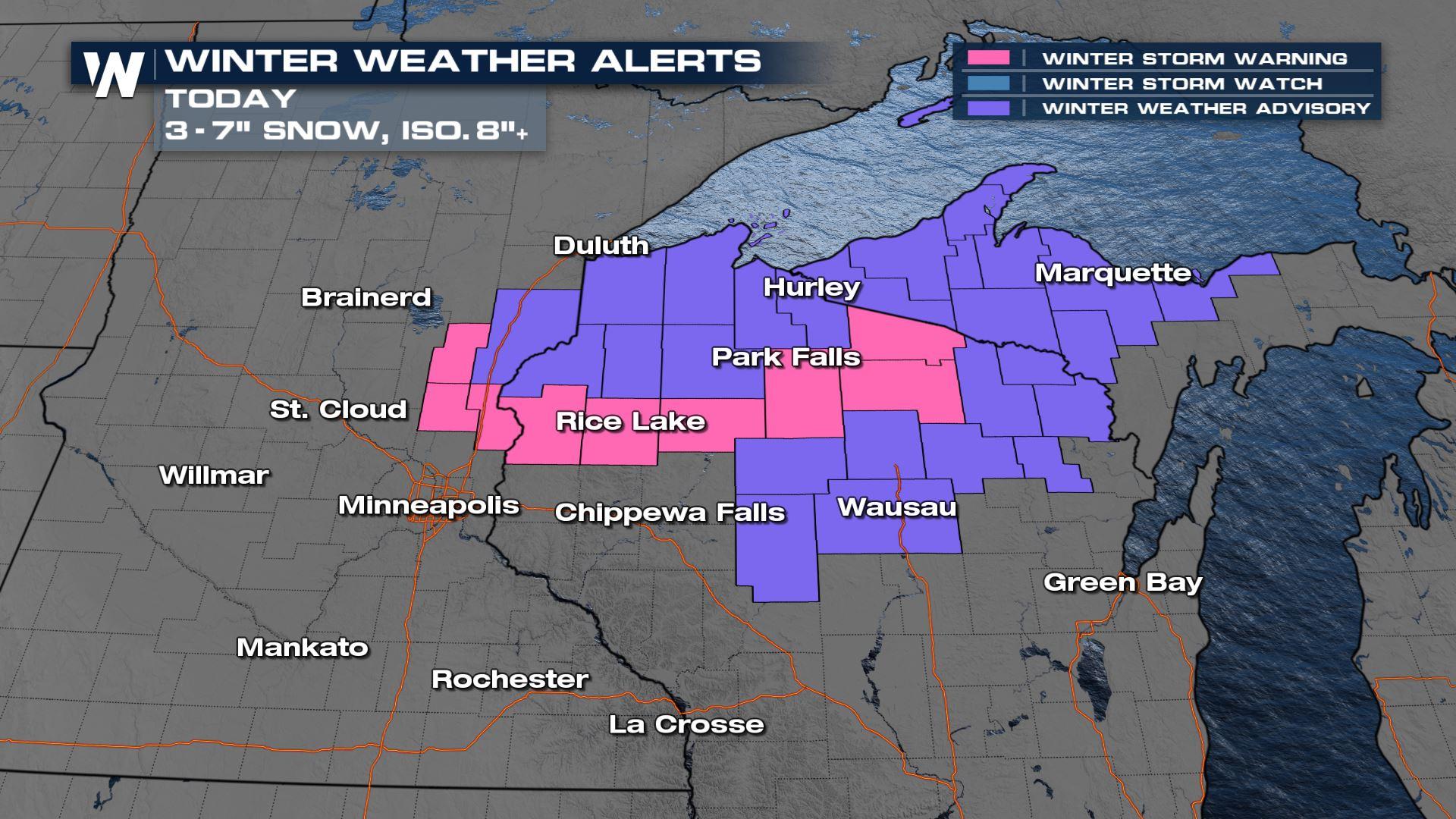
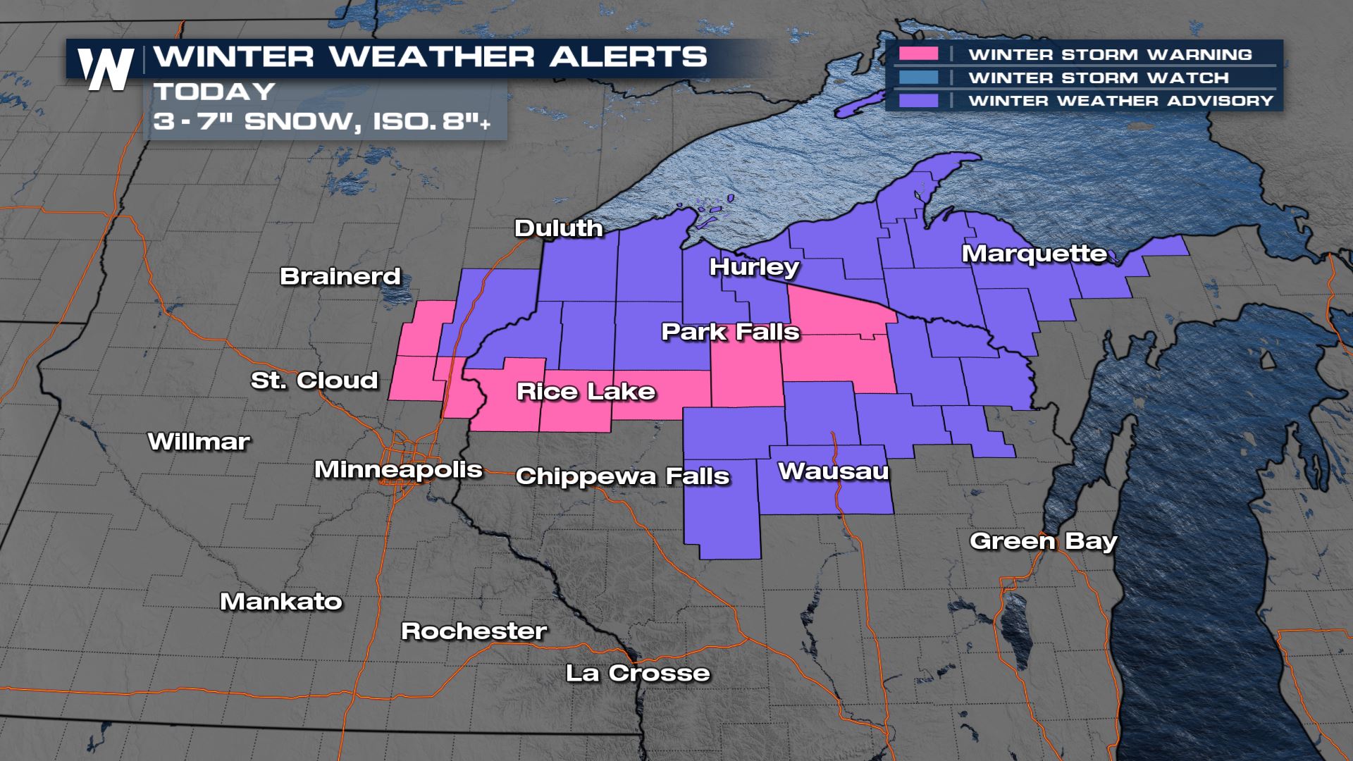
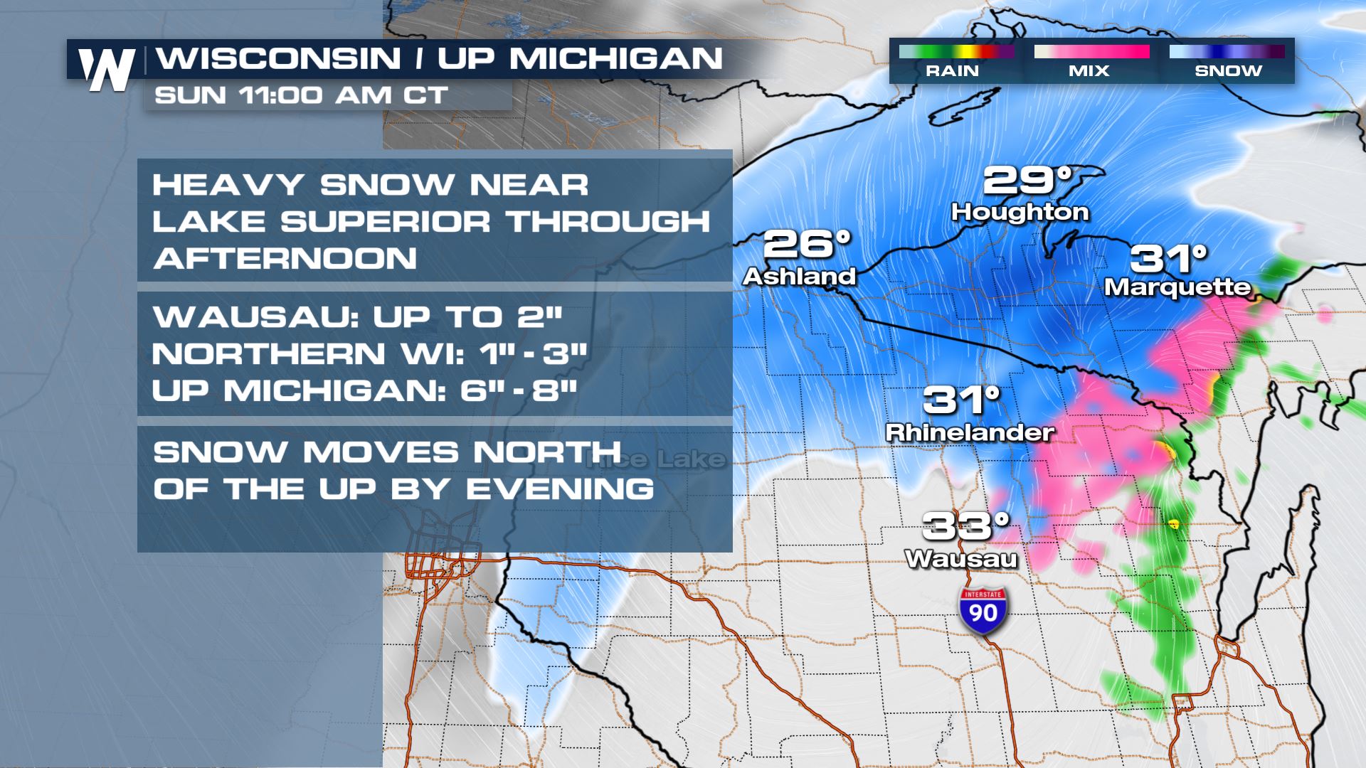
Winter Weather Alerts remain through this afternoon for far eastern Minnesota through Wisconsin and into the UP of Michigan. We could see on the highest extend up to 6-9" of snow.
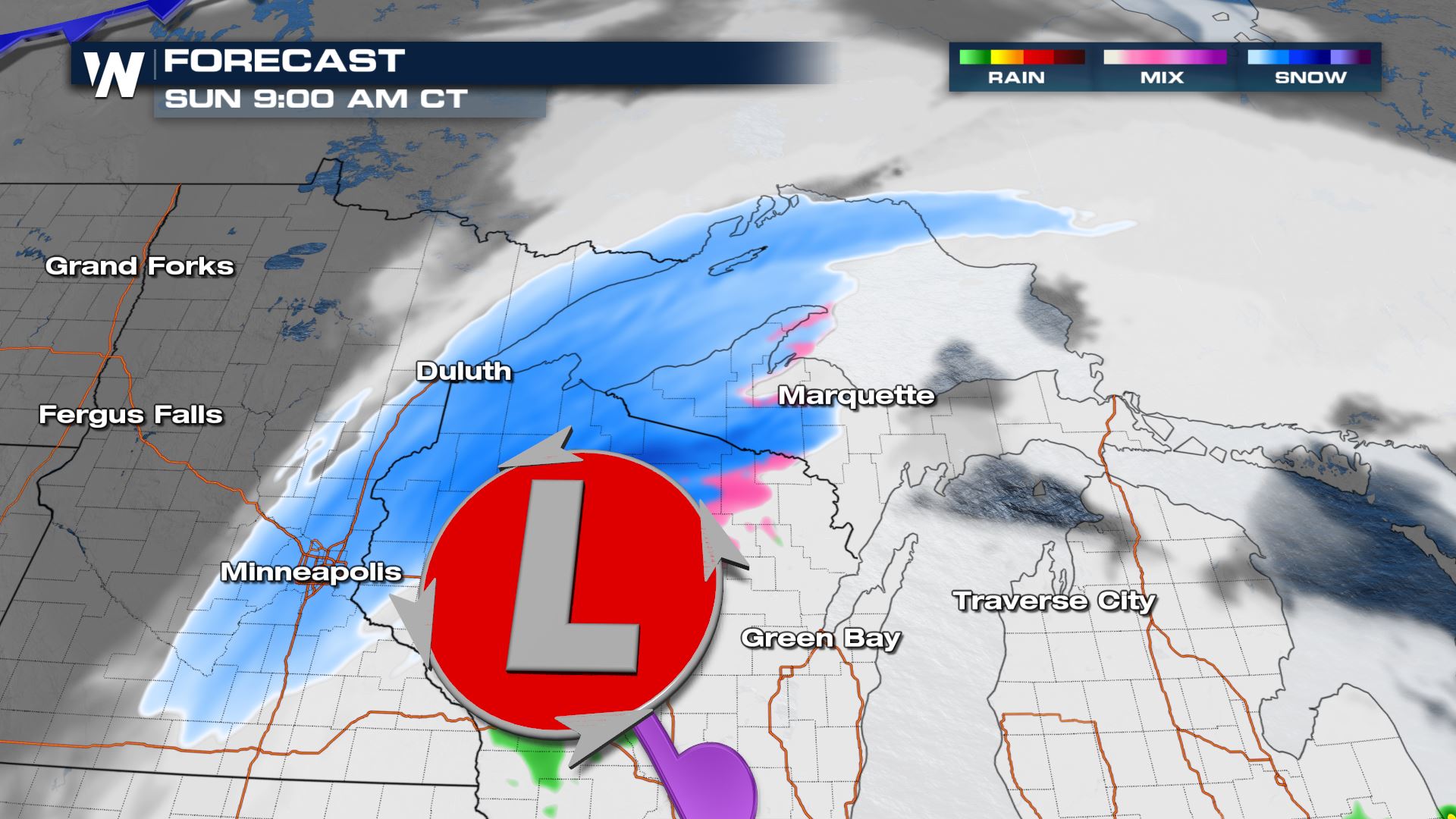
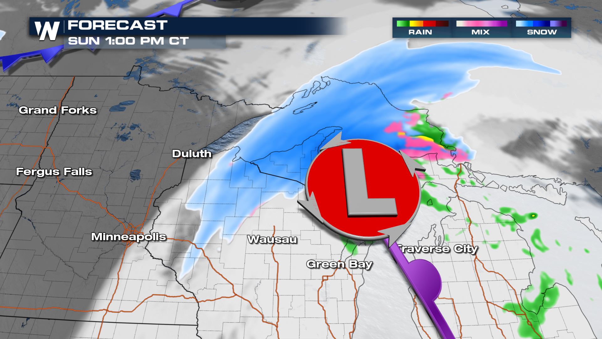
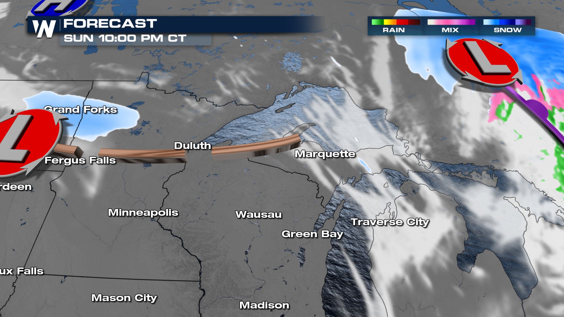
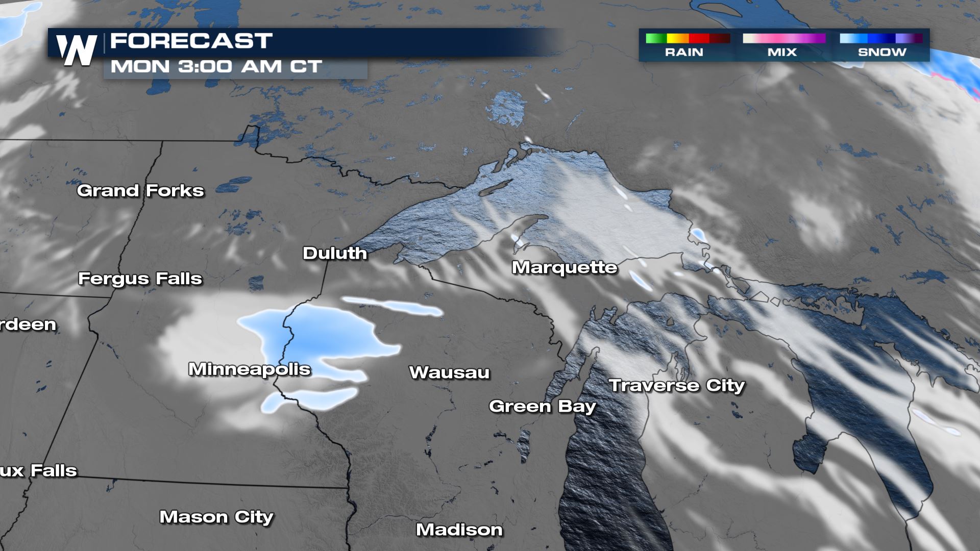
 A trailing trough in the upper-levels could bring another quick round of mostly light snow to the Upper Midwest Sunday night into Monday morning.
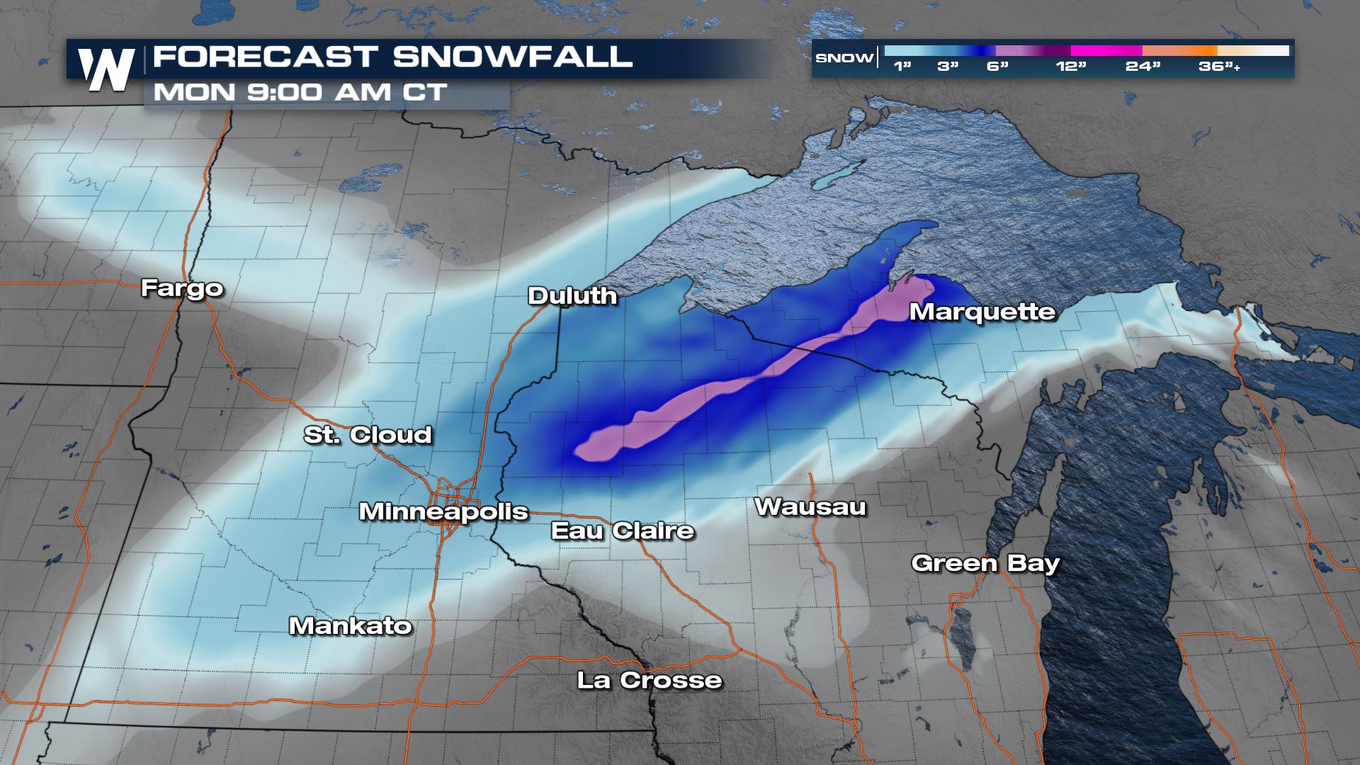
 A stripe of moderate snow is expected across the region under winter alerts. On the lower end, areas on the cusp of heavier snow will receive 1-3 inches, while most locations in the dark blue or purple should expect between 3-9 inches.
 You can always get the latest forecast for this region on air at 30 past the hour in your Central Regional Forecast, or on demand through our app.
Forecast
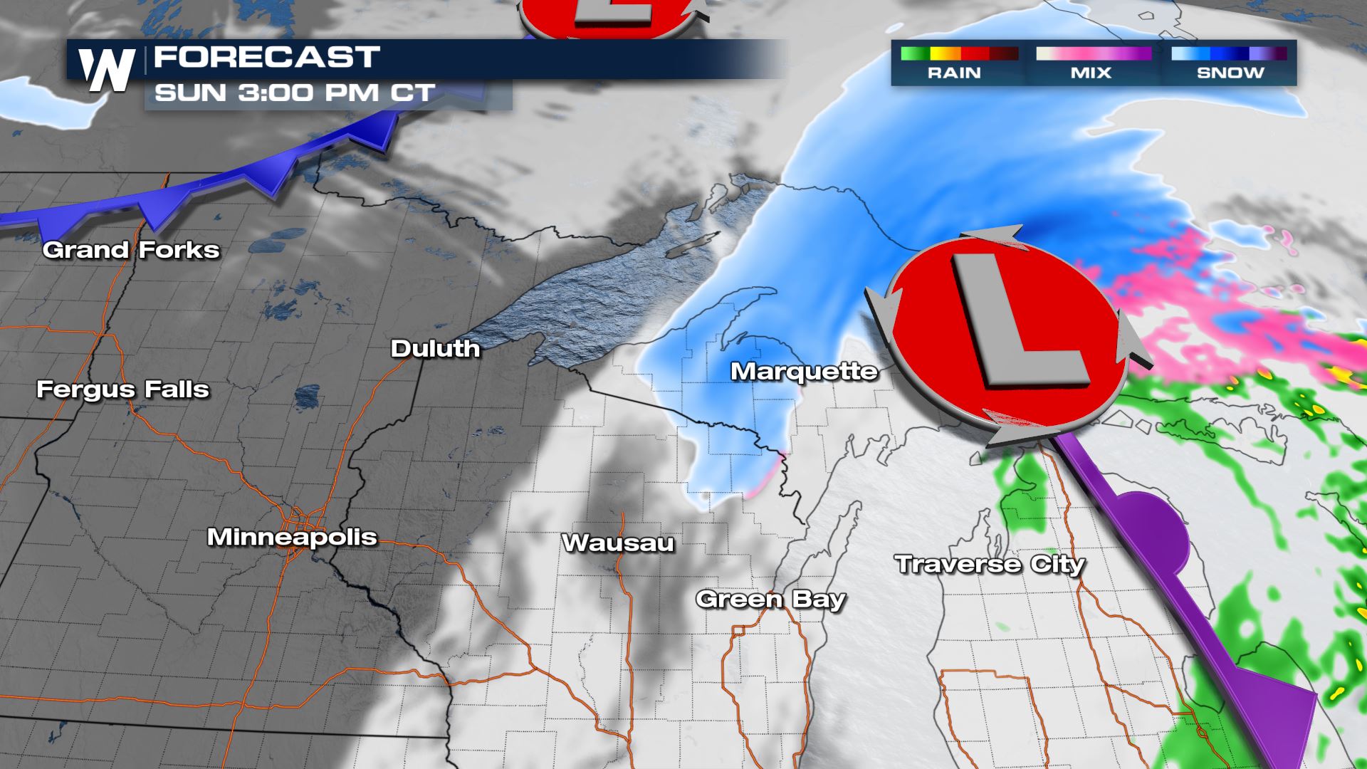
From Sunday morning into the early afternoon the light to moderate snow is expected to pivot through Northern Wisconsin into the Upper Peninsula of Michigan.
A trailing trough in the upper-levels could bring another quick round of mostly light snow to the Upper Midwest Sunday night into Monday morning.
Accumulation
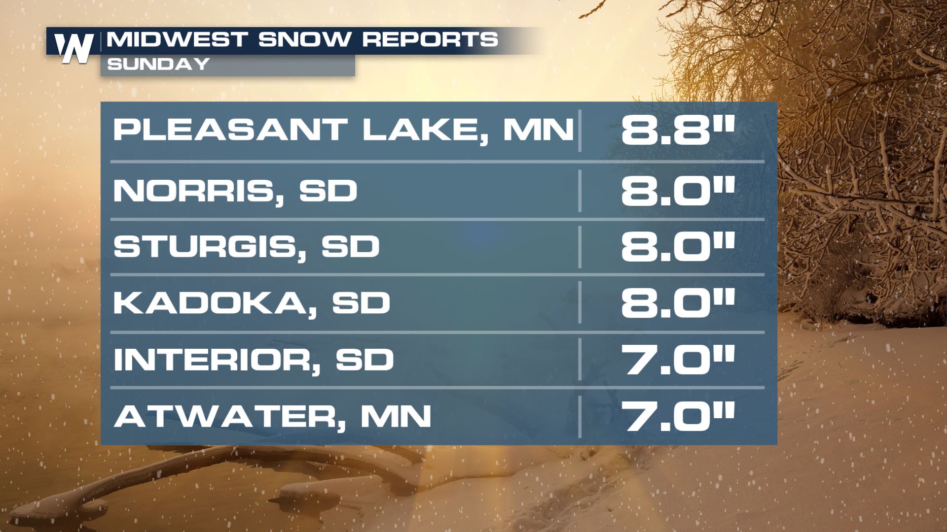
We have already seen between 7-9" from South Dakota through Minnesota so far.
A stripe of moderate snow is expected across the region under winter alerts. On the lower end, areas on the cusp of heavier snow will receive 1-3 inches, while most locations in the dark blue or purple should expect between 3-9 inches.
You can always get the latest forecast for this region on air at 30 past the hour in your Central Regional Forecast, or on demand through our app.All Weather News
More

More Storms for the East Through Monday
A low-pressure system that moved through the
3 Aug 2026 12:20 PM


After Reaching Category 5, Genevieve Weakens in the Pacific
PacificGenevieve formed last Friday south of
3 Aug 2026 12:30 AM

Flooding, Severe Storms Target the Midwest Again
After an active week of storms across the nor
1 Aug 2026 1:40 AM

Flooding Risk Increases as Heavy Rain Targets the Tri-State Area
Tuesday, heavy rainfall moved across the Nort
30 Jul 2026 12:25 AM