Chantal forms in Atlantic; no threat to land
Top Stories
20 Aug 2019 9:00 PM
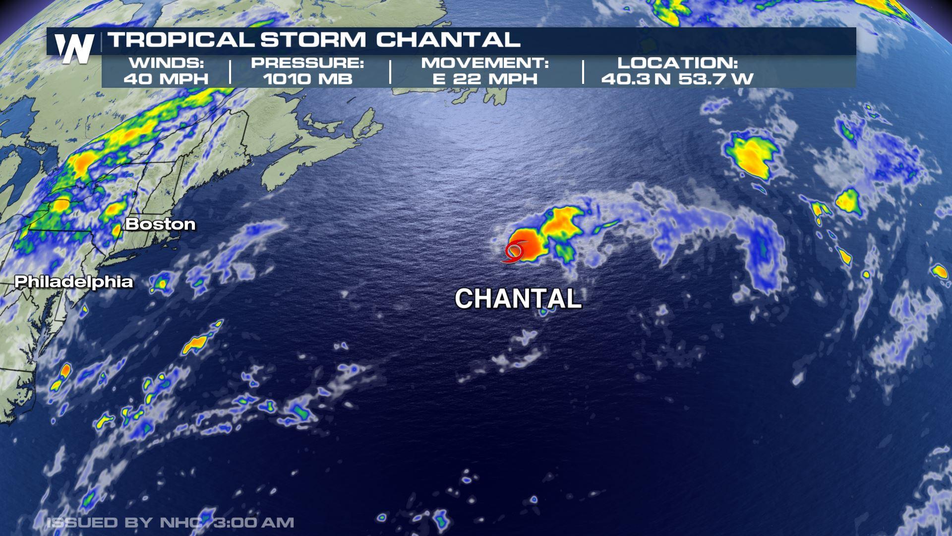
Tropical Storm Chantal formed over the Atlantic Ocean on Tuesday night, becoming the third-named storm in the Atlantic Basin's 2019 season.
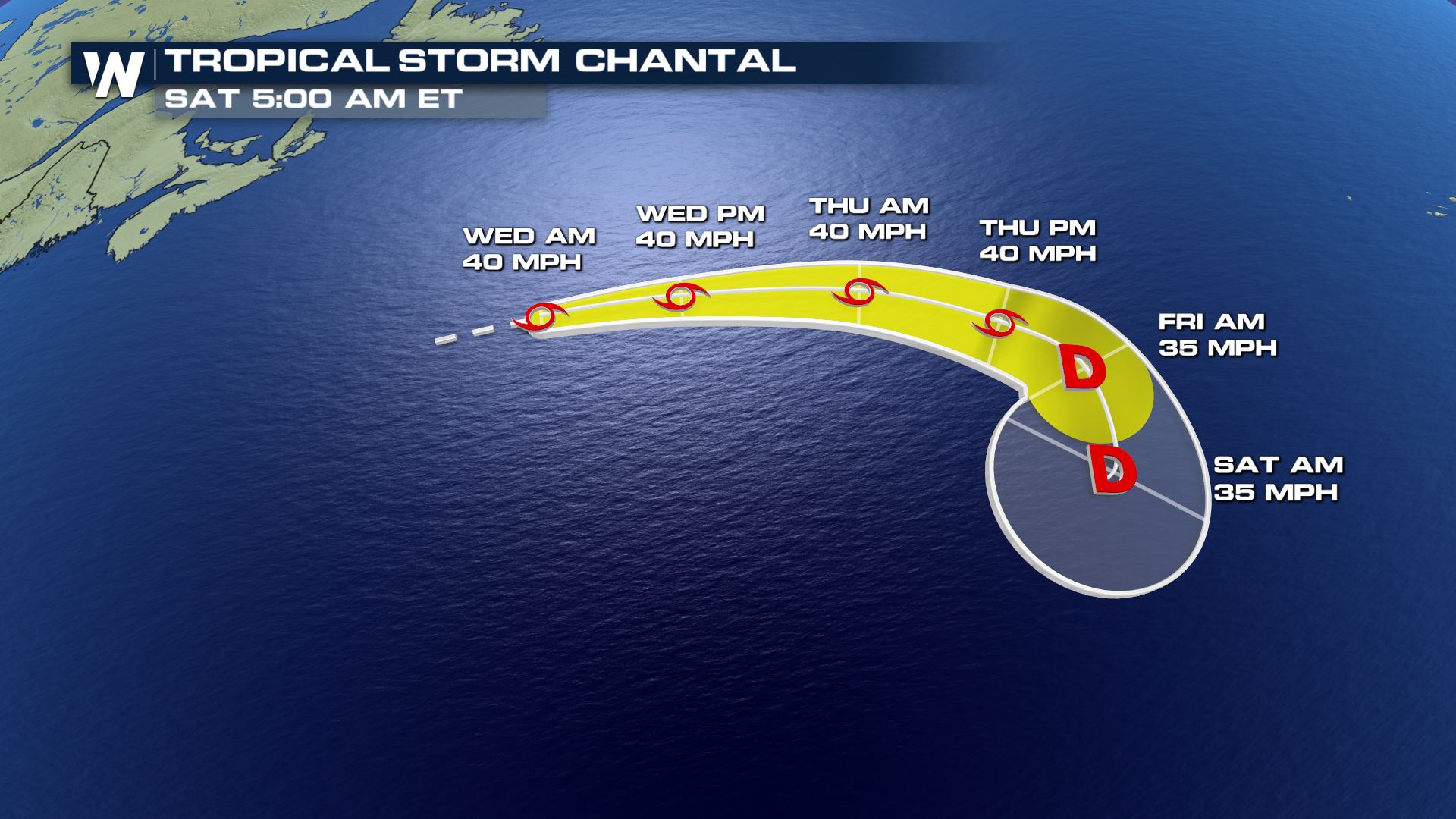
 Fortunately, the storm is expected to stay out to sea over the open ocean of the north Atlantic. It's expected to move east - away from the Atlantic seaboard - and in the direction of the Azores Islands off the northwest coast of Africa. There, it's expected to stall later this week, almost exactly halfway between the eastern United States and western Africa. It is of no threat to land, at least based on current trends and forecasts.
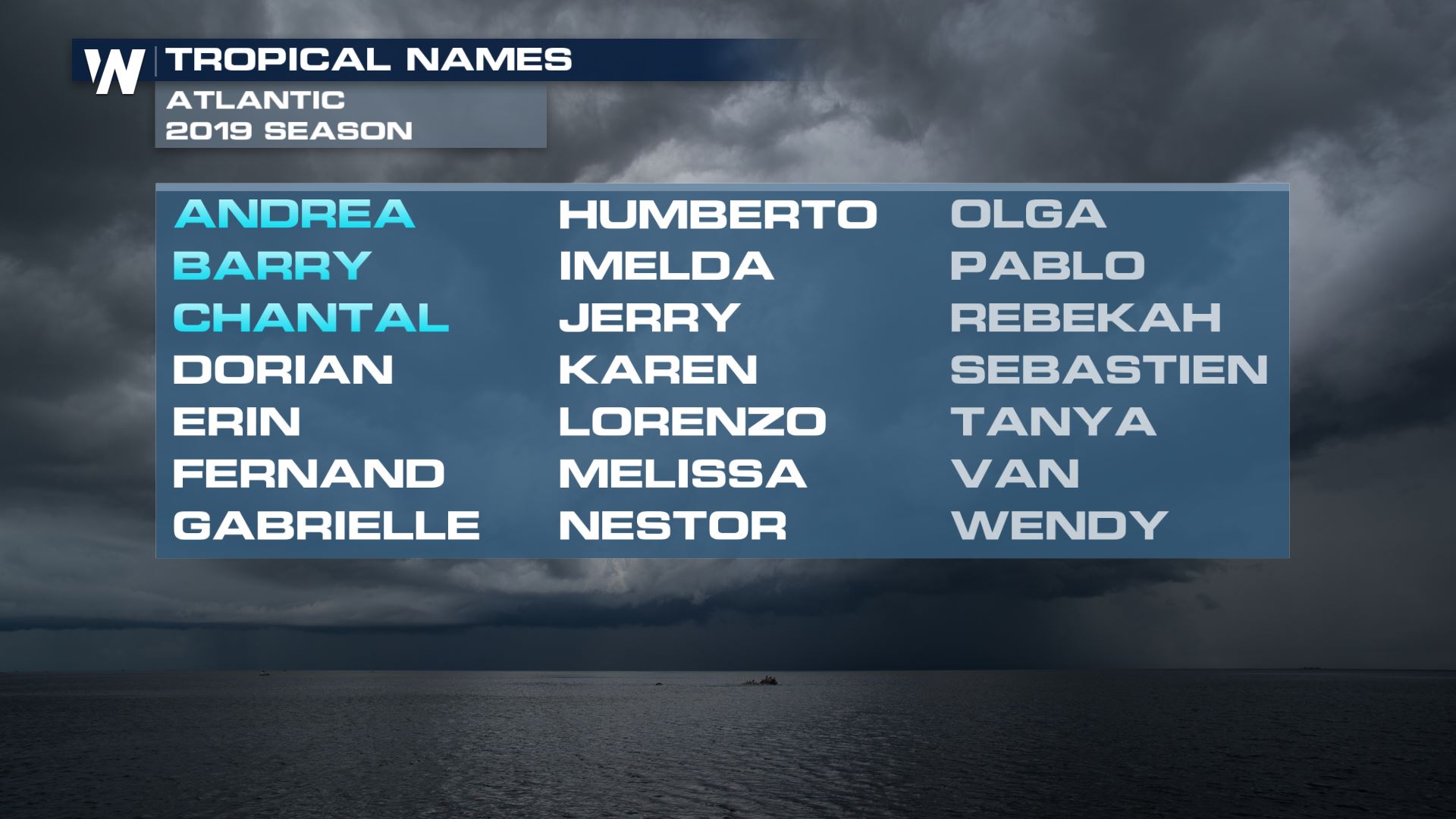
 Of perhaps greatest significance, Chantal is the Atlantic's third-named storm of the season and breaks an unusually quiet spell of tropical activity.
 https://twitter.com/philklotzbach/status/1164001420451827713?s=20
Chantal also formed unusually far north for a tropical storm, becoming the highest formation point for a tropical system in over 30 years.
https://twitter.com/philklotzbach/status/1164009256544133123?s=20
Stay with WeatherNation for the latest on Chantal and the tropics.
Meteorologist Chris Bianchi
https://twitter.com/philklotzbach/status/1164001420451827713?s=20
Chantal also formed unusually far north for a tropical storm, becoming the highest formation point for a tropical system in over 30 years.
https://twitter.com/philklotzbach/status/1164009256544133123?s=20
Stay with WeatherNation for the latest on Chantal and the tropics.
Meteorologist Chris Bianchi
Fortunately, the storm is expected to stay out to sea over the open ocean of the north Atlantic. It's expected to move east - away from the Atlantic seaboard - and in the direction of the Azores Islands off the northwest coast of Africa. There, it's expected to stall later this week, almost exactly halfway between the eastern United States and western Africa. It is of no threat to land, at least based on current trends and forecasts.
Of perhaps greatest significance, Chantal is the Atlantic's third-named storm of the season and breaks an unusually quiet spell of tropical activity.
https://twitter.com/philklotzbach/status/1164001420451827713?s=20
Chantal also formed unusually far north for a tropical storm, becoming the highest formation point for a tropical system in over 30 years.
https://twitter.com/philklotzbach/status/1164009256544133123?s=20
Stay with WeatherNation for the latest on Chantal and the tropics.
Meteorologist Chris BianchiAll Weather News
More
Heavy Rain Returns to Texas This Weekend
It's been a week since the devastating floods
12 Jul 2025 3:10 AM

Medium Range Tropics Forecast Favors Gulf, CSU Updates Seasonal Forecast
While the Atlantic appears quiet, conditions
12 Jul 2025 3:05 AM

Elevated Tornado Risk Targets the Midwest Friday
Friday was another busy day with severe weath
12 Jul 2025 3:00 AM

Storms Return From the Front Range to Texas
Moisture is moving back into the Central and
12 Jul 2025 2:50 AM

Timeline: How Catastrophic Flooding Unfolded in Texas Hill Country
TEXAS - Catastrophic flooding devastated port
11 Jul 2025 10:00 AM

Severe Thunderstorms Expected Across the East Coast
The severe weather and flood threat continues
11 Jul 2025 2:35 AM

Ruidoso Flash Flooding - Record Crest for the Rio Ruidoso River
A slow-moving monsoonal thunderstorm develope
10 Jul 2025 1:55 AM