Cold Blast for the High Plains and Upper Midwest Late Next Week
Top Stories
27 Jan 2018 8:27 AM
Sometimes Mother Nature likes to remind us that we are still in the heart of winter. We are looking at a big reminder later next week for the High Plains and the Upper Midwest.
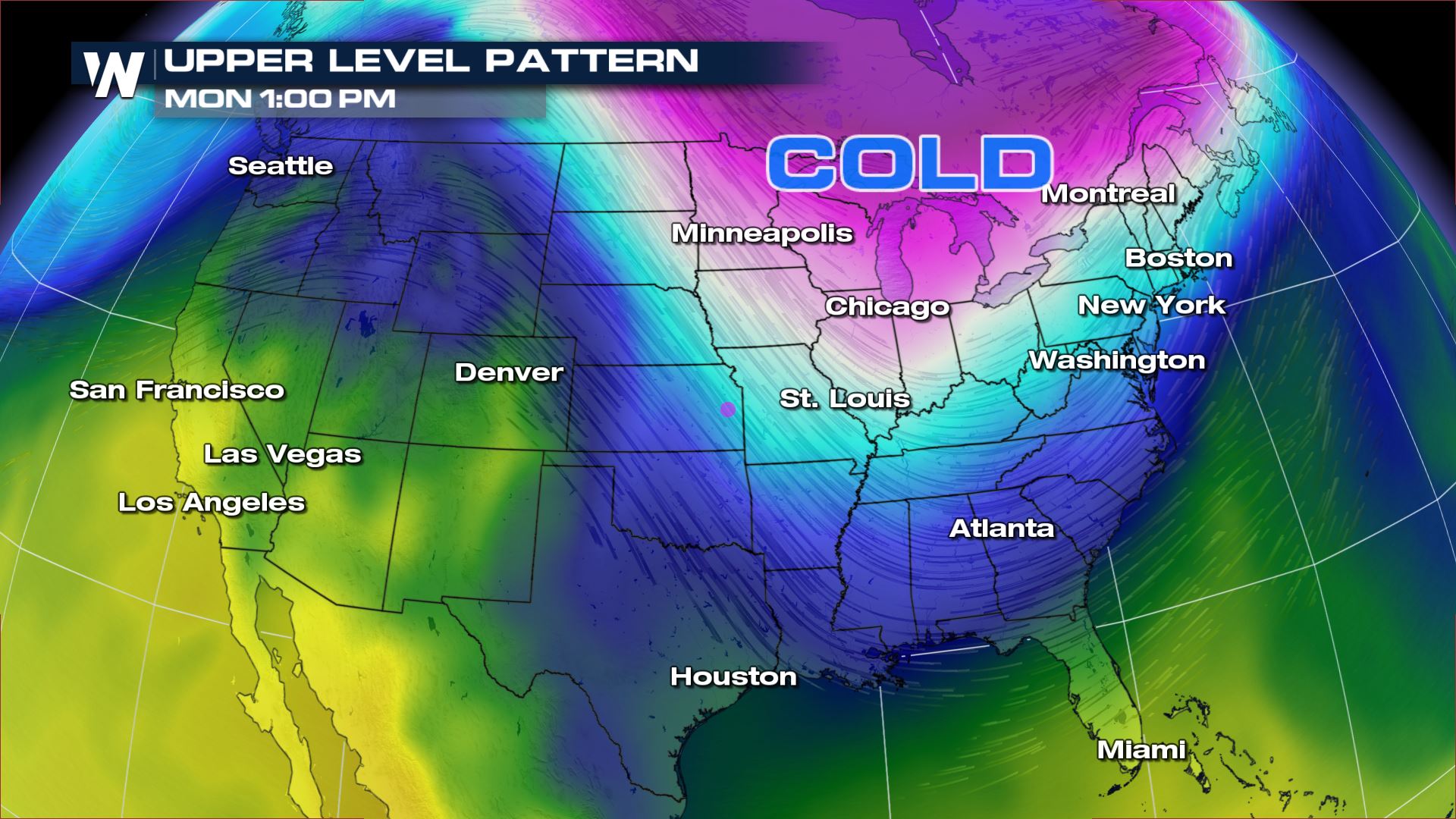
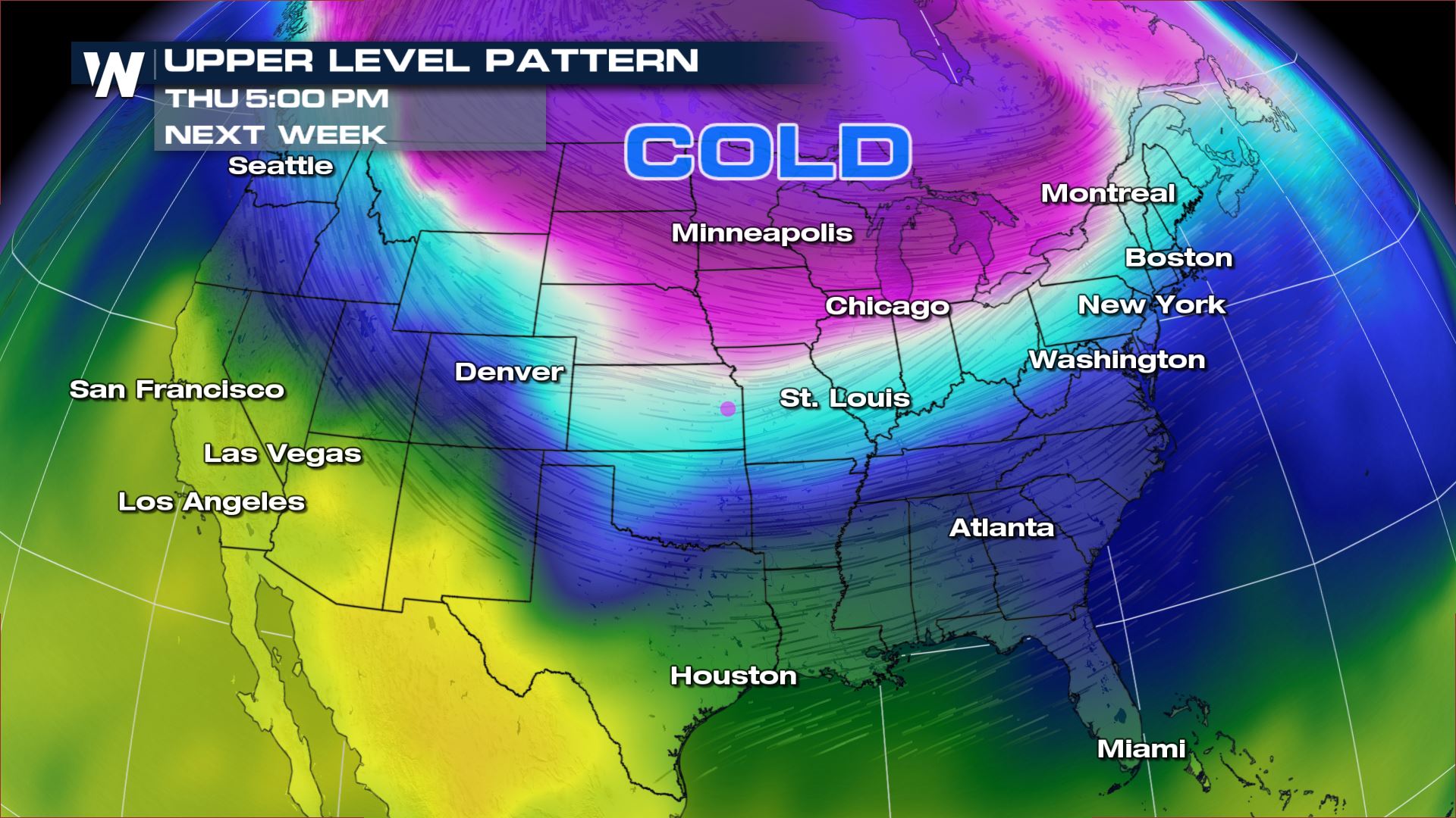
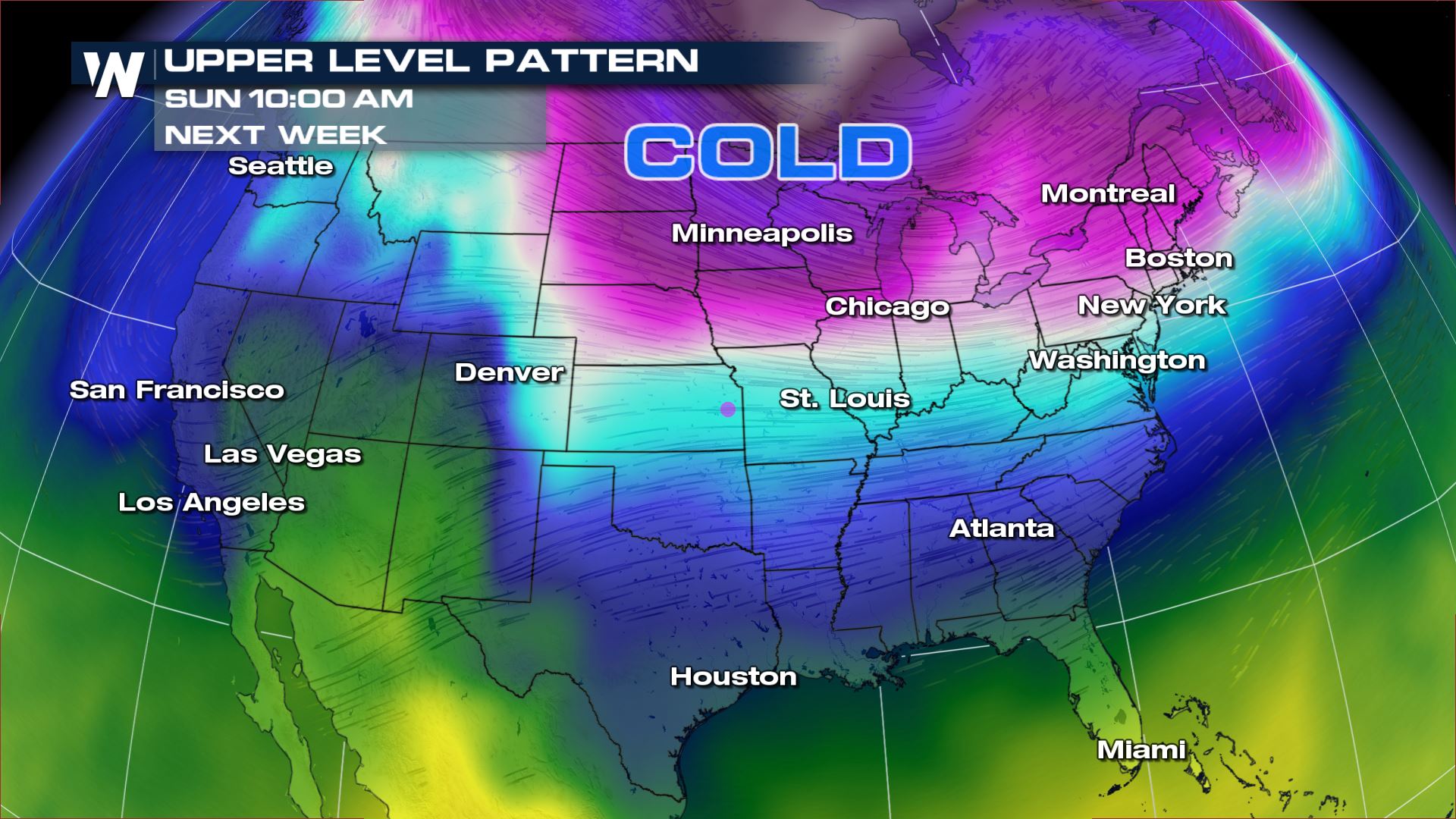 As we look at the upper level forecast for next week, we can see the cold air pushing south out of Canada. The coldest air will be moving into the High Plains and Upper Midwest...especially for next Thursday and Friday. This means high temperatures in the low teens and morning lows near or even below zero. The winds will make it feel even colder and wind chill values could drop 20° to 30° below zero!

 Meteorologist Patrick Crawford
Cold Air Forecast
As we look at the upper level forecast for next week, we can see the cold air pushing south out of Canada. The coldest air will be moving into the High Plains and Upper Midwest...especially for next Thursday and Friday. This means high temperatures in the low teens and morning lows near or even below zero. The winds will make it feel even colder and wind chill values could drop 20° to 30° below zero!
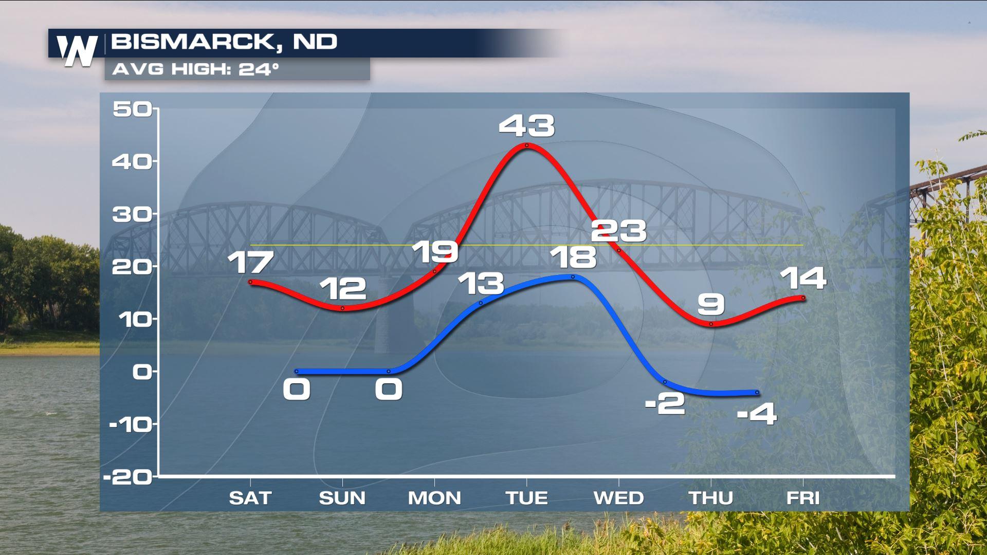
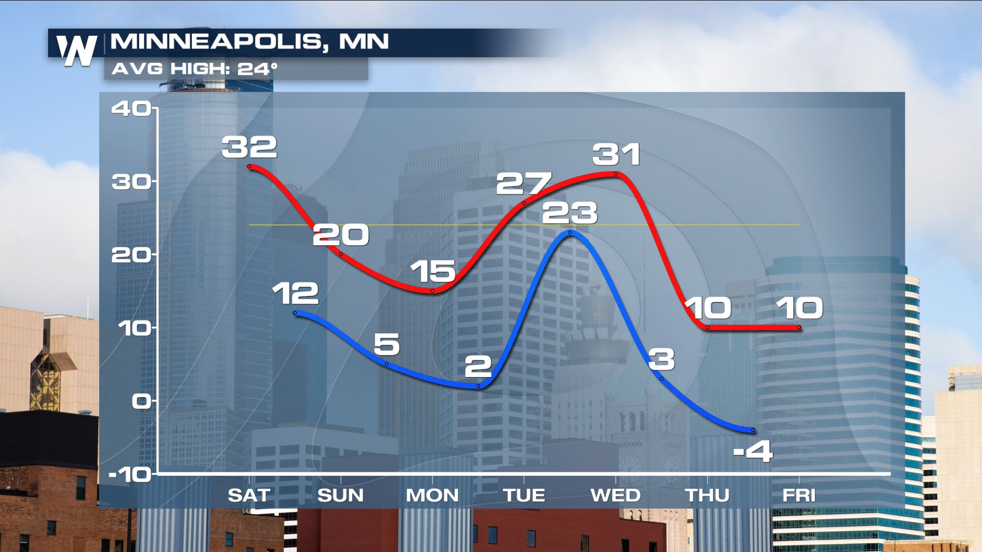
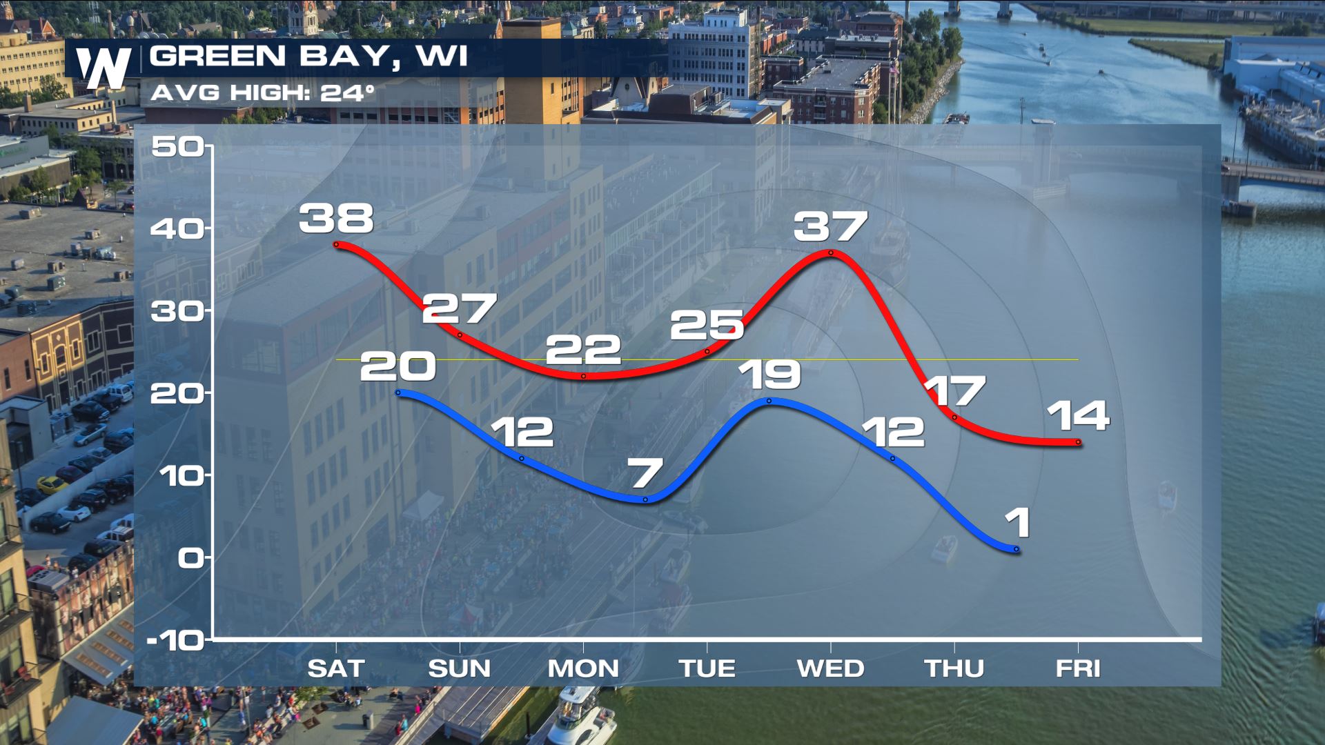
Extended Forecast
Here is a look at some extended forecast from across the region. These graphics really show the drop in temperatures for late next week.
Meteorologist Patrick Crawford
All Weather News
More
Wildfire Outbreak in the Pacific Northwest
SPOKANE, WA - On Saturday, August 1st, the Ol
3 Aug 2026 1:55 AM

More Storms for the East Through Monday
A low-pressure system that moved through the
3 Aug 2026 1:50 AM


After Reaching Category 5, Genevieve Weakens in the Pacific
PacificGenevieve formed last Friday south of
3 Aug 2026 12:30 AM

Flooding, Severe Storms Target the Midwest Again
After an active week of storms across the nor
1 Aug 2026 1:40 AM

Flooding Risk Increases as Heavy Rain Targets the Tri-State Area
Tuesday, heavy rainfall moved across the Nort
30 Jul 2026 12:25 AM

Severe Weather: Energy From the Midwest Now in the Southeast
UPPER MIDWEST - Through Monday, dangerous tor
29 Jul 2026 10:30 PM