Cold Front Brings Severe Weather Threat to the Plains and Great Lakes
Special Stories
26 Jun 2020 9:00 AM
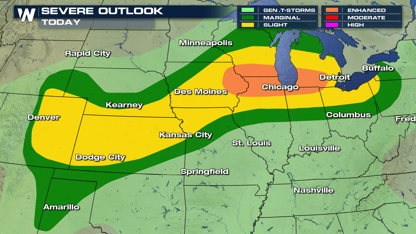
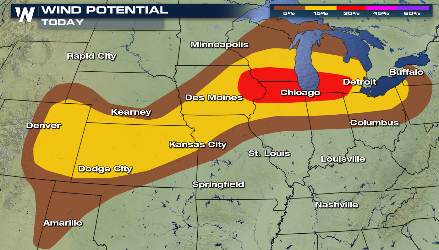
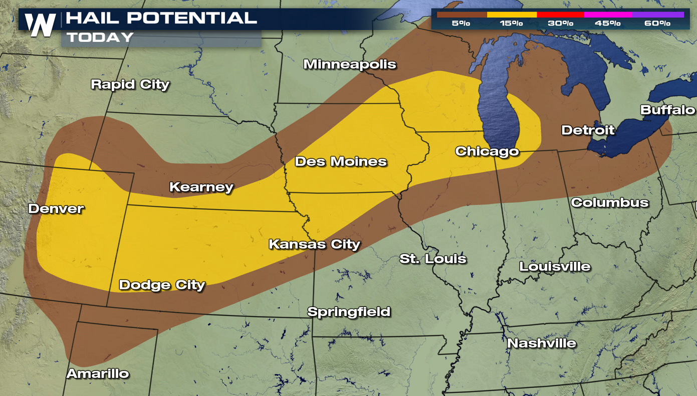
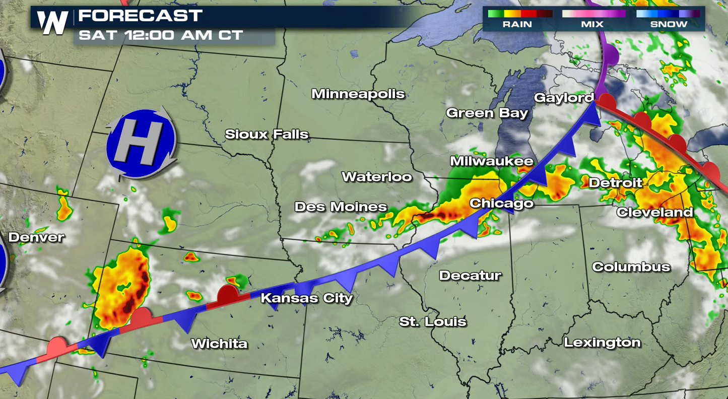
Severe storms are again possible across the northern tier of the nation today (Friday) as a trough and accompanying cold front sweep from the Rockies to the Great Lakes. The environment remains favorable for scattered severe storms exists today (Friday) from the Great Lakes to the Front Range. An elevated risk for severe storms has been issued by the Storm Prediction Center (SPC) from Iowa to Lower Michigan.
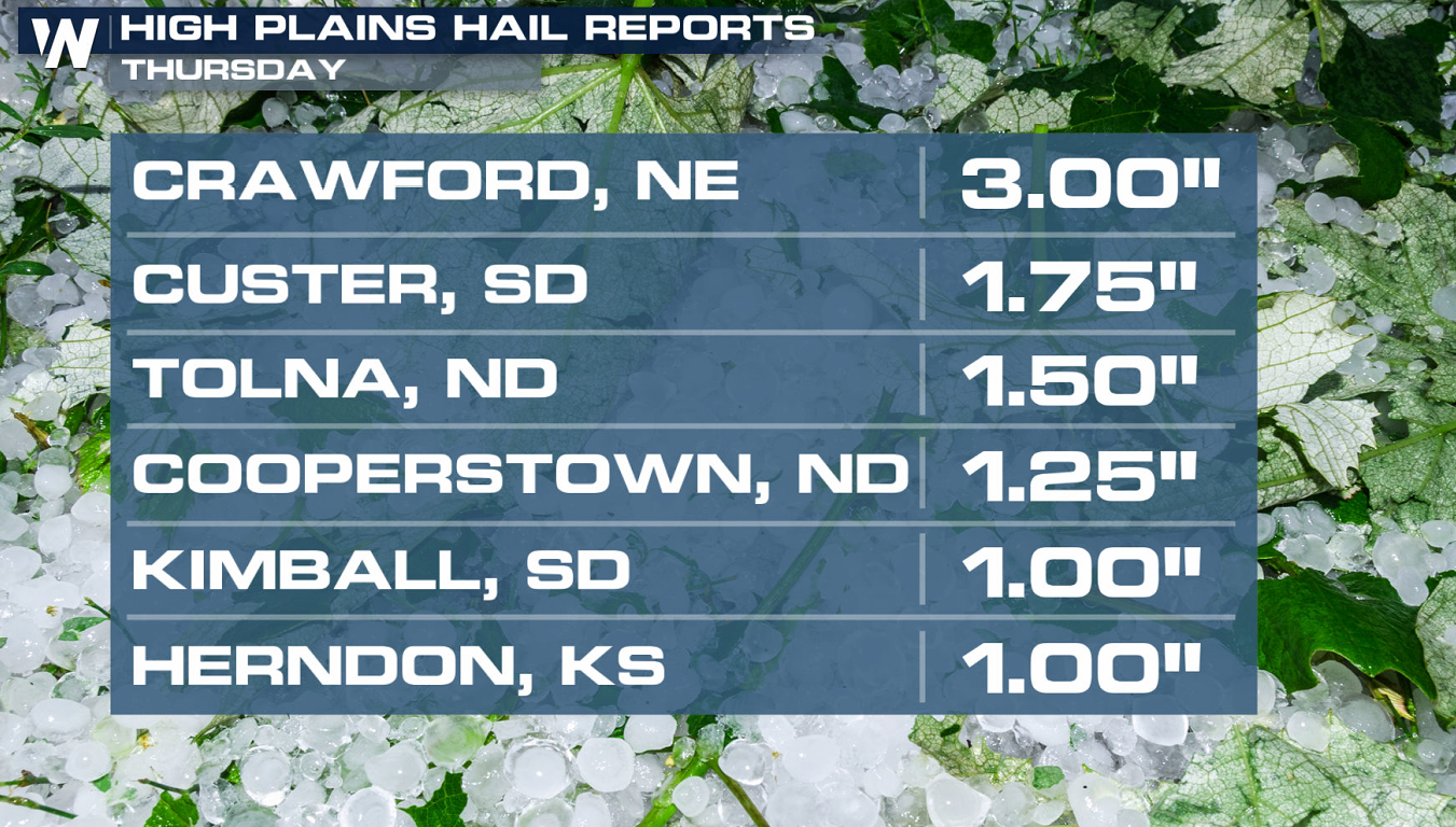
On Thursday, severe weather produced very large hail fell in several Plains states. Hail around the size of baseballs fell in Nebraska.
https://twitter.com/WeatherNation/status/1276509590864027650
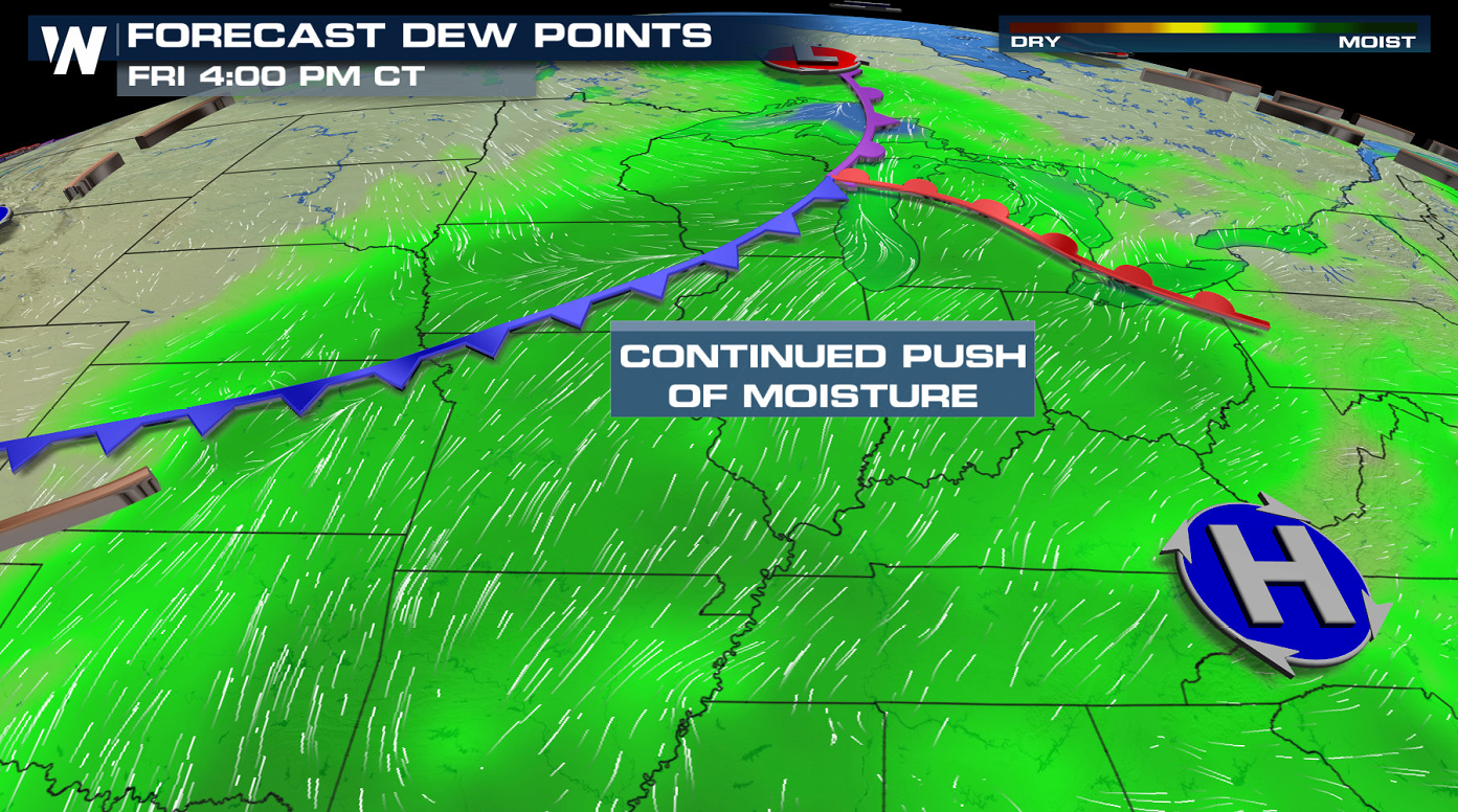
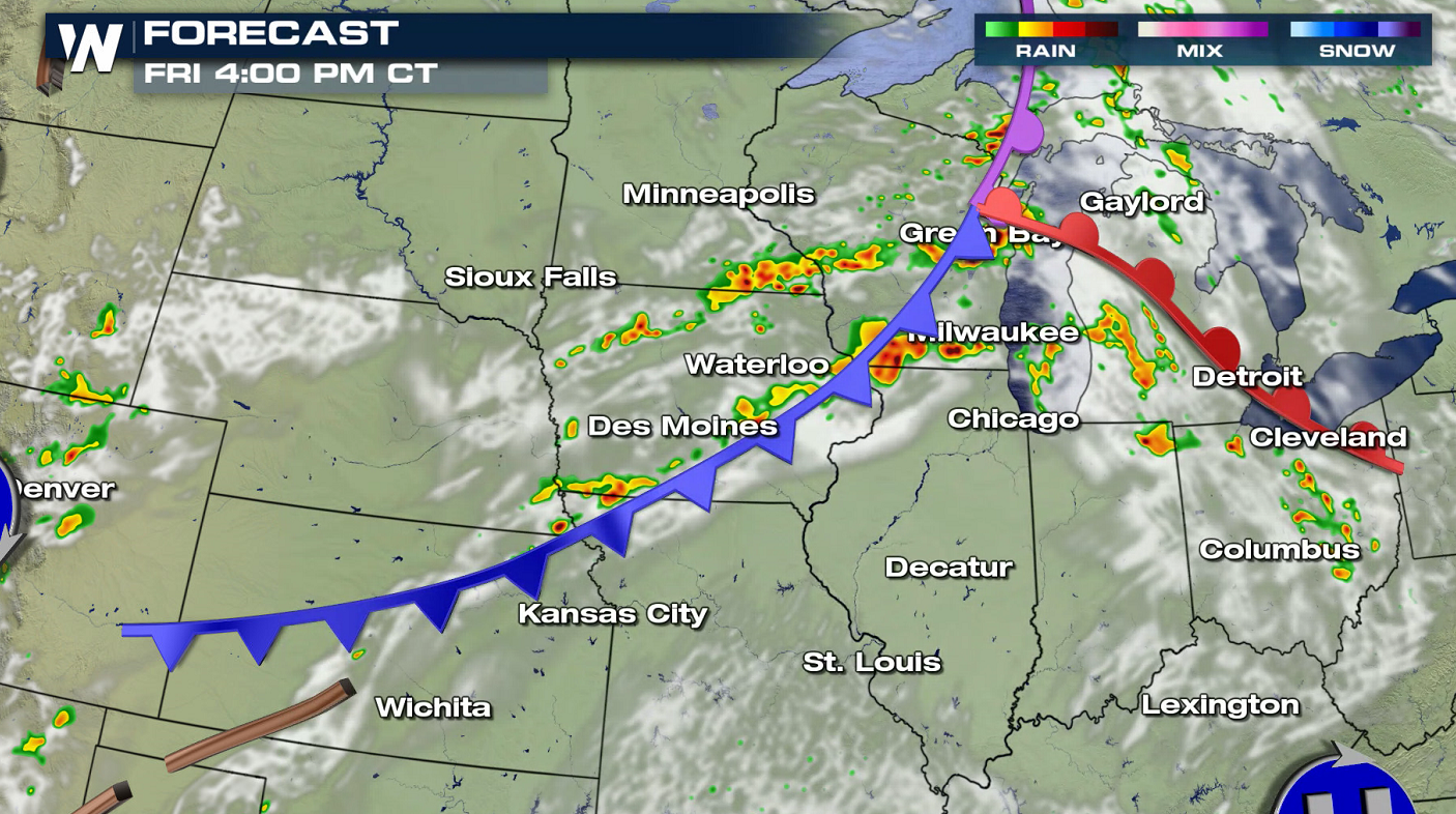
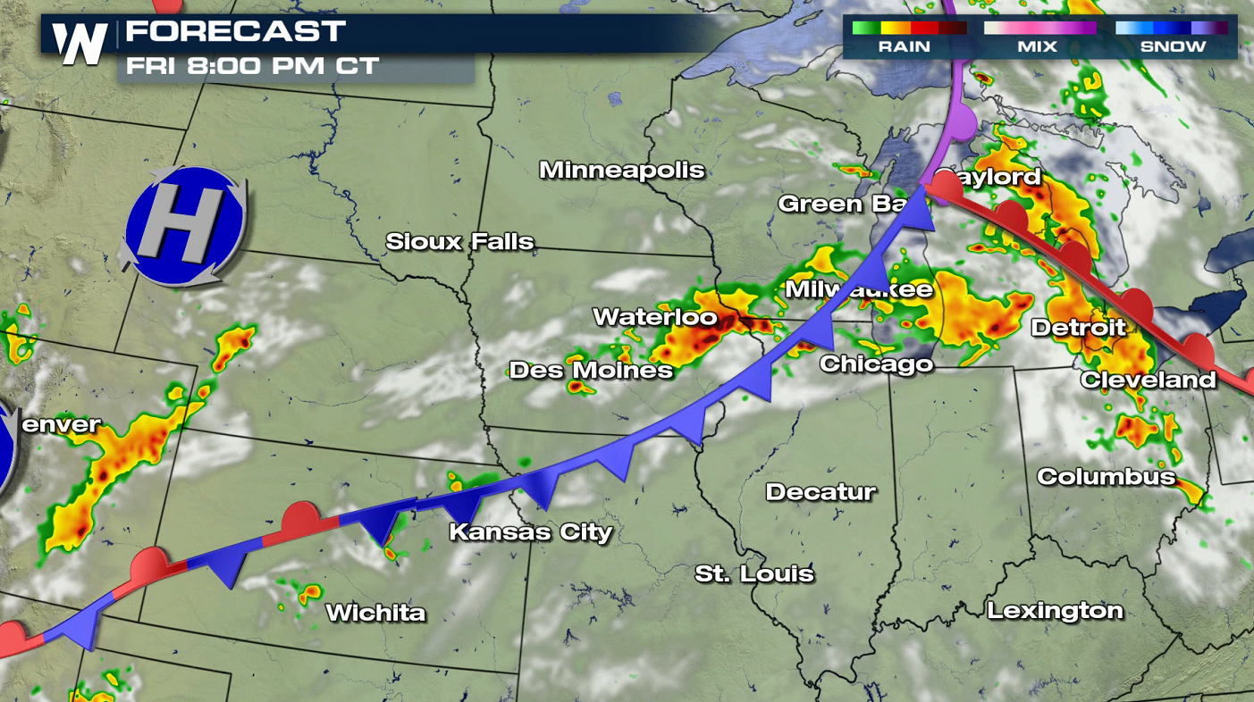
 As the front moves into the Great Lakes, low-level moisture is expected to increase, helping to destabilize the atmosphere. Warm temperatures and sufficient moisture will combine with a region of increased wind shear in the mid-levels of the atmosphere, which will aid in the formation of scattered or numerous severe thunderstorms.
 The threat for damaging wind gusts will be the main concern, Large hail and a few tornadoes will also be possible for the areas indicated below.
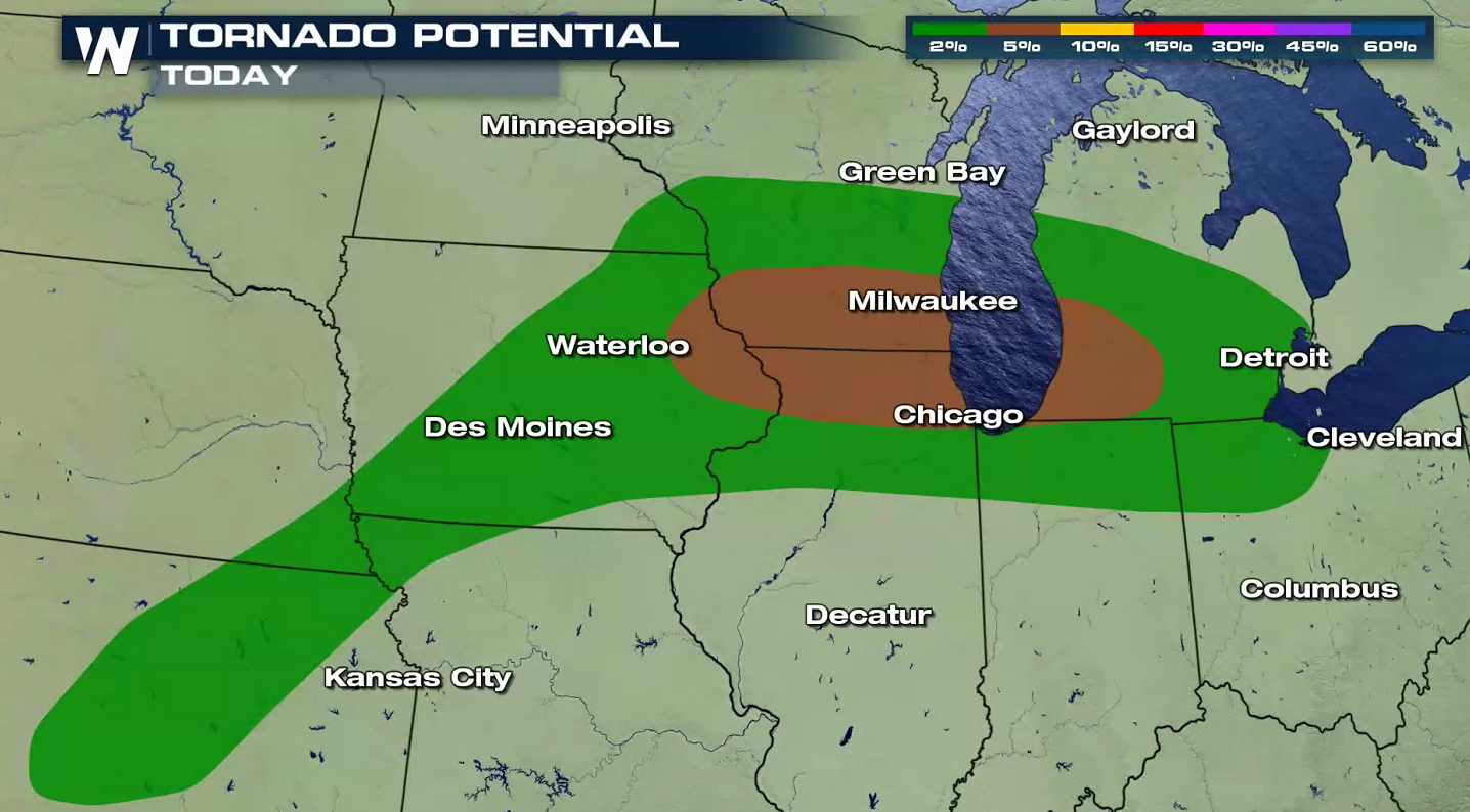
 Storms should develop by the early to middle afternoon hours and are expected to progress to the east and southeast into the evening. Linear segments (lines of storms) could form near the front, potentially broadening the damaging wind threat.
 Stay with WeatherNation for the latest updates on current storm activity and the forecast. This article will be updated as new information becomes available.
As the front moves into the Great Lakes, low-level moisture is expected to increase, helping to destabilize the atmosphere. Warm temperatures and sufficient moisture will combine with a region of increased wind shear in the mid-levels of the atmosphere, which will aid in the formation of scattered or numerous severe thunderstorms.
The threat for damaging wind gusts will be the main concern, Large hail and a few tornadoes will also be possible for the areas indicated below.
Storms should develop by the early to middle afternoon hours and are expected to progress to the east and southeast into the evening. Linear segments (lines of storms) could form near the front, potentially broadening the damaging wind threat.
Stay with WeatherNation for the latest updates on current storm activity and the forecast. This article will be updated as new information becomes available.All Weather News
More

Flooding Risk Increases as Heavy Rain Targets the Tri-State Area
TRI-STATE AREA - Along with the threat of sev
29 Jul 2026 2:00 AM

Tropics: Fausto Heads towards Hawaii; Genevieve a Major Hurricane
PacificTropical Storm Fausto continues to tra
29 Jul 2026 1:35 AM


Southeast Flood Risk Lingers Near Stalled Front
A stalled boundary over the Southeast will ke
25 Jul 2026 10:55 AM

Another Round of Storms Targets the Northeast
Tuesday brought severe weather again across p
23 Jul 2026 1:15 AM