Cut-Off Low Brings Severe Weather Threat Back

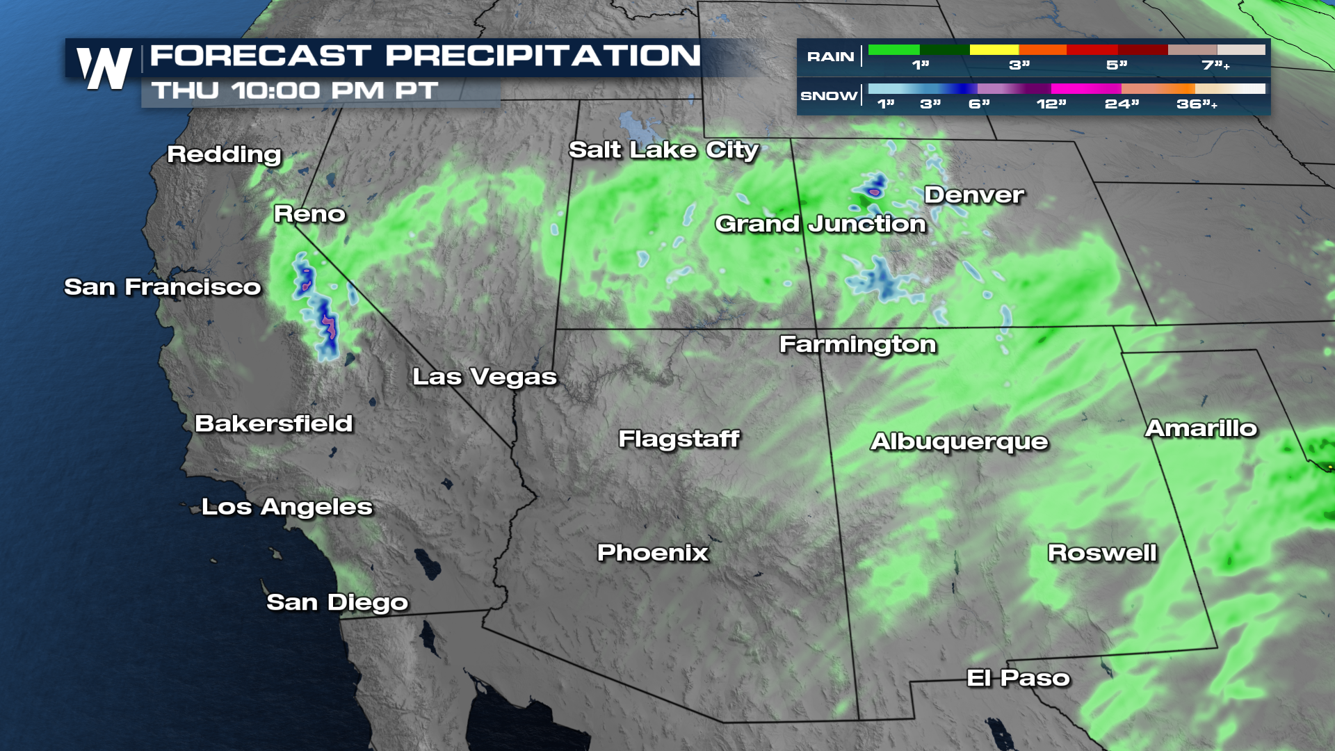
An area of low pressure that's looking for it way is sitting and spinning off of the coast of California. As it gets kicked inland later this week, it's going to bring the unsettled weather with it. It will bring some beneficial rain and snow to parts of the southwest, including California and Colorado. A few inches of snow will be possible in the Sierra Nevada mountains as well as the western slope of the Colorado Rockies.
However, it's where that system ends up by the weekend that is raising some eyebrows. As this system emerges out of the Rockies, it will be moving into notably warmer temperatures, which could be just enough to power storms into the severe threshold.
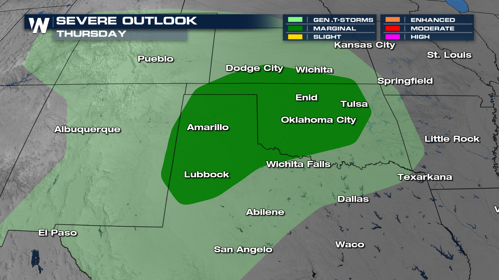
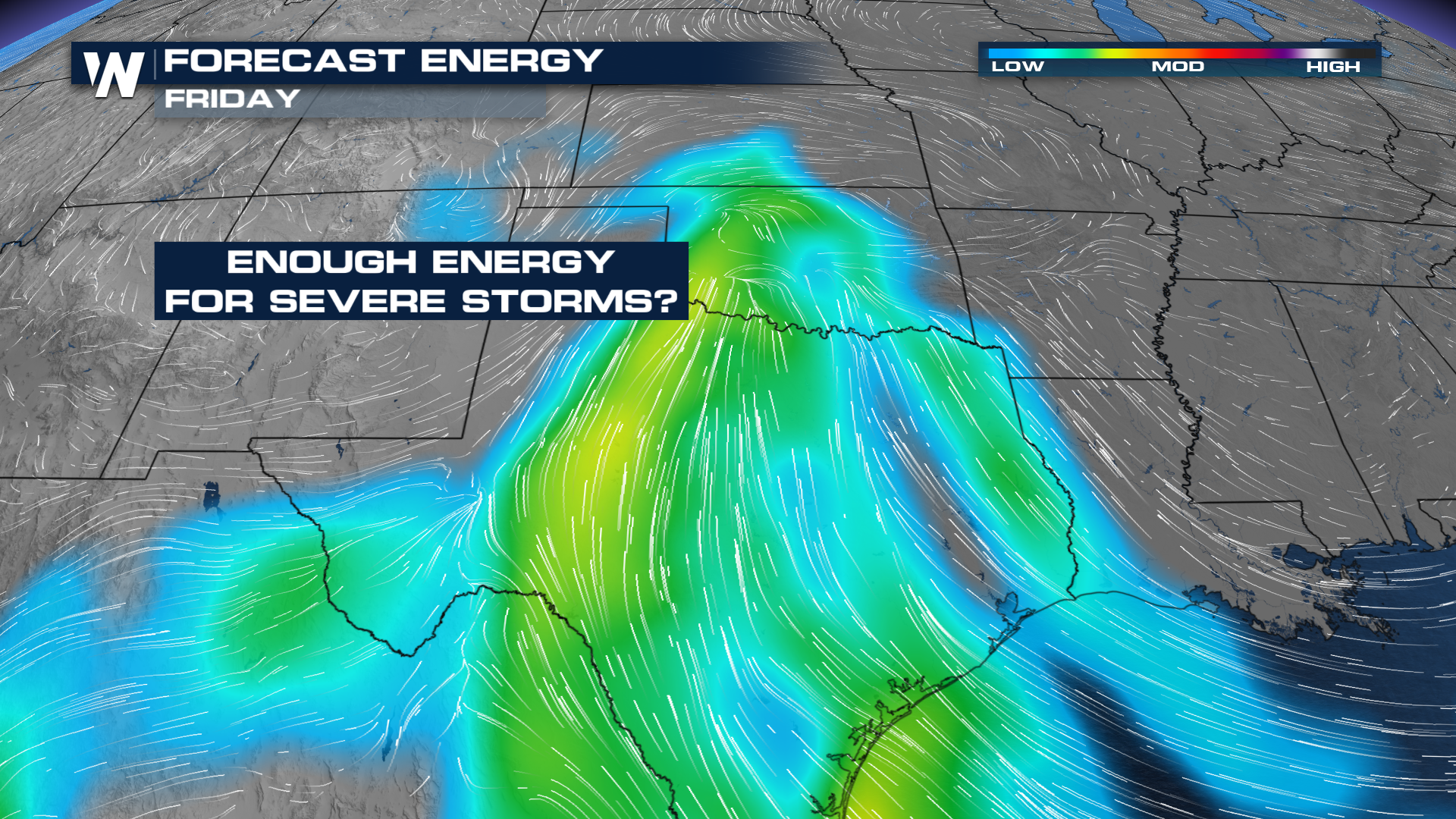 But will this system have enough ingredients to talk about another weekend severe weather event? The Storm Prediction Center is already highlighting areas of the panhandle of Texas and western Oklahoma for a low-end threat by Thursday
 However, getting beyond four and five days out can be a little murky. Right now, this feels like a repeat of last weekend's storms, with all modes on the table. One thing we are starting to firmly grasp is the rainfall amounts will add up!
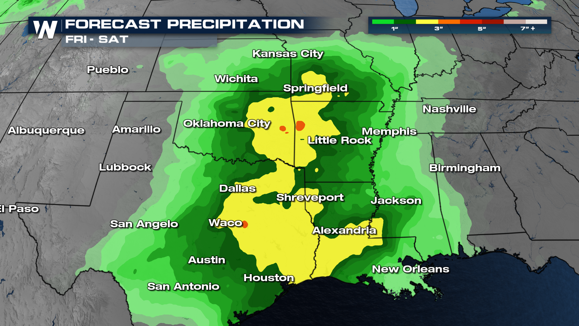 With multiple rounds of storms expected, flash flooding will need to be monitored, especially in eastern Oklahoma and east Texas. Here's a first look at what storms could look like Thursday through Saturday
There is loads of time for all of this to change, but start thinking about where the end of the week is going to take you. Do you have high school football game plans or trunk or treating? Those could be impacted by some of these potential storms.


