Next Wave in the Atlantic to Watch

The Atlantic hurricane season has been a relatively quiet one so far. Any cyclone that has formed has stayed out to sea, like Lorenzo most recently. If this latest wave develops, it could threaten more land directly than anything has so far. But there's a TON that can happen between now and then. The wave is currently over the Central Atlantic, heading west.
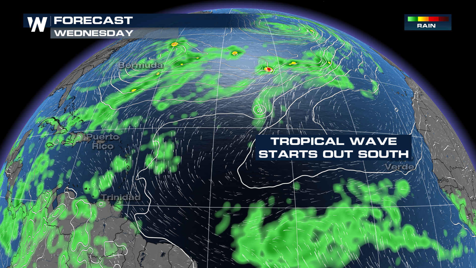 As this wave closes in on the Leeward Islands, little to no development is expected. However, heavy rain and breezy conditions will move through the island chain. What happens after that? Only time will tell.
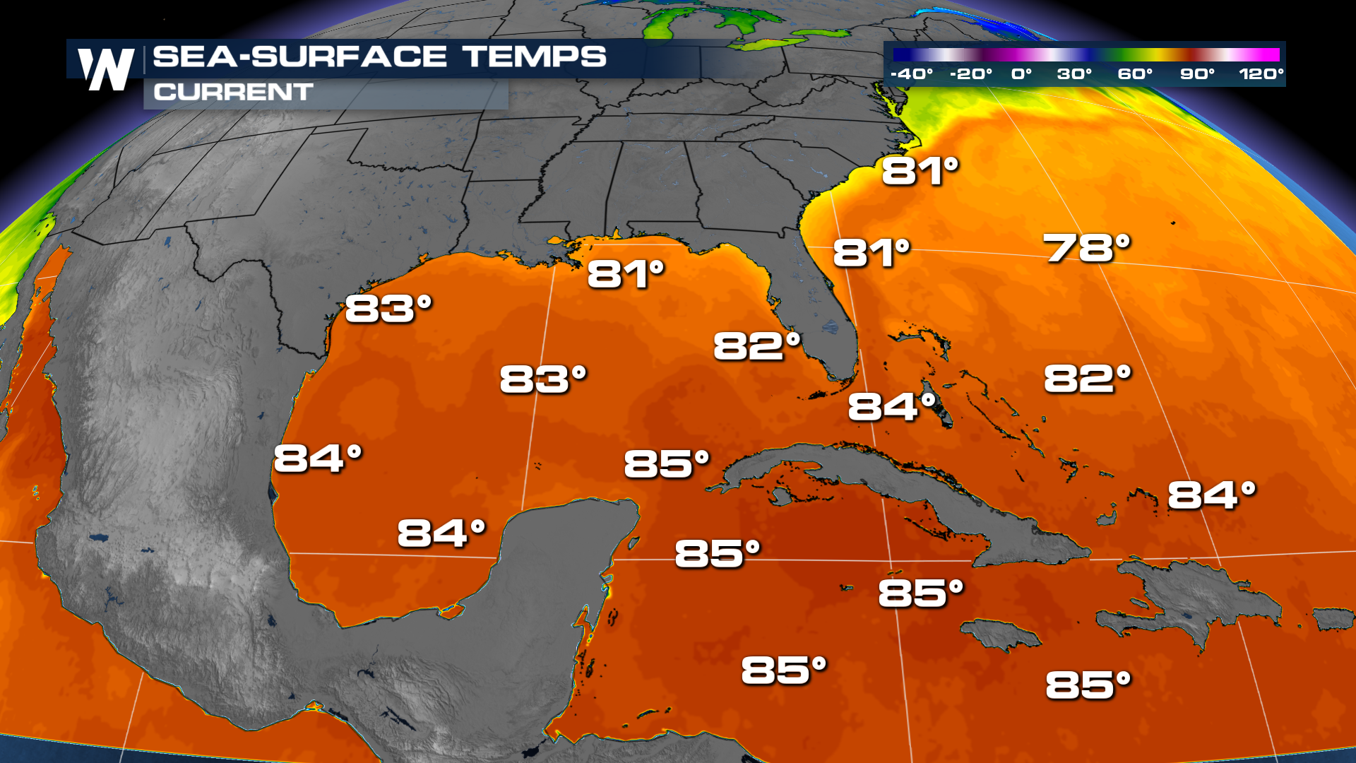
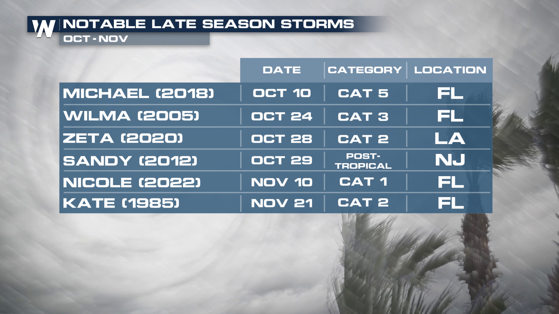
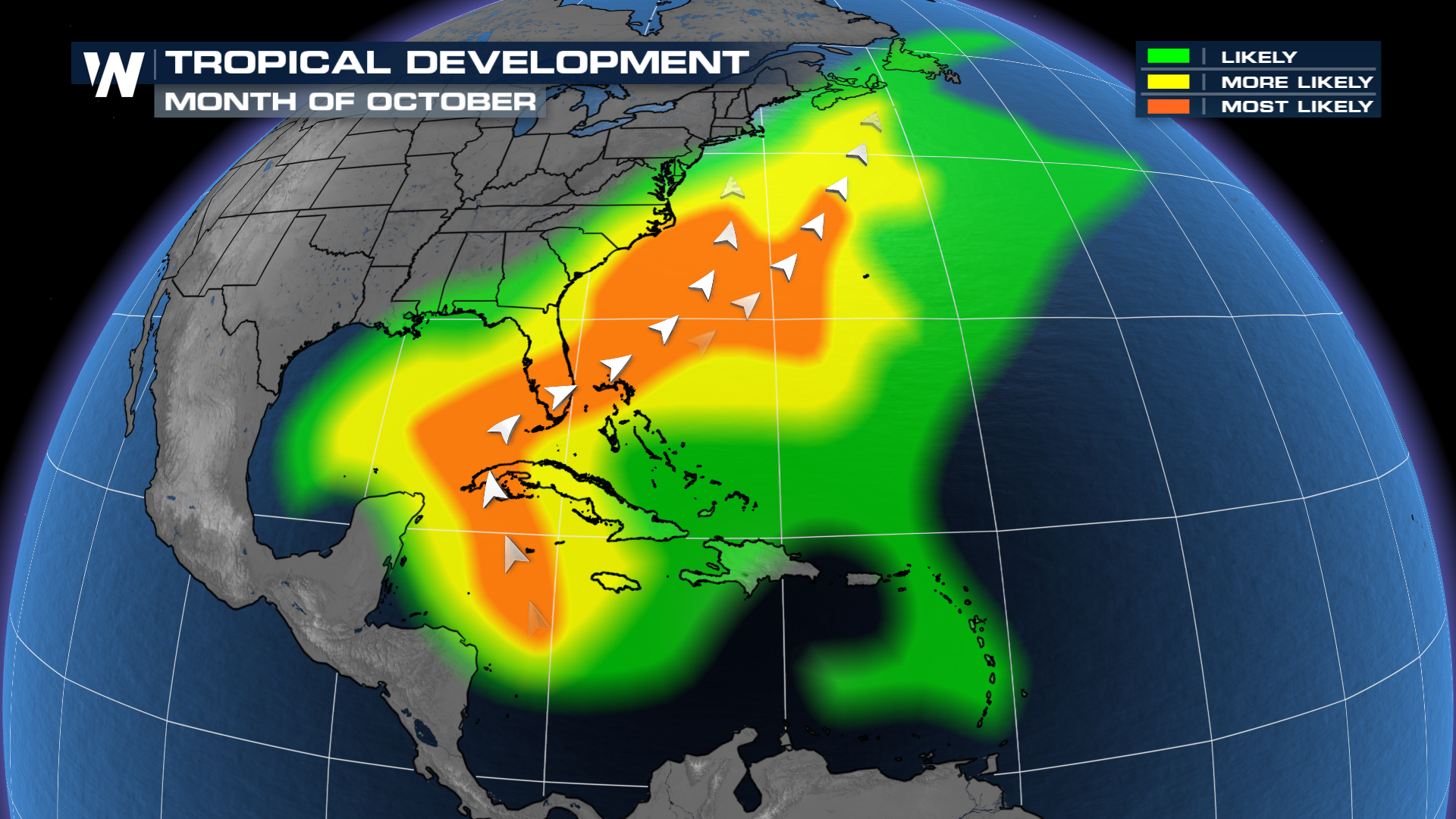
The concerns? The Caribbean is still as warm as bathwater right now, so it wouldn't take much time for something to potentially organize. The concern after that? Where does the system go IF it develops? Again, still a big IF, but climatologically speaking, this is where we would expect an October storm. Waters in the Caribbean will stay warmer later into the season, which helps keep the window of opportunity open for development.
 So what's the final outcome with this system? How many systems have "looked good" 12 days out and have fizzled on us this year? Are there some ensemble models that find some development? Sure. Are all of them developing this wave? Not yet. October is not the month to let your guard down.