Damaging Ice Event Over for the Ohio River Valley
Top Stories
4 Feb 2022 6:50 AM
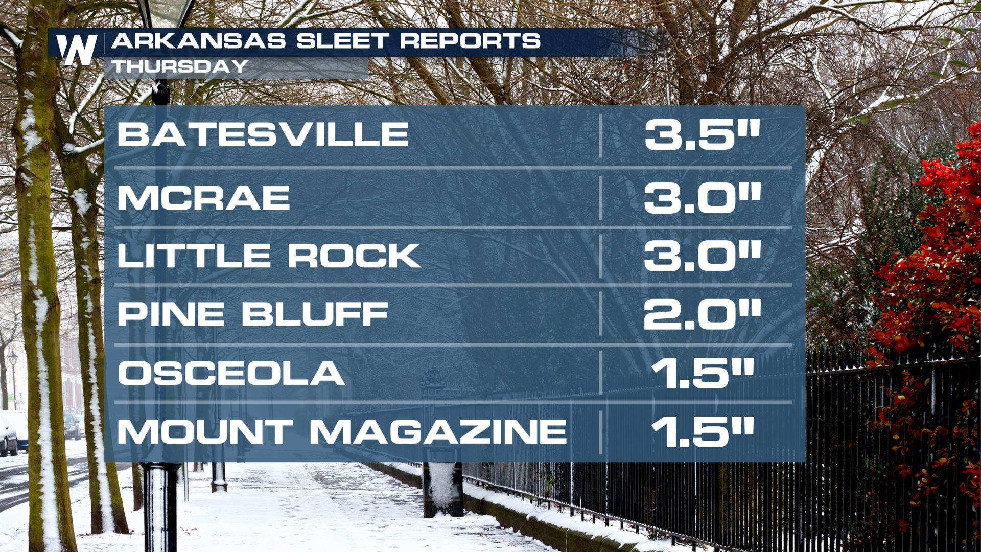
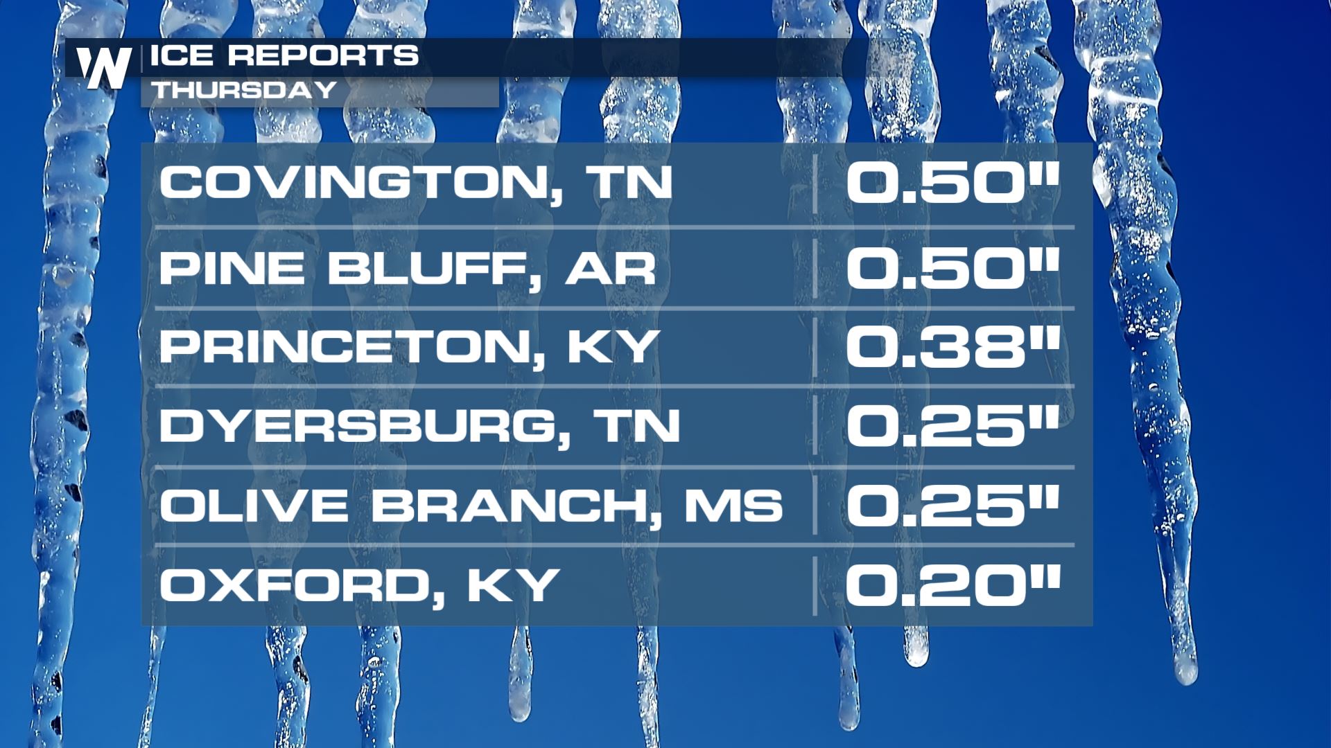
Ice reports have been trickling in as power outages continue to climb across the MS and OH Valleys. Some reports have topped half an inch! Lower amounts have been found across the Midwest and into the Ohio Valley, but totals may increase into Friday morning as another swath of freezing rain moves in.
 https://twitter.com/WeatherNation/status/1489403334083686412
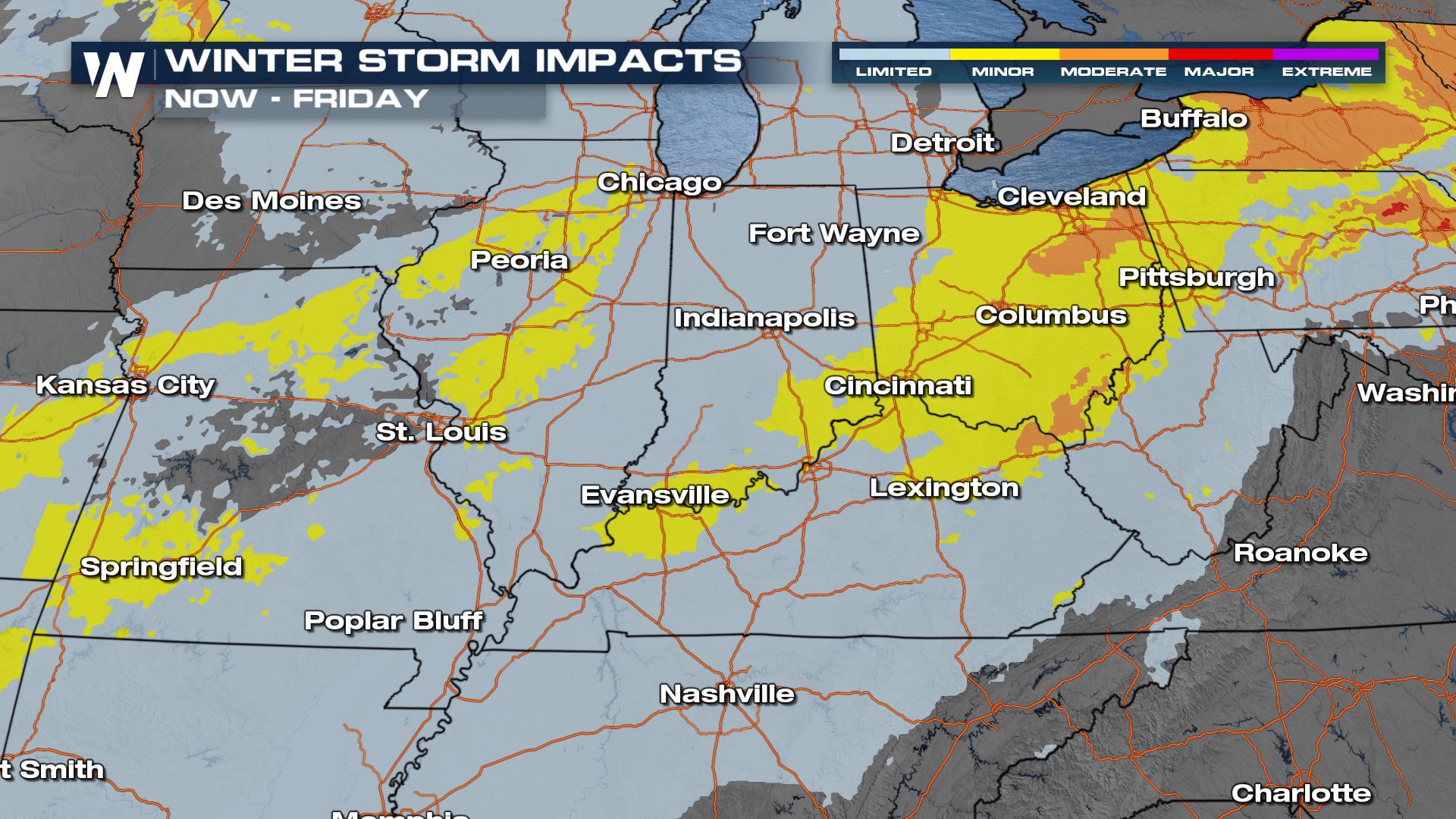
Even though the heavy winter precipitation is coming to an end gradually, travel is not recommended Friday. It will take time for crews to clear the roads from the ice and snow, and temperatures will remain below freezing. Major impacts means you are not only putting yourself, but also emergency crews in danger as well. Be patient!
https://twitter.com/WeatherNation/status/1489403334083686412
Even though the heavy winter precipitation is coming to an end gradually, travel is not recommended Friday. It will take time for crews to clear the roads from the ice and snow, and temperatures will remain below freezing. Major impacts means you are not only putting yourself, but also emergency crews in danger as well. Be patient!
 Stay with WeatherNation as we continue to detail the winter storm with snow, ice and rain. We are streaming 24/7 on Roku and Pluto.
https://twitter.com/WeatherNation/status/1489403334083686412
Even though the heavy winter precipitation is coming to an end gradually, travel is not recommended Friday. It will take time for crews to clear the roads from the ice and snow, and temperatures will remain below freezing. Major impacts means you are not only putting yourself, but also emergency crews in danger as well. Be patient!
Stay with WeatherNation as we continue to detail the winter storm with snow, ice and rain. We are streaming 24/7 on Roku and Pluto.All Weather News
More
Wildfire Outbreak in the Pacific Northwest
Conditions have been incredibly dry out west.
2 Aug 2026 1:30 PM

After Reaching Category 5, Genevieve Weakens in the Pacific
PacificGenevieve formed on last Friday south
2 Aug 2026 1:25 PM

More Storms for the East Sunday and Monday
A low-pressure system crashing through the Mi
2 Aug 2026 1:25 PM


Flooding, Severe Storms Target the Midwest Again
After an active week of storms across the nor
1 Aug 2026 1:40 AM

Flooding Risk Increases as Heavy Rain Targets the Tri-State Area
Tuesday, heavy rainfall moved across the Nort
30 Jul 2026 12:25 AM

Severe Weather: Energy From the Midwest Now in the Southeast
UPPER MIDWEST - Through Monday, dangerous tor
29 Jul 2026 10:30 PM