Debris Flow Threat for Southwest California

Top Stories
18 Mar 2018 7:10 PM
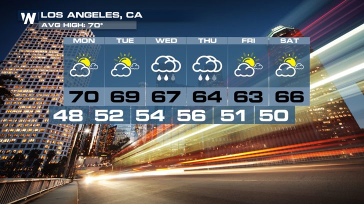
All eyes continue to be on a strong storm system that will be making its way into Southwest California Tuesday through Thursday night.
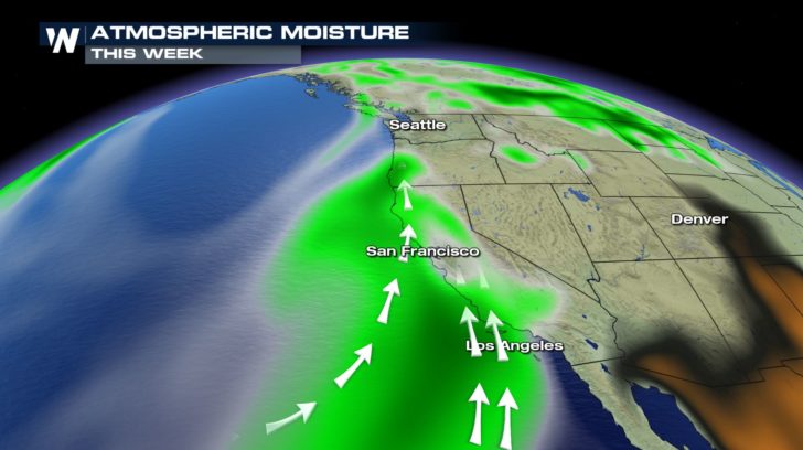
An atmospheric river, or an intense plume of moisture out over the Pacific Ocean, will supply the approaching system with enough water to likely produce some of the highest rainfall totals so far this season for this area.
https://twitter.com/twitter/statuses/975545834807808000
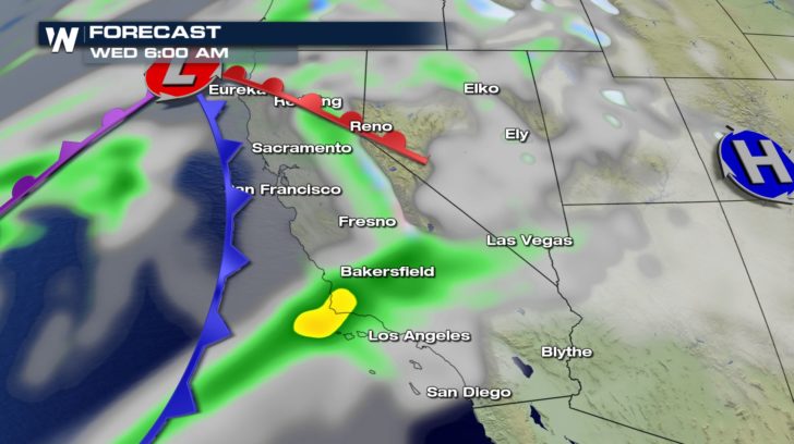
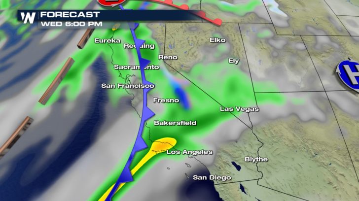
 The heaviest of the rain is expected to fall between late Tuesday night and early Thursday
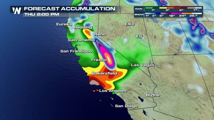
 We could see peak rainfall rates between 0.50-0.75" per hour, which could lead to an increased threat of flash flooding/debris flows in the Thomas, Whittier, Creek, and La Tuna burn scar areas.
https://www.facebook.com/WeatherNation/videos/10156232567654874/
Pre-Evacuation advisories are already in effect for some cities in and near these burn scar locations.
https://twitter.com/countyofsb/status/975177158653022208
Storm totals are forecast to be between 1-4" for the coasts and valleys and up to 6" possible in the foothills and mountains.
We could see peak rainfall rates between 0.50-0.75" per hour, which could lead to an increased threat of flash flooding/debris flows in the Thomas, Whittier, Creek, and La Tuna burn scar areas.
https://www.facebook.com/WeatherNation/videos/10156232567654874/
Pre-Evacuation advisories are already in effect for some cities in and near these burn scar locations.
https://twitter.com/countyofsb/status/975177158653022208
Storm totals are forecast to be between 1-4" for the coasts and valleys and up to 6" possible in the foothills and mountains.
 In addition to a concern for the recent burn areas, other impacts include widespread flooding across the entire region and rockslides in/near canyons.
Check in with your local emergency managers for the latest evacuation notices prior to this storm.
In addition to a concern for the recent burn areas, other impacts include widespread flooding across the entire region and rockslides in/near canyons.
Check in with your local emergency managers for the latest evacuation notices prior to this storm.
 For WeatherNation, I'm Meteorologist Meredith Garofalo
The heaviest of the rain is expected to fall between late Tuesday night and early Thursday
We could see peak rainfall rates between 0.50-0.75" per hour, which could lead to an increased threat of flash flooding/debris flows in the Thomas, Whittier, Creek, and La Tuna burn scar areas.
https://www.facebook.com/WeatherNation/videos/10156232567654874/
Pre-Evacuation advisories are already in effect for some cities in and near these burn scar locations.
https://twitter.com/countyofsb/status/975177158653022208
Storm totals are forecast to be between 1-4" for the coasts and valleys and up to 6" possible in the foothills and mountains.
In addition to a concern for the recent burn areas, other impacts include widespread flooding across the entire region and rockslides in/near canyons.
Check in with your local emergency managers for the latest evacuation notices prior to this storm.
For WeatherNation, I'm Meteorologist Meredith GarofaloAll Weather News
More
East Gears Up for Stormy, Wet Weekend
A low pressure system crashing through the Mi
1 Aug 2026 6:15 PM


Flooding, Severe Storms Target the Midwest Again
After an active week of storms across the nor
1 Aug 2026 1:40 AM

After Reaching Category 5, Genevieve Weakens in the Pacific
PacificFausto is now a post-tropical cyclone.
31 Jul 2026 1:30 AM

Flooding Risk Increases as Heavy Rain Targets the Tri-State Area
Tuesday, heavy rainfall moved across the Nort
30 Jul 2026 12:25 AM

Severe Weather: Energy From the Midwest Now in the Southeast
UPPER MIDWEST - Through Monday, dangerous tor
29 Jul 2026 10:30 PM