Derecho Tears Through North Dakota and Minnesota Friday

Hundreds of thousands of households are dealing with power outages Saturday morning, many are also dealing with significant tree damage, after a derecho ripped through North Dakota and Minnesota Friday night into Saturday morning. The derecho brought wind gusts of 70 -105 mph to the region spanning over 400 miles, producing an impressive shelf cloud along it's leading edge (video below).
What is a derecho?
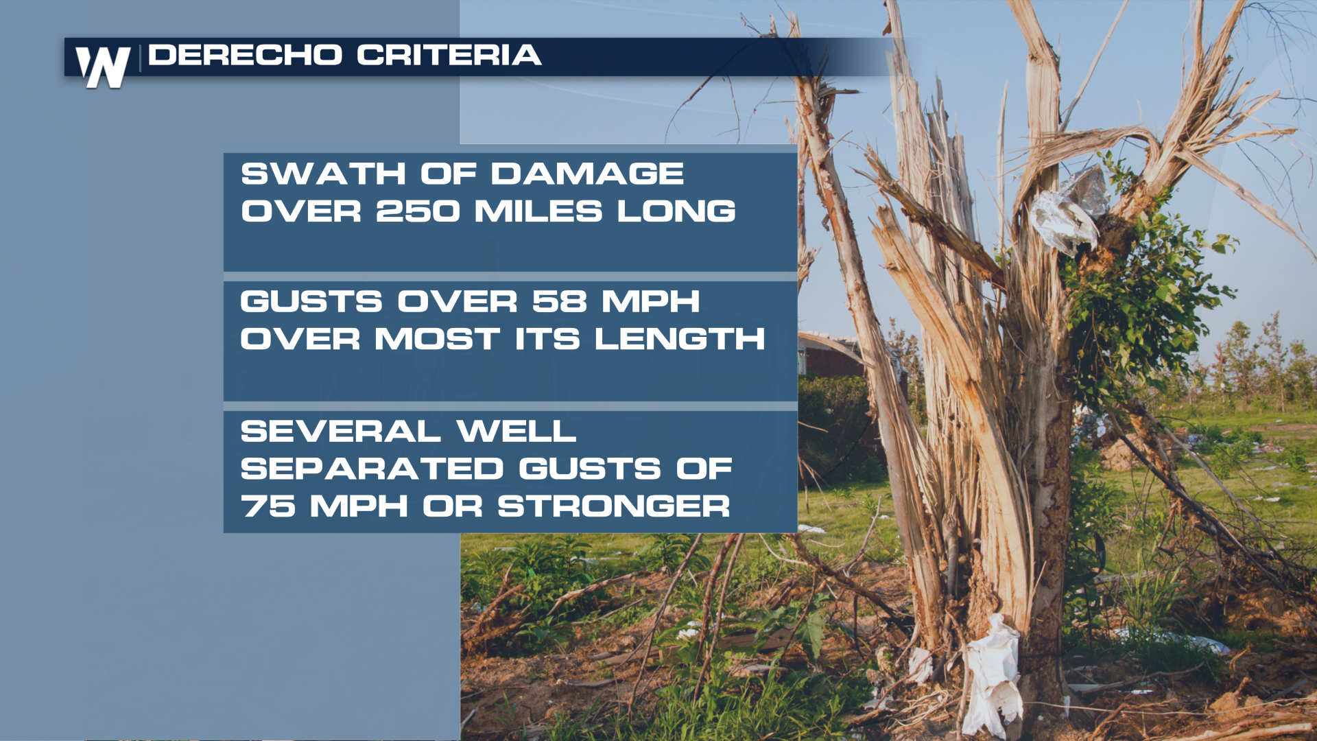 A derecho is a long-lived severe wind event, with specific criteria about the length and width of the damaging wind swath. The SPC has a detailed page dedicated to these destructive wind storms. Several typically occur each year, through they can vary in intensity and area. A notable derecho ripped through Des Moines in 2020, producing hurricane force winds and widespread damage.
All criteria appear to have been met Friday night and Saturday morning to classify this event as a derecho. Regardless, widespread wind damage has been reported with many trees and powerlines down. Several tornadoes did occur in addition to the straight-line winds.
Reports
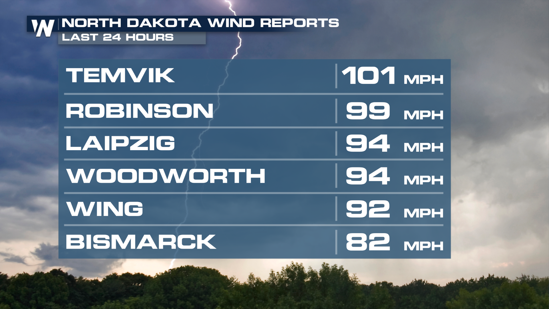
Wind gusts in North Dakota and Minnesota (as well as northern South Dakota) were impressive, many over hurricane strength. A wake-low also developed behind the leading edge, producing severe strength winds (58+ mph) in some locations for over an hour!
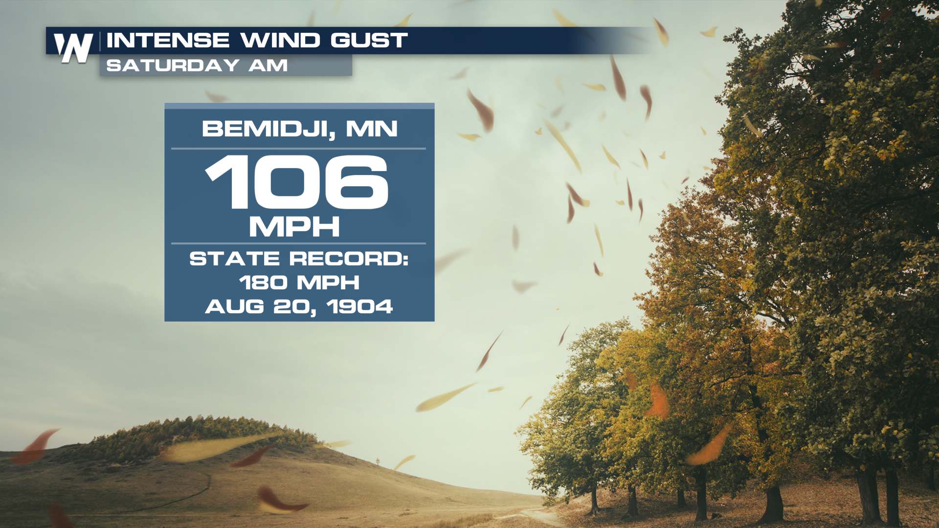
 Bemidji, Minnesota was hit particularly hard in the overnight hours as a intense bout of winds moved through the area, with a tornado potentially embedded in the circulation. The Bemidji Regional Airport reported a gust to 106 mph, with widespread damage reported in the area.
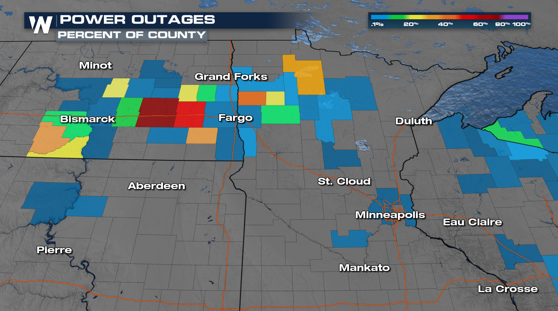
 The widely spanning severe winds have left hundreds of thousands of households in the dark as of Saturday morning, with some counties reporting well over 60-60% of customers without power. As a reminder, if you're going to run a generator to power anything keep it at least 25 feet away from any opening in your home, like windows and doors.