Detailed Look at Tuesday's Severe Chances

Top Stories
26 Nov 2019 1:49 AM
A strong cold front sweeping across the Mississippi and Tennessee Valleys today will generate numerous showers and thunderstorms. There is a good chance that some of these storms could turn severe Tuesday afternoon and evening. Here is the very latest.
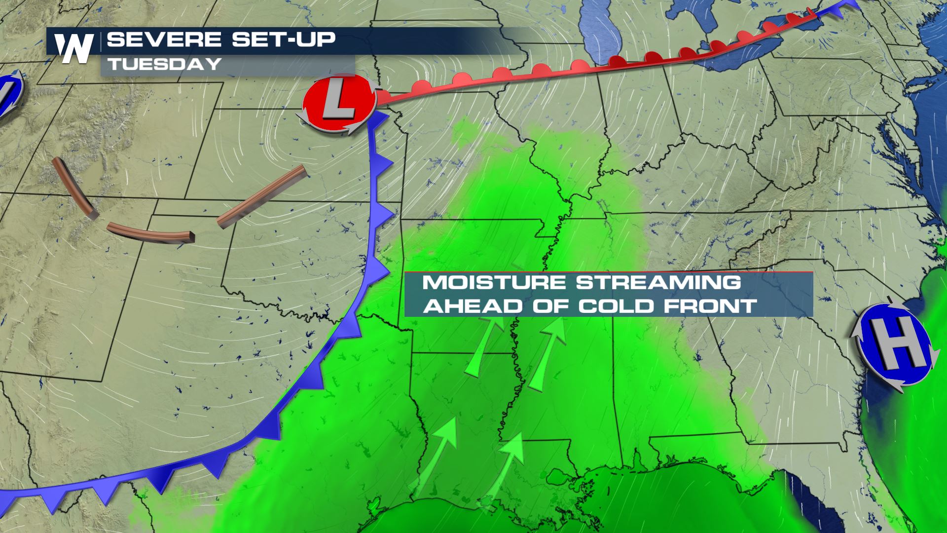 Southerly flow out ahead of this strong cold front will help to support the heavy showers and storms. Instability will also be strong enough out in front of the cold front to help lift this moisture into the upper-levels of the atmosphere.
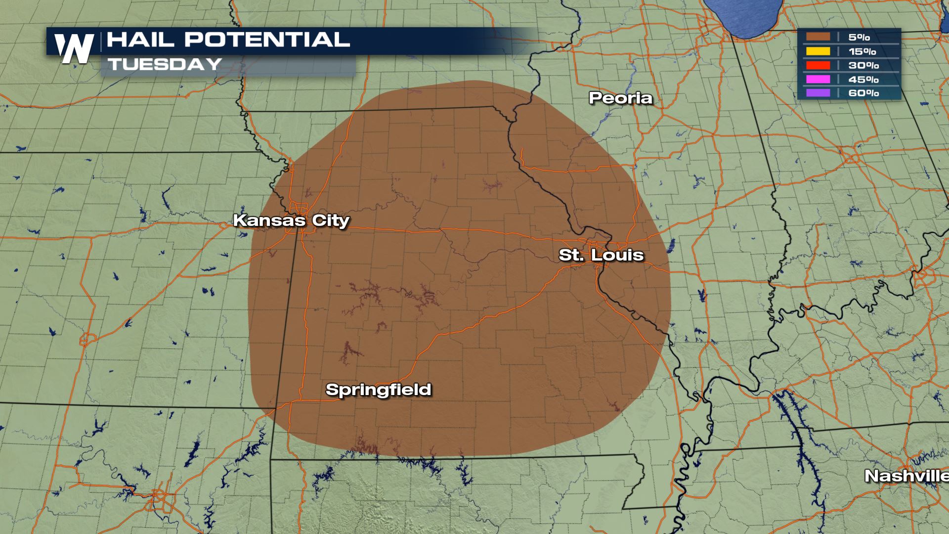
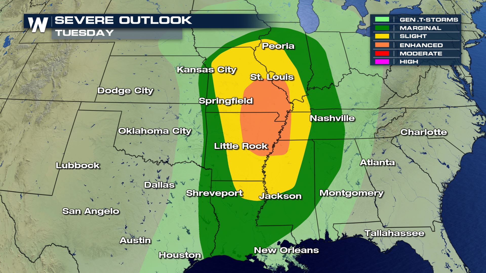 Notice the amount of real estate that is covered with today's severe risk. It starts from the Gulf Coast and extends north into Central Illinois. This means several cities will have big impacts when it comes to the holiday travel.
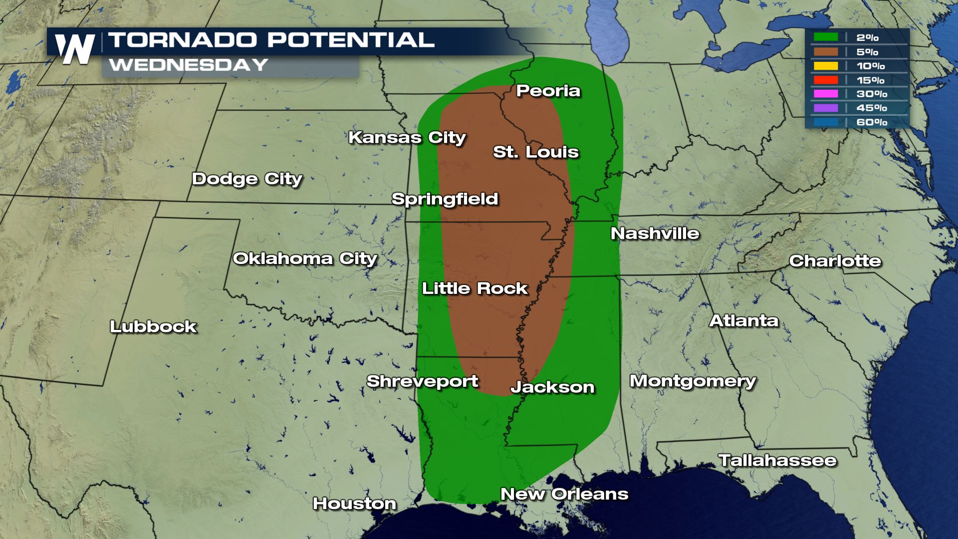
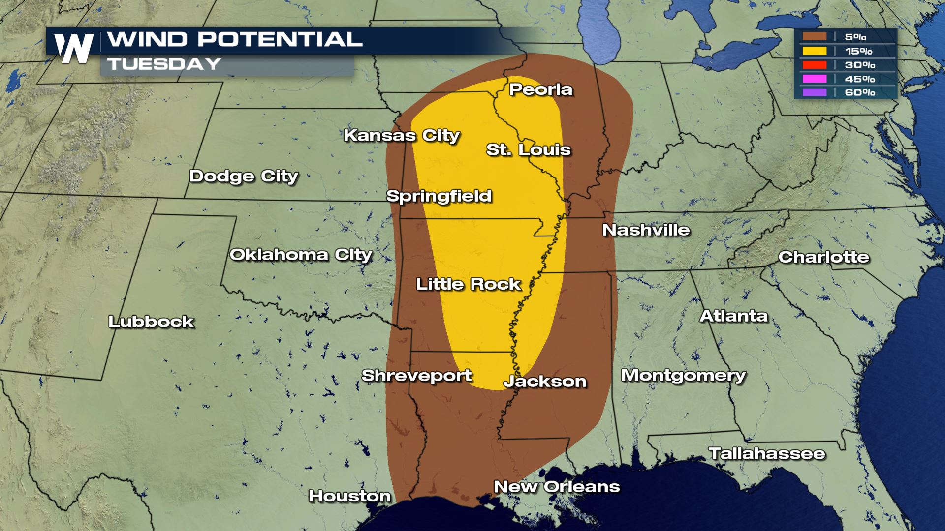
 All modes of severe weather are in the forecast today, but the risk for damaging winds and tornadoes will be the primary risk. Sadly with all the people on the roads you will want to have a way to get weather alerts in case a severe storm is moving over your area or wherever you are located on your travels.
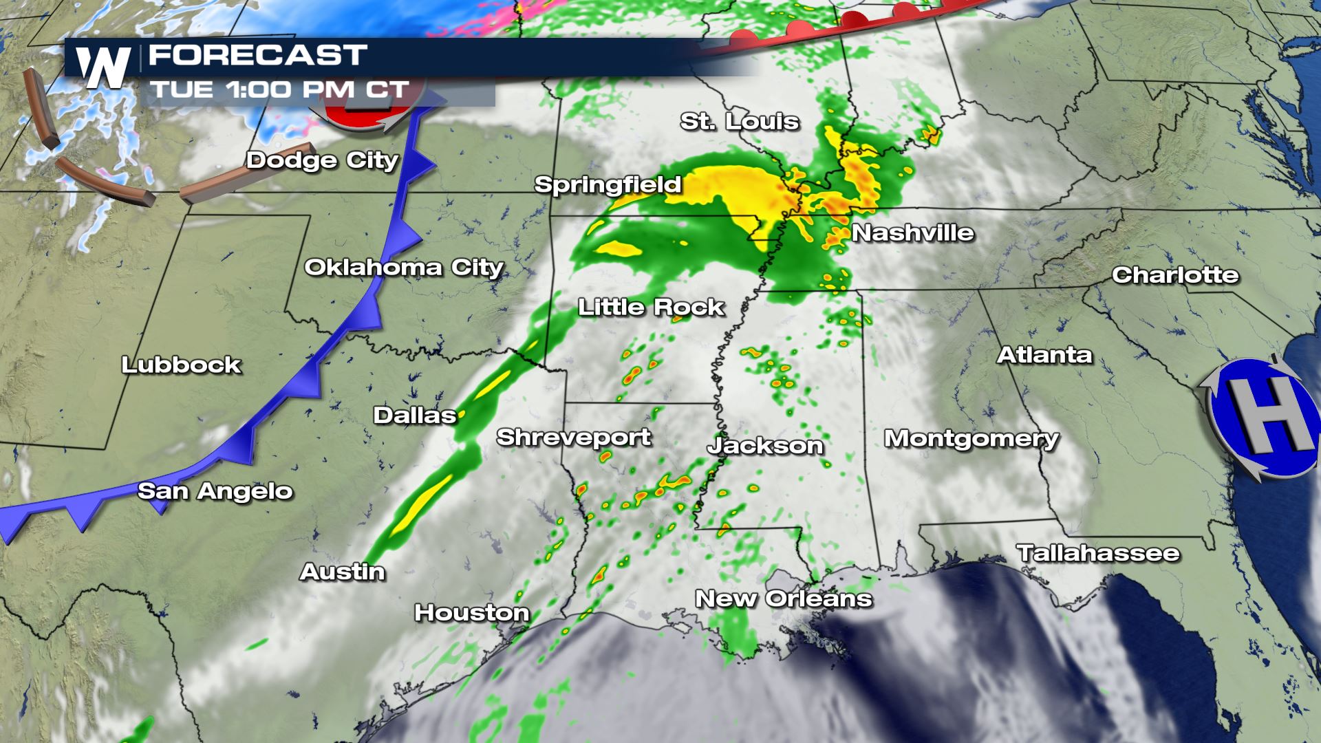
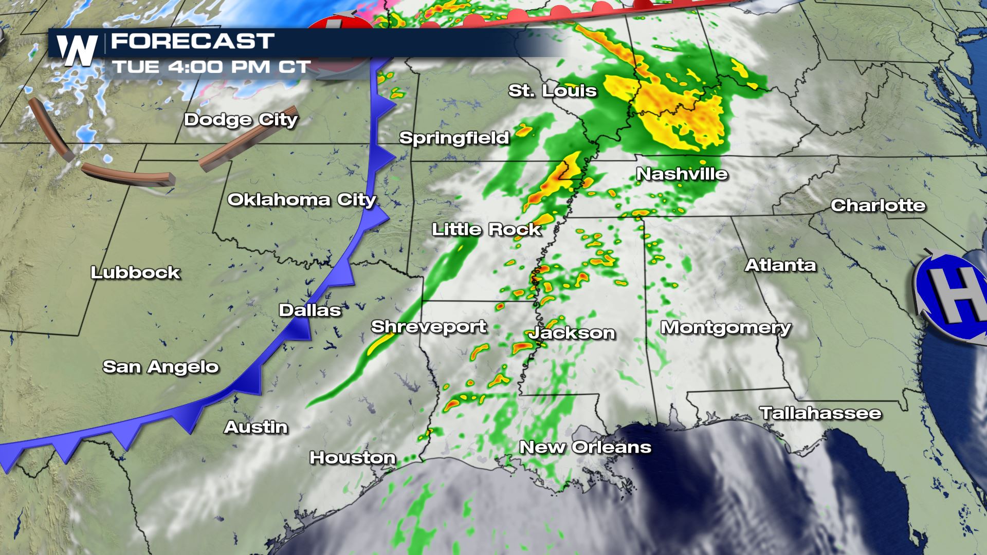
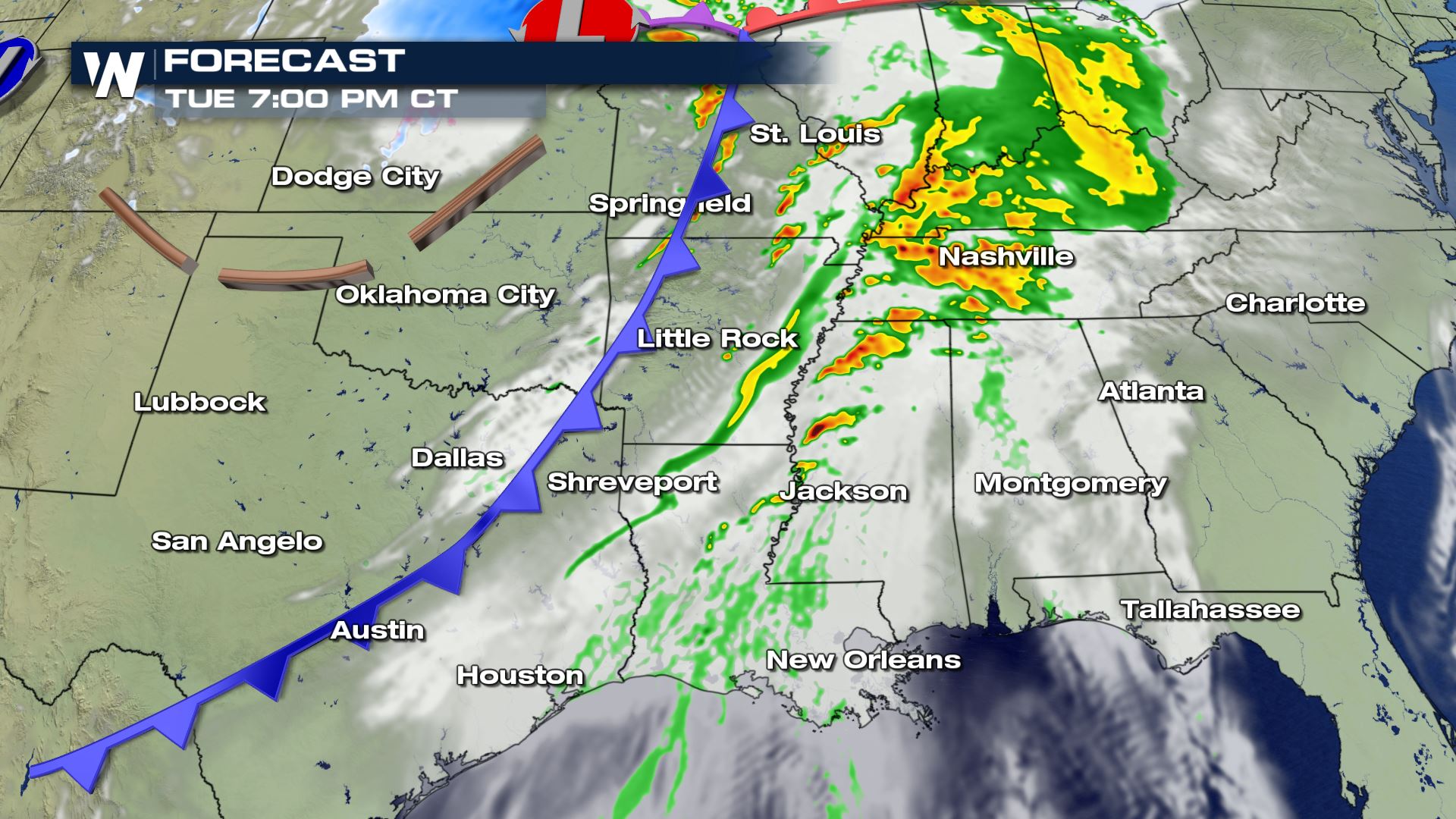 The timing for today's storms will be all afternoon and evening.
Keep checking with WeatherNation for all the details you need to know on today's severe weather event.
The timing for today's storms will be all afternoon and evening.
Keep checking with WeatherNation for all the details you need to know on today's severe weather event.
Severe Set-Up
Southerly flow out ahead of this strong cold front will help to support the heavy showers and storms. Instability will also be strong enough out in front of the cold front to help lift this moisture into the upper-levels of the atmosphere.
Severe Outlook
Notice the amount of real estate that is covered with today's severe risk. It starts from the Gulf Coast and extends north into Central Illinois. This means several cities will have big impacts when it comes to the holiday travel.
Severe Risks
All modes of severe weather are in the forecast today, but the risk for damaging winds and tornadoes will be the primary risk. Sadly with all the people on the roads you will want to have a way to get weather alerts in case a severe storm is moving over your area or wherever you are located on your travels.
Forecast
The timing for today's storms will be all afternoon and evening.
Keep checking with WeatherNation for all the details you need to know on today's severe weather event.
All Weather News
More
Wildfire Outbreak in the Pacific Northwest
Conditions have been incredibly dry out west.
2 Aug 2026 12:20 PM


More Storms for the East Sunday and Monday
A low-pressure system crashing through the Mi
2 Aug 2026 2:20 AM

After Reaching Category 5, Genevieve Weakens in the Pacific
PacificGenevieve formed on last Friday south
2 Aug 2026 1:30 AM

Flooding, Severe Storms Target the Midwest Again
After an active week of storms across the nor
1 Aug 2026 1:40 AM

Flooding Risk Increases as Heavy Rain Targets the Tri-State Area
Tuesday, heavy rainfall moved across the Nort
30 Jul 2026 12:25 AM

Severe Weather: Energy From the Midwest Now in the Southeast
UPPER MIDWEST - Through Monday, dangerous tor
29 Jul 2026 10:30 PM