Dolores Makes Landfall in Mexico as Strong Tropical Storm
Top Stories
19 Jun 2021 8:00 AM
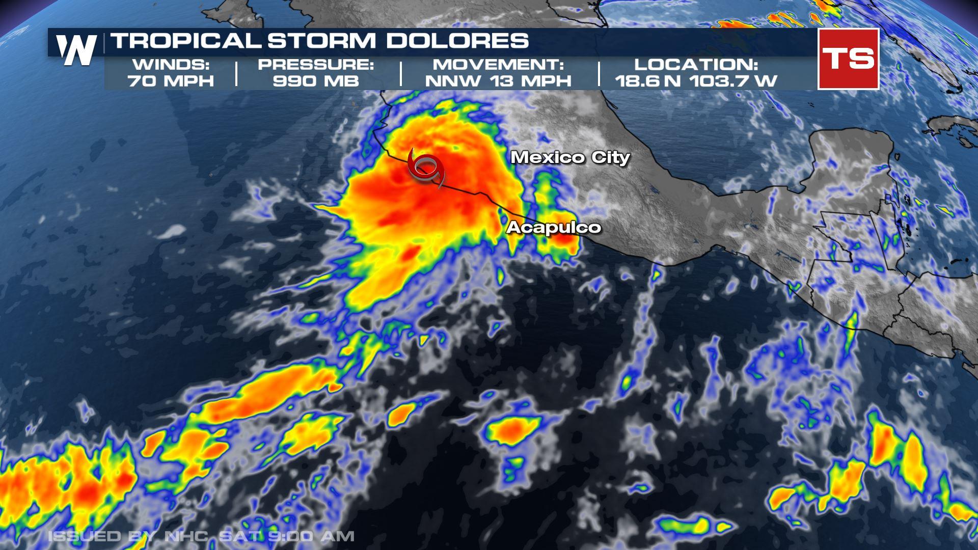
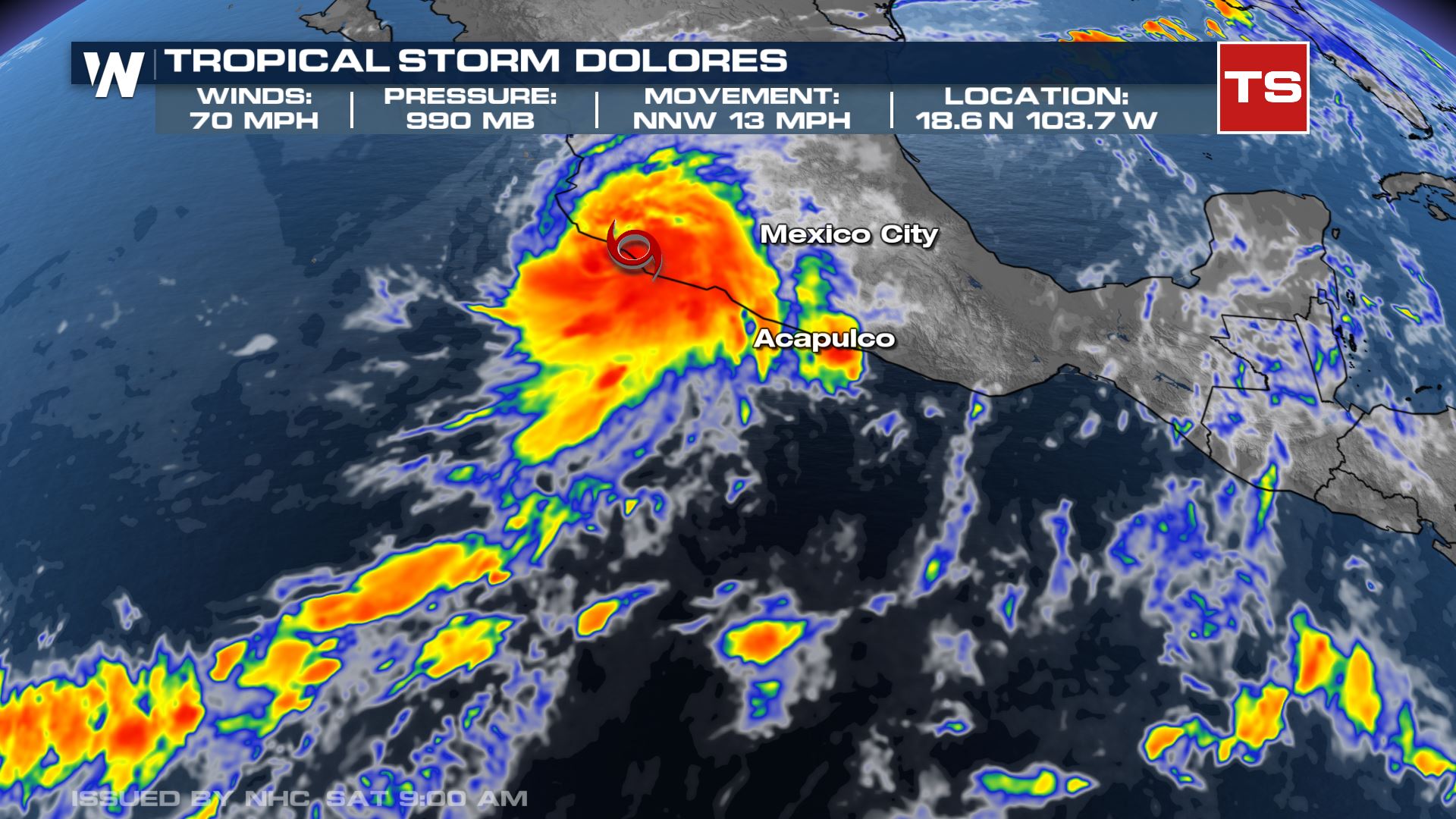
Dolores made landfall in Mexico as a strong tropical storm Saturday morning, with max windspeeds of 70 mph. Life-threatening flash flooding and mudslides are happening in southwest Mexico.
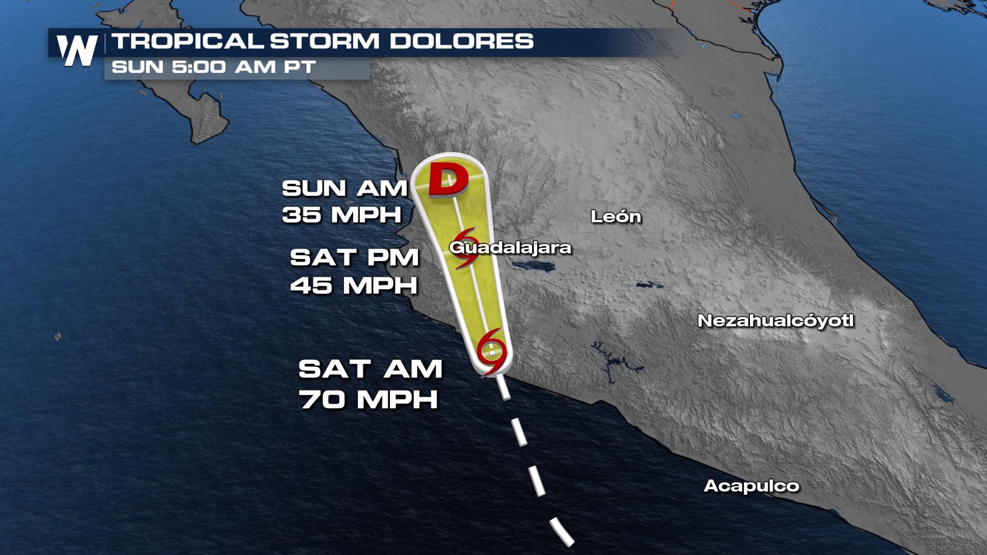
 Dolores remains a strong tropical storm but will steadily weaken as it moves inland. It's expected to dissipate over the high mountains of western Mexico by Sunday morning.
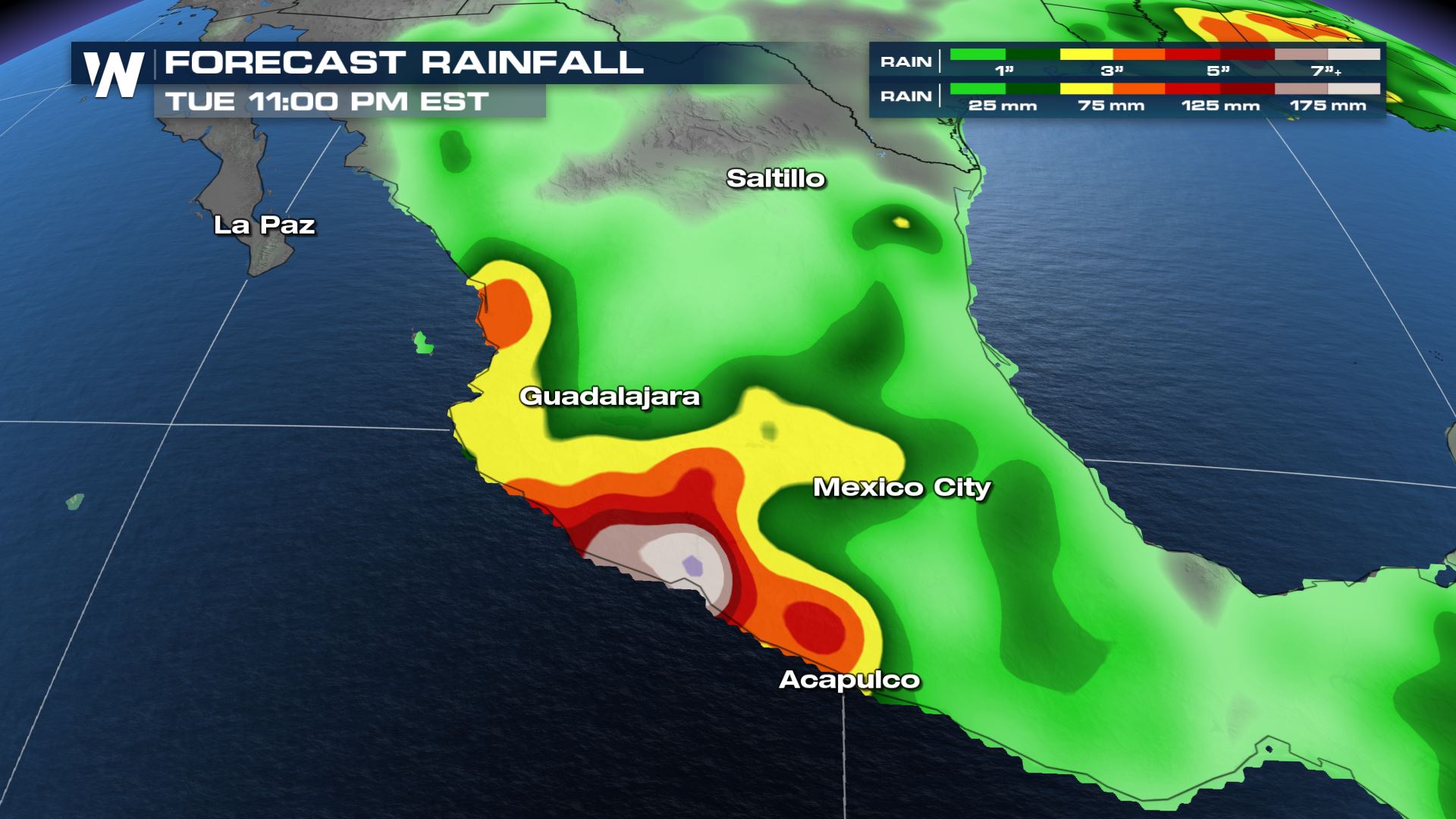
 Dolores has brought heavy rain to the Mexican states of Michoacan and Colima and will bring more heavy rain to Southwest and West-Central Mexico even after it dissipates. This could lead to life threatening flash flooding and mudslides as an additional 175+ mm/7" inches of rain is possible in isolated areas.
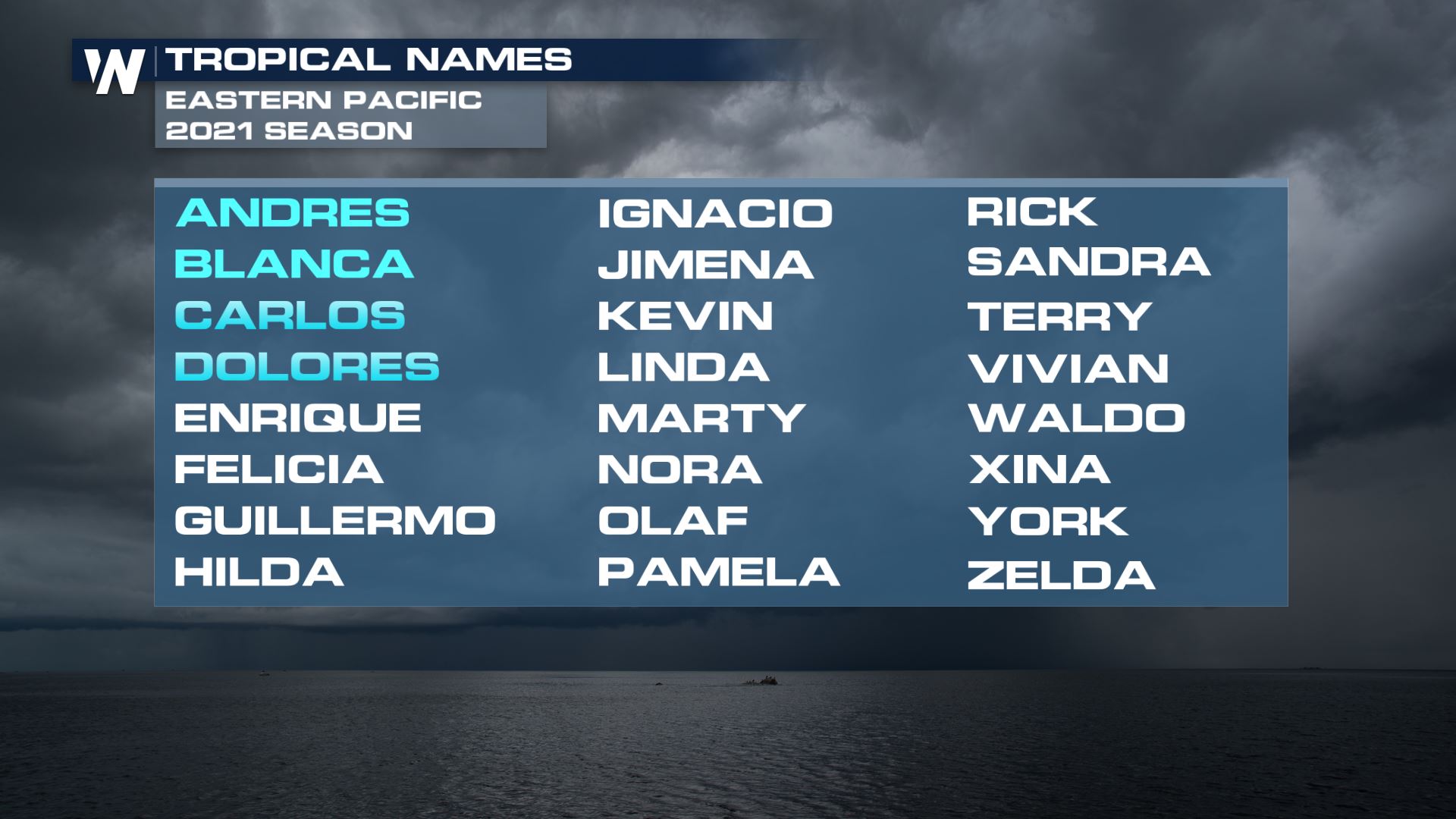
 There is no tropical development expected in the Eastern Pacific for the next 5 days. However the next name on the list is Enrique.
Dolores remains a strong tropical storm but will steadily weaken as it moves inland. It's expected to dissipate over the high mountains of western Mexico by Sunday morning.
Dolores has brought heavy rain to the Mexican states of Michoacan and Colima and will bring more heavy rain to Southwest and West-Central Mexico even after it dissipates. This could lead to life threatening flash flooding and mudslides as an additional 175+ mm/7" inches of rain is possible in isolated areas.
There is no tropical development expected in the Eastern Pacific for the next 5 days. However the next name on the list is Enrique.
All Weather News
More
Wildfire Outbreak in the Pacific Northwest
SPOKANE, WA - On Saturday, August 1st, the Ol
2 Aug 2026 7:20 PM

More Storms for the East Through Monday
A low-pressure system that moved through the
2 Aug 2026 7:20 PM


After Reaching Category 5, Genevieve Weakens in the Pacific
PacificGenevieve formed on last Friday south
2 Aug 2026 6:25 PM

Flooding, Severe Storms Target the Midwest Again
After an active week of storms across the nor
1 Aug 2026 1:40 AM

Flooding Risk Increases as Heavy Rain Targets the Tri-State Area
Tuesday, heavy rainfall moved across the Nort
30 Jul 2026 12:25 AM

Severe Weather: Energy From the Midwest Now in the Southeast
UPPER MIDWEST - Through Monday, dangerous tor
29 Jul 2026 10:30 PM