Downburst Derails 86-Car Train In Texas
Special Stories
1 Jul 2020 5:55 PM
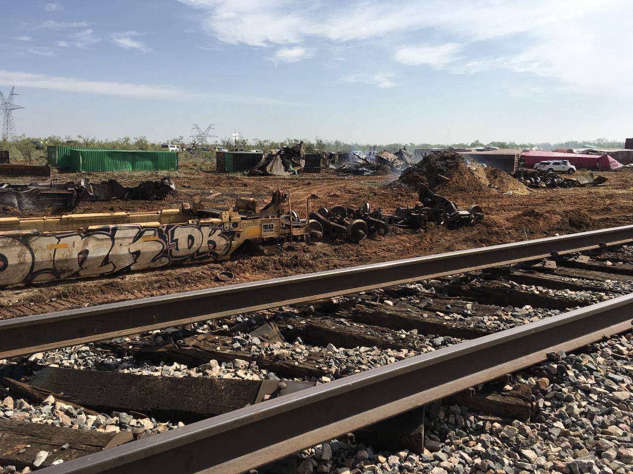
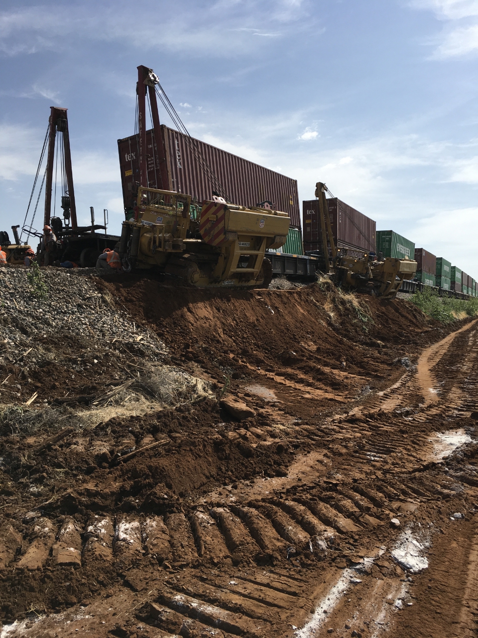
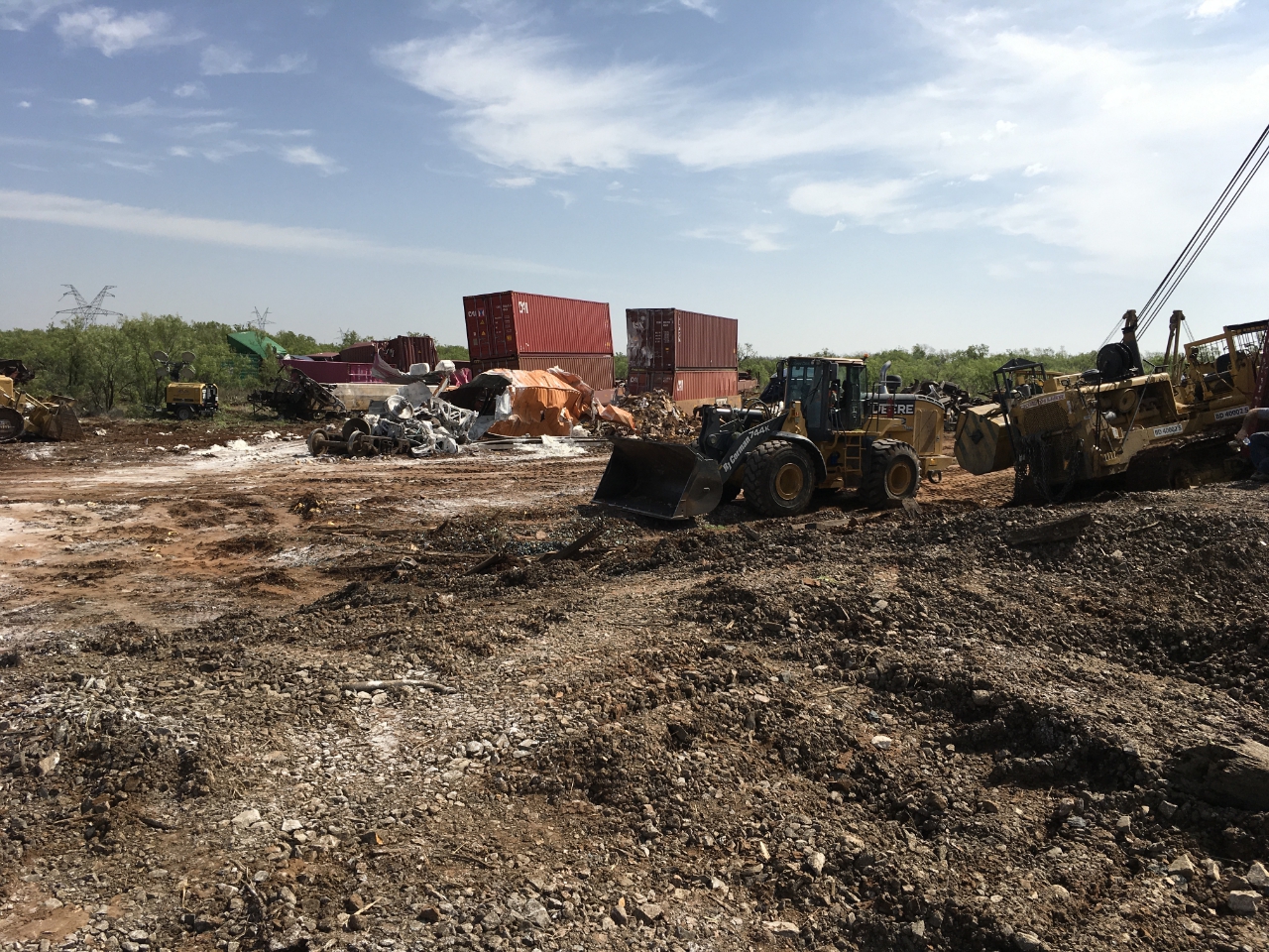
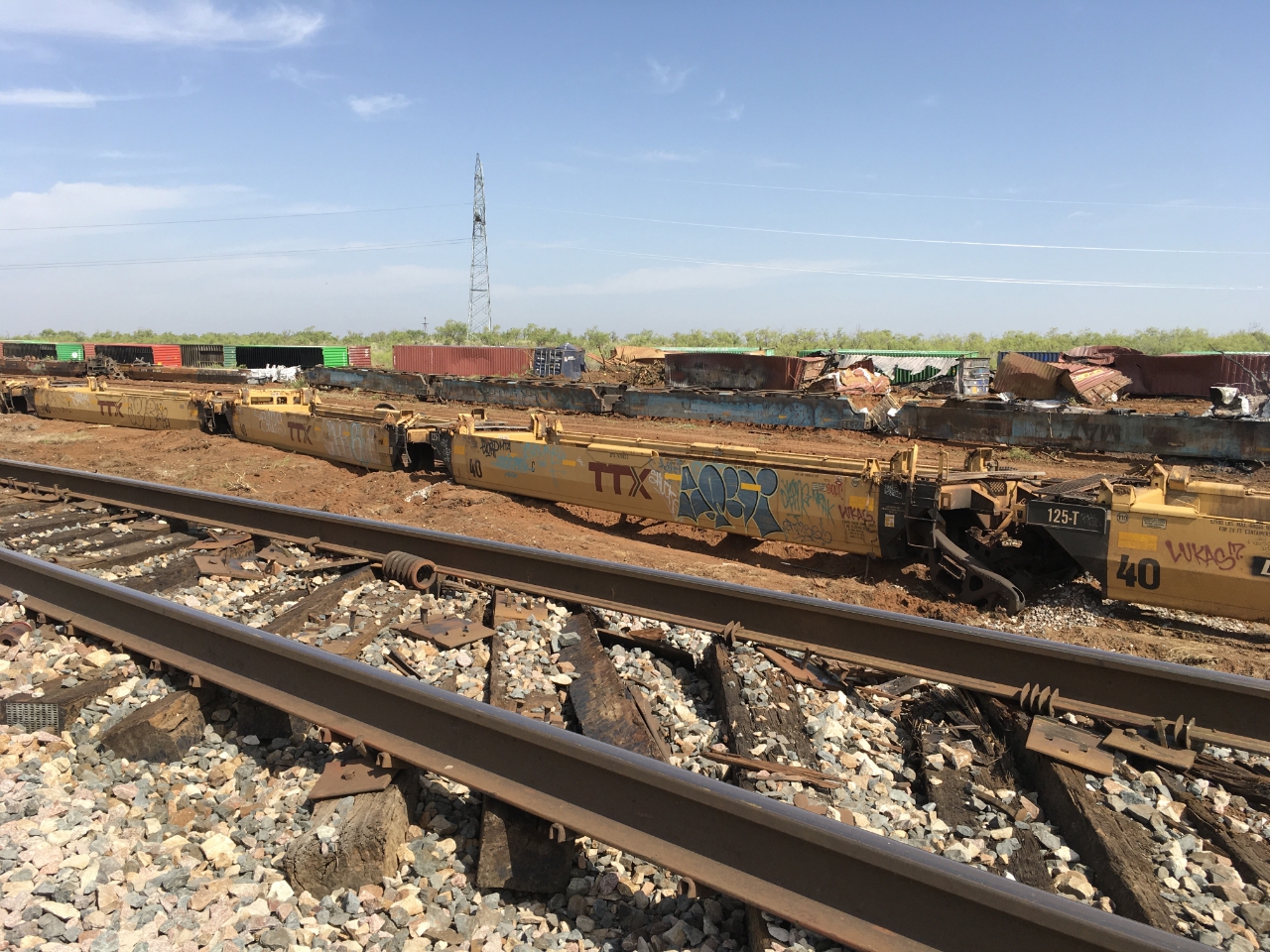
A mile-long swath of 80+ mph wind was likely the cause of a train derailment of 86 cars in Texas on Tuesday. The National Weather Service (NWS) office in Midland, TX confirmed the information Wednesday afternoon. The train was carrying cargo at the time.
 Courtesy NWS Midland
In a Public Information Statement released Wednesday evening, NWS Midland said it had sent meteorologists to Colorado City, Texas to investigate storm damage from the day prior. The meteorologists found that "significant thunderstorm wind damage occurred three miles east of Colorado City. Damage included five snapped power line poles and an 86 train car derailment less than one mile south of Interstate 20."
Courtesy NWS Midland
In a Public Information Statement released Wednesday evening, NWS Midland said it had sent meteorologists to Colorado City, Texas to investigate storm damage from the day prior. The meteorologists found that "significant thunderstorm wind damage occurred three miles east of Colorado City. Damage included five snapped power line poles and an 86 train car derailment less than one mile south of Interstate 20."
 Courtesy NWS Midland
The meteorologists' report goes on to say that all of the damage was oriented in the same direction. That statement indicates the storm damage was likely due to straight-line wind, rather than a tornado. This swath of wind damage was estimated to be a little more than one mile in length with wind between 80 and 100 mph!
Courtesy NWS Midland
The meteorologists' report goes on to say that all of the damage was oriented in the same direction. That statement indicates the storm damage was likely due to straight-line wind, rather than a tornado. This swath of wind damage was estimated to be a little more than one mile in length with wind between 80 and 100 mph!
 Courtesy NWS Midland
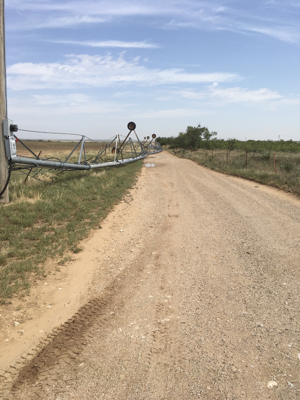
The train derailment damage occurred in northeastern Mitchell County, TX. A separate storm about nine miles southeast of Colorado City, TX caused damage in a cotton field. The storm "toppled a center pivot irrigation system, about 750 feet long" according to the NWS Midland office. The peak estimated wind with that storm is believed to be 65-70 mph.
Courtesy NWS Midland
The train derailment damage occurred in northeastern Mitchell County, TX. A separate storm about nine miles southeast of Colorado City, TX caused damage in a cotton field. The storm "toppled a center pivot irrigation system, about 750 feet long" according to the NWS Midland office. The peak estimated wind with that storm is believed to be 65-70 mph.
 Courtesy NWS Midland
This goes to show that severe thunderstorms are very powerful and can do similar damage compared to a tornado. In the short video below, WeatherNation Meteorologist Meredith Garofalo explains what straight line wind is and why it is so dangerous.
https://www.youtube.com/watch?v=ey-032W0t3c
All pictures courtesy the National Weather Service - Midland, TX
Courtesy NWS Midland
In a Public Information Statement released Wednesday evening, NWS Midland said it had sent meteorologists to Colorado City, Texas to investigate storm damage from the day prior. The meteorologists found that "significant thunderstorm wind damage occurred three miles east of Colorado City. Damage included five snapped power line poles and an 86 train car derailment less than one mile south of Interstate 20."
Courtesy NWS Midland
The meteorologists' report goes on to say that all of the damage was oriented in the same direction. That statement indicates the storm damage was likely due to straight-line wind, rather than a tornado. This swath of wind damage was estimated to be a little more than one mile in length with wind between 80 and 100 mph!
Courtesy NWS Midland
The train derailment damage occurred in northeastern Mitchell County, TX. A separate storm about nine miles southeast of Colorado City, TX caused damage in a cotton field. The storm "toppled a center pivot irrigation system, about 750 feet long" according to the NWS Midland office. The peak estimated wind with that storm is believed to be 65-70 mph.
Courtesy NWS Midland
This goes to show that severe thunderstorms are very powerful and can do similar damage compared to a tornado. In the short video below, WeatherNation Meteorologist Meredith Garofalo explains what straight line wind is and why it is so dangerous.
https://www.youtube.com/watch?v=ey-032W0t3c
All pictures courtesy the National Weather Service - Midland, TXAll Weather News
More
Wildfire Outbreak in the Pacific Northwest
SPOKANE, WA - On Saturday, August 1st, the Ol
3 Aug 2026 1:55 AM

More Storms for the East Through Monday
A low-pressure system that moved through the
3 Aug 2026 1:50 AM


After Reaching Category 5, Genevieve Weakens in the Pacific
PacificGenevieve formed last Friday south of
3 Aug 2026 12:30 AM

Flooding, Severe Storms Target the Midwest Again
After an active week of storms across the nor
1 Aug 2026 1:40 AM

Flooding Risk Increases as Heavy Rain Targets the Tri-State Area
Tuesday, heavy rainfall moved across the Nort
30 Jul 2026 12:25 AM

Severe Weather: Energy From the Midwest Now in the Southeast
UPPER MIDWEST - Through Monday, dangerous tor
29 Jul 2026 10:30 PM