Heavy Snow Knocks Out Power in the Northeast, Blizzard Warning Issued
Over 20 inches of snowfall has accumulated across areas in the Northeast, bringing down trees and power lines. Less than 100,000 households were still without power in NY and PA as of Saturday afternoon.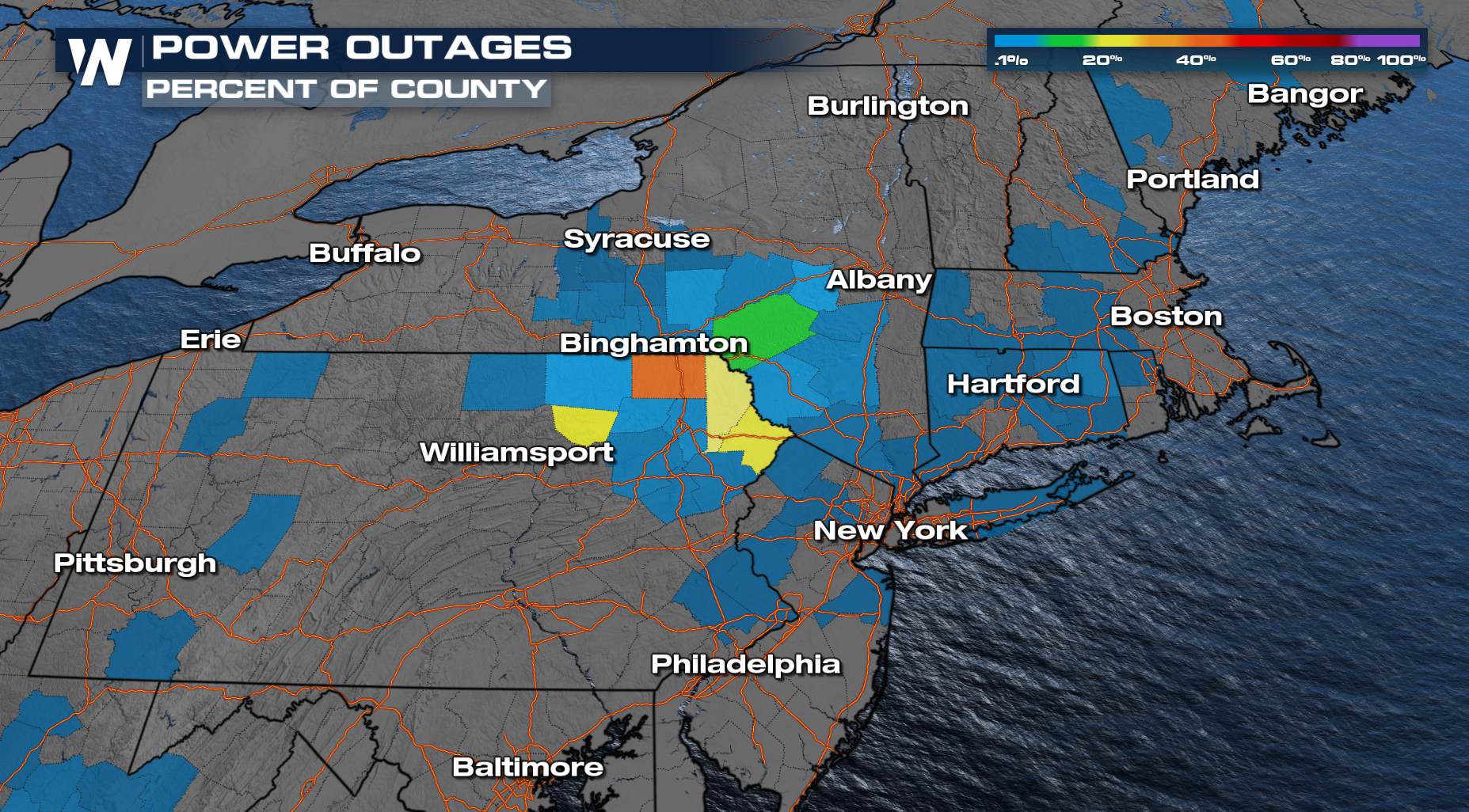
High Point New Jersey reported the most snow, topping 20 inches! Unfortunately this fell on many trees that still had leaves, causing branches to come down.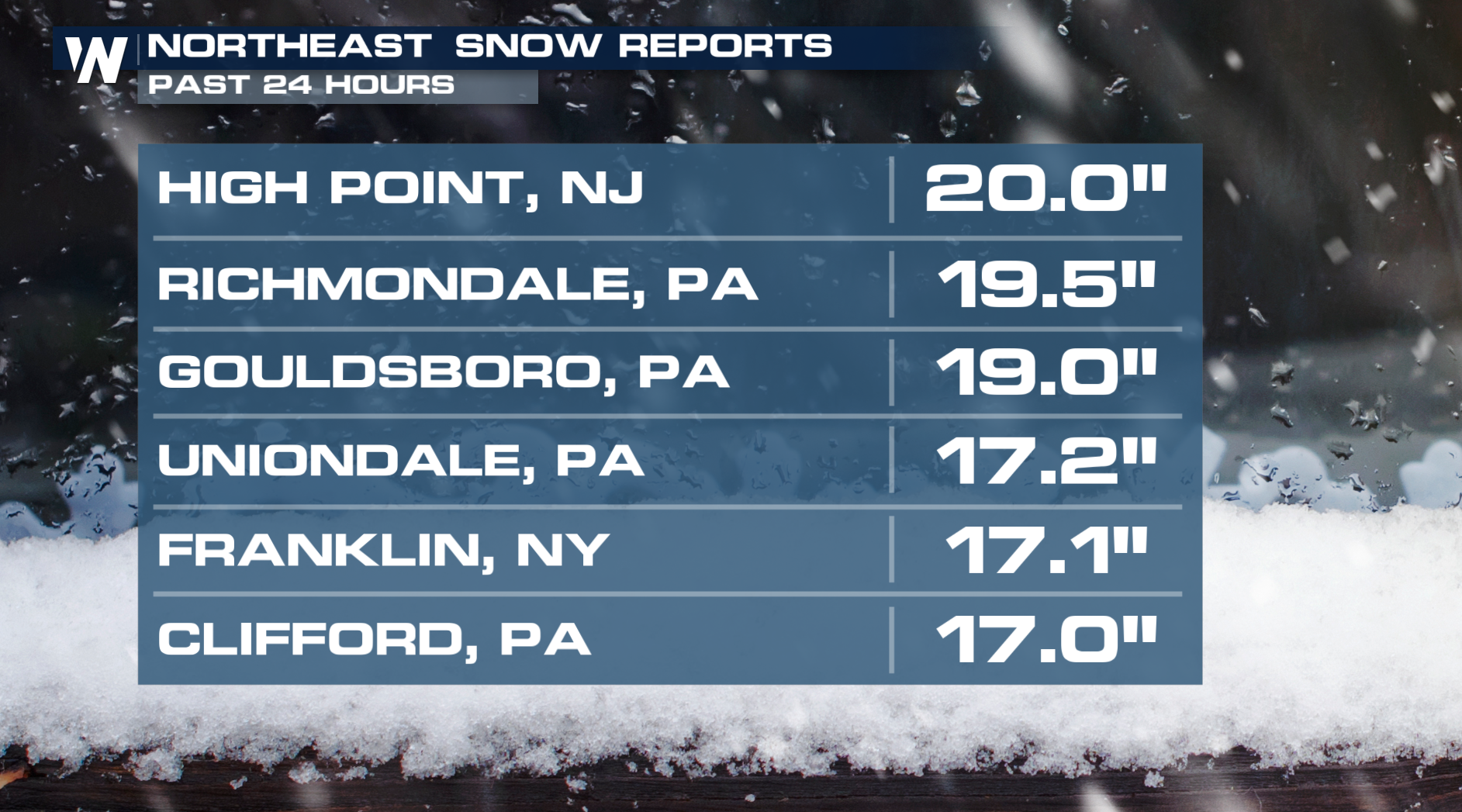
Winter storm alerts have been discontinued for all except along the spine of the mountains in West Virginia.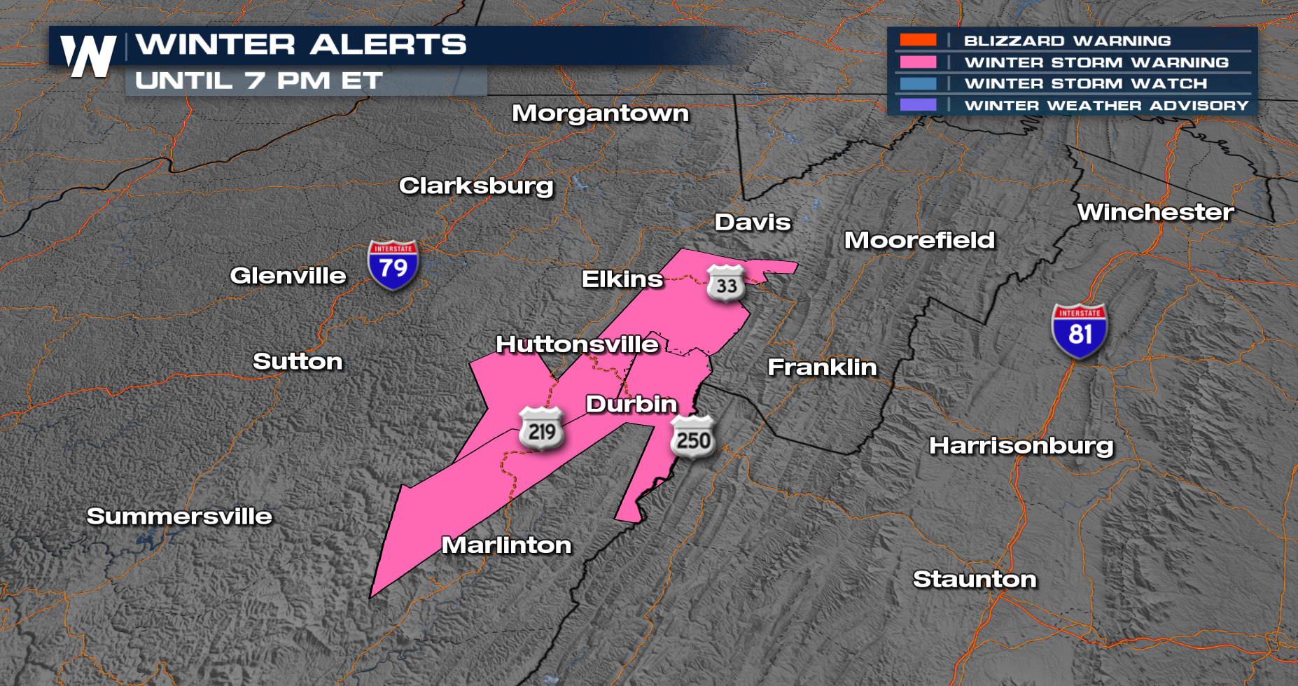
For the rest of the night, we will see some off and on light showers across parts of PA and NY. Some snow will continue in northern New England through the day on Sunday as cold NW flow continues.
Additional rain and snow will be mostly light, except along the coast of New England where over an inch of rain is still possible. 3-6 inches of snow could grace the mountains near the Canadian border.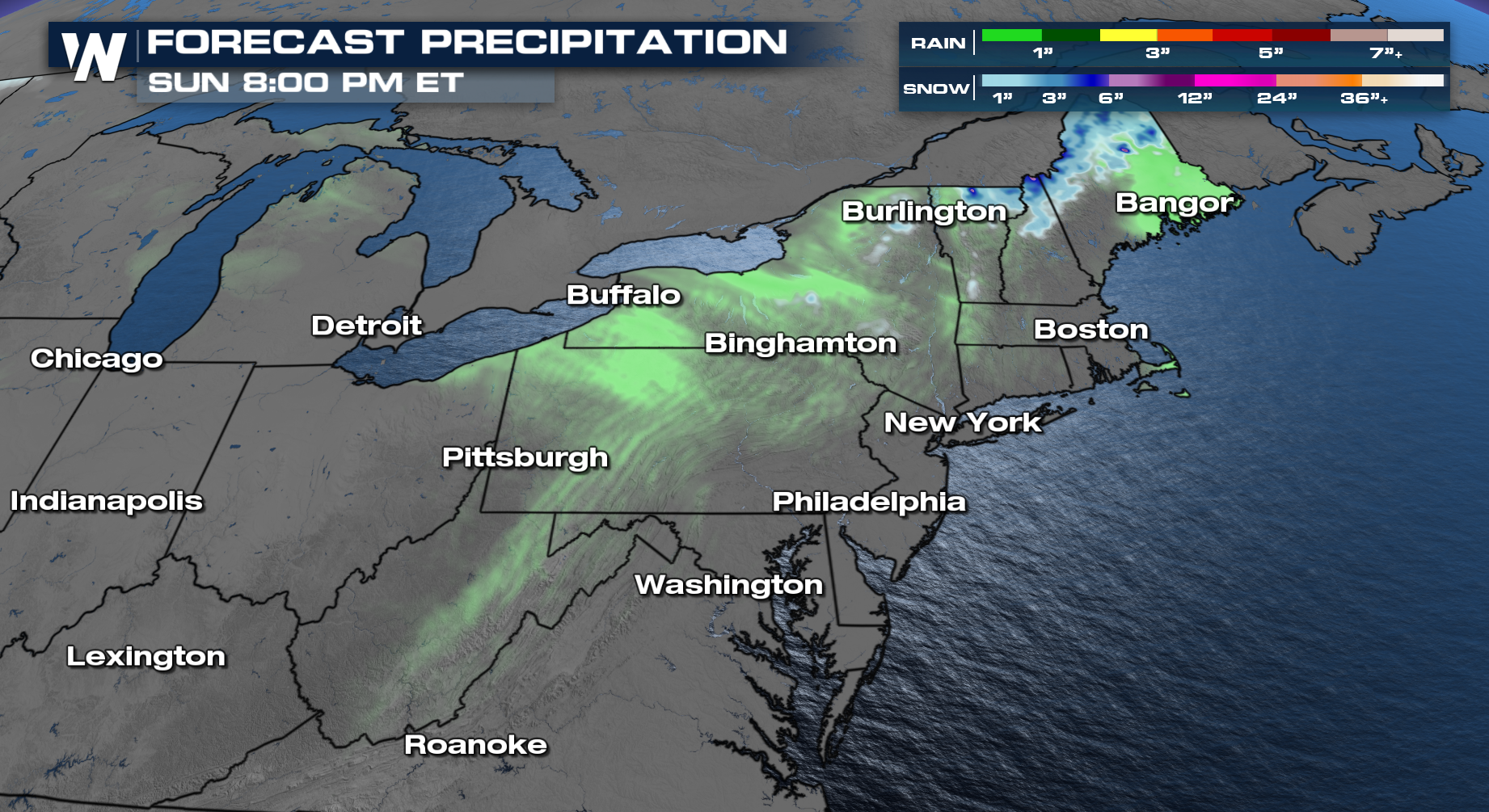
Following the system, temperatures will rebound only to go back down as we head into next week!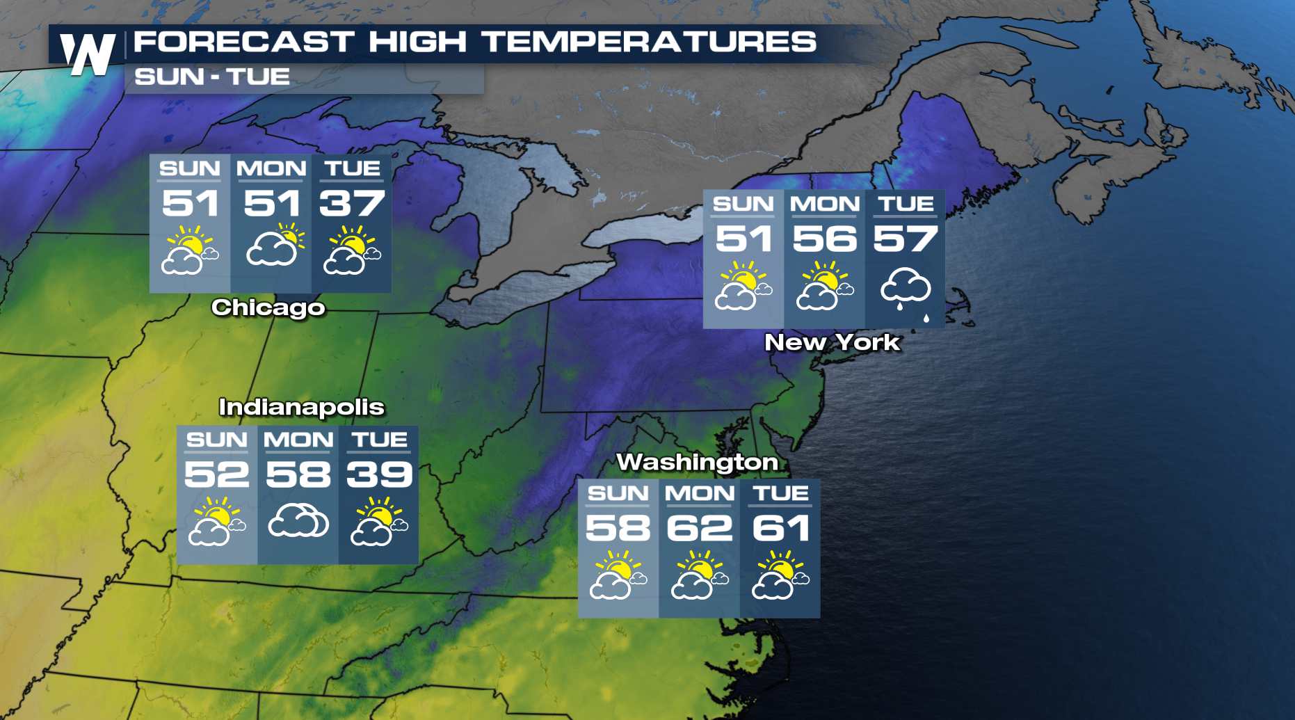 Catch more details on the rain and snow across the northeast can be found :10 past the hour on WeatherNation during your Eastern Regional Forecast.