EF-3 Tornado Confirmed in Houston Tuesday
Top Stories
27 Jan 2023 7:00 AM
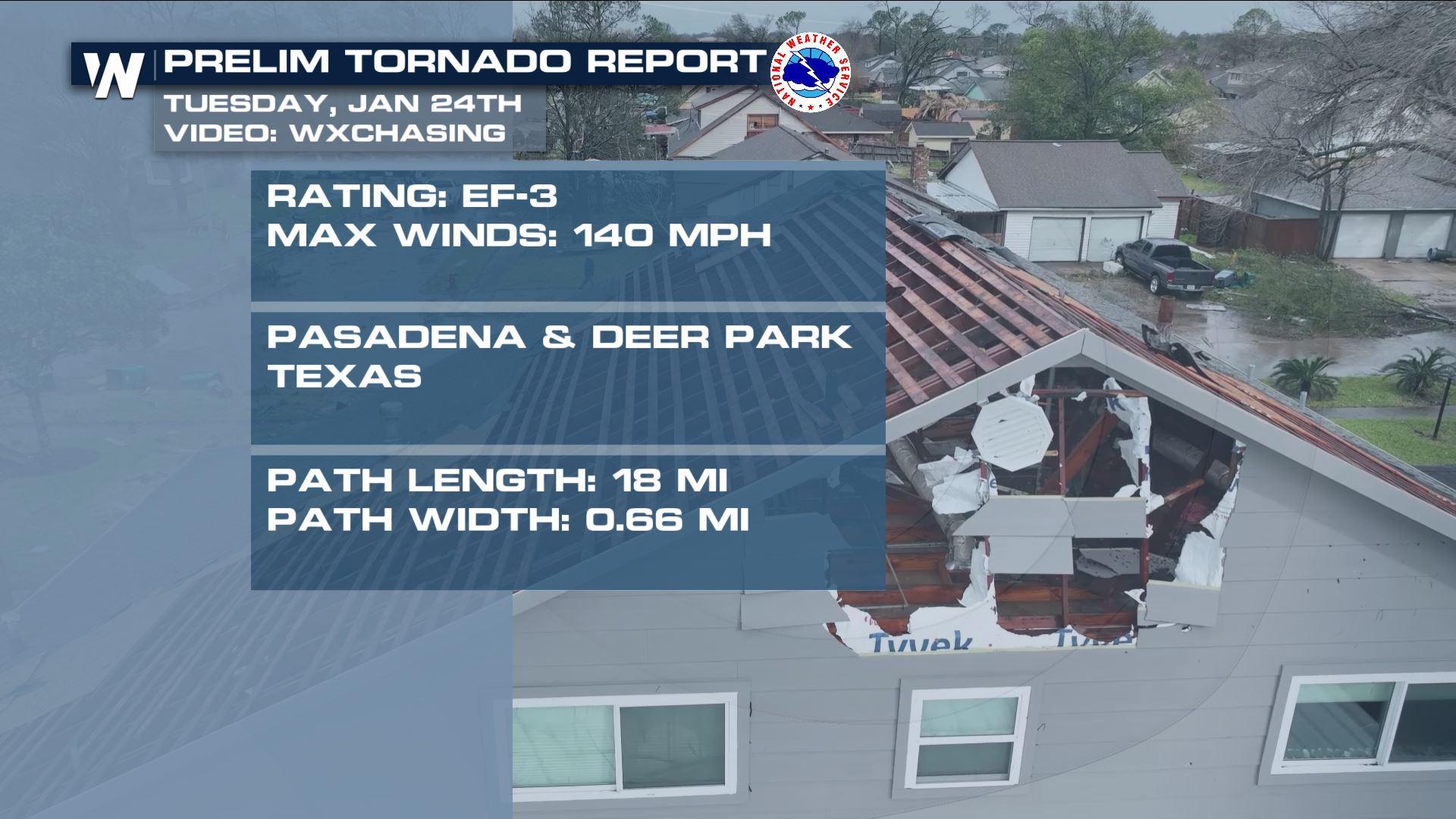
A tornado emergency was issued early Tuesday afternoon for the Baytown and SE Houston communities. This was the highest level of a tornado warning, and reports of damage just east of Houston are numerous. This is the first tornado emergency ever issued by the National Weather Service office out of Houston. Early Wednesday morning, the National Weather Service office in Houston confirmed an EF-3 hit the Deer Park / Pasadena, TX area.
https://twitter.com/WeatherNation/status/1618394918048890882?s=20
Our field correspondents were able to survey the damage in Pasadena, TX by drone on Tuesday afternoon, showing widespread damage to homes in the town. Shingles and drywall were ripped off homes and debris was scattered throughout. A train was pushed off the tracks and multiple semi trucks were blown over. The community of Deer Park was also hit very hard by this same tornado.
https://twitter.com/WeatherNation/status/1618017281056931840
Our crews surveyed more tornado damage in Orange, TX, a community located on the Louisiana/Texas border.
https://twitter.com/WeatherNation/status/1618058699037097984
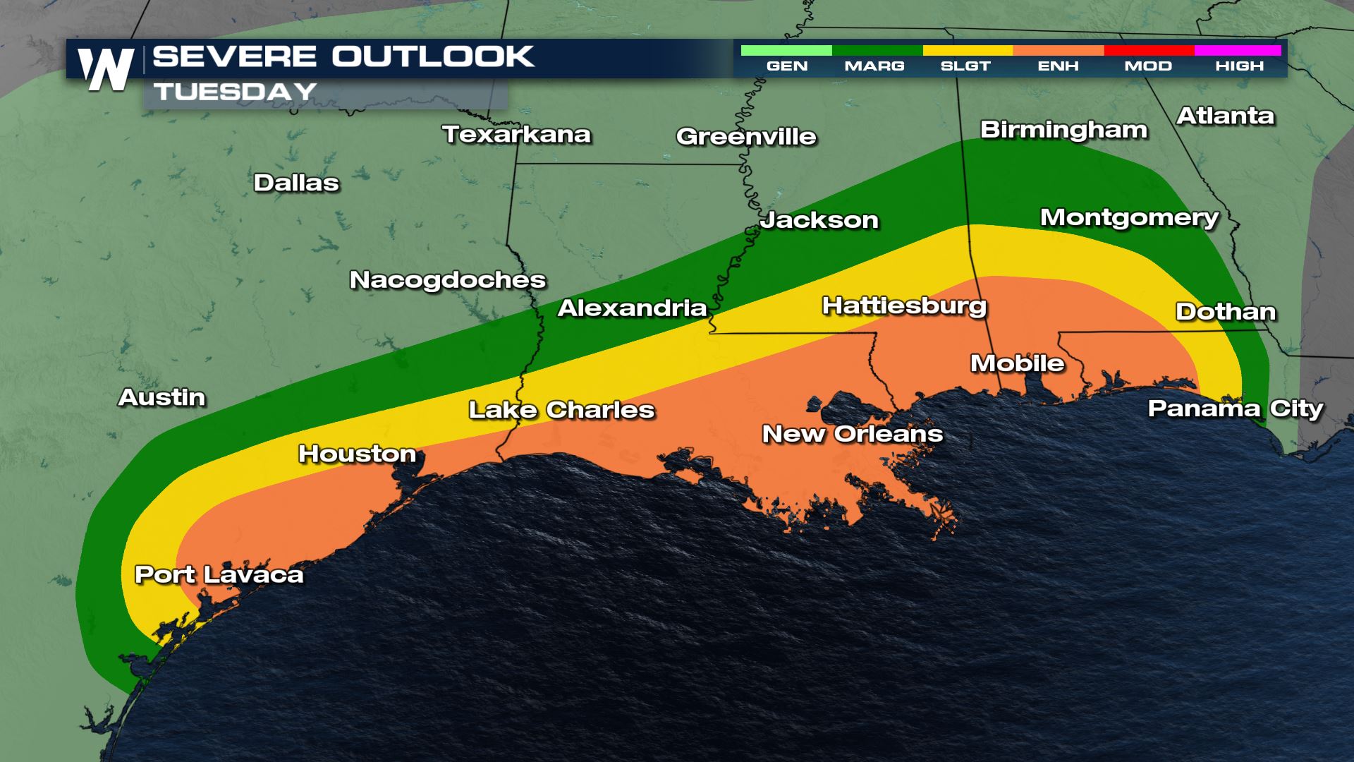
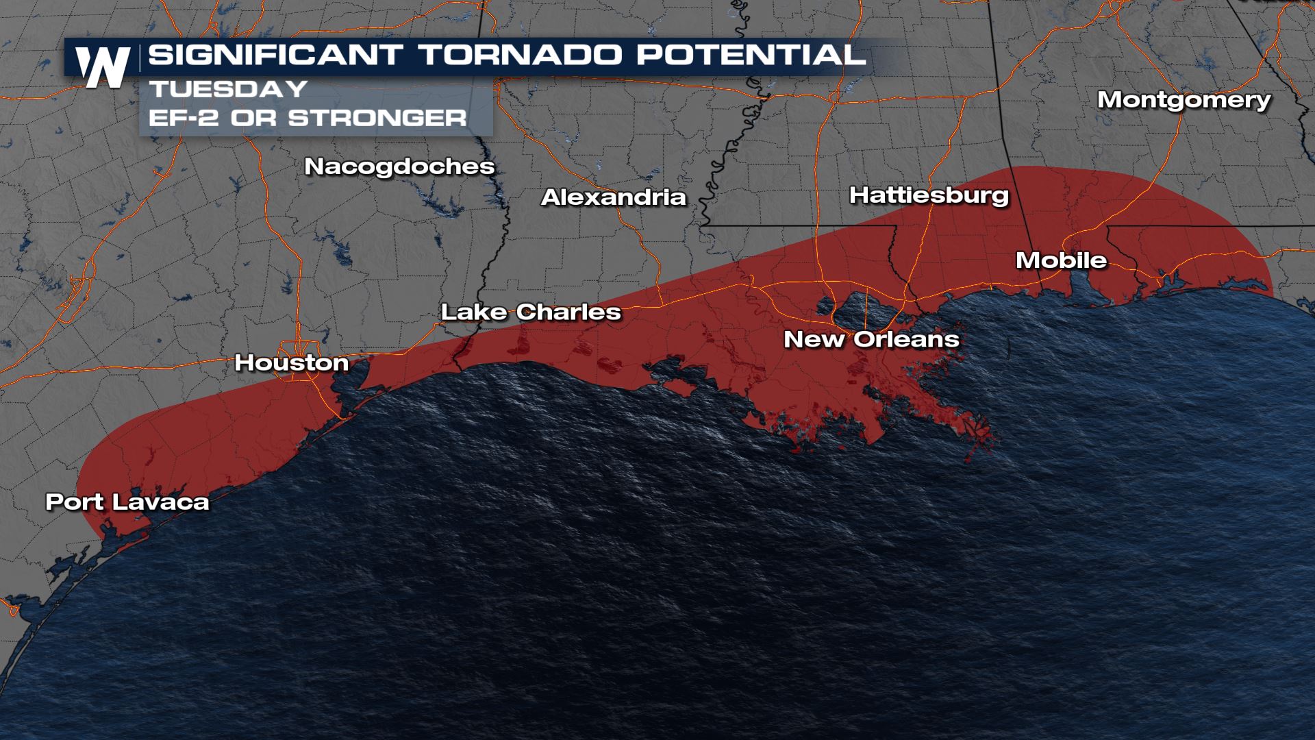
On Tuesday we had an ENHANCED risk issued by the Storm Prediction Center (level 3 out of 5) for the Gulf Coast of Texas, Louisiana, Mississippi, and Alabama along with the Florida panhandle. There was also the risk for "significant tornadoes" through the I-10 corridor where the SPC highlighted the potential for an EF-2 or greater tornado.
 For the latest on the storm surveys, stay with WeatherNation for the most up-to-date forecast & information!
For the latest on the storm surveys, stay with WeatherNation for the most up-to-date forecast & information!All Weather News
More

East Gears Up for Stormy, Wet Weekend
A low pressure system crashing through the Mi
1 Aug 2026 9:15 PM


Flooding, Severe Storms Target the Midwest Again
After an active week of storms across the nor
1 Aug 2026 1:40 AM

After Reaching Category 5, Genevieve Weakens in the Pacific
PacificFausto is now a post-tropical cyclone.
31 Jul 2026 1:30 AM

Flooding Risk Increases as Heavy Rain Targets the Tri-State Area
Tuesday, heavy rainfall moved across the Nort
30 Jul 2026 12:25 AM

Severe Weather: Energy From the Midwest Now in the Southeast
UPPER MIDWEST - Through Monday, dangerous tor
29 Jul 2026 10:30 PM