Subtropical Storm Ernesto Forms in the Atlantic
Special Stories
15 Aug 2018 8:29 AM
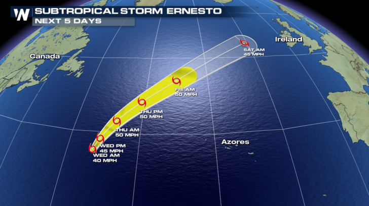
The newest subtropical system has developed in the Atlantic. Ernesto is now the 5th named storm of the Atlantic hurricane season. The storm is located a thousand miles west of the Azores and is no threat to land areas. The cyclone is moving slowly north at 8 mph with winds near 40 mph. The storm formed early Wednesday morning when the National Hurricane Center issued their first advisory on the system.
Track Ernesto here using the interactive radar map.
 Some strengthening is possible during the next 24 hours, according to the National Hurricane Center. The system will linger over an area of warm water temperatures and fairly low wind shear conditions. By later Wednesday or early Thursday, the storm is forecast to reach winds near 50 mph.
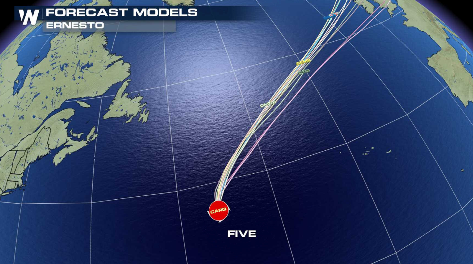
 After that time, sharply colder waters, drier air, and a significant increase in wind shear should cause the storm to transition to a regular, extratropical low pressure center. The forecast models show the post-tropical system merging with a frontal zone in 3 to 4 days.
For WeatherNation: Meteorologist Mace Michaels
 Some strengthening is possible during the next 24 hours, according to the National Hurricane Center. The system will linger over an area of warm water temperatures and fairly low wind shear conditions. By later Wednesday or early Thursday, the storm is forecast to reach winds near 50 mph.
 After that time, sharply colder waters, drier air, and a significant increase in wind shear should cause the storm to transition to a regular, extratropical low pressure center. The forecast models show the post-tropical system merging with a frontal zone in 3 to 4 days.
For WeatherNation: Meteorologist Mace Michaels
After that time, sharply colder waters, drier air, and a significant increase in wind shear should cause the storm to transition to a regular, extratropical low pressure center. The forecast models show the post-tropical system merging with a frontal zone in 3 to 4 days.
For WeatherNation: Meteorologist Mace MichaelsAll Weather News
More