Windy Storms Replace Chilly Start in the Northeast

RECORD COLD - Another crisp morning for portions of the east. This morning, Salisbury, MD, and Elizabeth City, North Carolina broke records for the coldest mornings!
OVERNIGHT
It was a busy day for portions of Western New York as we saw multiple severe warned storms. Things are much calmer with the loss of daytime heating as we now see a general thunderstorm risk overnight.
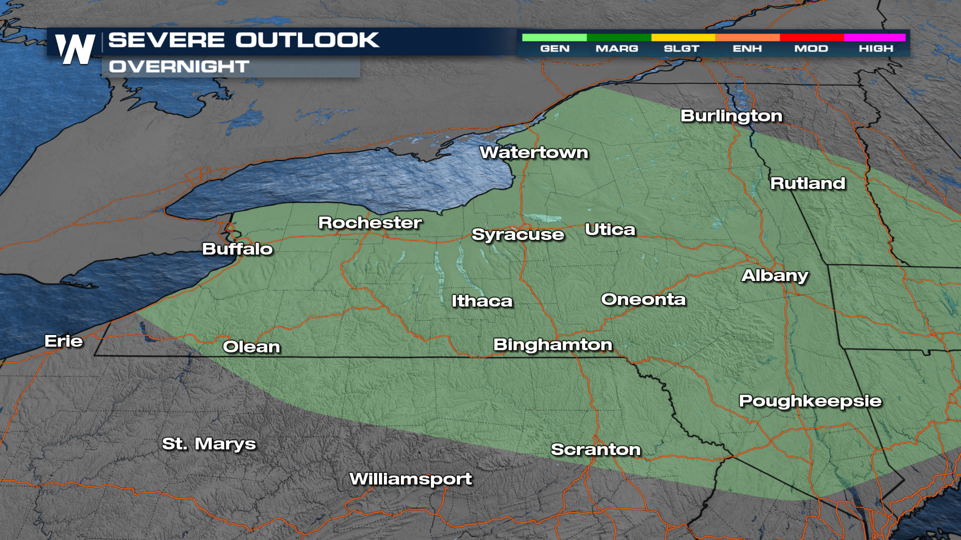 A few storms remain overnight as a trough of low pressure lingers, but the severe threat will be minimal.
After record mornings and cool days for some, temps will be near average to above average. Burlington will see 67° on Tuesday, but by Thursday warm up to 80°. Nashville will see impacts from Francine's remnants this week, including rain and cooler temps. By Thursday, Nashville will see temps drop from the low 90s to the upper 70s. 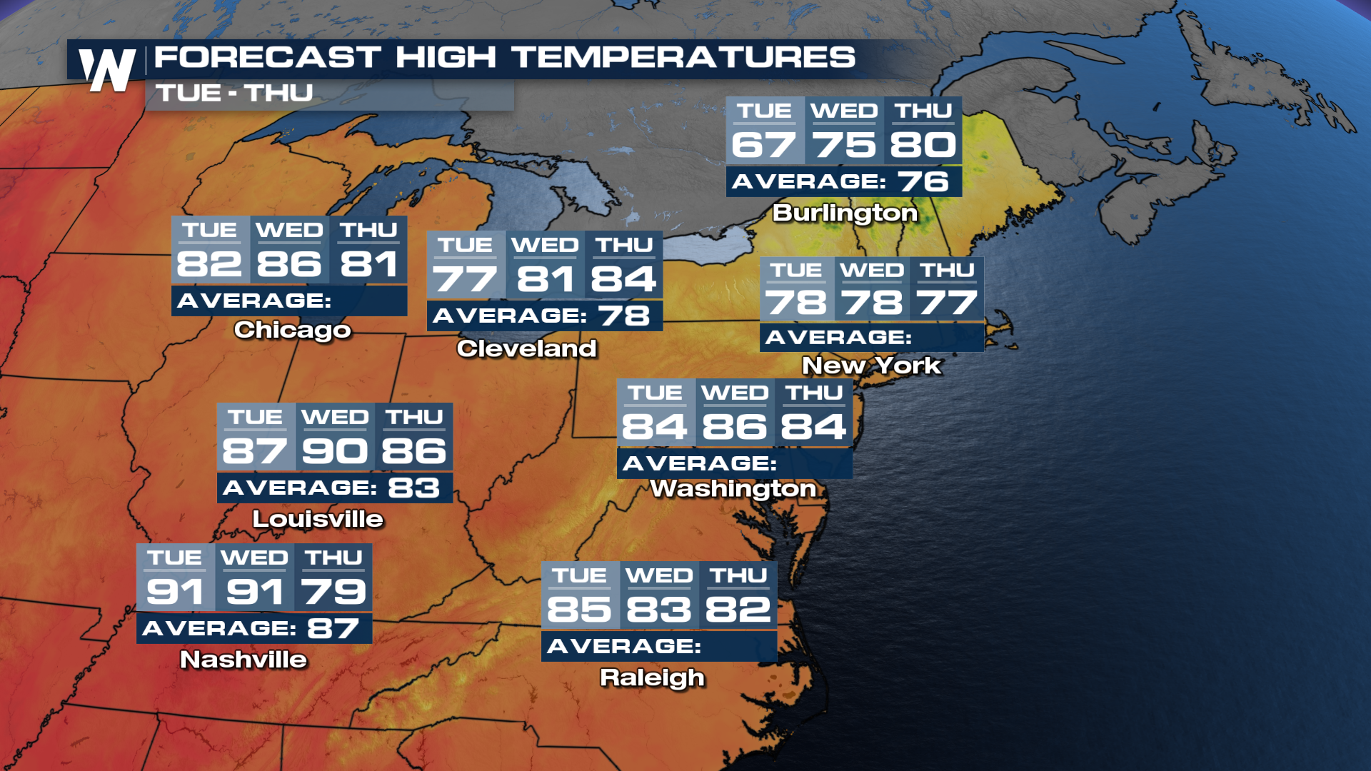 For the latest update on this portion of the country, tune into the East Regional Forecast, at 10 past every hour.


