Widespread Significant Severe Weather Possible This Weekend

On the heels of severe thunderstorm activity to end the week, another strong upper-level trough will be dropping across the Great Plains this weekend. Model data continues to hint at stronger ingredients coming together, including instability and wind shear. The SPC highlighted a risk area on Saturday, with a particular emphasis on Kansas, Nebraska, and Iowa (above).
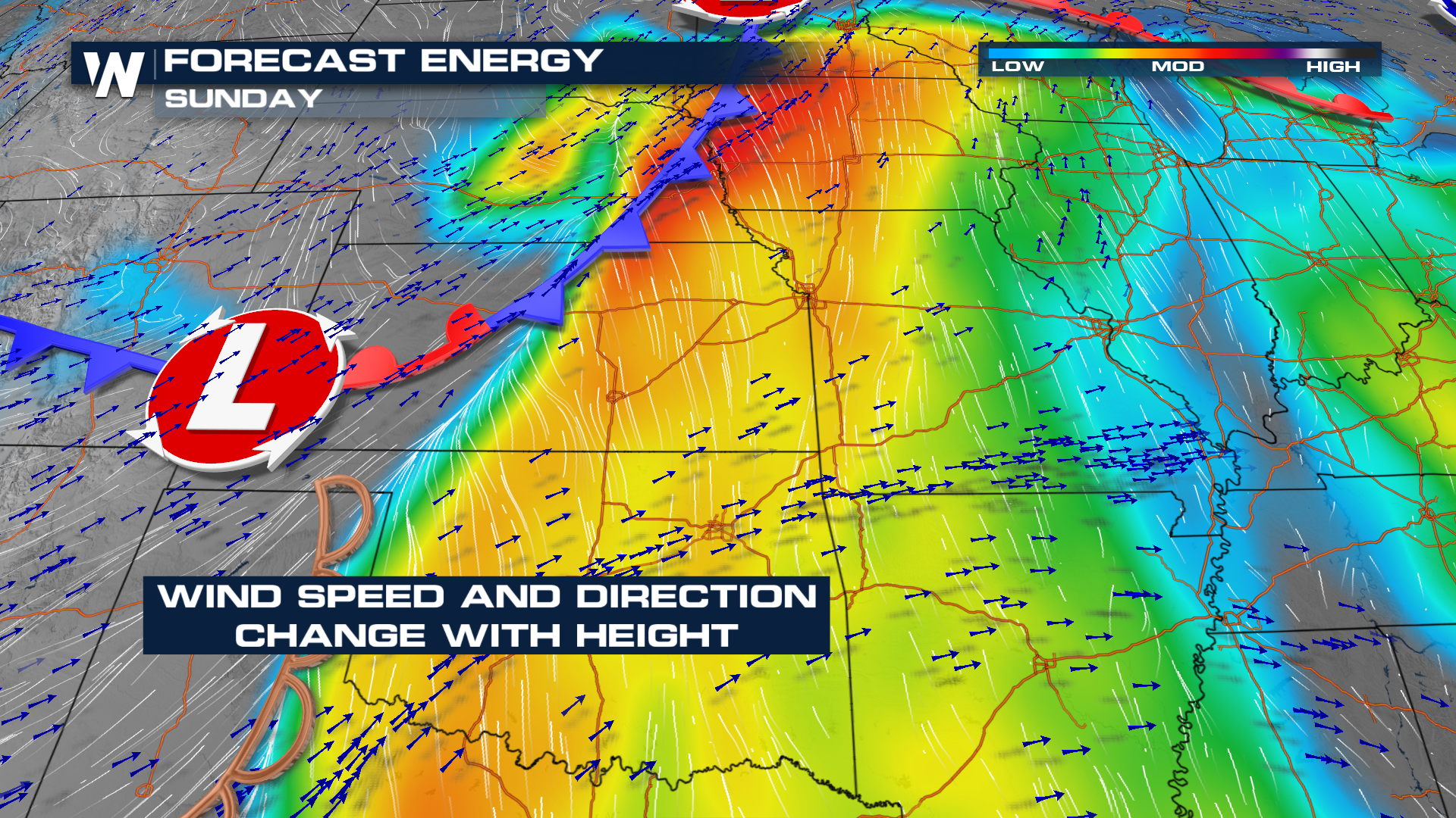
By Sunday, moderate to high instability will be building in. Southwesterly winds aloft and southerly winds at the surface will enhance wind shear, and changing wind direction with height would increase the tornado threat.
Storms are expected to develop along several fronts, including a developing dryline across the High Plains.
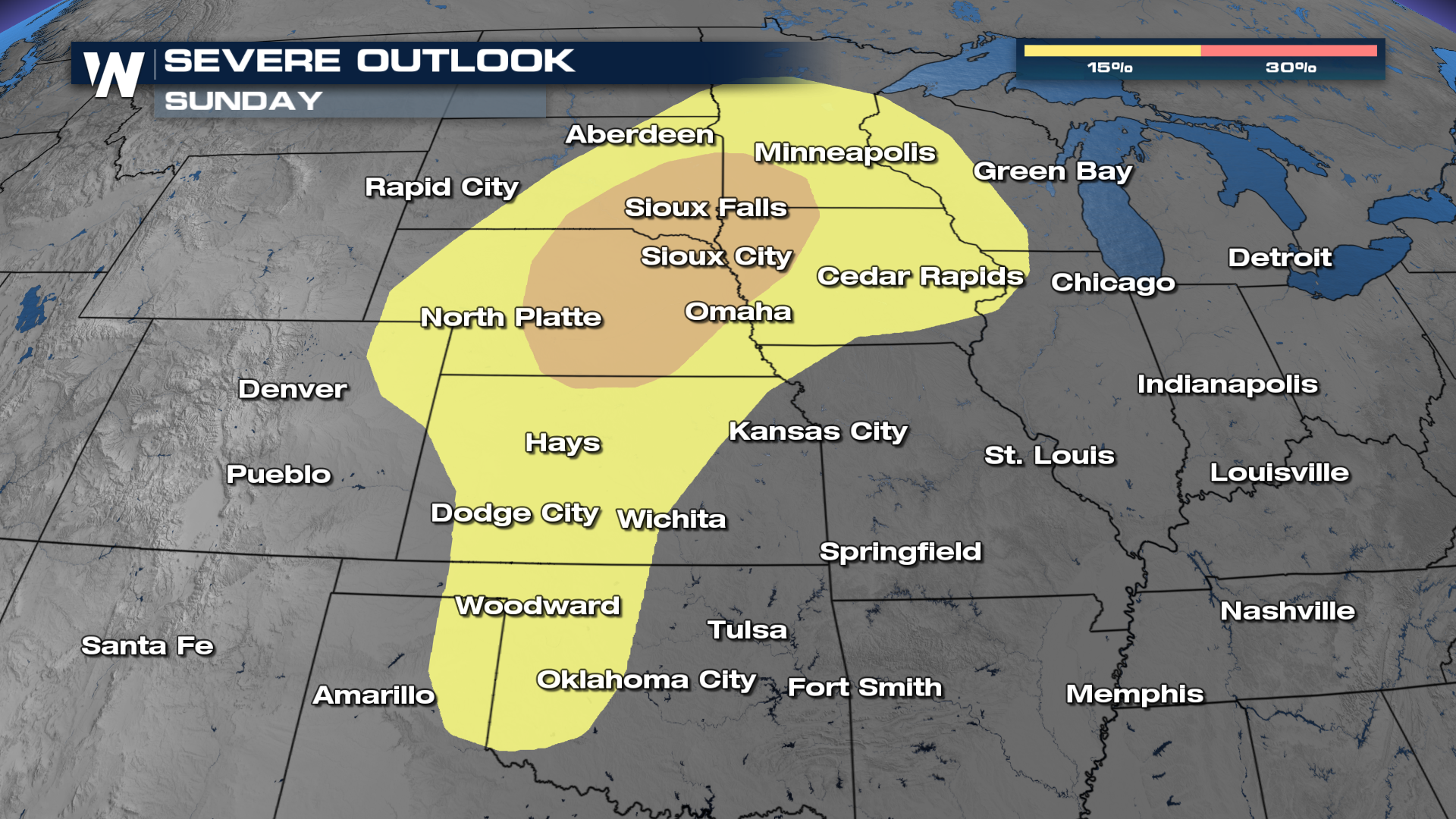
While isolated thunderstorms may form along the dryline, Sunday's outlook features a higher risk area across Siouxland by the end of the weekend.
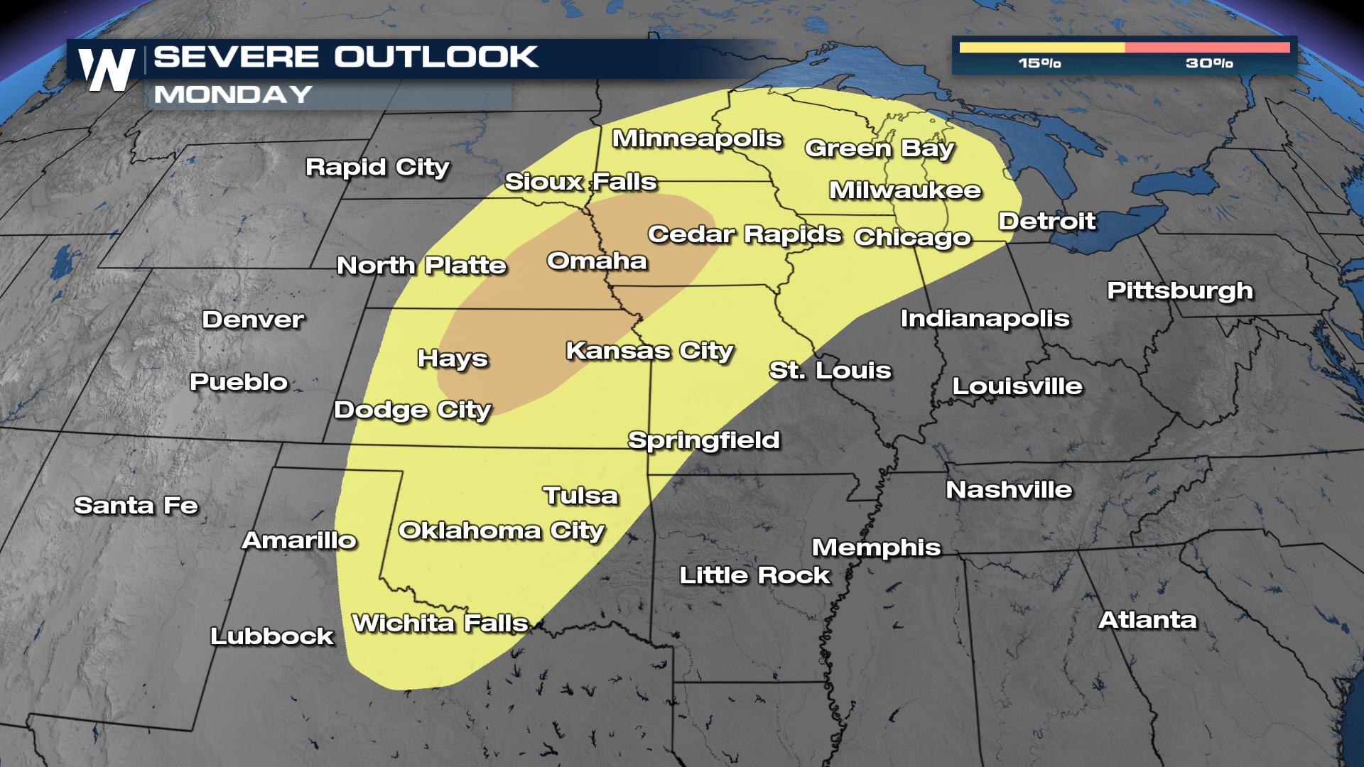
A similar setup will present itself on Monday, with strong upper-level winds increasing wind shear over an unstable atmosphere.


