Feeling the Gloom In the Twin Cities
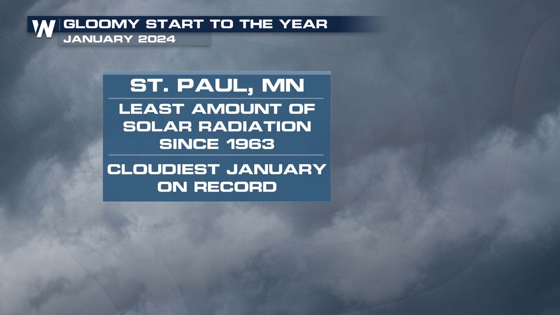
Midwest Winters. They can be brutal. Between the Arctic cold and heavy snow, it can be tough to navigate. But having a tough time shaking the gloomy skies might be the worst part about Winter in the Midwest. St. Paul has seen the least amount of solar radiation to start a year in recorded history. The records go back to 1963. With all of the cloud cover around, you would think this is one of the snowiest starts to a calendar year, right?
 Nope.
Nope.
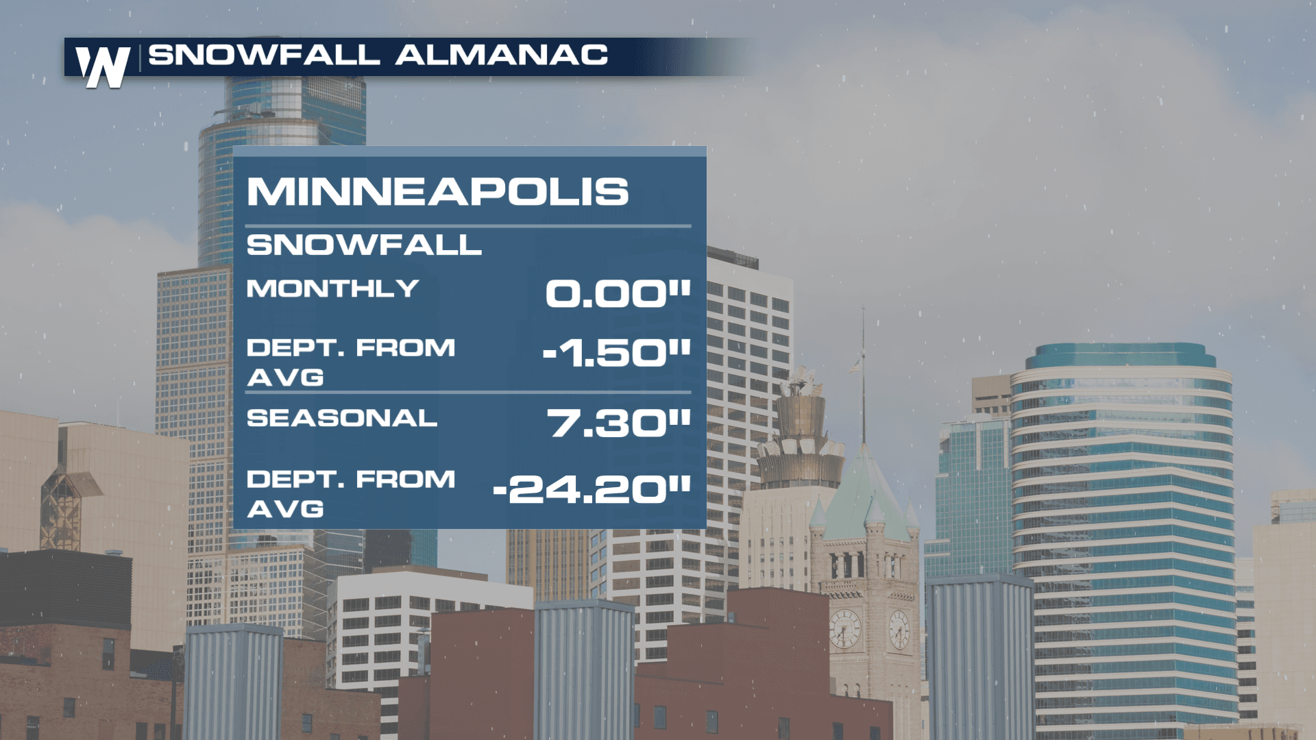
The Twin Cities are off to one of their driest starts to a year in history as well! It's been the endless fog that has plagued many in the Upper Midwest the past few weeks. With temperatures still well above average, any snow that is on the ground is melting, fueling the low-level moisture needed for foggy mornings. Want to look through the data for yourself? The Minnesota Department of Natural Resources has all of the data HERE.
 The system moving through the West, prompting FLOODING IN SOUTHERN CALIFORNIA will jump into the plains and try to spark some rain chances later this week. If it's going to be gloomy out, it might as well snow. Rain will have to do this week. We even have the chance for a few thunderstorms around Minnesota and Wisconsin by Thursday too!


