First Batch of Winter for the Northeast Wraps Up Today
Top Stories
2 Jan 2022 2:15 PM
As a powerful system moves through the heart of the country bringing everything from severe storms across the south, to heavy snow and ice through the Midwest, the northeast will brace for their turn at accumulation by the end of the weekend.
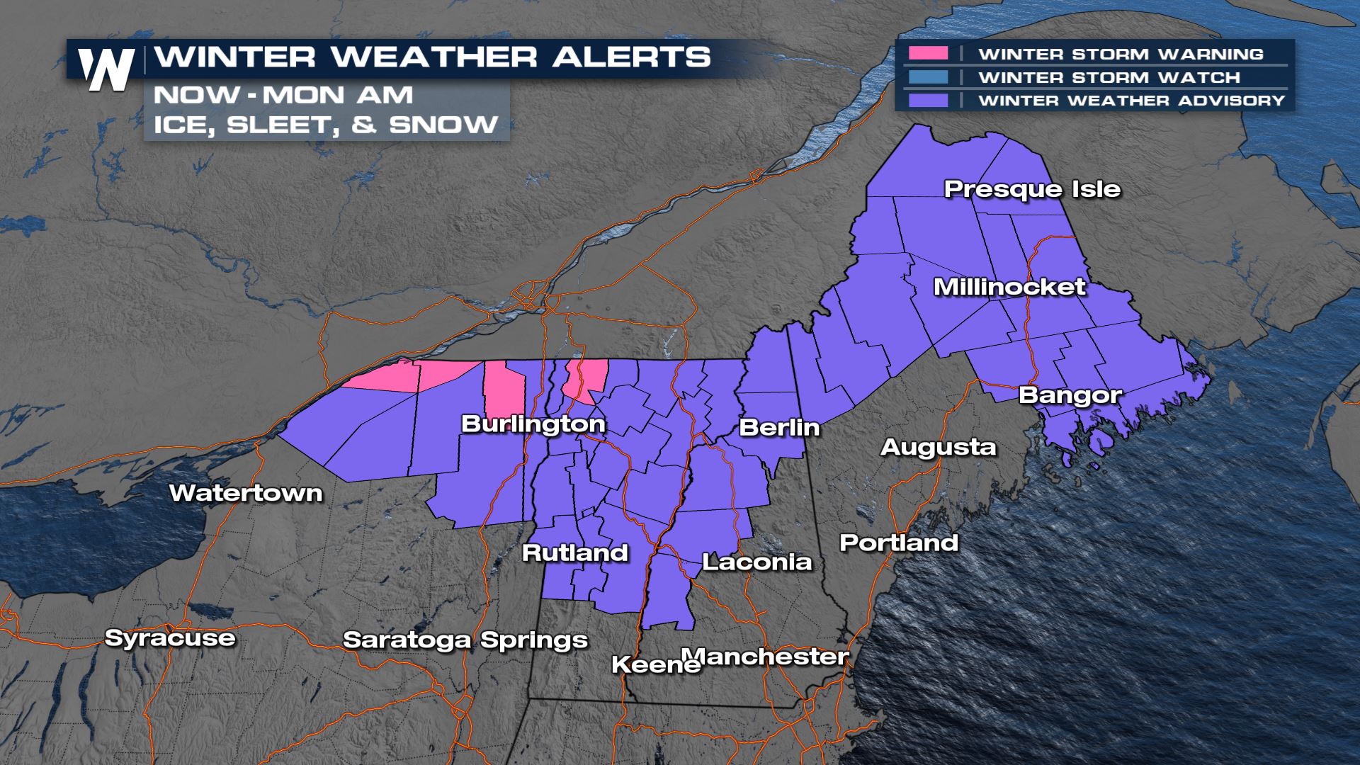
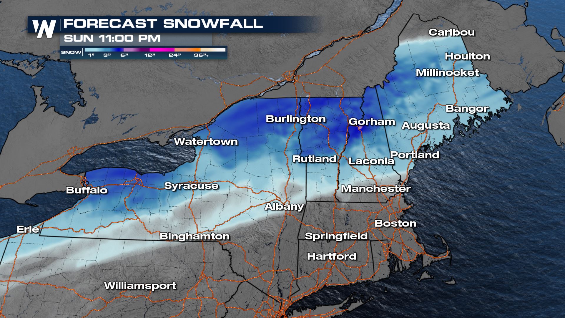
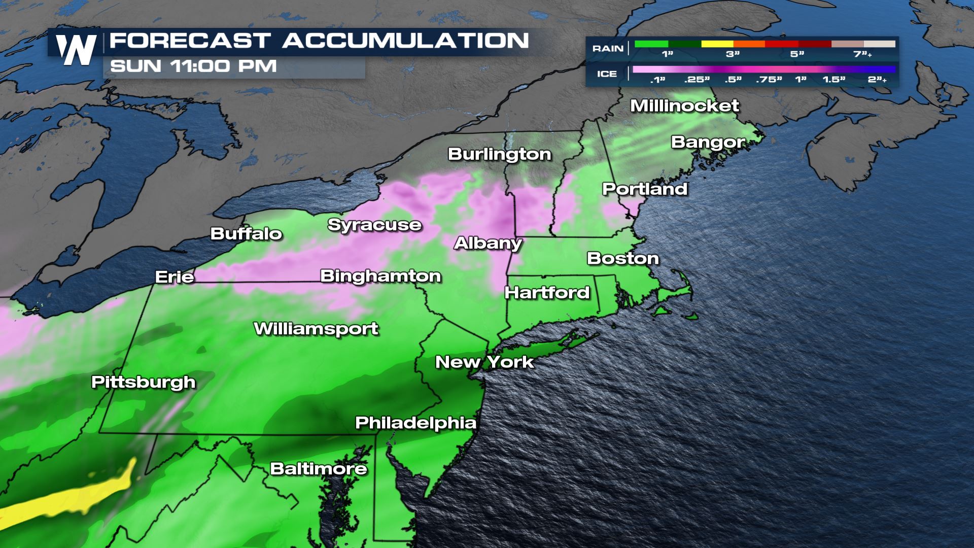
 Winter Weather Advisories are in place near the Canadian border. Snow accumulations will be up to 3-6", higher in some mountainous areas. The tricky part will be nailing down the ice. On the southern end, through northern Pennsylvania, New York, and southern New England, ice accumulations could reach a tenth of an inch.
 Stay with WeatherNation as we keep you updated on the cold, snow and messy conditions in the Northeast.
Timing
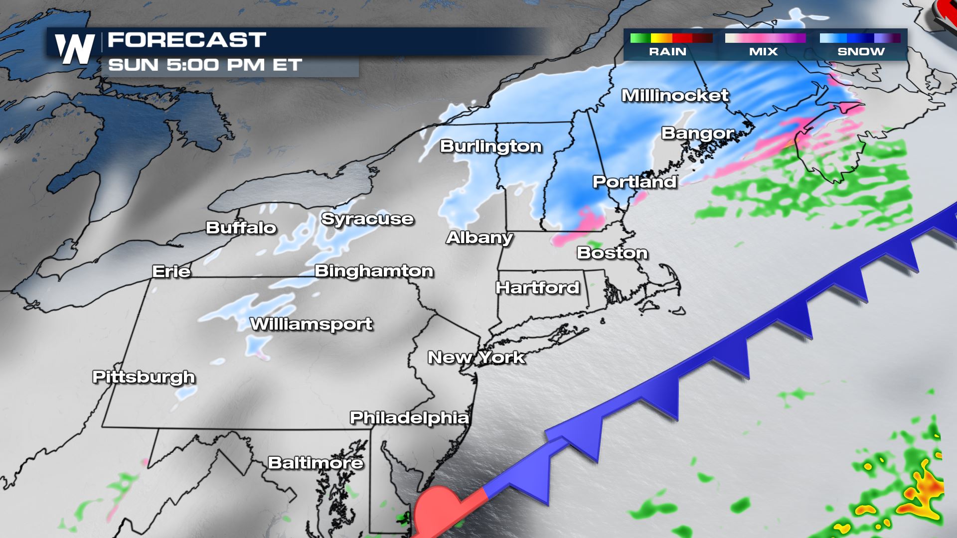
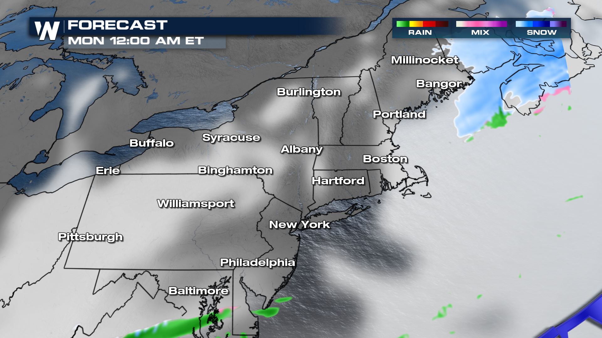
The snow will move northeast through the evening on Sunday. Most accumulation will be complete by midnight Monday, but that's when cold air and blustery winds will funnel in.
 Winter Weather Advisories are in place near the Canadian border. Snow accumulations will be up to 3-6", higher in some mountainous areas. The tricky part will be nailing down the ice. On the southern end, through northern Pennsylvania, New York, and southern New England, ice accumulations could reach a tenth of an inch.


TEMPERATURES
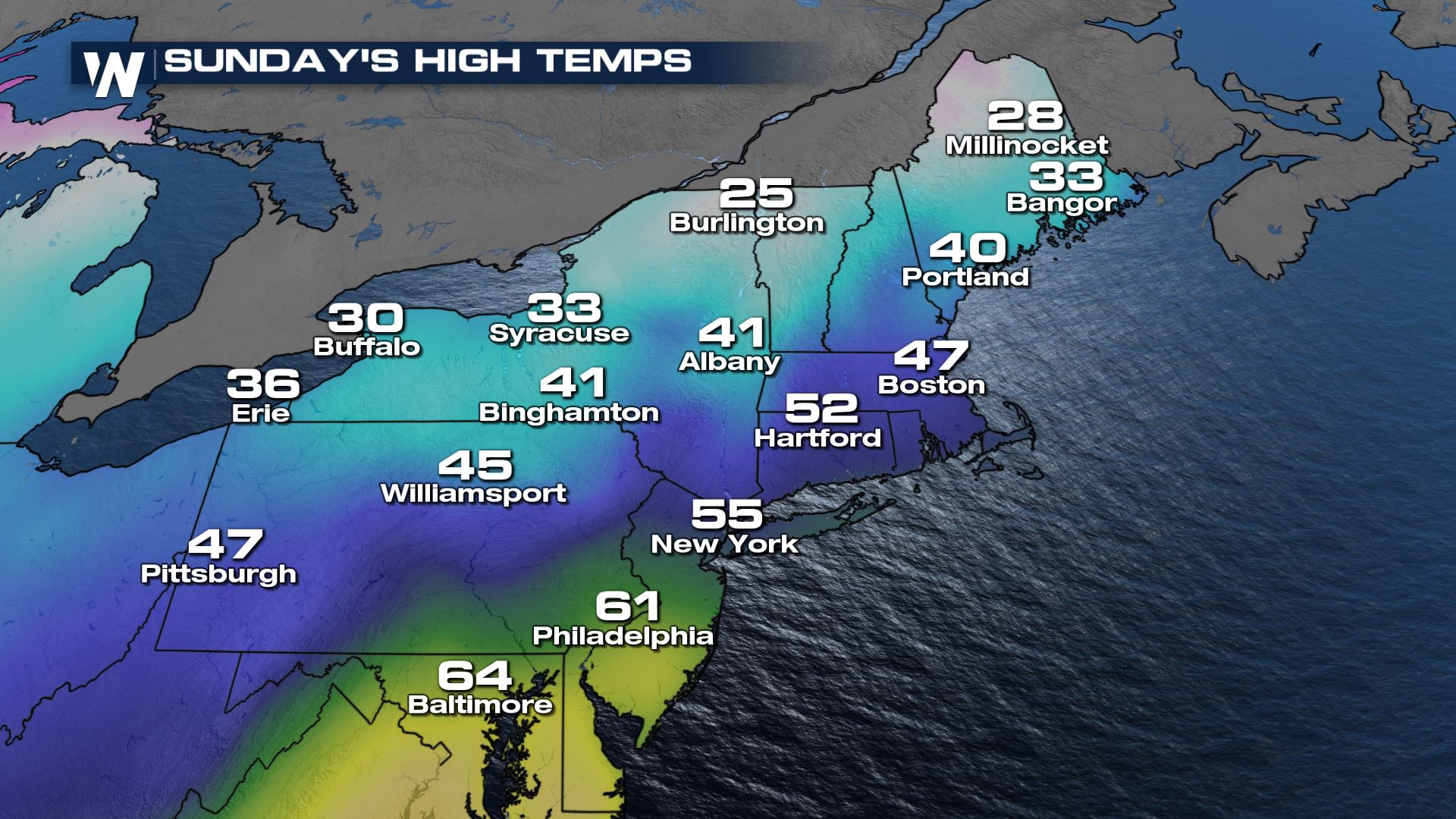
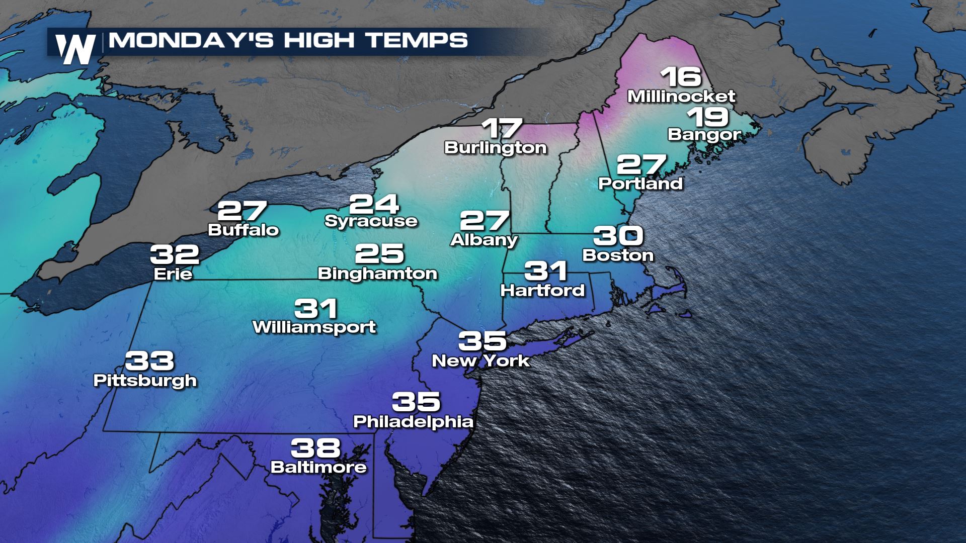
After the front moves through, highs are expected to plummet. Temperatures will play a big role in precipitation type on Sunday, but once the low moves through, highs will drop as much as 20-30 degrees!
 Stay with WeatherNation as we keep you updated on the cold, snow and messy conditions in the Northeast.
All Weather News
More