Flooding Concerns From the Plains to the Ohio Valley
Special Stories
26 Mar 2018 11:12 AM
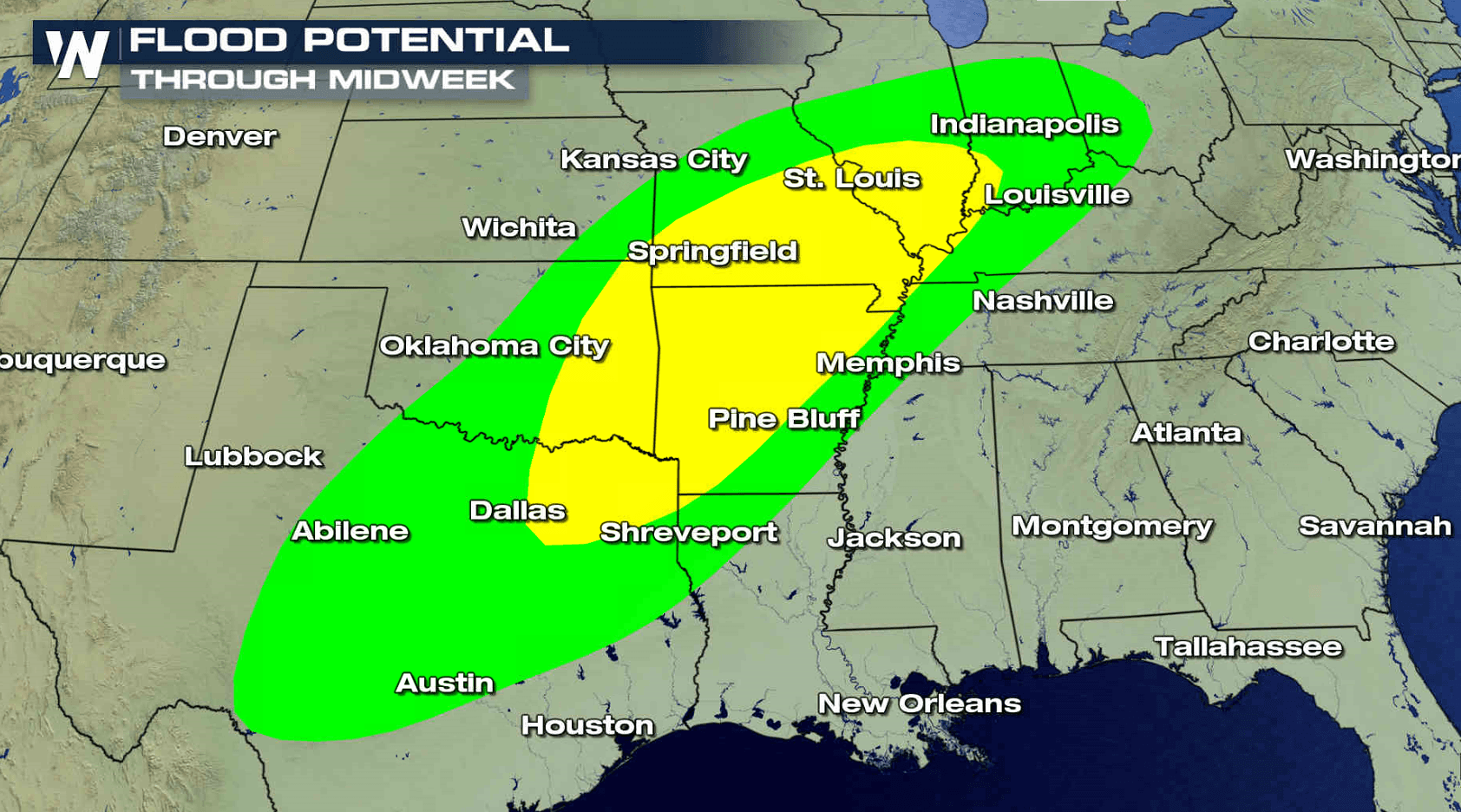
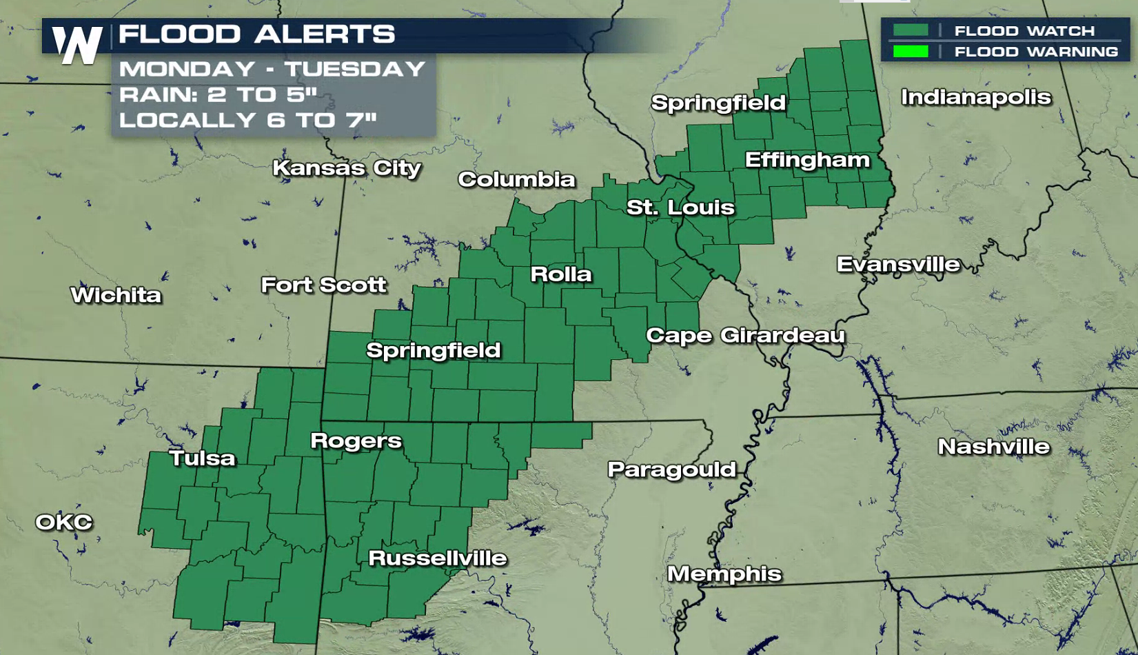
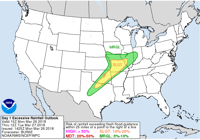
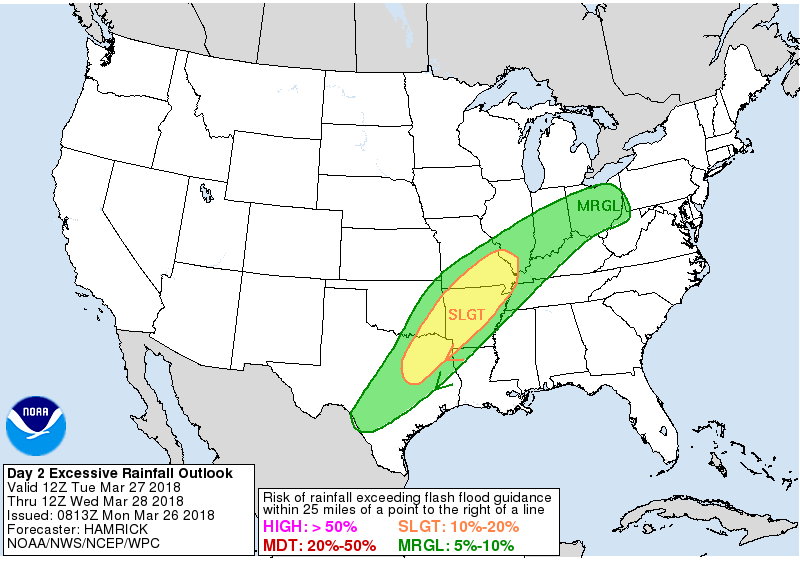
A slow moving storm system will produce numerous showers and thunderstorms to start this week from the Ohio Valley into the Plains. Flood Watches have already been issued from Illinois to Oklahoma. The excessive rain outlook today has an area from Indiana to Texas that could see rainfall amounts exceeding flash flood guidance. 1" to 3" of rain is possible into Tuesday morning.
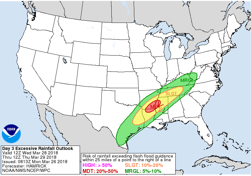
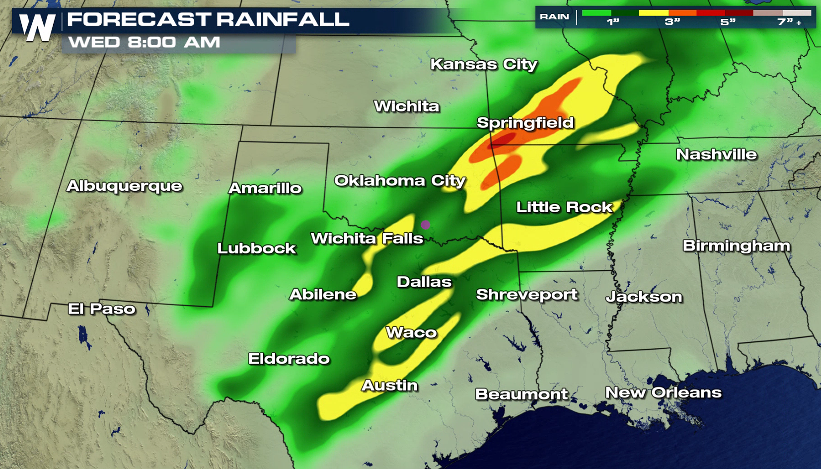
 Flooding concerns continue for Tuesday and Wednesday as the storm system slowly sinks to the south. With storms expected to develop and track over similar areas, the flooding threat is increased. Dew points levels will remain high in the atmosphere with higher humidity streaming into the region from the Gulf of Mexico. Rainfall totals may exceed 5" in some areas through Wednesday. Stay tuned to WeatherNation for flooding updates.
 For WeatherNation: Meteorologist Mace Michaels
Flooding concerns continue for Tuesday and Wednesday as the storm system slowly sinks to the south. With storms expected to develop and track over similar areas, the flooding threat is increased. Dew points levels will remain high in the atmosphere with higher humidity streaming into the region from the Gulf of Mexico. Rainfall totals may exceed 5" in some areas through Wednesday. Stay tuned to WeatherNation for flooding updates.
For WeatherNation: Meteorologist Mace MichaelsAll Weather News
More

Flooding, Severe Storms Target the Midwest Again
After an active week of storms across the nor
1 Aug 2026 1:40 AM


After Reaching Category 5, Genevieve Weakens in the Pacific
PacificFausto is now a post-tropical cyclone.
31 Jul 2026 1:30 AM

Flooding Risk Increases as Heavy Rain Targets the Tri-State Area
Tuesday, heavy rainfall moved across the Nort
30 Jul 2026 12:25 AM

Severe Weather: Energy From the Midwest Now in the Southeast
UPPER MIDWEST - Through Monday, dangerous tor
29 Jul 2026 10:30 PM