Flooding Observed in California
Special Stories
6 Dec 2018 2:20 PM
WHAT HAS HAPPENED
Flash flooding has been reported in parts of southern California on Thursday afternoon. Two miles north of downtown Anaheim, a trained spotter reported that flash flooding was occurring along Orangethorpe Avenue, west of Raymond Street. The spotter reported 8-12 inches of water on the curb. Social media videos showed the cars trying to get through the flooded roads.
https://twitter.com/WeatherNation/status/1070783409805357057
Earlier in the day, the heavy rain may have contributed to this airliner sliding down the runway in Burbank, CA.
https://www.facebook.com/WeatherNation/videos/320776858529085/
The heavy rain slid down area mountainsides, especially over burn scar areas within previous wildfire areas.
https://twitter.com/WeatherNation/status/1070771066090401793
FORECAST
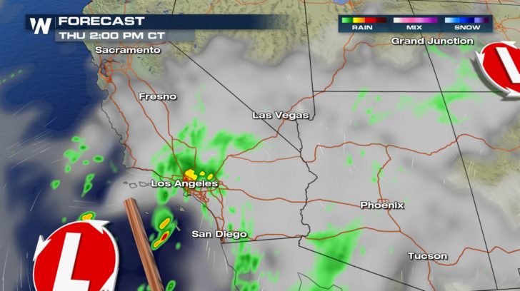
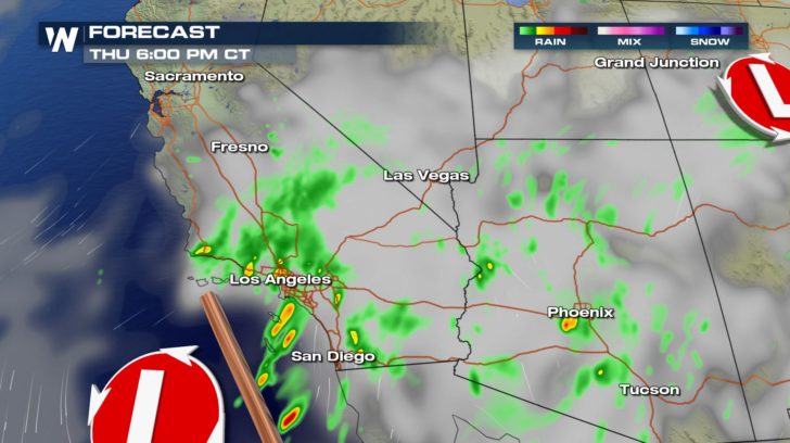
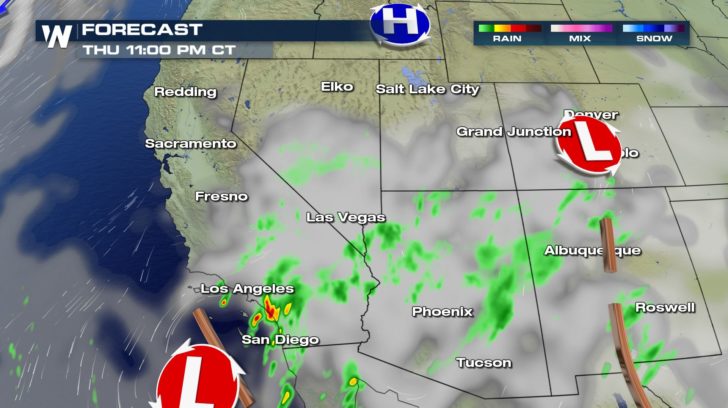 Heavy rain will be the threat in southern California for today. Rain showers will be lingering all day long before gradually pushing out later this evening.
FLOOD ALERTS
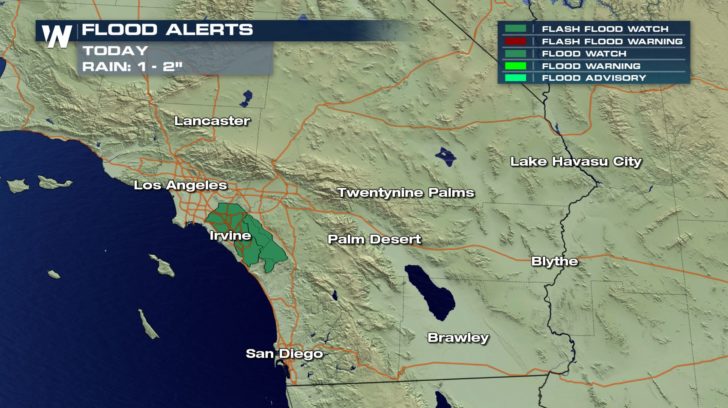 Flash flood watches are in effect in southern California. Another 1 to 2 inches of rain is expected to fall today. This could potentially lead to flash flooding and ponding on roads. This is especially true near the burn scars of recent fires such as the Woolsey and Hill Fires. Mud and debris flow across highways are already being reported especially on Highway 1. Make sure to take extra precaution around burn scar areas and to always "turn around, don't drown" if you see flooding on roadways.
A LOOK AHEAD
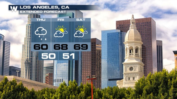
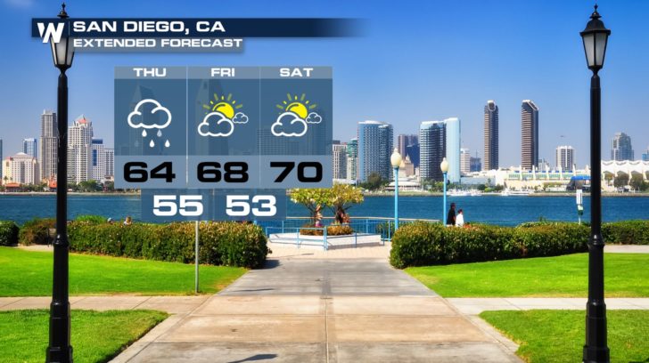 For WeatherNation, Meteorologists Shelly Lindblade and Steve Glazier


 Heavy rain will be the threat in southern California for today. Rain showers will be lingering all day long before gradually pushing out later this evening.
FLOOD ALERTS
 Flash flood watches are in effect in southern California. Another 1 to 2 inches of rain is expected to fall today. This could potentially lead to flash flooding and ponding on roads. This is especially true near the burn scars of recent fires such as the Woolsey and Hill Fires. Mud and debris flow across highways are already being reported especially on Highway 1. Make sure to take extra precaution around burn scar areas and to always "turn around, don't drown" if you see flooding on roadways.
A LOOK AHEAD

 For WeatherNation, Meteorologists Shelly Lindblade and Steve Glazier
All Weather News
More