Flooding Threat Continues from the Mississippi River to the Red River of the South

Special Stories
5 Sep 2018 1:40 PM
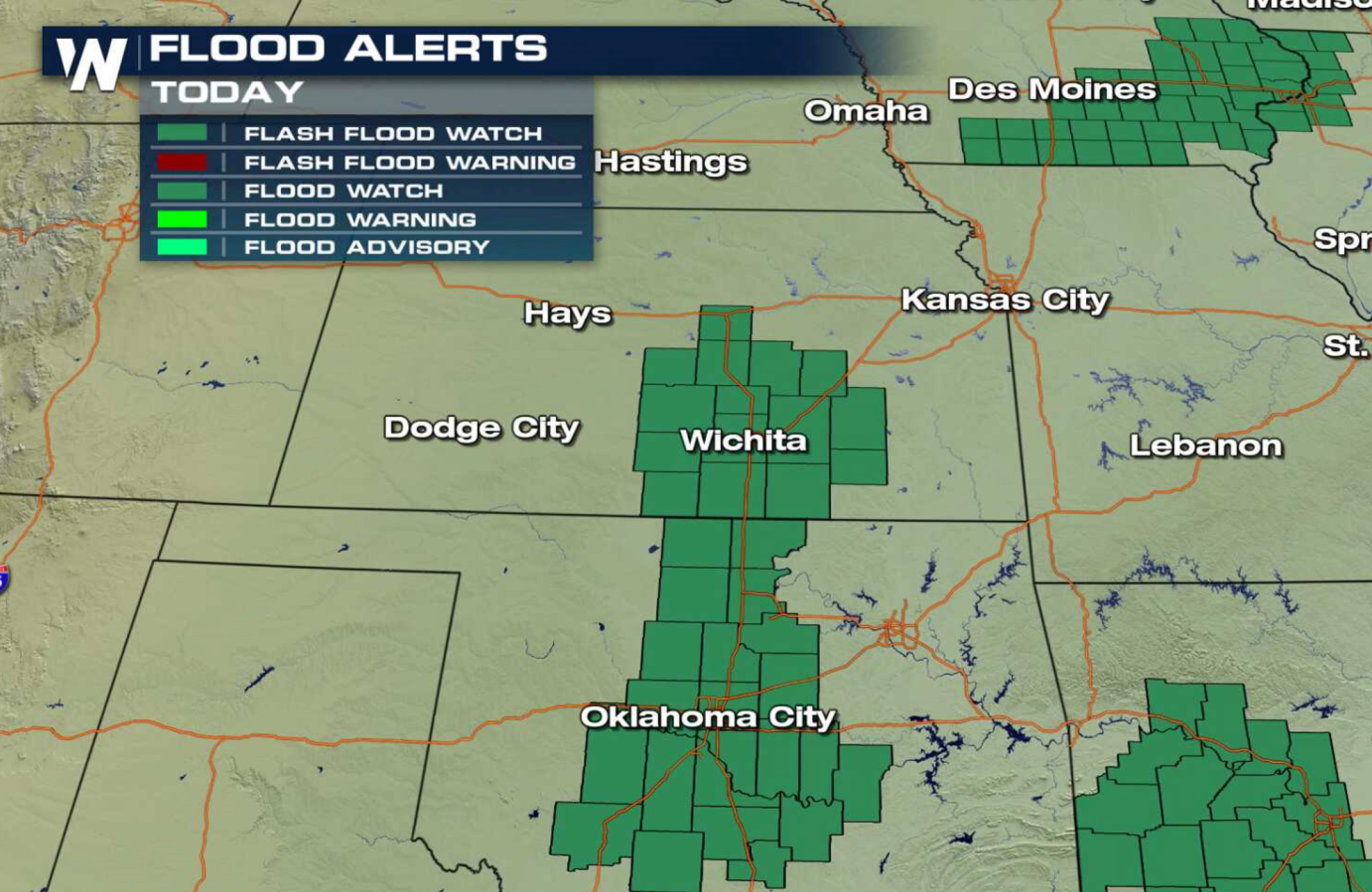
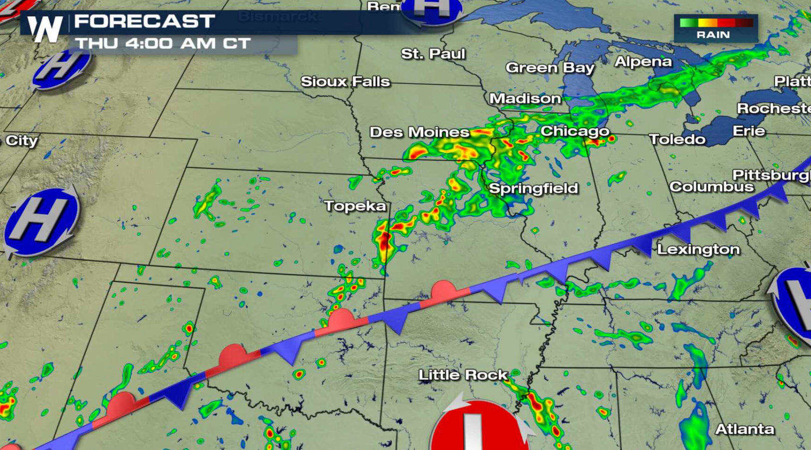
A slow moving storm system continues to bring heavy rain from the Mississippi River, through the Plains, to the Red River of the South. Flash Flood Watches remain in effect from Illinois to Oklahoma. Several inches of rain is likely, with isolated areas possibly seeing as much as 6" of rain.

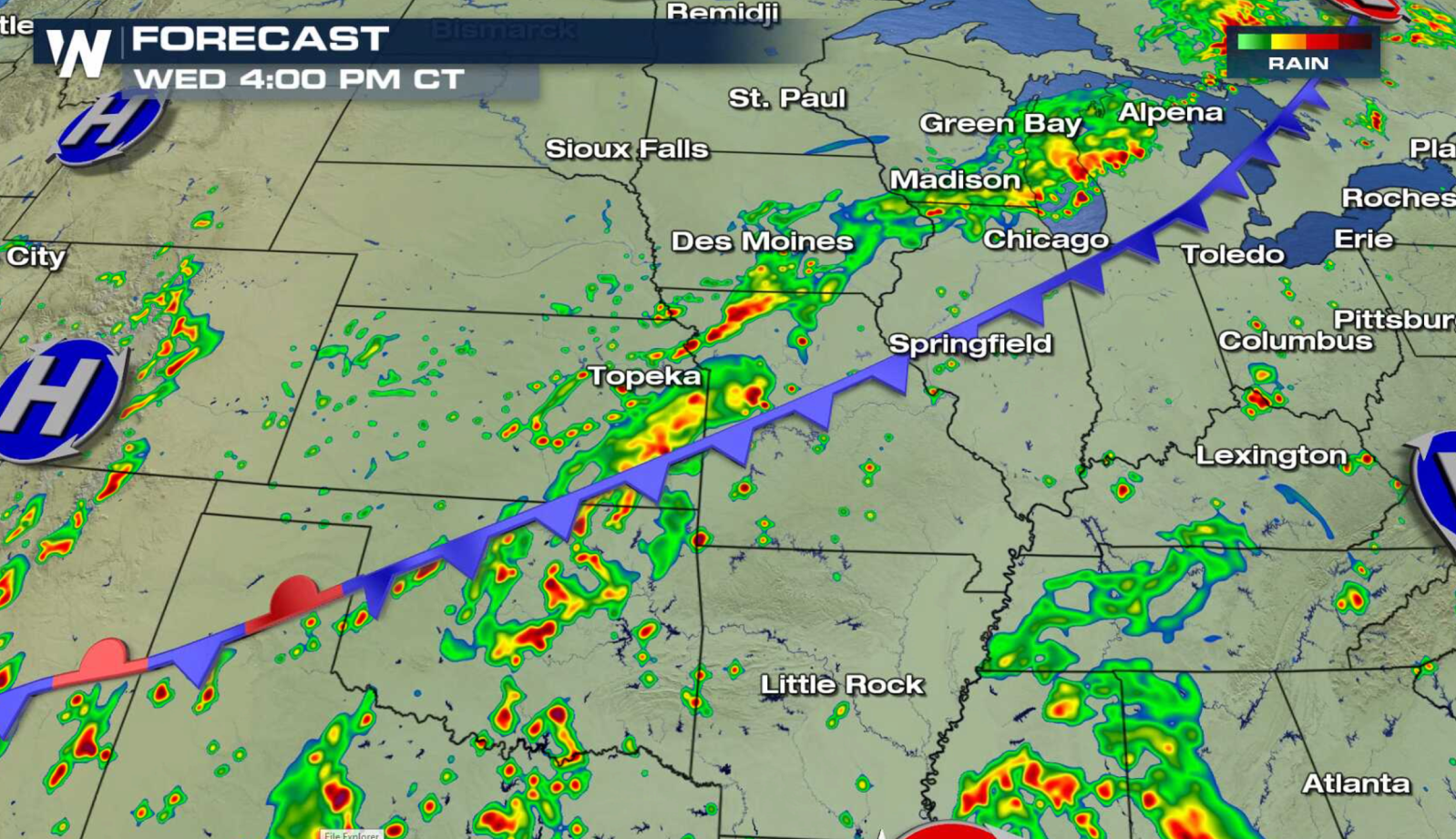
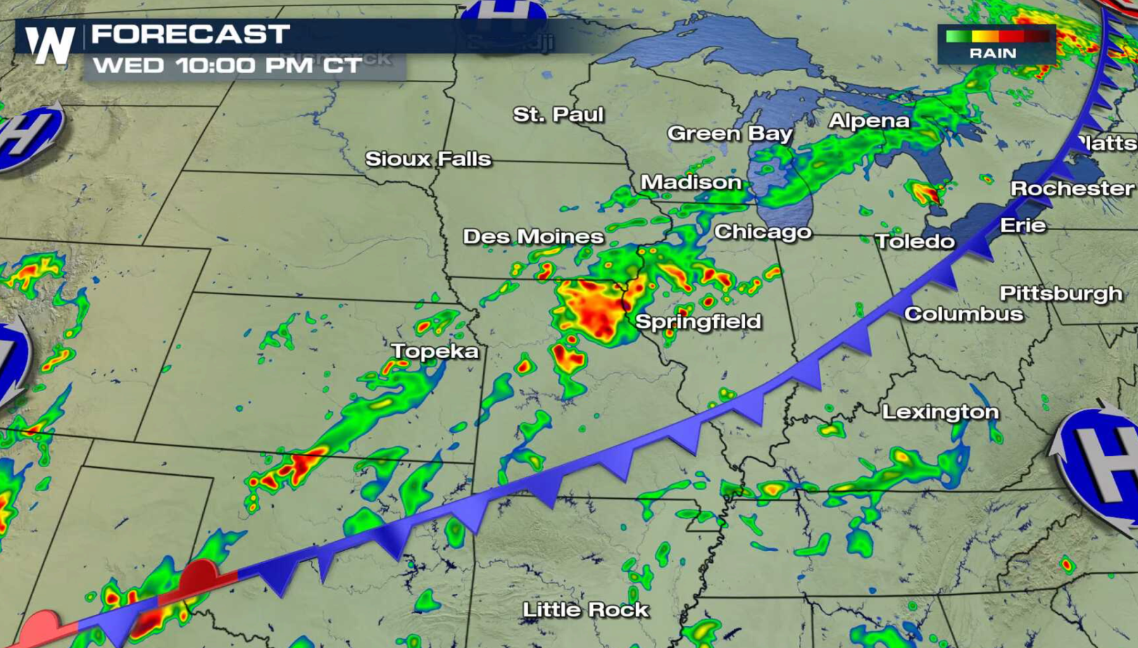
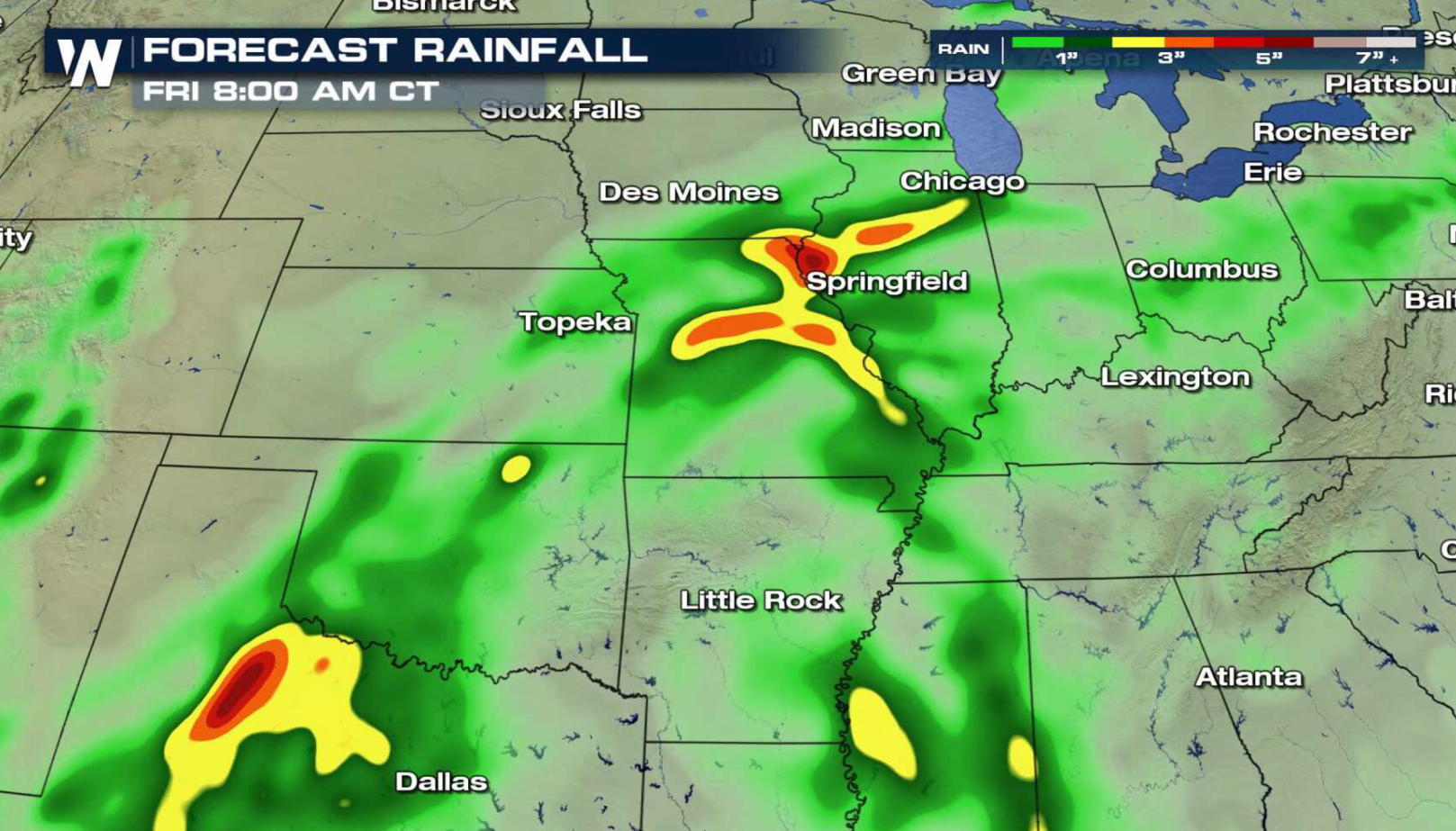 A cold front is stretched out from the Great Lakes to the southern Plains with high humidity streaming along it. With the tropical air present, showers and thunderstorms are able to produce high rainfall totals in a short amount of time. With the overall wind pattern light, storms move slowly and track over similar areas repeatedly, leading to the flooding threat. Over saturated souls further exacerbate the situation.
 For WeatherNation: Meteorologist Mace Michaels
A cold front is stretched out from the Great Lakes to the southern Plains with high humidity streaming along it. With the tropical air present, showers and thunderstorms are able to produce high rainfall totals in a short amount of time. With the overall wind pattern light, storms move slowly and track over similar areas repeatedly, leading to the flooding threat. Over saturated souls further exacerbate the situation.
For WeatherNation: Meteorologist Mace MichaelsAll Weather News
More
East Gears Up for Stormy, Wet Weekend
A low pressure system crashing through the Mi
1 Aug 2026 11:35 AM


Flooding, Severe Storms Target the Midwest Again
After an active week of storms across the nor
1 Aug 2026 1:40 AM


After Reaching Category 5, Genevieve Weakens in the Pacific
PacificFausto is now a post-tropical cyclone.
31 Jul 2026 1:30 AM

Flooding Risk Increases as Heavy Rain Targets the Tri-State Area
Tuesday, heavy rainfall moved across the Nort
30 Jul 2026 12:25 AM

Severe Weather: Energy From the Midwest Now in the Southeast
UPPER MIDWEST - Through Monday, dangerous tor
29 Jul 2026 10:30 PM