Flooding Threat in Georgia and Florida
Special Stories
3 Dec 2018 9:34 AM
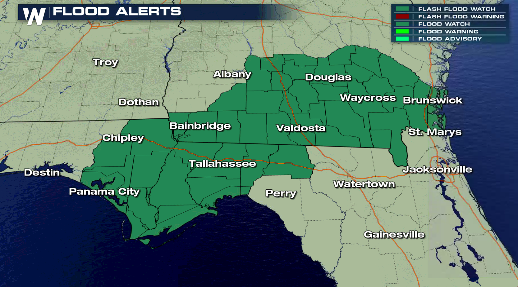
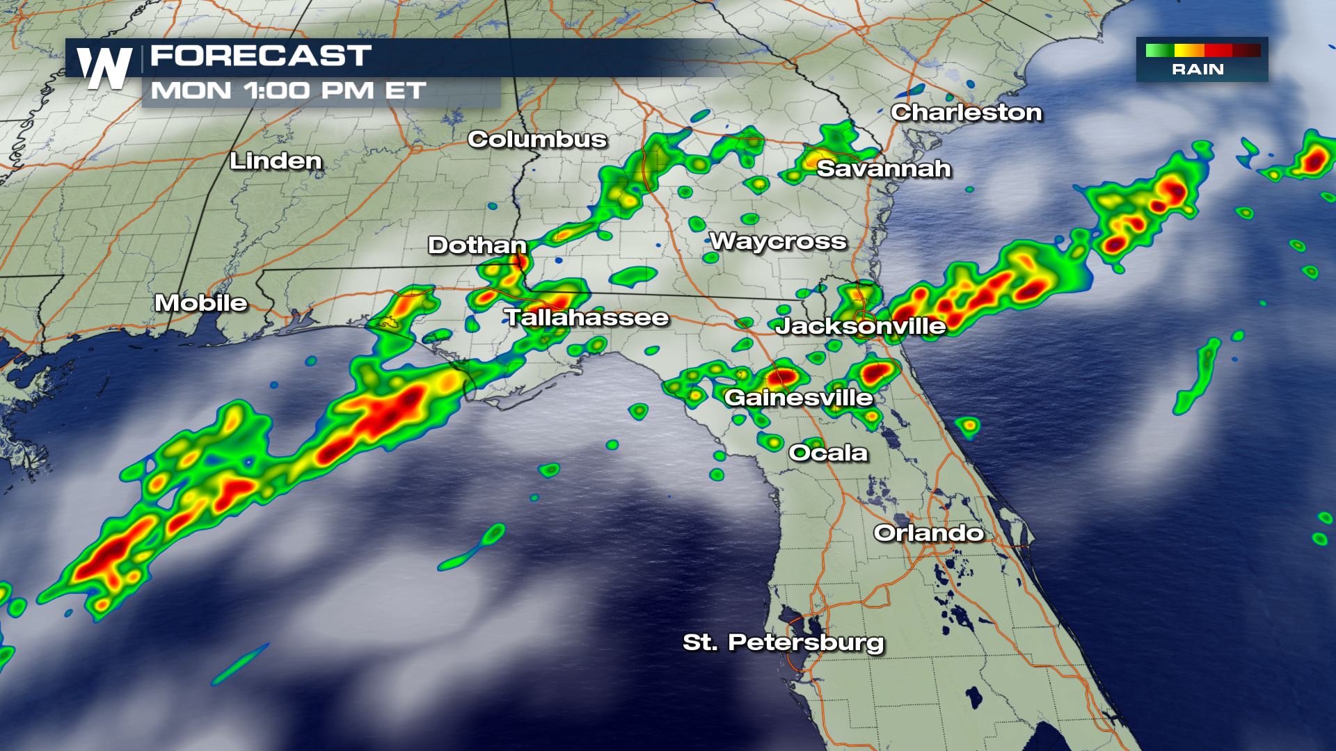
A slow moving cold front will produce scattered showers and thunderstorms today (Monday) across the Southeast, with a threat for flooding rains in southern Georgia and northern Florida. Flash Flood Watches remain in effect, with the potential of more than 3" of rain. There is also a risk for severe thunderstorms.
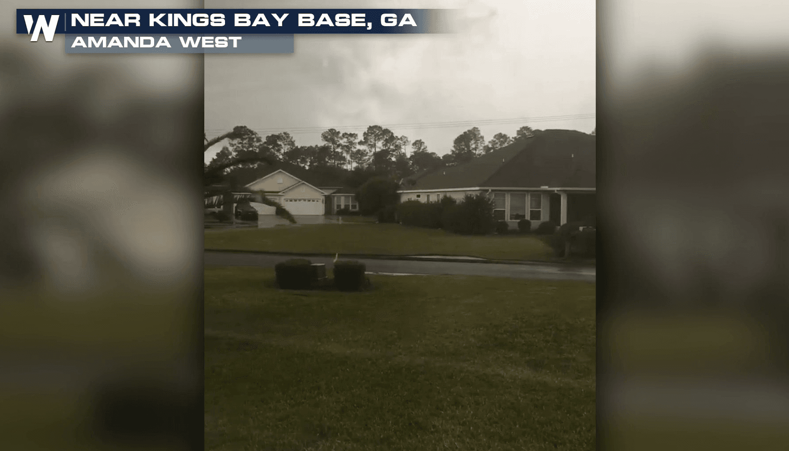
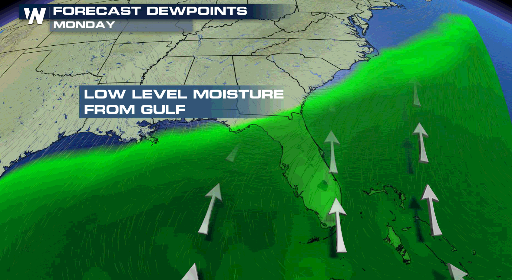
 Southerly winds ahead of the front will push high humidity across the region. This will fuel thunderstorms and increase the chance for heavy rainfall. There have already been some reports of flooding in the last 24 hours.
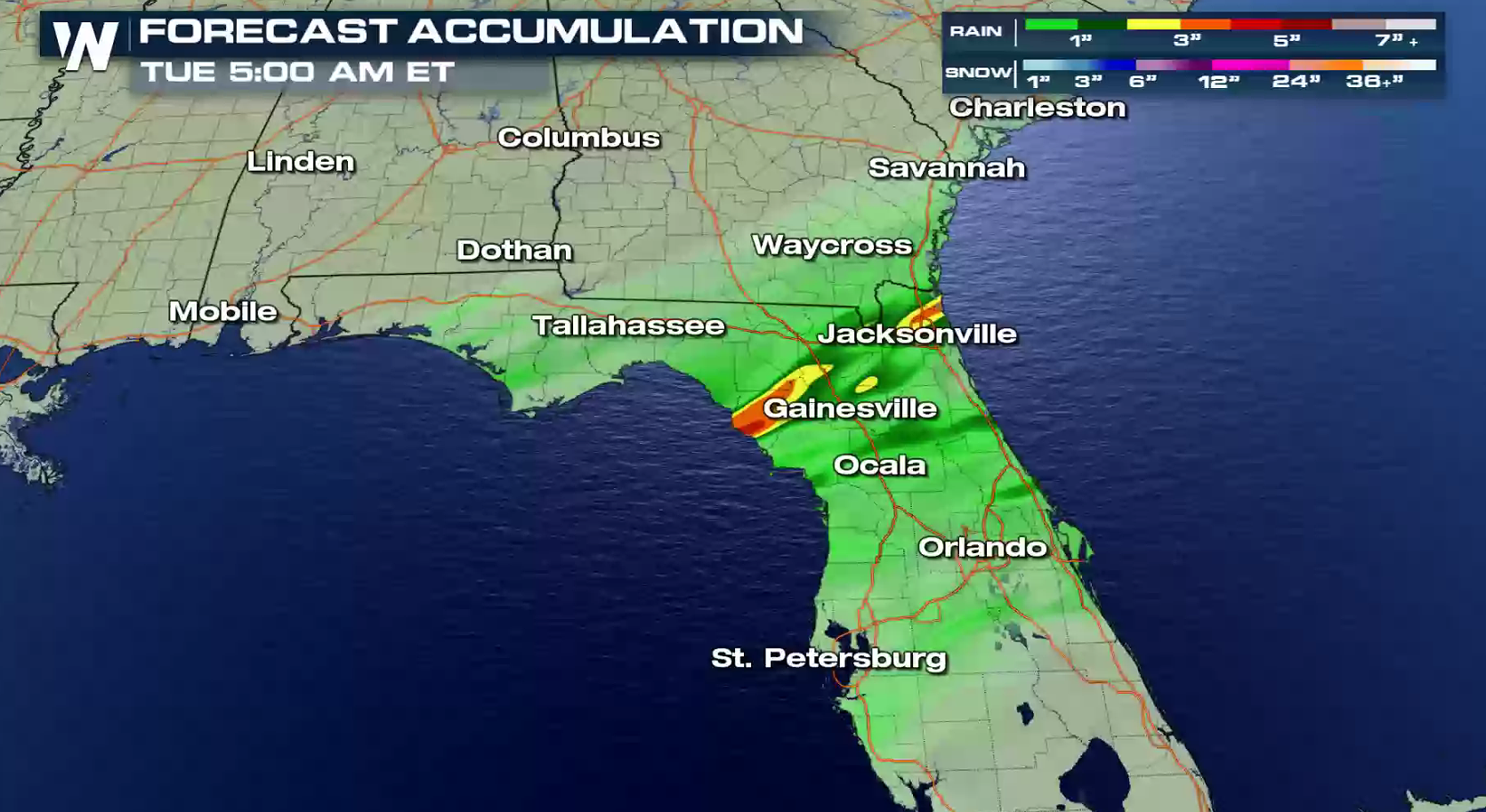
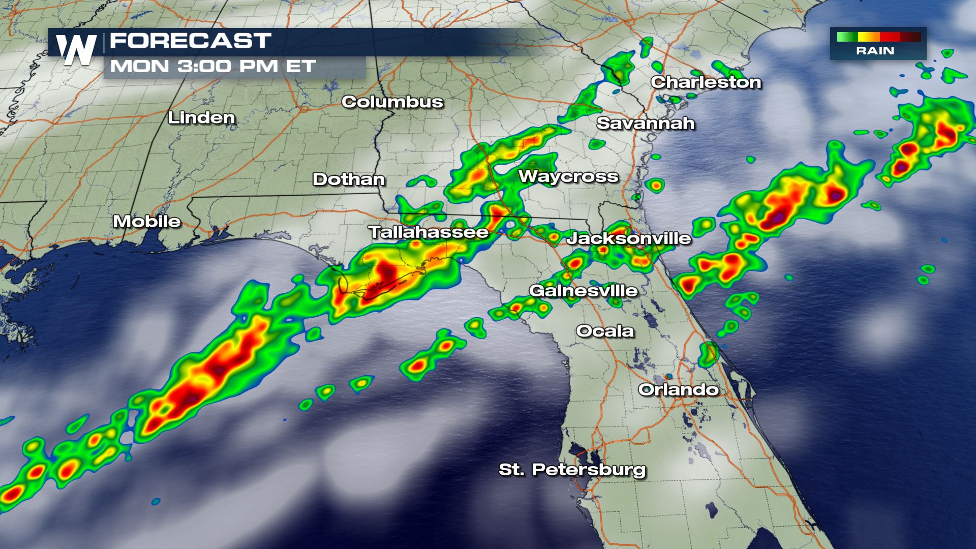
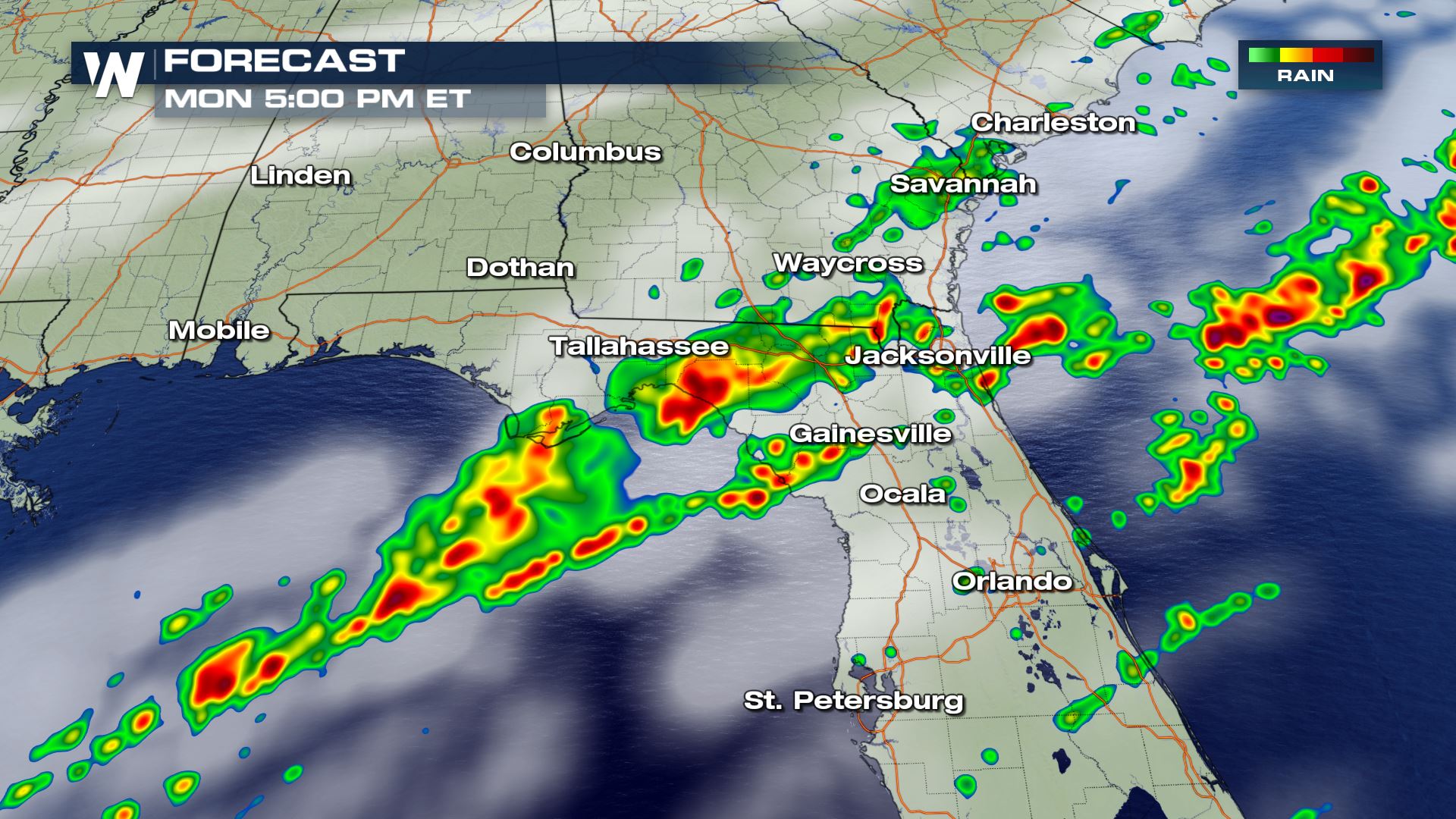
 Thunderstorms will move along and ahead of the front from the Gulf of Mexico toward the Atlantic Ocean. Some storms will likely produce heavy rain over similar areas due to the slow moving nature of the front. This will increase the threat for flooding. Stay tuned to WeatherNation on-air and online for update.
 For WeatherNation: Meteorologist Mace Michaels
Southerly winds ahead of the front will push high humidity across the region. This will fuel thunderstorms and increase the chance for heavy rainfall. There have already been some reports of flooding in the last 24 hours.
Thunderstorms will move along and ahead of the front from the Gulf of Mexico toward the Atlantic Ocean. Some storms will likely produce heavy rain over similar areas due to the slow moving nature of the front. This will increase the threat for flooding. Stay tuned to WeatherNation on-air and online for update.
For WeatherNation: Meteorologist Mace MichaelsAll Weather News
More
More Storms for the East Through Monday
A low-pressure system that moved through the
3 Aug 2026 12:20 PM


After Reaching Category 5, Genevieve Weakens in the Pacific
PacificGenevieve formed last Friday south of
3 Aug 2026 12:30 AM

Flooding, Severe Storms Target the Midwest Again
After an active week of storms across the nor
1 Aug 2026 1:40 AM

Flooding Risk Increases as Heavy Rain Targets the Tri-State Area
Tuesday, heavy rainfall moved across the Nort
30 Jul 2026 12:25 AM

Severe Weather: Energy From the Midwest Now in the Southeast
UPPER MIDWEST - Through Monday, dangerous tor
29 Jul 2026 10:30 PM