Florida: Rain Coming to Drought-Stricken State

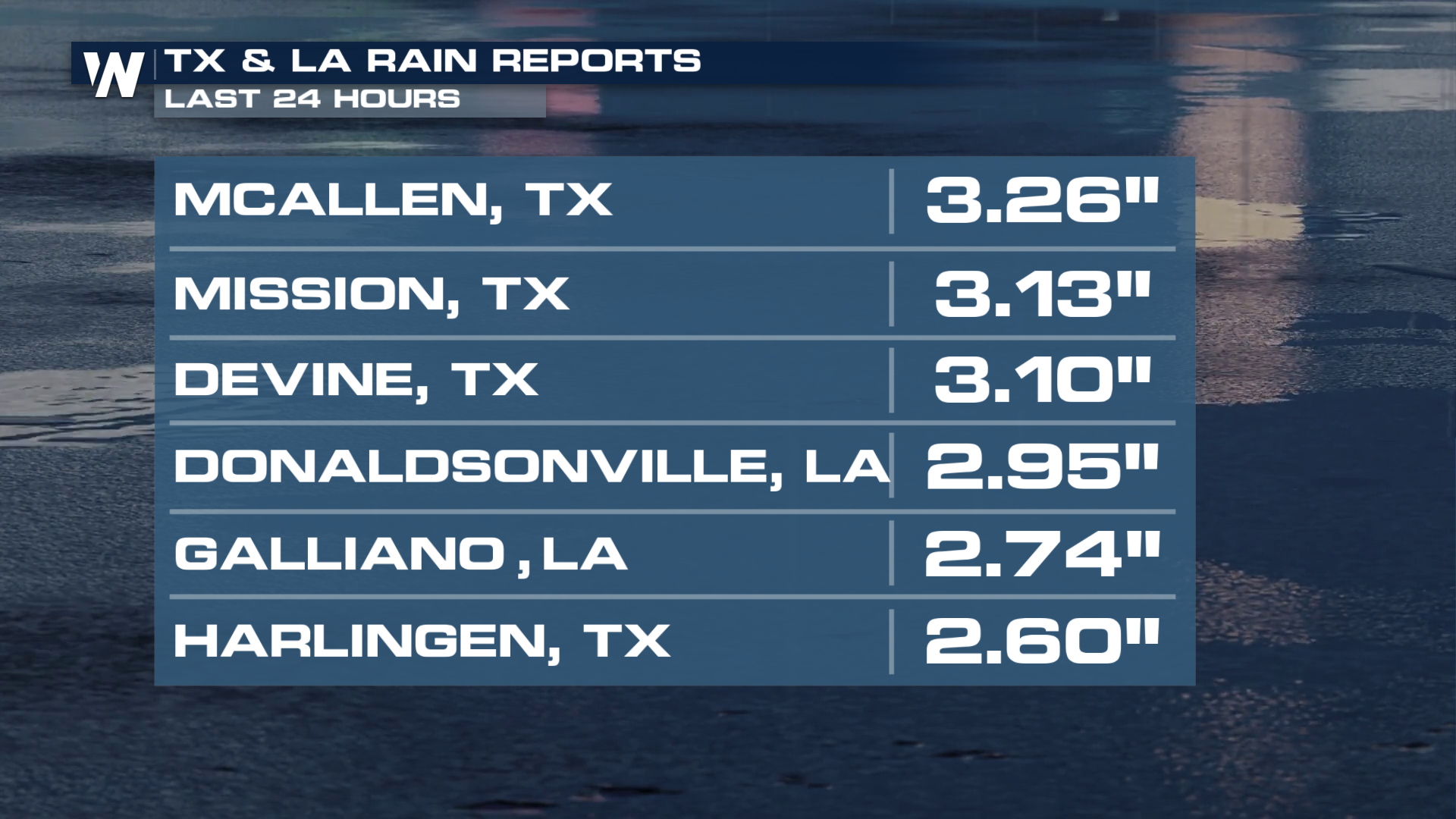
A low-pressure system that moved over Texas brought more than 3 inches of rainfall to parts of the state on Sunday. This was much-needed rain for many drought-stricken areas.
 This system is expected to move over the Gulf and track toward Florida as we head into the week, bringing showers and thunderstorms along with it.
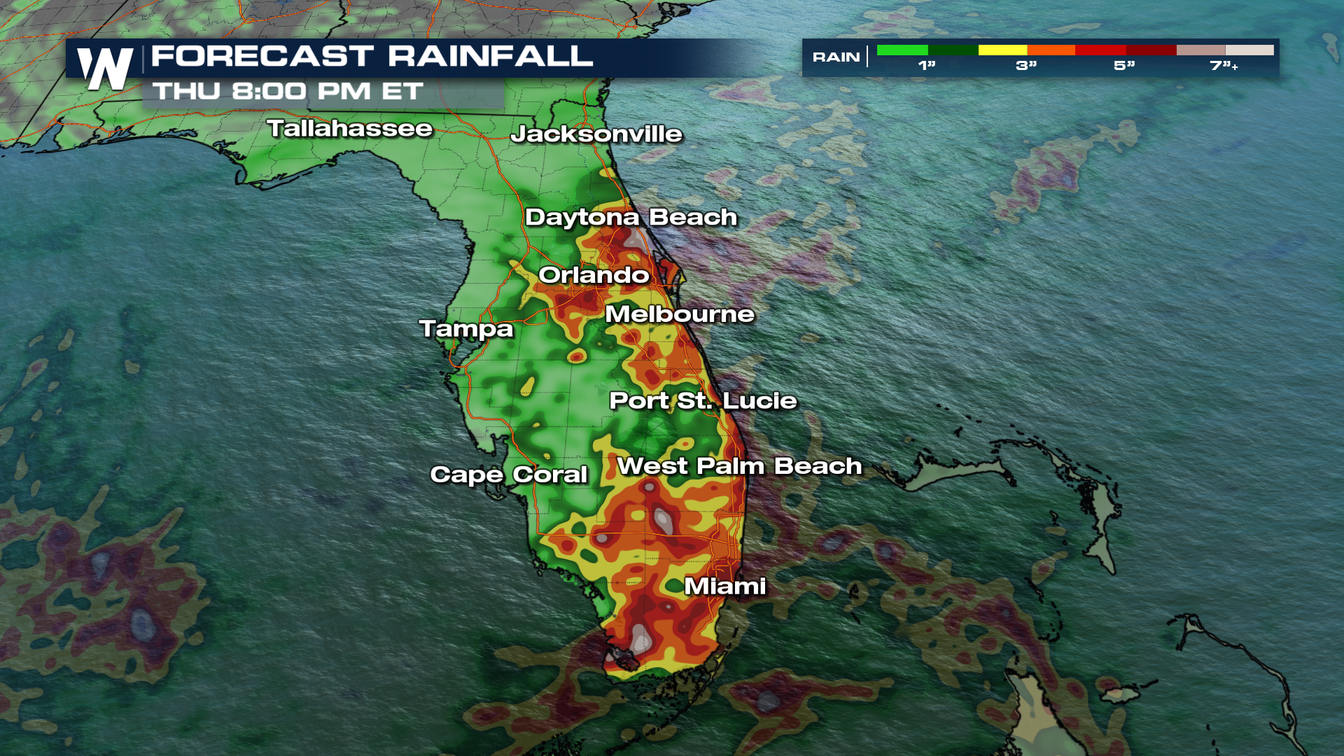
An upper-level low, combined with a trailing surface front, will lead to periods of heavy rain across the Sunshine State. Forecast models continue to show widespread showers and storms across Florida, especially during the afternoons throughout the week. The front is not expected to clear the region until Tuesday and rain will continue into Wednesday.
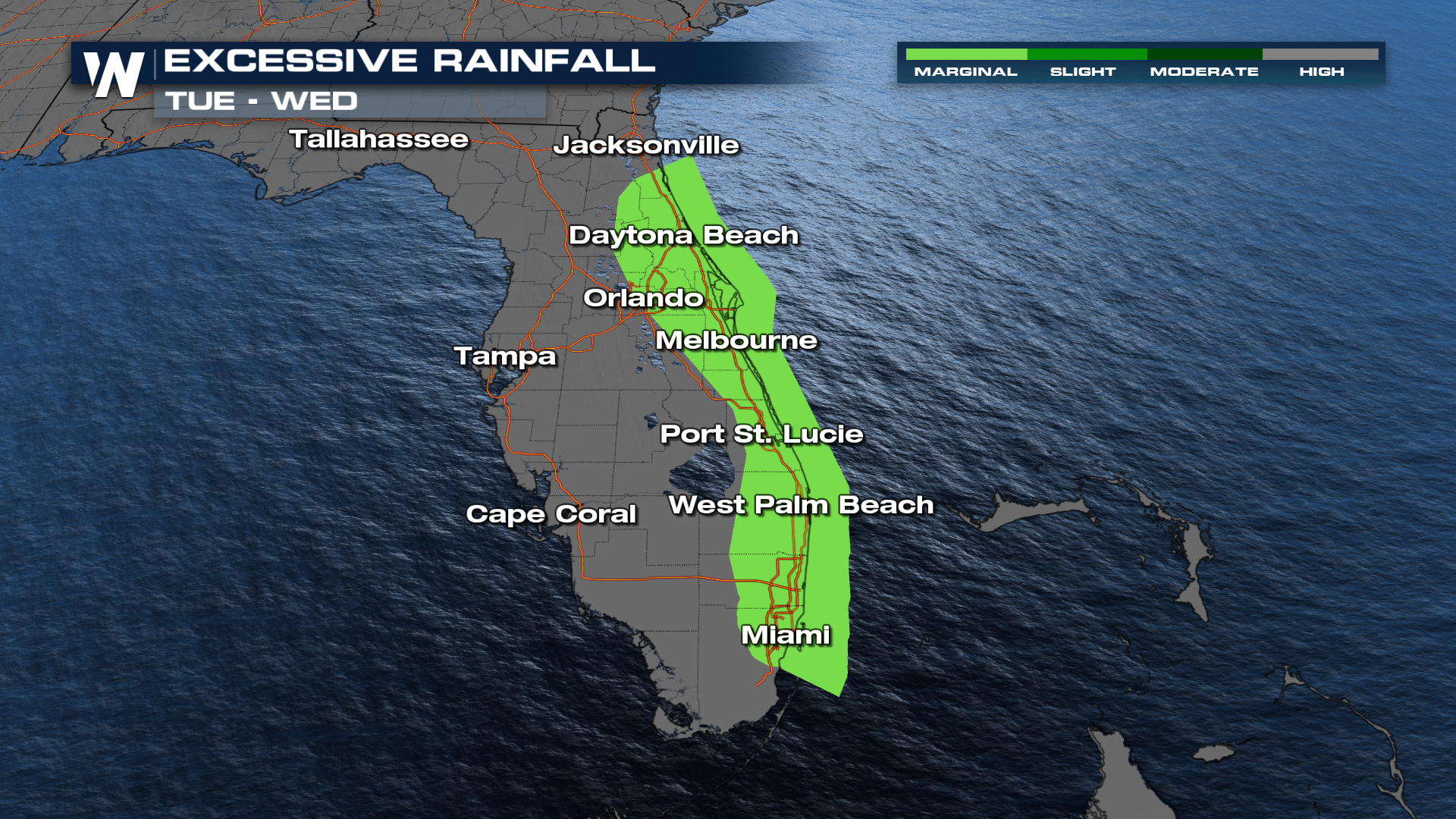
Rainfall totals may exceed 5-7 inches over the course of the week. As a result, an excessive rainfall outlook has been issued for parts of the Atlantic Coast, with a level 1 out of 4, MARGINAL risk, for flash flooding.
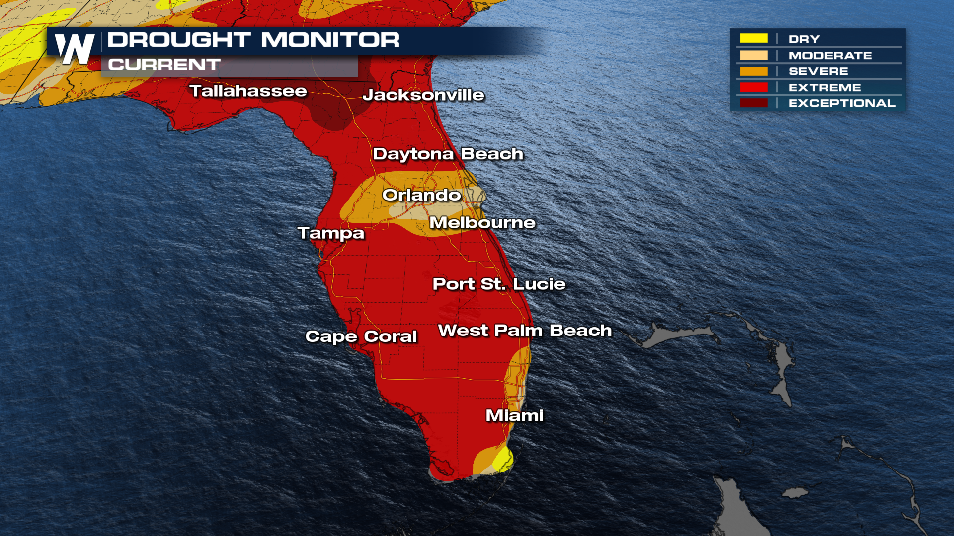
 This rain arrives at a critical time, as Florida’s drought conditions have worsened in the latest update. Much of the state is now experiencing extreme to exceptional drought (levels 4-5), which has already led to water restrictions.
 So while this rain is much-needed for a drought-stricken state, it also raises concerns for flooding, making this a week of both relief and risk across Florida.


