Florida Rainy Pattern Continues
Top Stories
18 Sep 2022 6:00 PM
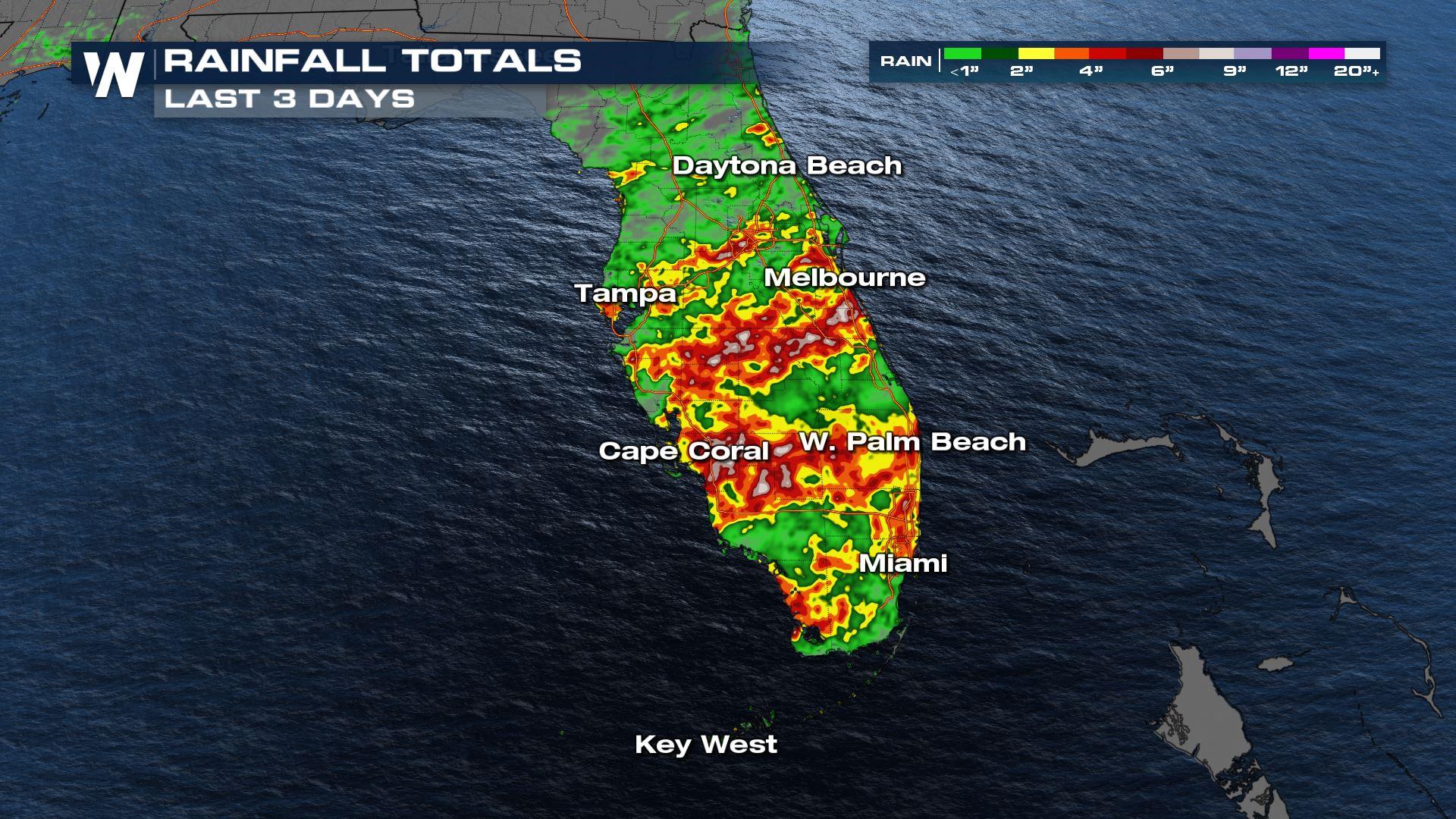
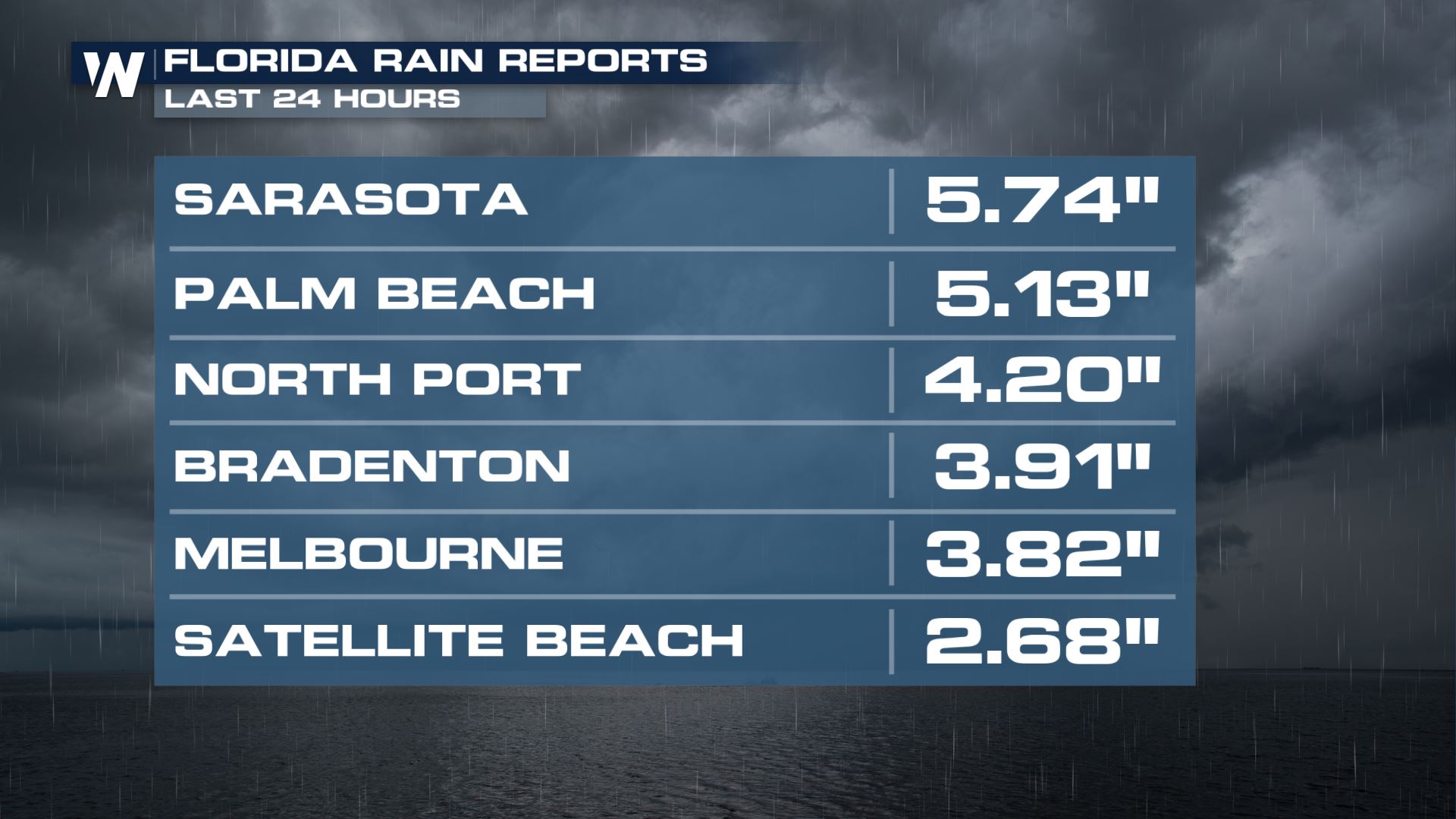
The soggy pattern continues in Florida with another day of scattered showers and storms expected this evening and into Monday. Check out how much rainfall we have seen over the last 24 hours and last 3 days.
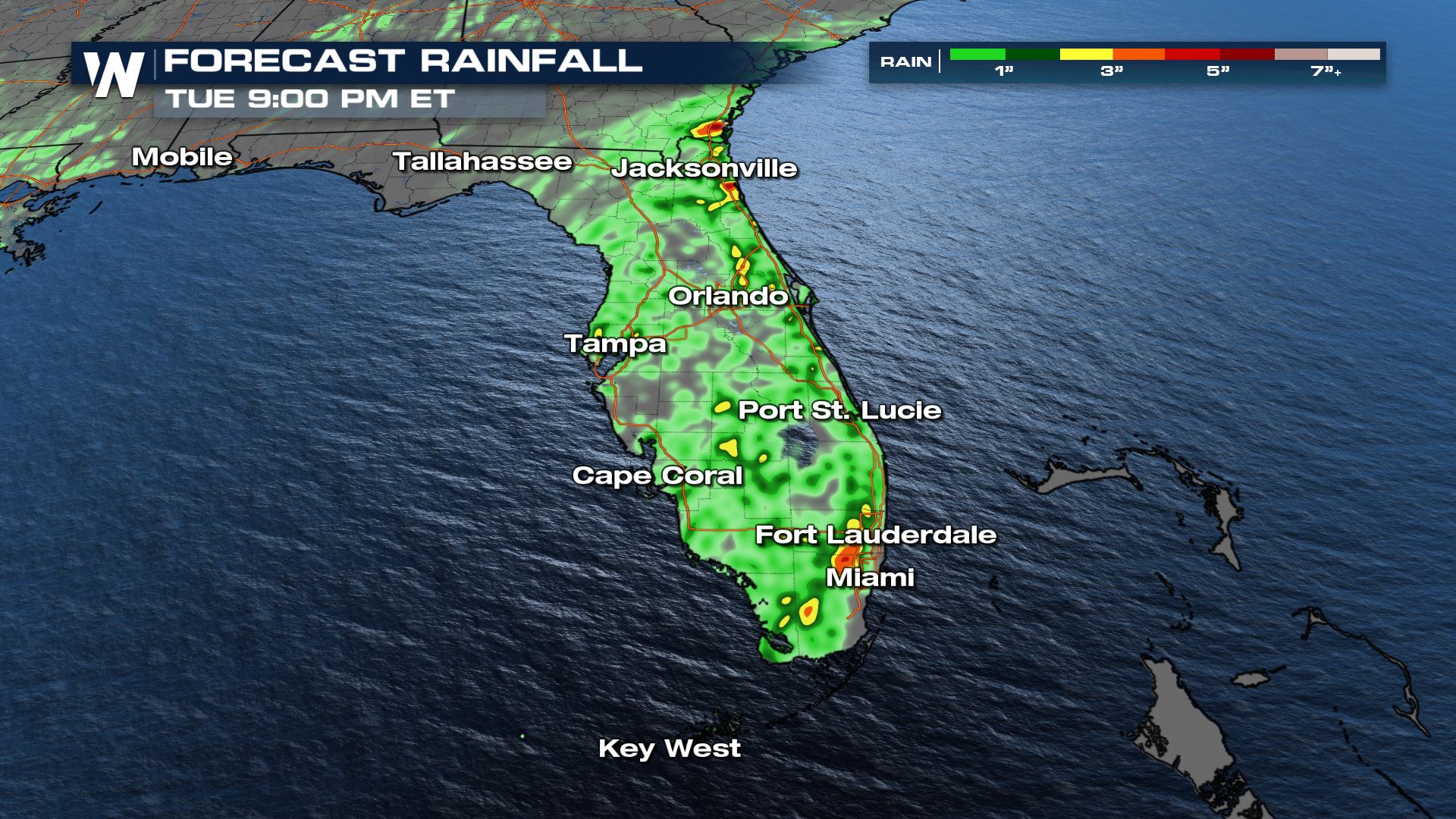
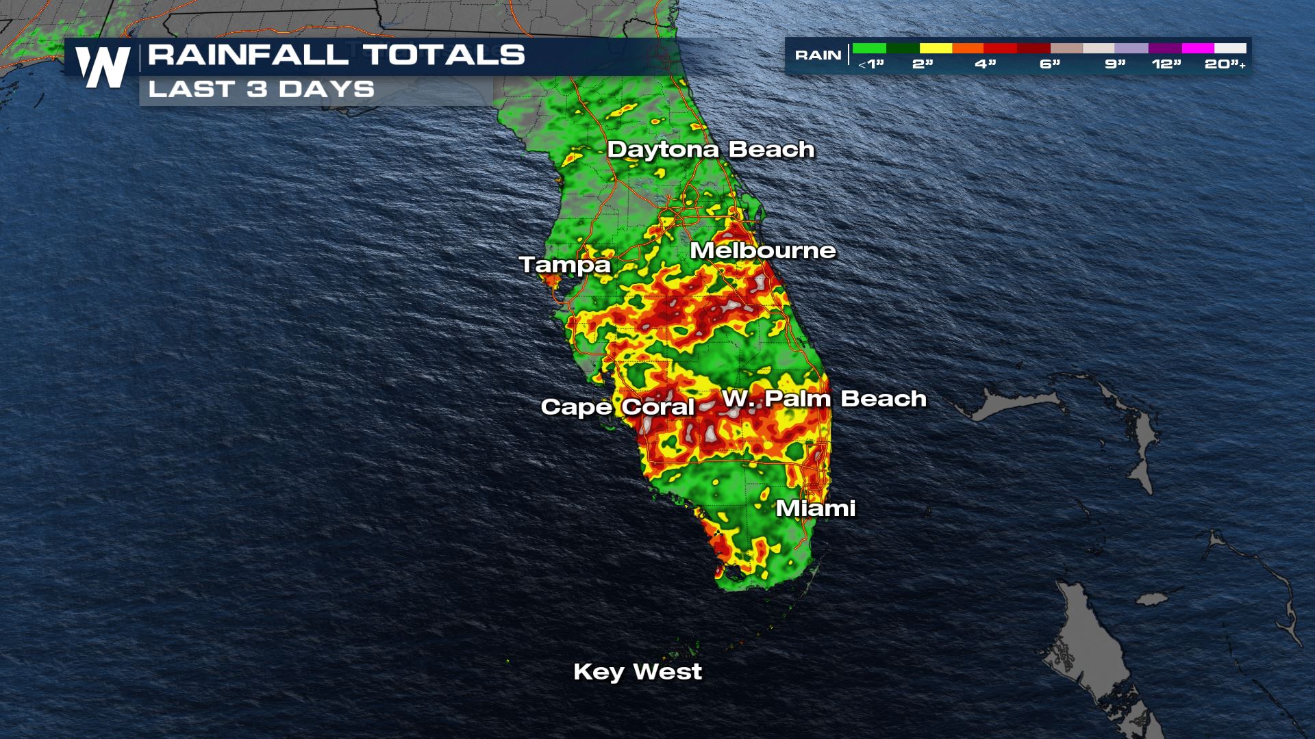 Areas of heavy rain are possible and flooding will be an issue, especially since the ground is already saturated. Localized flooding in low-lying and poor drainage areas will be a concern and some rivers are already in minor flood stage.
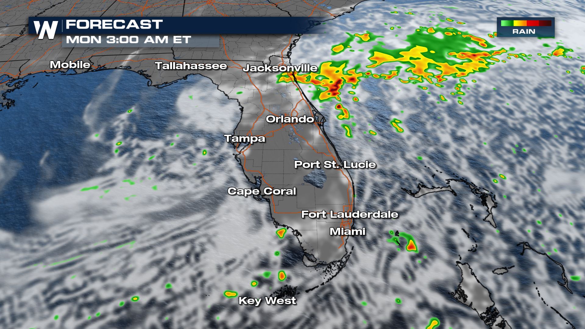
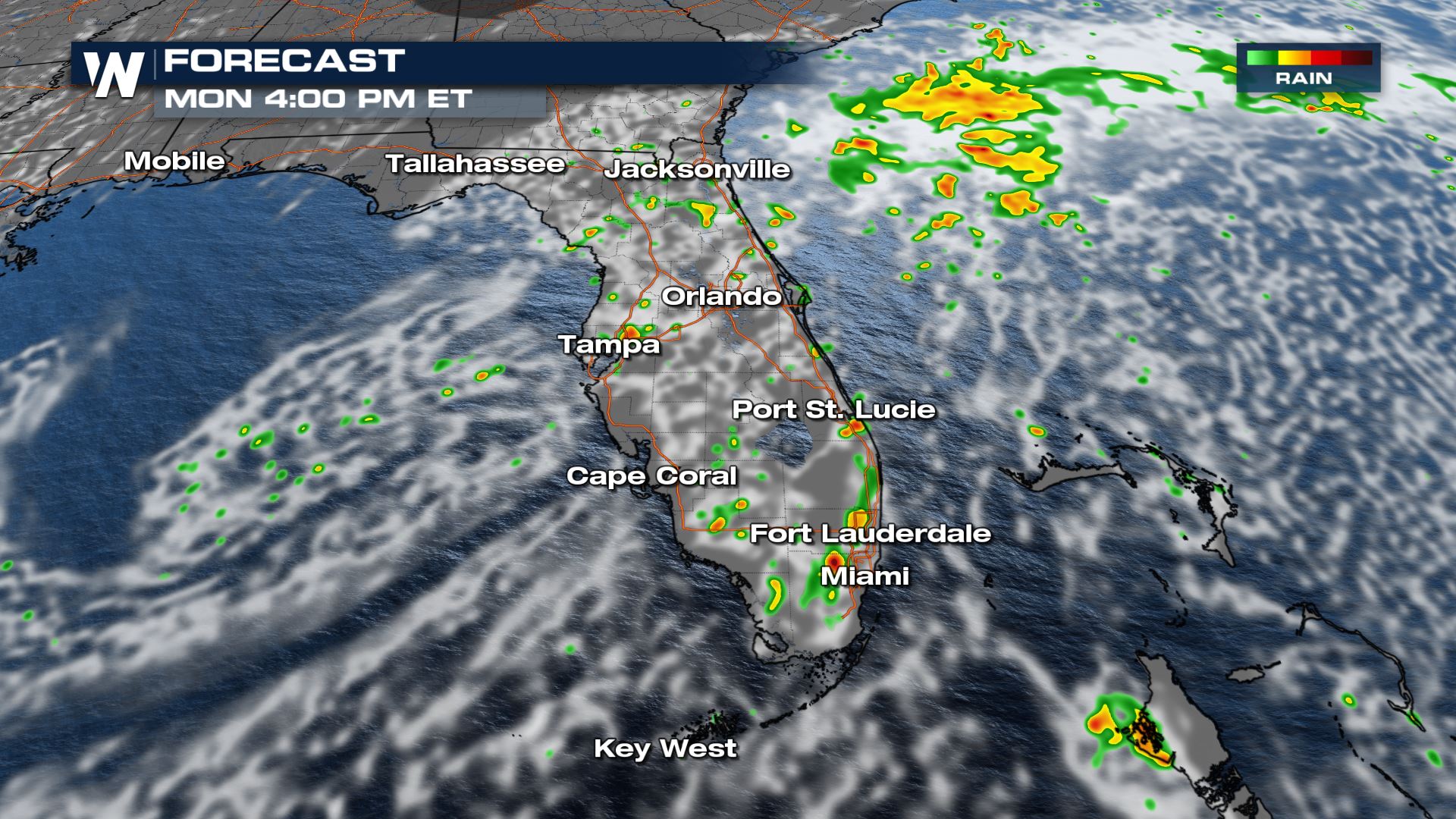 While we won't see the widespread severe weather potential, we could have a few stronger storms here and there.
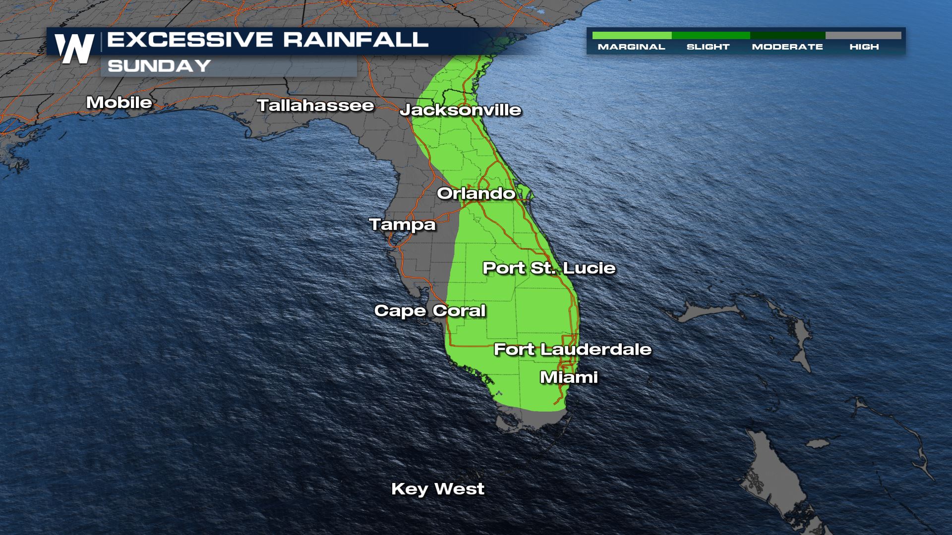
The Weather Prediction Center has highlighted the risk for excessive rainfall for a good portion of the Peninsula. Be prepared for ponding on the roads during heavy thunderstorms. The forecast rainfall in the Southeast will range from very little in some spots, to more than four inches in other locations!
While we won't see the widespread severe weather potential, we could have a few stronger storms here and there.
The Weather Prediction Center has highlighted the risk for excessive rainfall for a good portion of the Peninsula. Be prepared for ponding on the roads during heavy thunderstorms. The forecast rainfall in the Southeast will range from very little in some spots, to more than four inches in other locations!
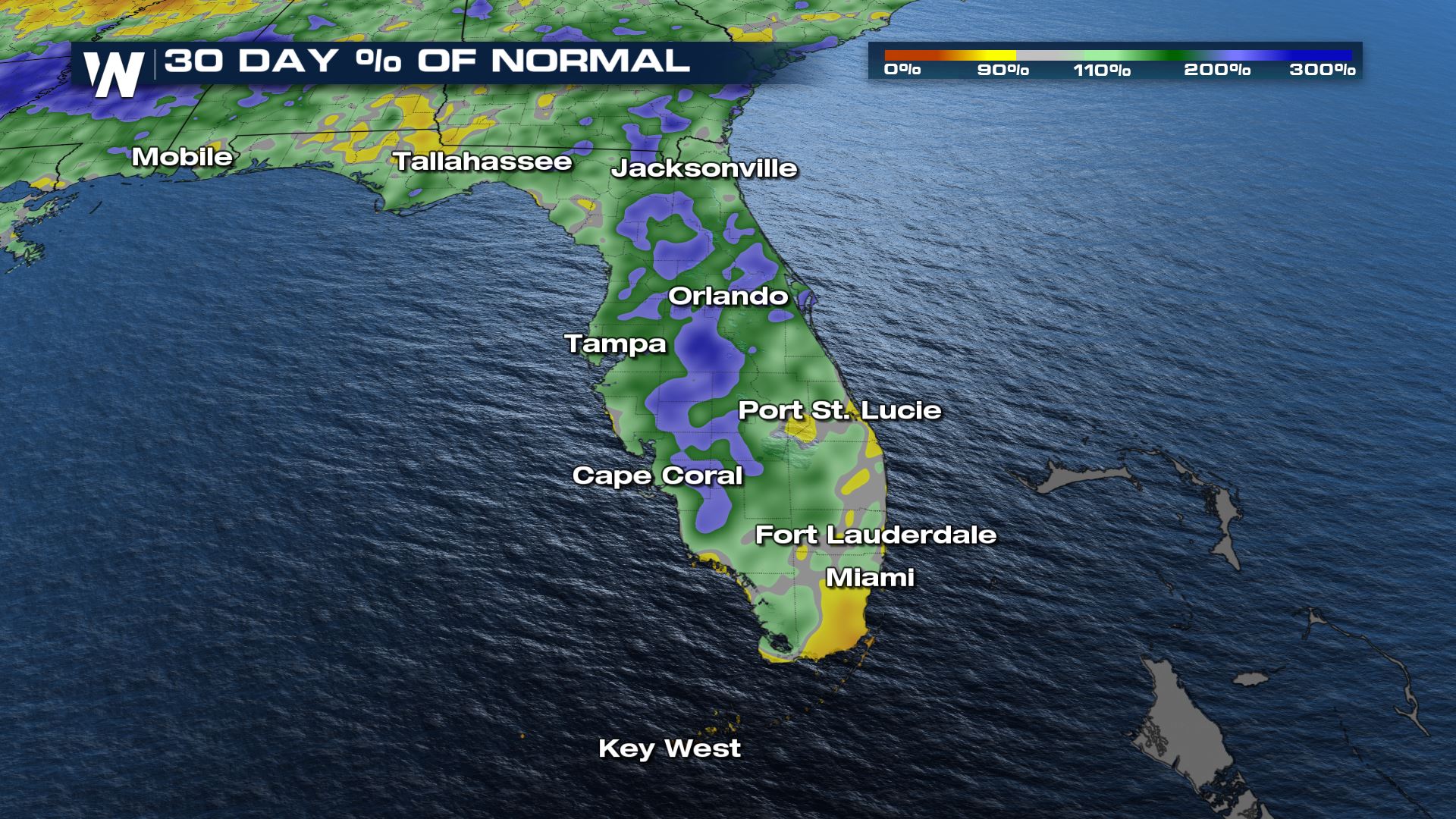
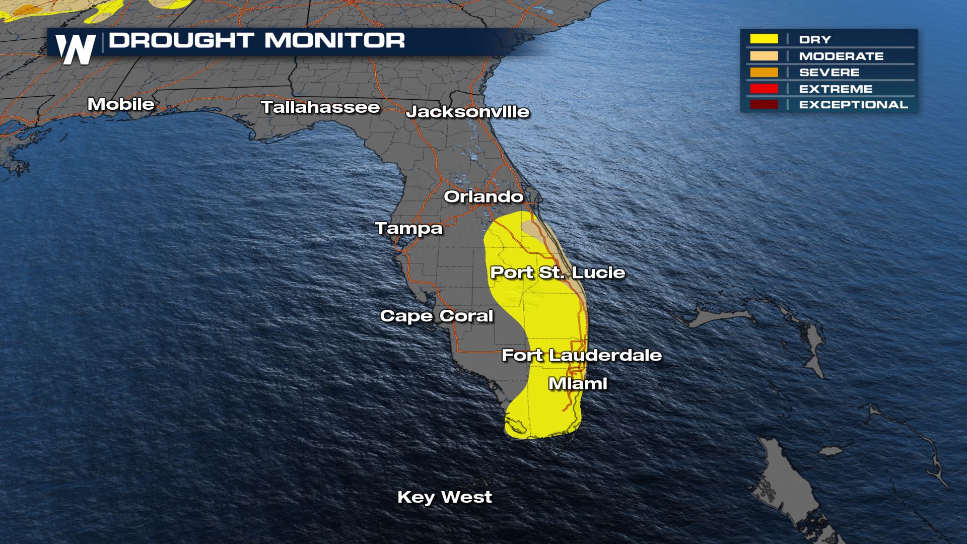
 Some areas have seen too much of a good thing but other parts of Florida could use the rain - over the last 30 days we have been below average for precipitation in SE Florida, around the I-95 corridor. This follows where our drought levels have expanded in the Sunshine state too!
 Join WeatherNation for the latest information during the Southeast Region Forecast, always at 10 minutes past the hour.
Areas of heavy rain are possible and flooding will be an issue, especially since the ground is already saturated. Localized flooding in low-lying and poor drainage areas will be a concern and some rivers are already in minor flood stage.
While we won't see the widespread severe weather potential, we could have a few stronger storms here and there.
The Weather Prediction Center has highlighted the risk for excessive rainfall for a good portion of the Peninsula. Be prepared for ponding on the roads during heavy thunderstorms. The forecast rainfall in the Southeast will range from very little in some spots, to more than four inches in other locations!
Some areas have seen too much of a good thing but other parts of Florida could use the rain - over the last 30 days we have been below average for precipitation in SE Florida, around the I-95 corridor. This follows where our drought levels have expanded in the Sunshine state too!
Join WeatherNation for the latest information during the Southeast Region Forecast, always at 10 minutes past the hour.All Weather News
More
Wildfire Outbreak in the Pacific Northwest
SPOKANE, WA - On Saturday, August 1st, the Ol
2 Aug 2026 7:20 PM

More Storms for the East Through Monday
A low-pressure system that moved through the
2 Aug 2026 7:20 PM


After Reaching Category 5, Genevieve Weakens in the Pacific
PacificGenevieve formed on last Friday south
2 Aug 2026 6:25 PM

Flooding, Severe Storms Target the Midwest Again
After an active week of storms across the nor
1 Aug 2026 1:40 AM

Flooding Risk Increases as Heavy Rain Targets the Tri-State Area
Tuesday, heavy rainfall moved across the Nort
30 Jul 2026 12:25 AM

Severe Weather: Energy From the Midwest Now in the Southeast
UPPER MIDWEST - Through Monday, dangerous tor
29 Jul 2026 10:30 PM