Wind and Hail Possible Along the Front Range Sunday

Top Stories
30 Jun 2024 10:00 PM
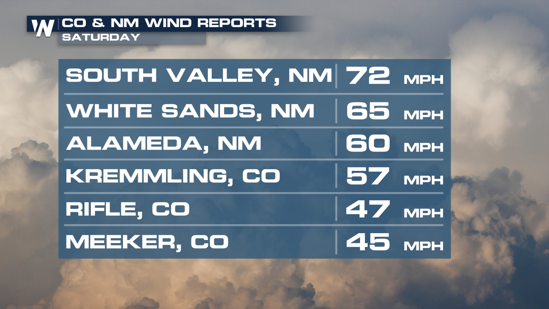
It's been stormy in the mid-section of the country! Multiple storm systems brought intense rainfall, leading to widespread flooding of cresting rivers and closing interstates in the Dakotas. Storms to kick off the weekend put out 60-70 mph gusts in New Mexico and Colorado on Saturday. The severe threat looks to linger along the Front Range Sunday.
 Storms will be ongoing on Sunday morning too, but additional development off the spine of the Rocky Mountains provides the highest severe weather likelihood on Sunday afternoon and evening.
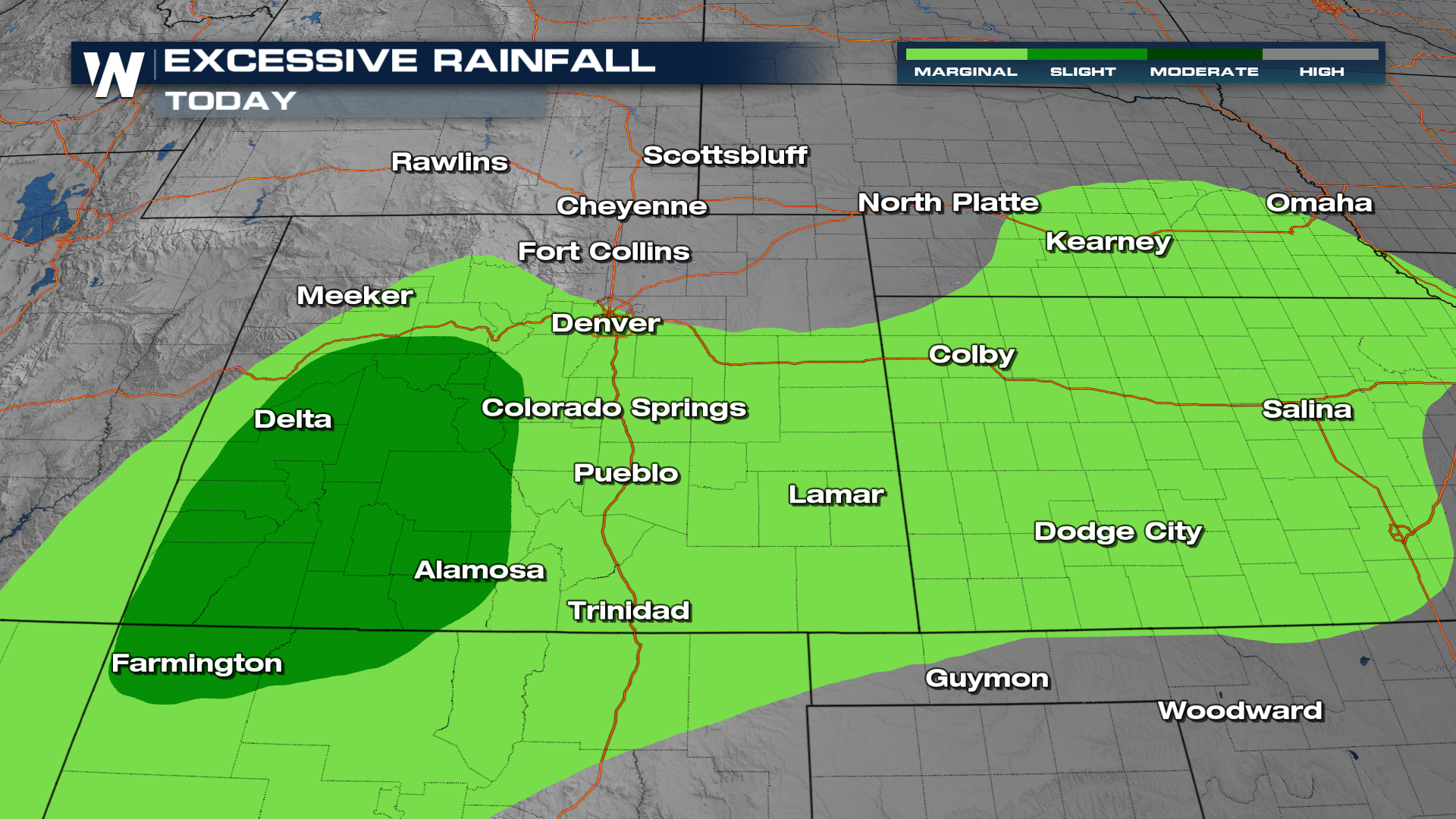
Additional rainfall that is expected to pile up will be within the 1-4+" range, which could lead to some flash flooding through Monday.
All Weather News
More


More Storms for the East Sunday and Monday
A low-pressure system crashing through the Mi
2 Aug 2026 2:20 AM

After Reaching Category 5, Genevieve Weakens in the Pacific
PacificGenevieve formed on last Friday south
2 Aug 2026 1:30 AM

Flooding, Severe Storms Target the Midwest Again
After an active week of storms across the nor
1 Aug 2026 1:40 AM

Flooding Risk Increases as Heavy Rain Targets the Tri-State Area
Tuesday, heavy rainfall moved across the Nort
30 Jul 2026 12:25 AM

Severe Weather: Energy From the Midwest Now in the Southeast
UPPER MIDWEST - Through Monday, dangerous tor
29 Jul 2026 10:30 PM