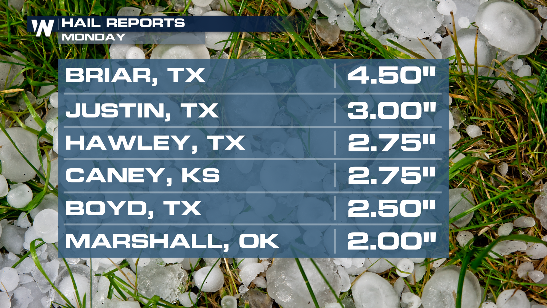
Grapefruit Hail Pummels Plains, Midwest
The severe weather threat continues today as it moves to the east. This article has all the information on the risk today and tomorrow: Storms Shift into the Midwest.
The central and southern U.S. were pummeled by storms on Monday. Briar, TX, which is about 25 miles northwest of Fort Worth, TX, saw grapefruit-sized hail! That's about 4.5" in diameter! Even portions of Kansas dealt with baseball-sized hail.
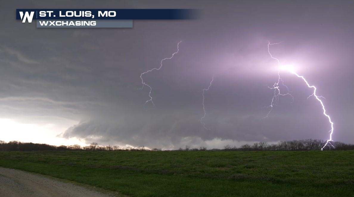
Sights like this one were a familiar one across a handful of states. This video came out of Cole County, MO where a variety of hailstone sizes were seen from a severe thunderstorm warning.
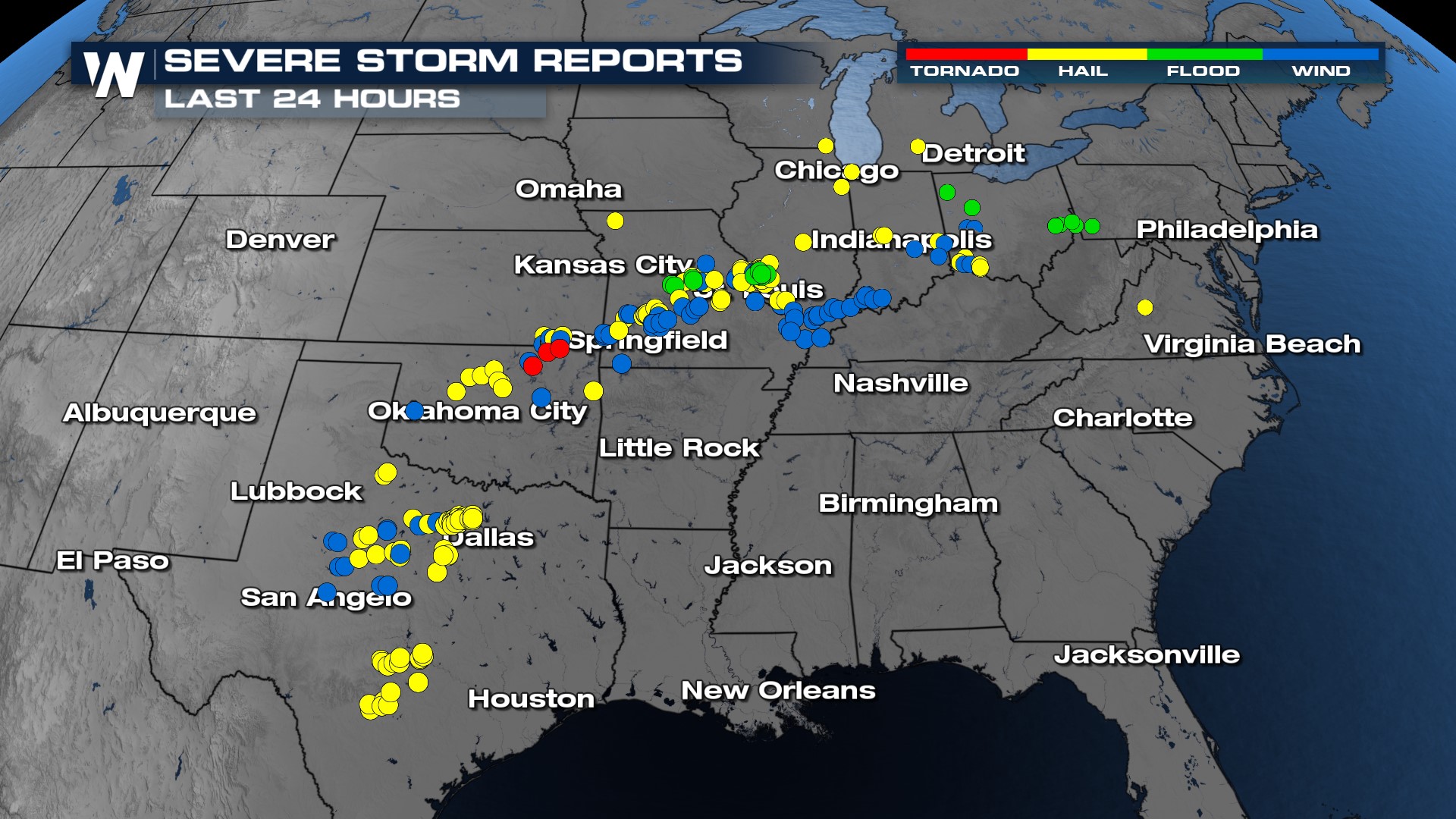
We had multiple severe storm reports, with hail and wind being the most common ones across the board. Towards the border of Oklahoma, there were a few possible tornadoes reported during the afternoon.
This video came out of Kingfisher, OK on Monday as a funnel cloud tried to touch down from a supercell.
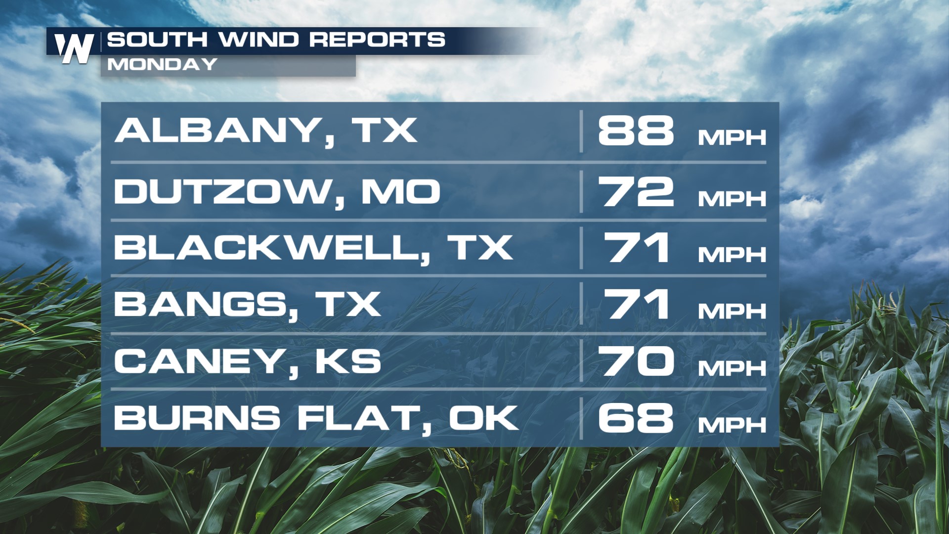
The strong, damaging winds were another major component of these storms. We saw multiple reports of wind gusts between 65-85 mph.
Blowing dust was a problem in the plains of Texas as this video came out of Gardendale with wind advisories that were in effect.
As the severe threat pushes eastward today, please continue to stay weather-aware.


