Halloween: Spook-Tacular or Spooky Forecast?
Special Stories
31 Oct 2019 7:30 AM
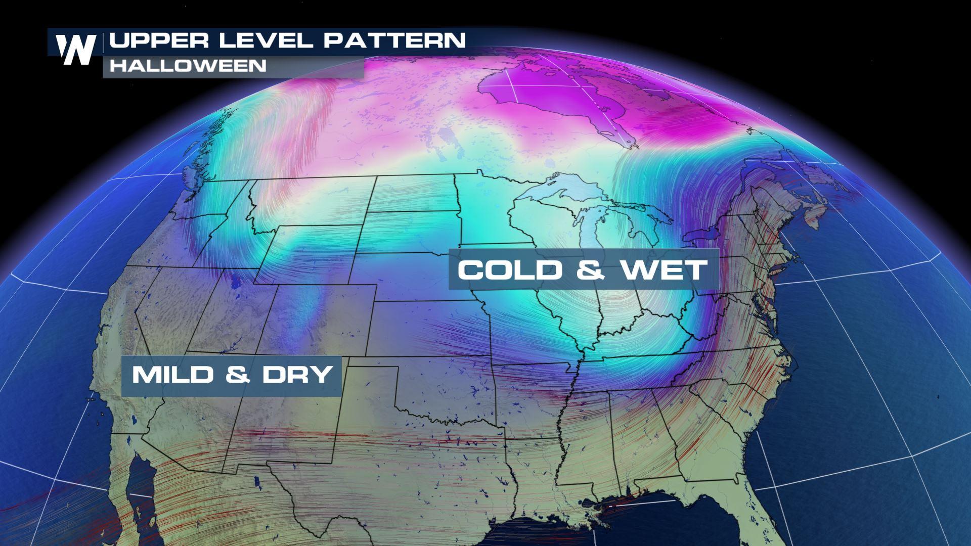
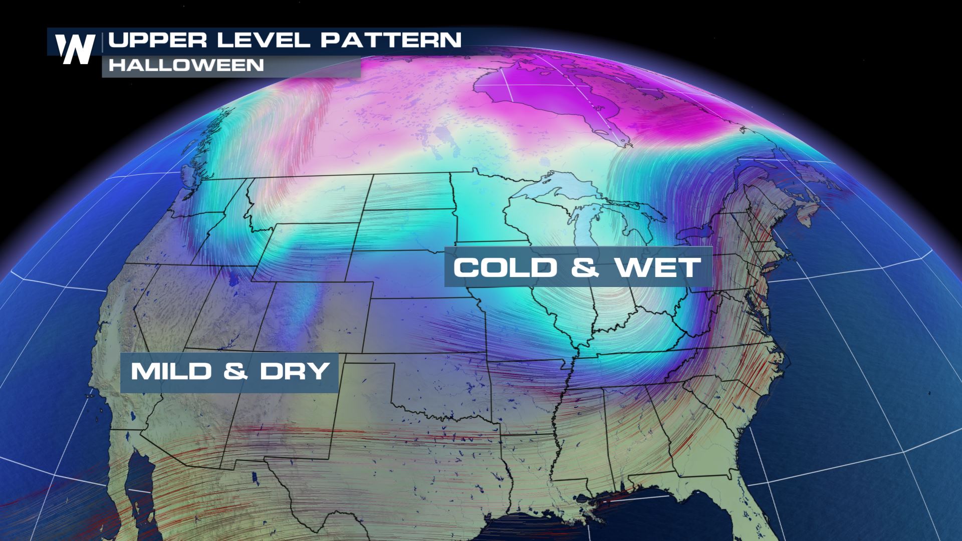
Depending on your location, your Halloween forecast could be bone-chilling cold or wickedly-warm! As a potent upper-level low swirls through the Mid-West and into the East Coast, it will bring a ghoulishly cold weather pattern across the region. As the system swings through, it will bring a cold shot of air, scattered showers and the risk for isolated severe weather.
[Related articles: Halloween Spooktacular Climate and Spooky Halloween Records]
 Let's break down the timing of your Halloween forecast across the nation.
Showers and thunderstorms will spread through the south, the Mid-Atlantic and into the northeast during the day. Snow will fall on the back side of the system from Chicago and points northward.
Let's break down the timing of your Halloween forecast across the nation.
Showers and thunderstorms will spread through the south, the Mid-Atlantic and into the northeast during the day. Snow will fall on the back side of the system from Chicago and points northward.
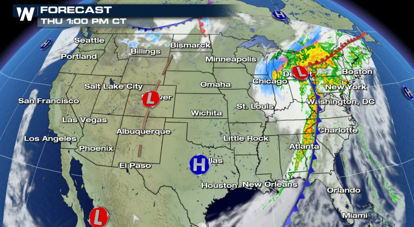 As the front moves east, it will tap into an area of instability, allowing for stronger storms to develop. Generally from New York south into Georgia.
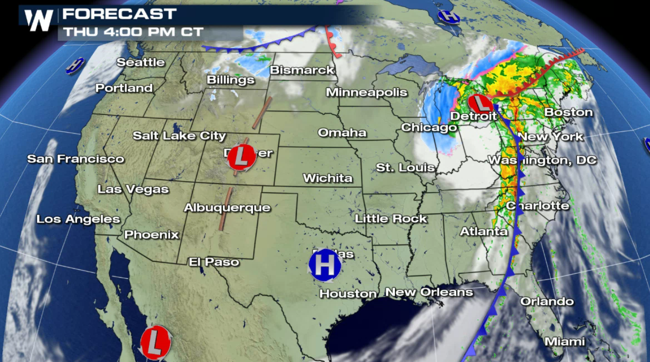 Along this line of storms, the possibility of severe weather may develop later in the afternoon and evening.
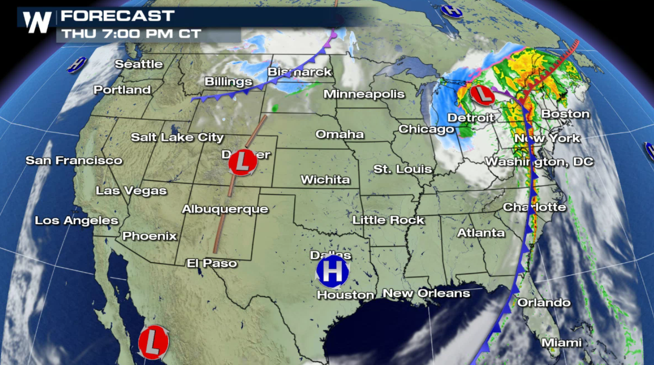 Showers and thunderstorms will continue into the night time hours.
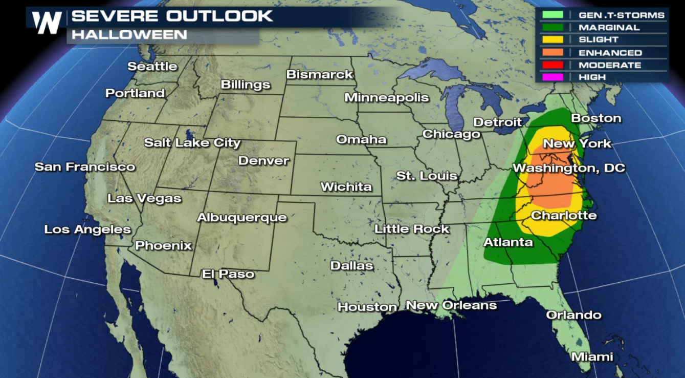
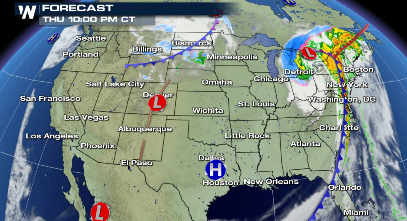 The Storm Prediction Center, or SPC, has issued an enhanced risk of severe weather in the areas shaded in orange. The largest threats will likely be damaging hail, gusty winds and flooding.
 Bundle up when taking the kiddos out for their trick or treat festivities as much colder air is in the forecast!
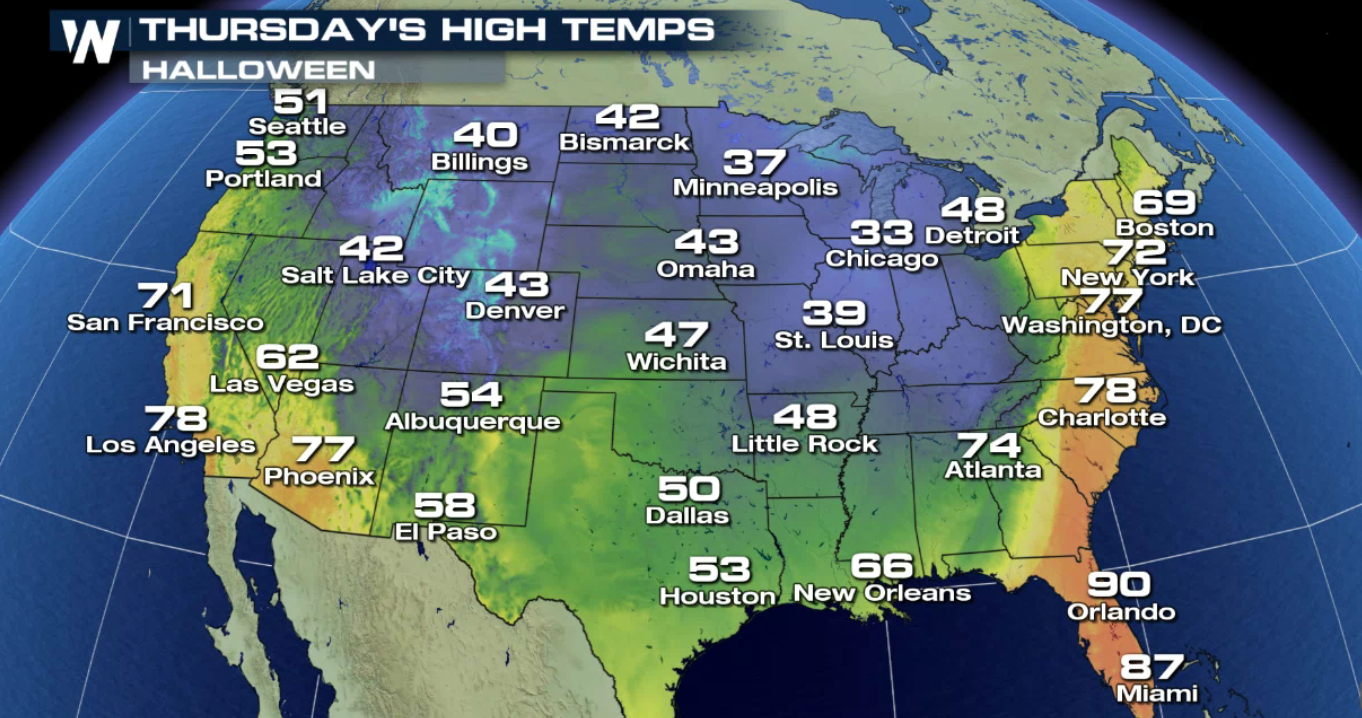
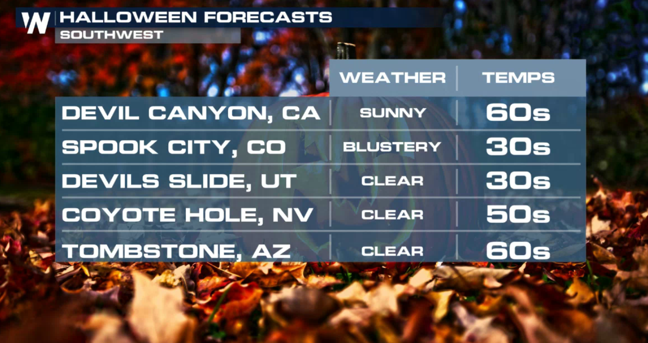
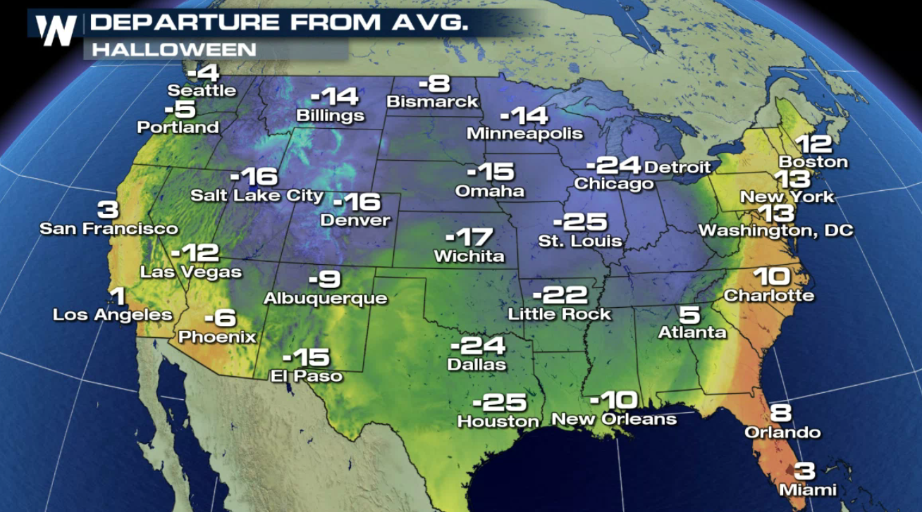 Here's a look at some selected cities Halloween forecasts across the country:
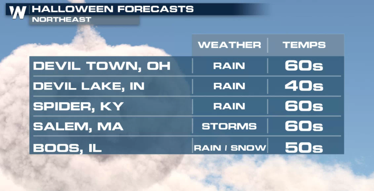
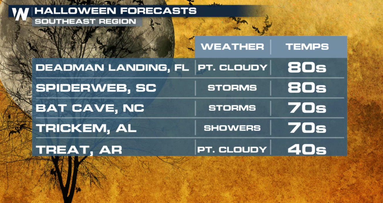
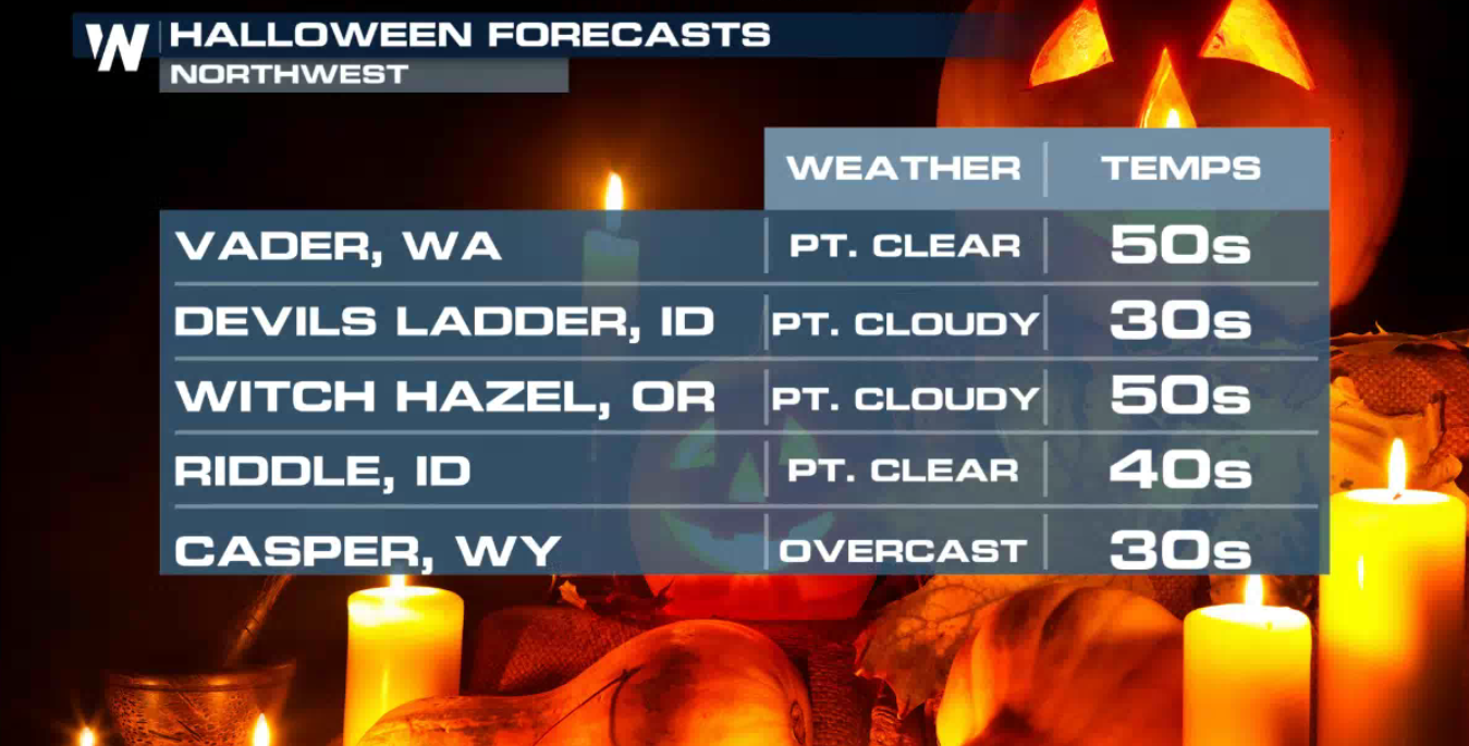
Let's break down the timing of your Halloween forecast across the nation.
Showers and thunderstorms will spread through the south, the Mid-Atlantic and into the northeast during the day. Snow will fall on the back side of the system from Chicago and points northward.
As the front moves east, it will tap into an area of instability, allowing for stronger storms to develop. Generally from New York south into Georgia.
Along this line of storms, the possibility of severe weather may develop later in the afternoon and evening.
Showers and thunderstorms will continue into the night time hours.
The Storm Prediction Center, or SPC, has issued an enhanced risk of severe weather in the areas shaded in orange. The largest threats will likely be damaging hail, gusty winds and flooding.
Bundle up when taking the kiddos out for their trick or treat festivities as much colder air is in the forecast!
Here's a look at some selected cities Halloween forecasts across the country:
All Weather News
More
Another Day of Storms in New Mexico
A powerful low pressure system has been movin
24 Oct 2026 12:30 PM

Sunny Day Flooding; King Tides Surge This Week
This week, the ocean is coming to low lying a
24 Oct 2026 11:32 AM

Hurricane Vance Swirling in the Pacific
After becoming a hurricane Friday, Vance quic
24 Oct 2026 10:25 AM

Warmer Than Average: Above-Normal Temperatures Across the Central U.S. This Week
WHAT TO EXPECTA ridge of high pressure linger
24 Oct 2026 10:00 AM


Several Fires Break Out in SoCal Last Week Amid Santa Ana Wind Event
Santa Ana winds helped several fires grow qui
19 Oct 2026 1:25 PM

Another Cold Morning Before Things Warm Back Up
Across portions of the Ohio Valley through th
19 Oct 2026 10:15 AM