Flooding Continues Along the Gulf Coast
Special Stories
17 Apr 2021 2:29 PM
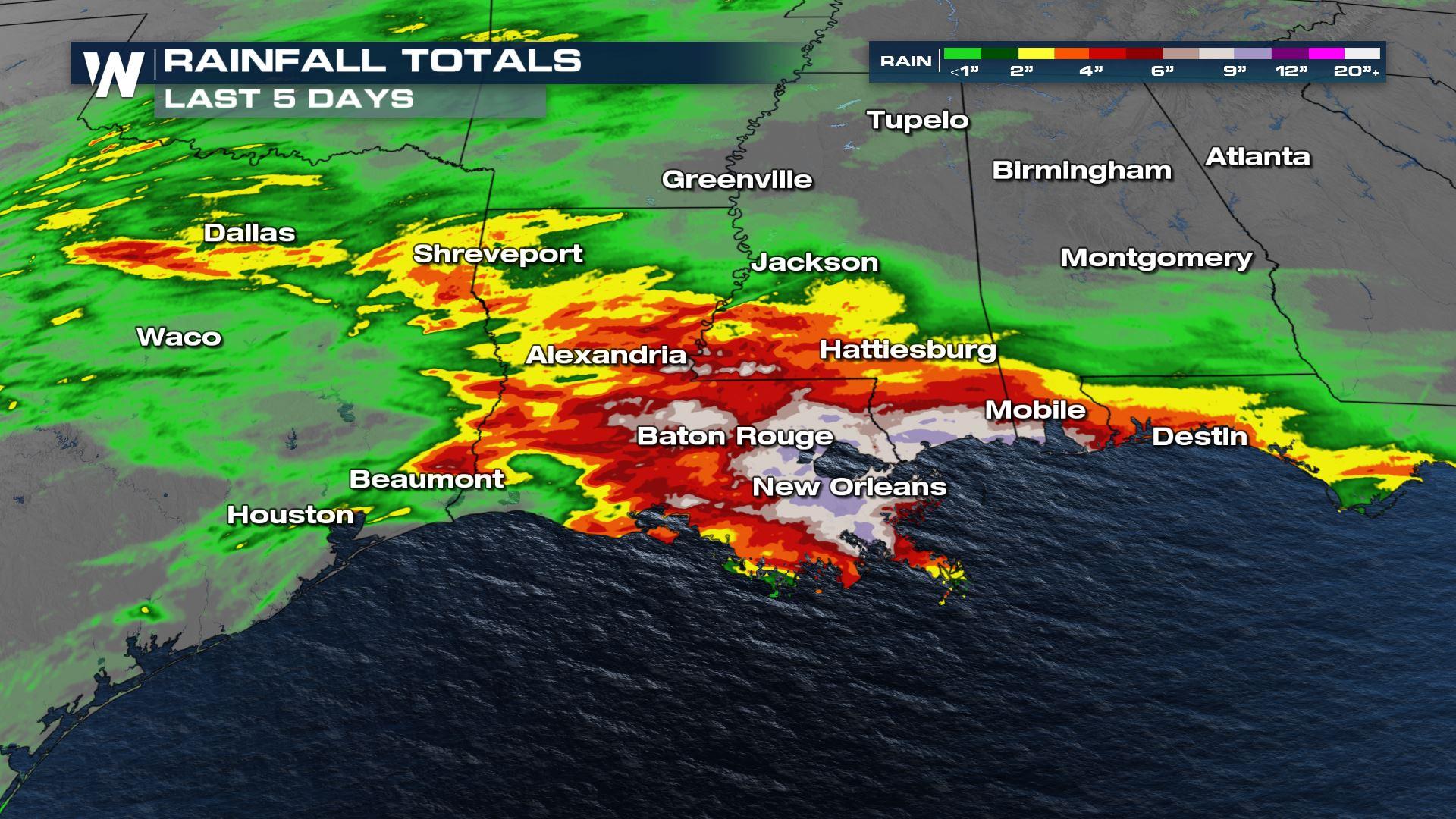
A stalled frontal system has ushered in several waves of heavy rain along portions of the Gulf Coast this week and weekend, leading to an increased risk for flooding and flash flooding. This region has already been saturated with heavy rainfall in some locations over the last five days, this will lead to flooding developing more quickly as additional heavy showers move over the area.

 This is the same area that saw strong storms capsize a boat off the southern coast of Louisiana. Gusty winds caused damage and water overran the streets of Port Fourchon, LA.
https://twitter.com/WeatherNation/status/1382498909801512960
This is the same area that saw strong storms capsize a boat off the southern coast of Louisiana. Gusty winds caused damage and water overran the streets of Port Fourchon, LA.
https://twitter.com/WeatherNation/status/1382498909801512960
 Numerous rivers and streams in the area are already in flood stage. Additional heavy showers could push some rivers into a higher flood stage. The heavy rainfall threat will then shift over to the Sunshine State of Florida on Sunday and Monday, perhaps lingering into Tuesday too.
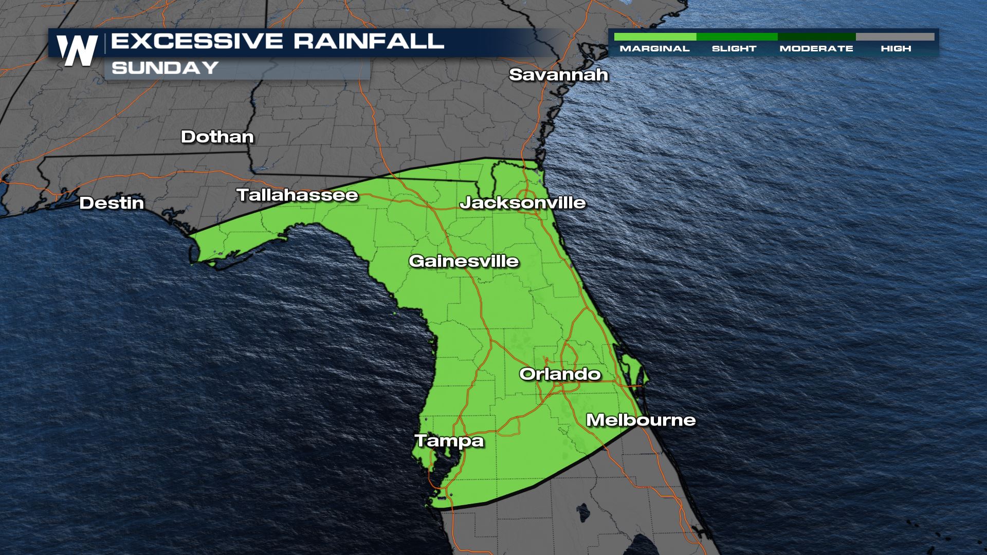
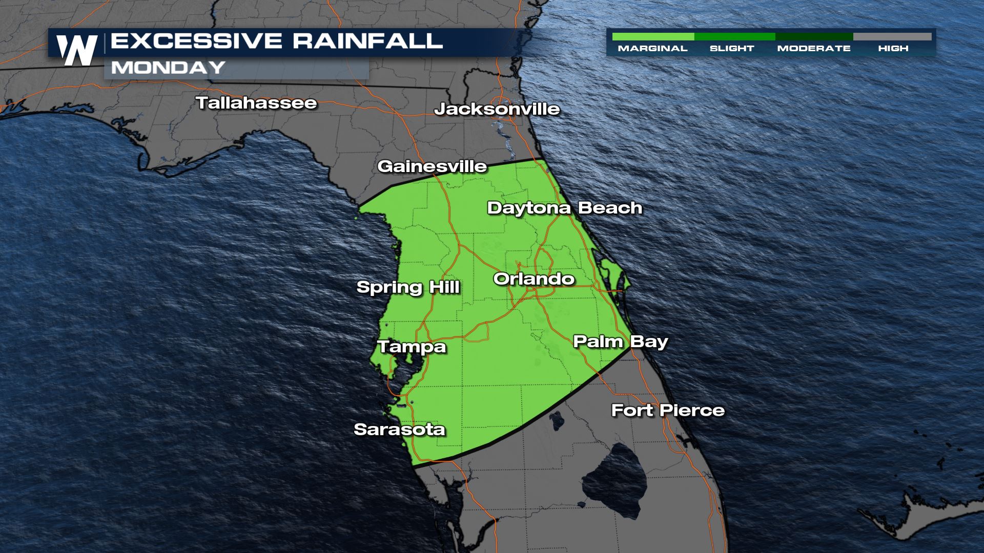 Additional heavy rain is expected to move over this region through the end of the weekend. Though there will be breaks at times, the breaks are not expected to be long enough to lead to significant evaporation. The Weather Prediction Center (WPC) has issued a marginal risk for excessive rain for this region through the start of the week. These regions can expect an increased risk for flash flooding.
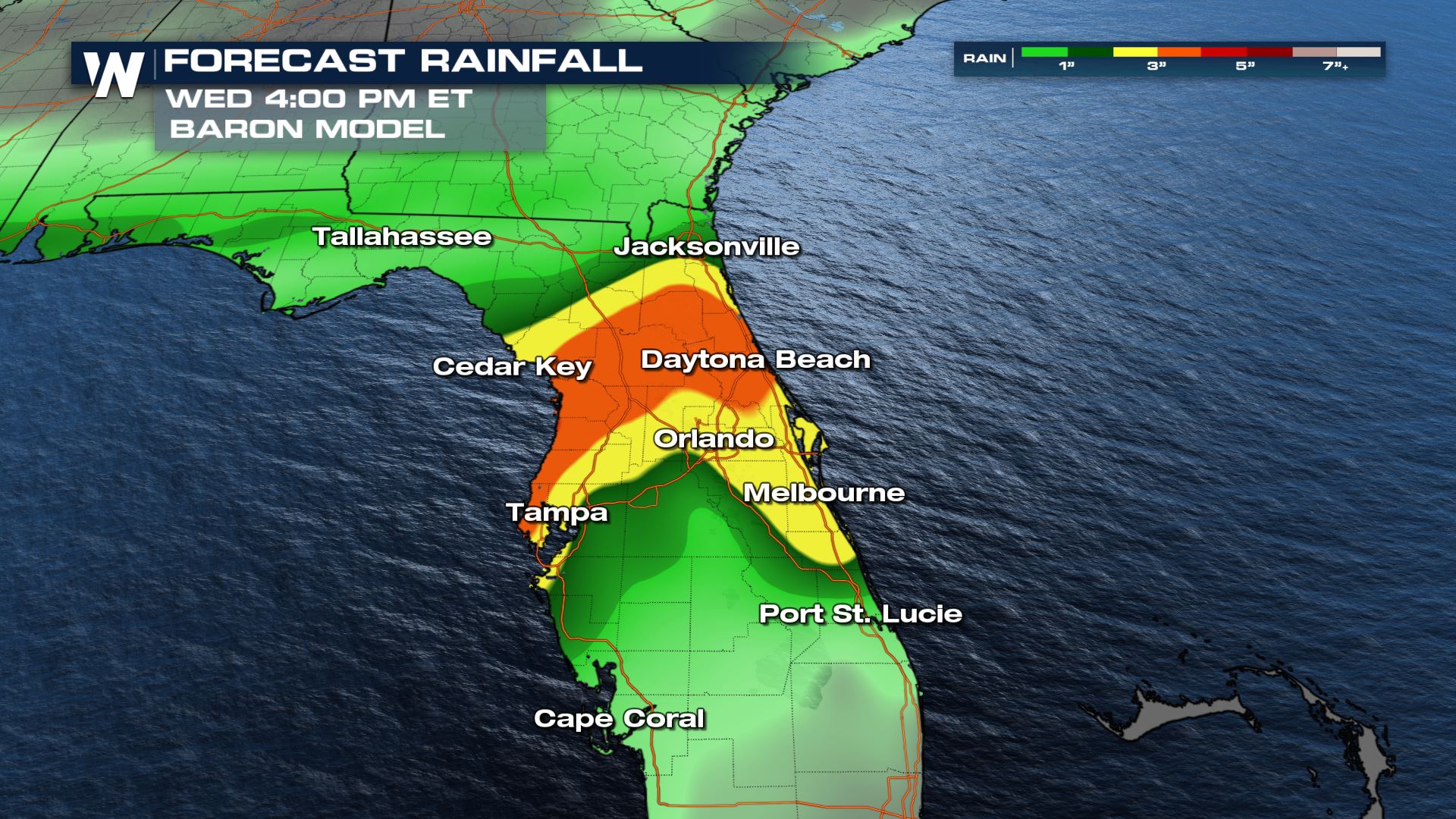 The latest forecast for rainfall is pinpointing a large area of heavy rain from north central Florida. Other pockets of heavy accumulations will be possible where isolated heavy showers are possible and, especially, where multiple rounds thunderstorms are possible.
Stay tuned to WeatherNation for more updates on the heavy rain on the way to the Gulf Coast.
The latest forecast for rainfall is pinpointing a large area of heavy rain from north central Florida. Other pockets of heavy accumulations will be possible where isolated heavy showers are possible and, especially, where multiple rounds thunderstorms are possible.
Stay tuned to WeatherNation for more updates on the heavy rain on the way to the Gulf Coast.
Totals
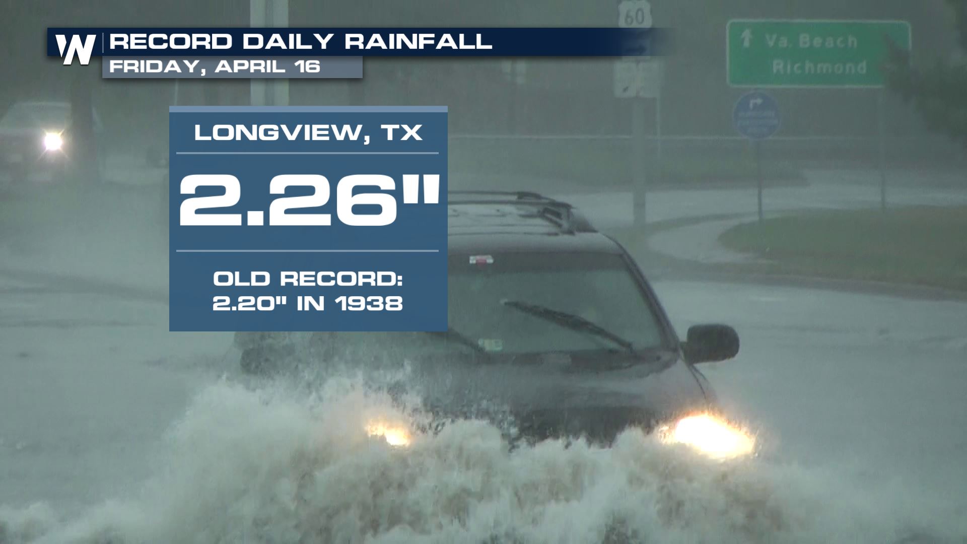
Record rainfall was observed Friday across parts of Louisiana and Texas. These were daily rainfall records for Friday, April 16th.
This is the same area that saw strong storms capsize a boat off the southern coast of Louisiana. Gusty winds caused damage and water overran the streets of Port Fourchon, LA.
https://twitter.com/WeatherNation/status/1382498909801512960
Flood Alerts
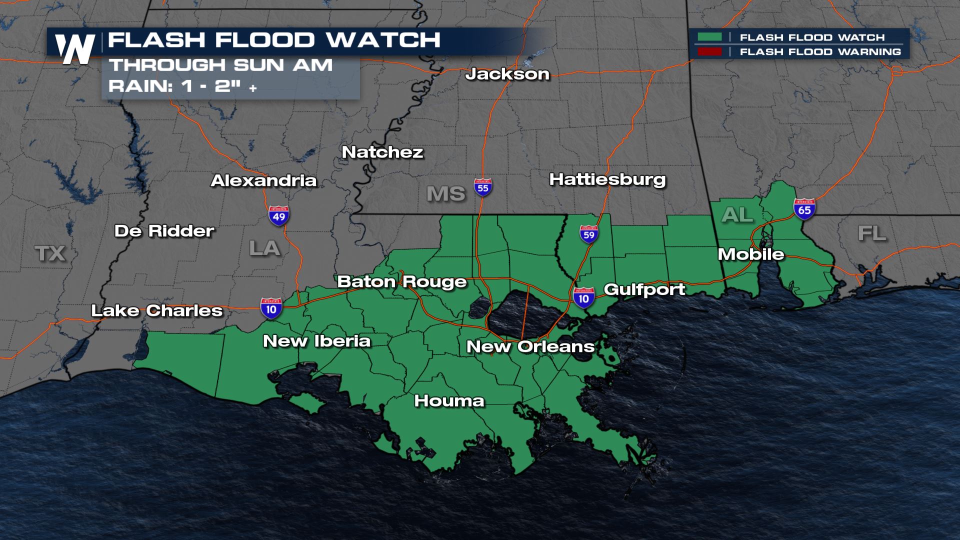
Flash Flood Watches are in effect along the Gulf Coast of Louisiana, Mississippi, and Alabama through the end of the day Saturday with 1 to 3 inches of additional rainfall. The threat of excessive rainfall will impact this already waterlogged region.
Numerous rivers and streams in the area are already in flood stage. Additional heavy showers could push some rivers into a higher flood stage. The heavy rainfall threat will then shift over to the Sunshine State of Florida on Sunday and Monday, perhaps lingering into Tuesday too.
Excessive Rain Outlook
Additional heavy rain is expected to move over this region through the end of the weekend. Though there will be breaks at times, the breaks are not expected to be long enough to lead to significant evaporation. The Weather Prediction Center (WPC) has issued a marginal risk for excessive rain for this region through the start of the week. These regions can expect an increased risk for flash flooding.
Rainfall Forecast
The latest forecast for rainfall is pinpointing a large area of heavy rain from north central Florida. Other pockets of heavy accumulations will be possible where isolated heavy showers are possible and, especially, where multiple rounds thunderstorms are possible.
Stay tuned to WeatherNation for more updates on the heavy rain on the way to the Gulf Coast.All Weather News
More
Wildfire Outbreak in the Pacific Northwest
Conditions have been incredibly dry out west.
2 Aug 2026 1:30 PM

After Reaching Category 5, Genevieve Weakens in the Pacific
PacificGenevieve formed on last Friday south
2 Aug 2026 1:25 PM

More Storms for the East Sunday and Monday
A low-pressure system crashing through the Mi
2 Aug 2026 1:25 PM


Flooding, Severe Storms Target the Midwest Again
After an active week of storms across the nor
1 Aug 2026 1:40 AM

Flooding Risk Increases as Heavy Rain Targets the Tri-State Area
Tuesday, heavy rainfall moved across the Nort
30 Jul 2026 12:25 AM

Severe Weather: Energy From the Midwest Now in the Southeast
UPPER MIDWEST - Through Monday, dangerous tor
29 Jul 2026 10:30 PM