Heavy Snow and Ice in the Midwest and Ohio Valley

Special Stories
26 Jan 2021 8:30 AM
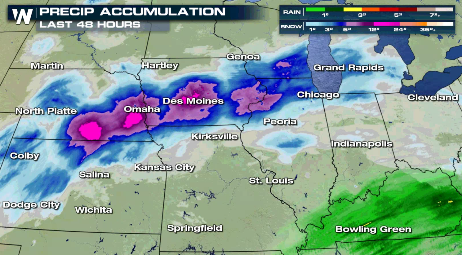
A strong winter storm brought heavy snow to the central Plains and western Great Lakes. Some of the highest snowfall accumulations were in Nebraska and Iowa where totals were over a foot.
RELATED ARTICLE - SNOW IN THE NORTHEAST AND MIDDLE ATLANTIC
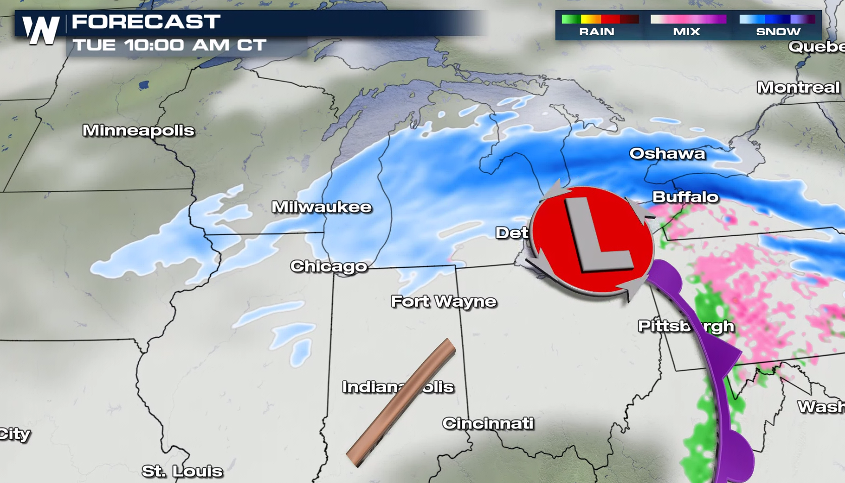 Precipitation begins to taper off today (Tuesday) as out low pressure center makes it's way through the Ohio Valley, but lingering snow will still be possible to the north. By afternoon, the heaviest of the snow comes to a close across the Midwest, with lingering snow near Lake Huron.
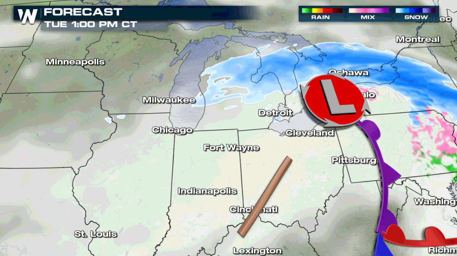
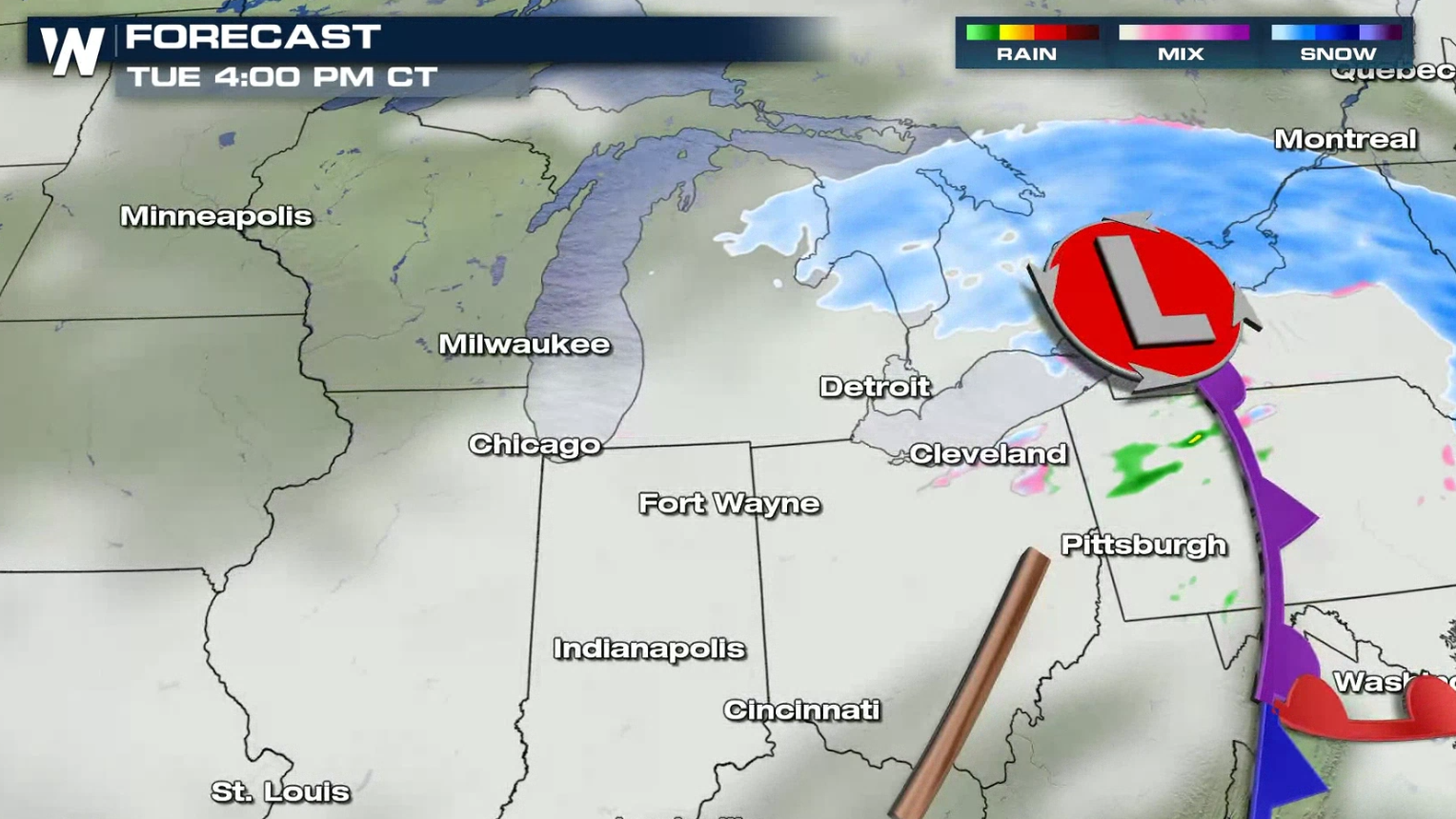
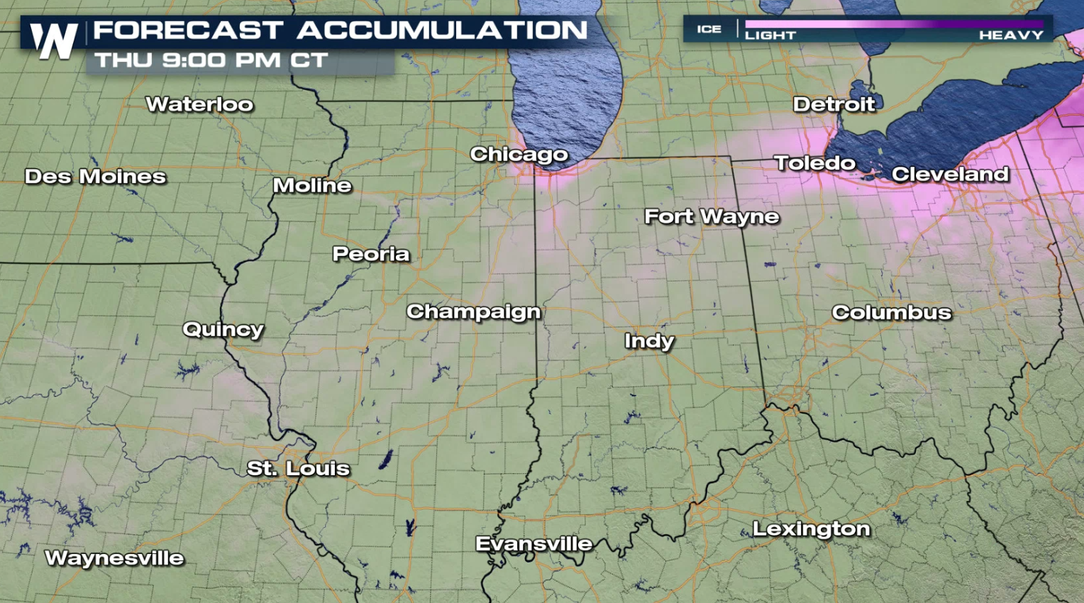
 Near Lake Michigan and Lake Erie, a coating of ice is possible. Amounts should be light.
 Stay with WeatherNation for all of the latest in the evolution and track of this particular winter storm as it moves into the Northeast and Middle Atlantic.
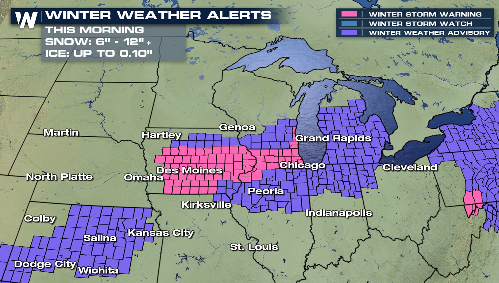
Winter Alerts
Winter Storm Warnings in pink have been issued through the Plains and Midwest where a couple inches of additional snowfall are possible today (Tuesday), along with strong wind gusts higher than 30 mph. Winter Weather Advisories have been issued in purple surrounding the warnings where we also mix in a wintry mix/icing element. More advisories have been extended eastward into the Ohio Valley and western Great Lakes as well.
Forecast
Note: For a closer look on some of these regions, scroll down to the end of the article.Tuesday Morning
Precipitation begins to taper off today (Tuesday) as out low pressure center makes it's way through the Ohio Valley, but lingering snow will still be possible to the north. By afternoon, the heaviest of the snow comes to a close across the Midwest, with lingering snow near Lake Huron.
Forecast Accumulation
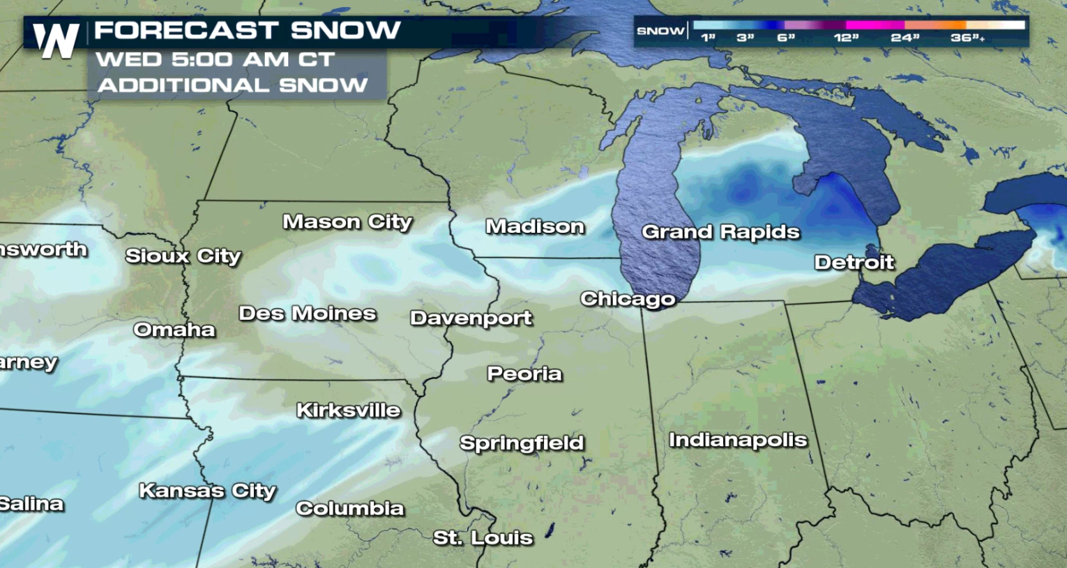
The heaviest snowfall today (Tuesday) will be in Lower Michigan where up to 6" may accumulate near Lake Michigan and Lake Huron. Lighter totals are possible in Wisconsin and Iowa.
Near Lake Michigan and Lake Erie, a coating of ice is possible. Amounts should be light.
Stay with WeatherNation for all of the latest in the evolution and track of this particular winter storm as it moves into the Northeast and Middle Atlantic.All Weather News
More

More Storms for the East Through Monday
A low-pressure system that moved through the
3 Aug 2026 12:20 PM


After Reaching Category 5, Genevieve Weakens in the Pacific
PacificGenevieve formed last Friday south of
3 Aug 2026 12:30 AM

Flooding, Severe Storms Target the Midwest Again
After an active week of storms across the nor
1 Aug 2026 1:40 AM

Flooding Risk Increases as Heavy Rain Targets the Tri-State Area
Tuesday, heavy rainfall moved across the Nort
30 Jul 2026 12:25 AM