Heavy, Wet Snow for the Great Lakes Today
Top Stories
4 Mar 2023 12:00 AM
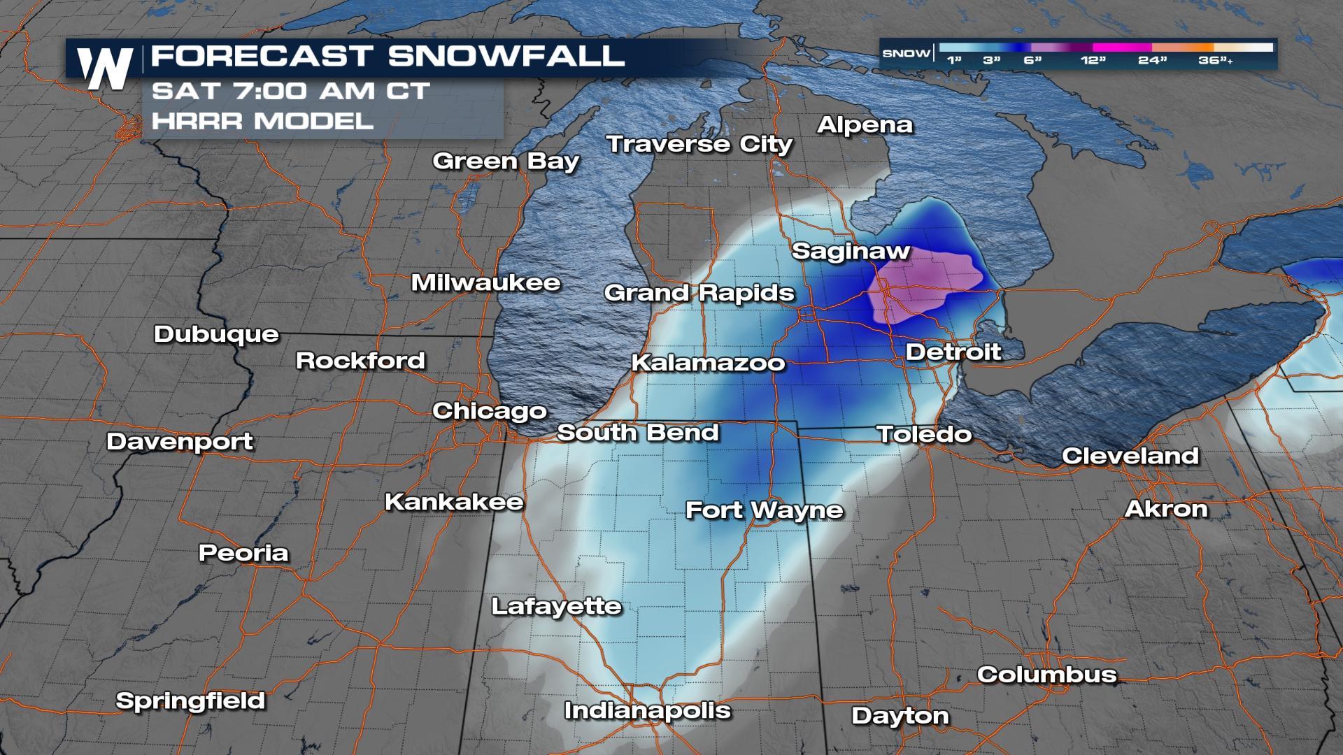
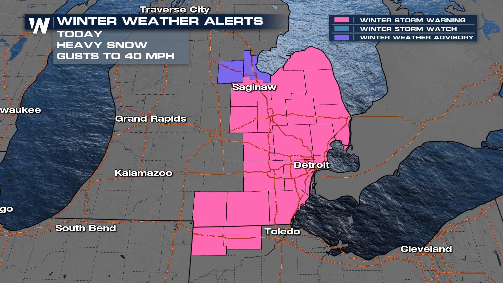
The area of low pressure producing rain through the Ohio Valley and severe weather in the south will combine with cold air in our atmosphere to produce potentially heavy snowfall through the Upper Great Lakes. This system is quickly coming to an end from west to east. According to reports, some locations in Michigan have already picked up about nine inches of snow.
Any additional snow will be light. Models are suggesting an additional one to three inches will still be possible before all of the energy move into the Northeast.
 For the latest, watch the Central Regional Forecast at :30 past the hour for updates.
All Weather News
More
More Storms for the East Through Monday
A low-pressure system that moved through the
2 Aug 2026 10:40 PM

Wildfire Outbreak in the Pacific Northwest
SPOKANE, WA - On Saturday, August 1st, the Ol
2 Aug 2026 10:35 PM


After Reaching Category 5, Genevieve Weakens in the Pacific
PacificGenevieve formed on last Friday south
2 Aug 2026 6:25 PM

Flooding, Severe Storms Target the Midwest Again
After an active week of storms across the nor
1 Aug 2026 1:40 AM

Flooding Risk Increases as Heavy Rain Targets the Tri-State Area
Tuesday, heavy rainfall moved across the Nort
30 Jul 2026 12:25 AM

Severe Weather: Energy From the Midwest Now in the Southeast
UPPER MIDWEST - Through Monday, dangerous tor
29 Jul 2026 10:30 PM