High Plains Severe Weather Risk to Start The Week
Special Stories
16 Jul 2018 11:36 AM
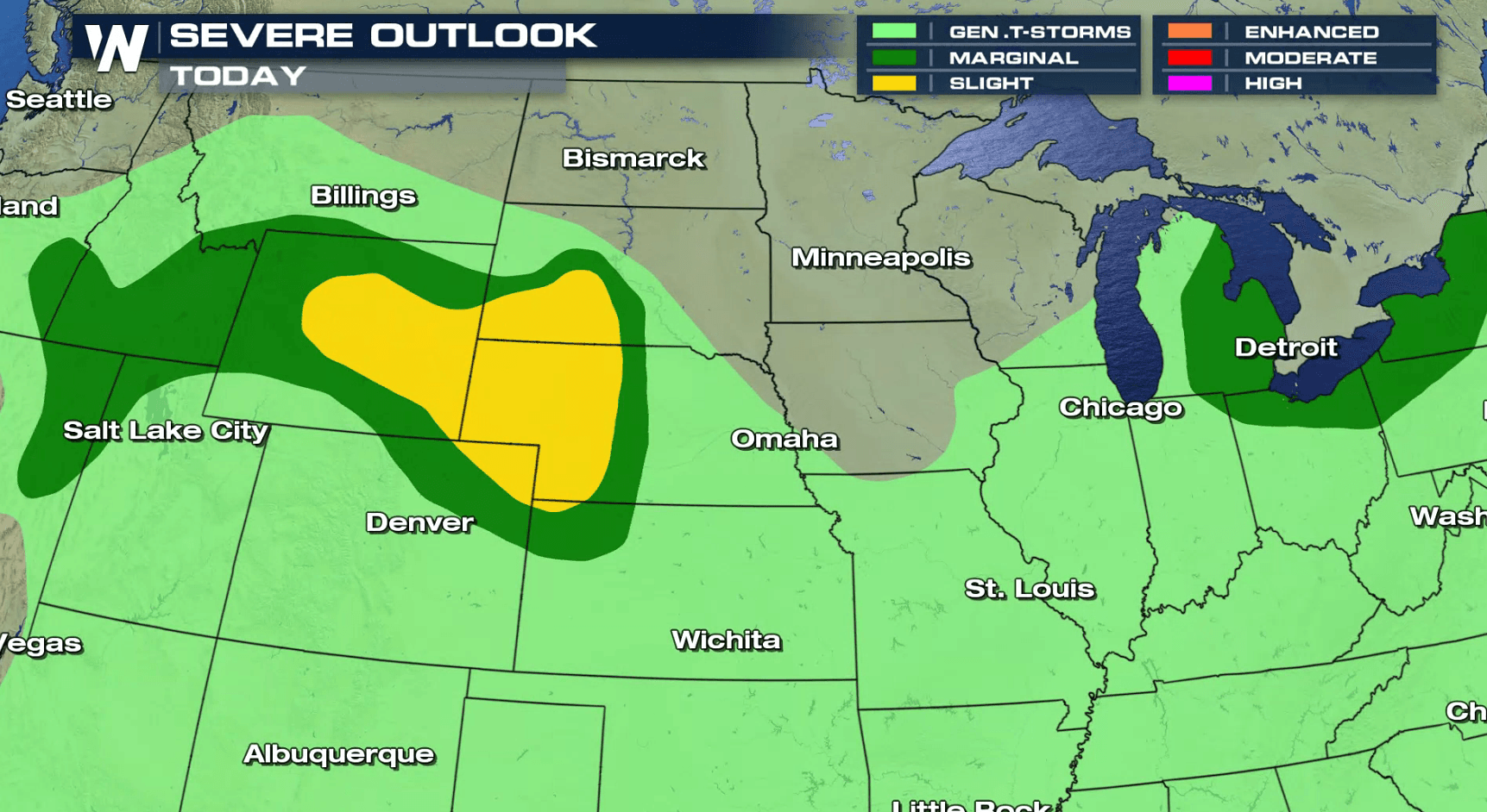
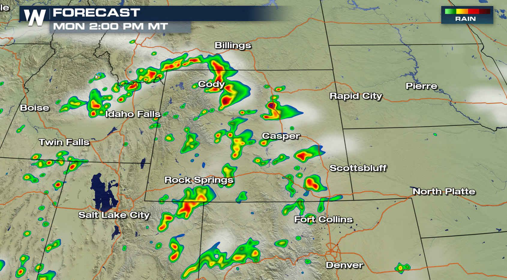
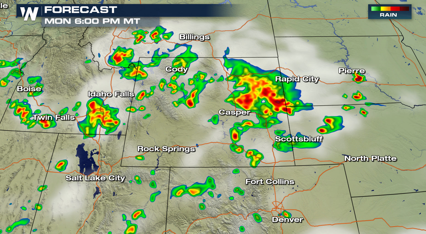
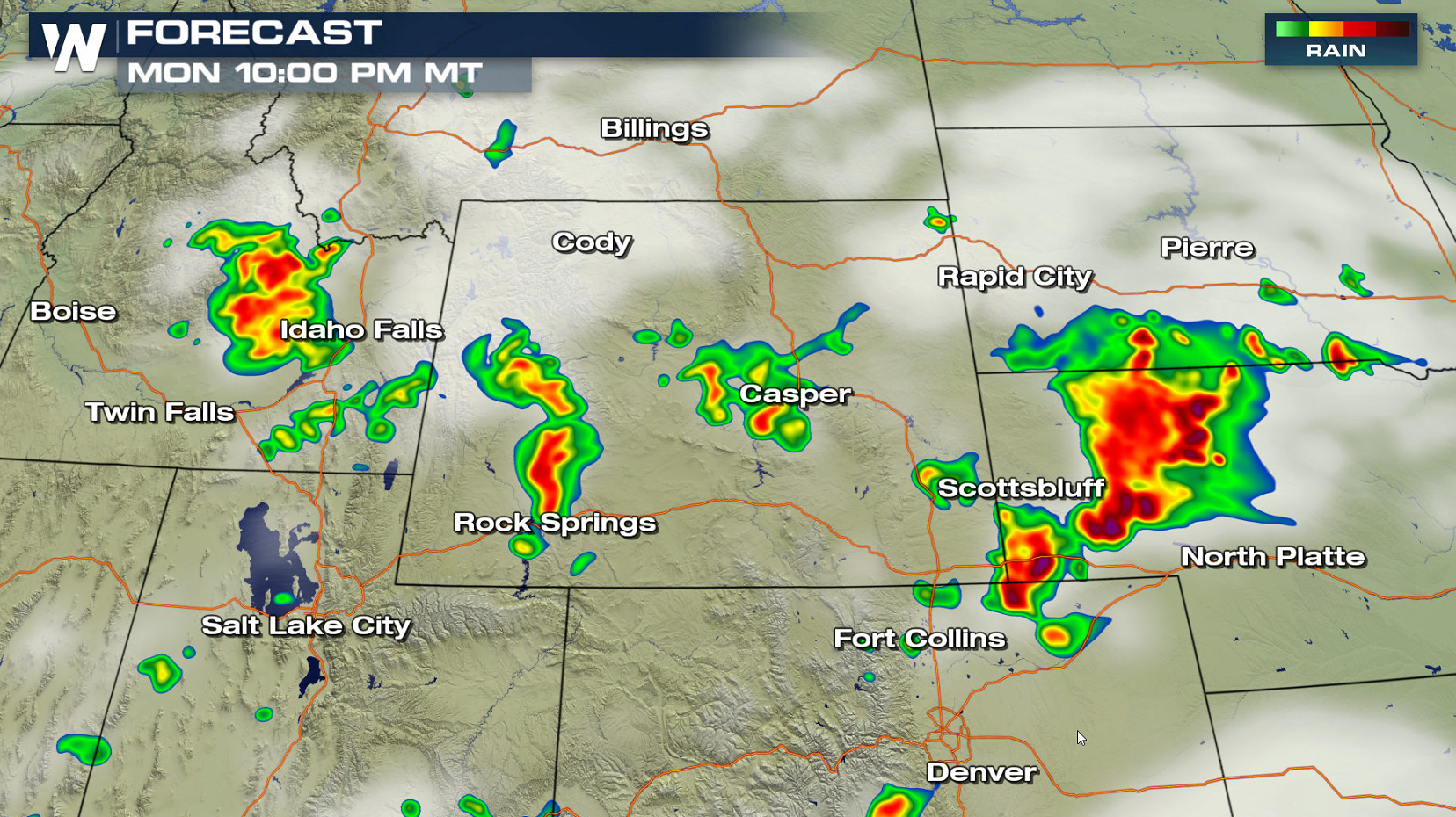
A storm system pushing out of the High Plains will bring a chance for severe thunderstorms later this afternoon and evening (Monday). A slight risk for severe thunderstorms extends from Wyoming to South Dakota and Kansas. Large hail and strong wind gusts are the biggest threats, with a low chance for a tornado.
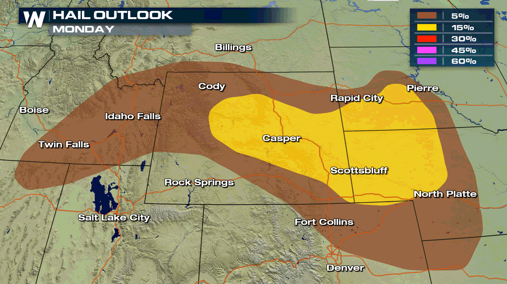
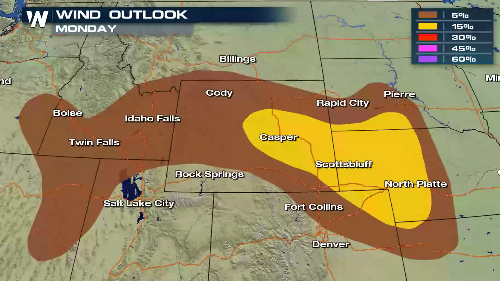
 A few storms will pop-up throughout the afternoon, with storm coverage becoming more widespread in the later afternoon and evening. Intensity will increase as well, as heat and humidity continues to build throughout the day.
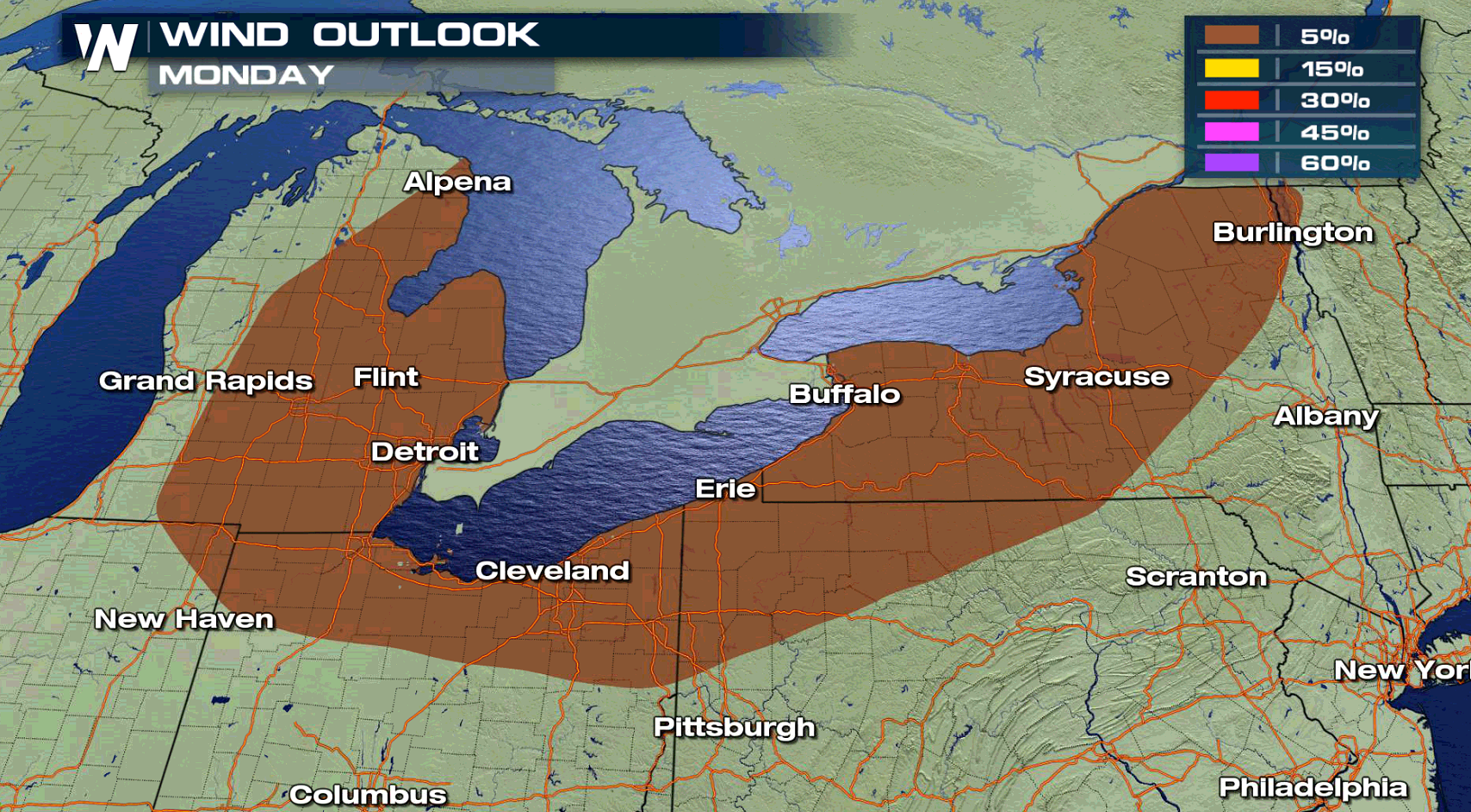
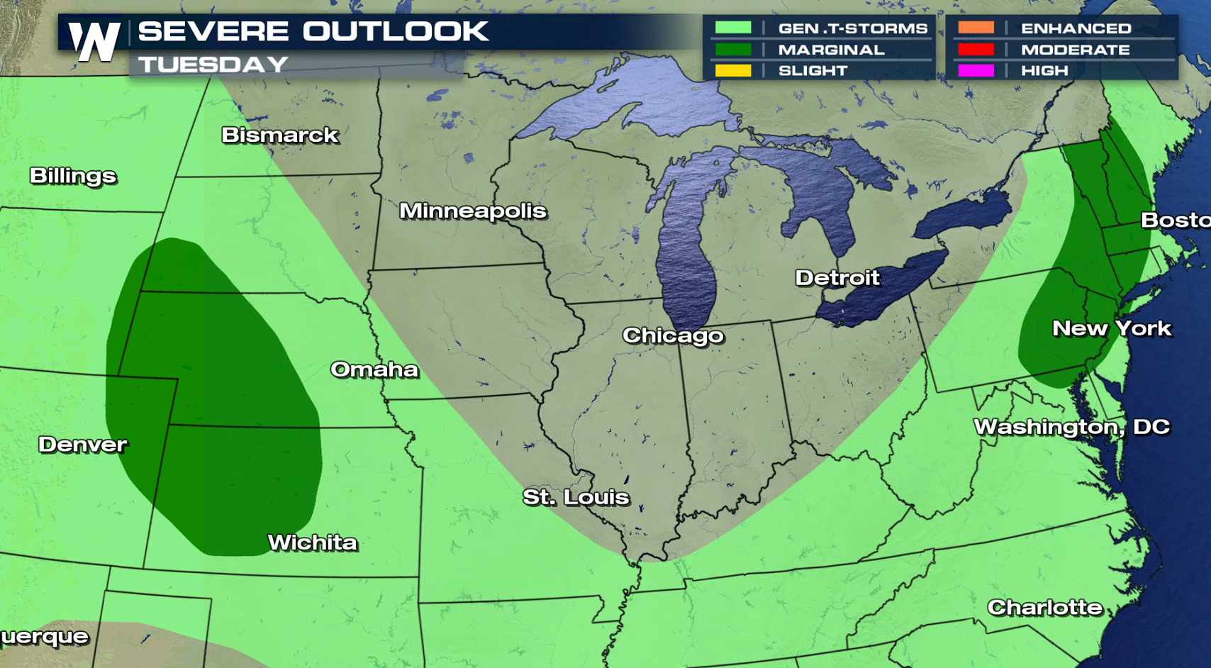
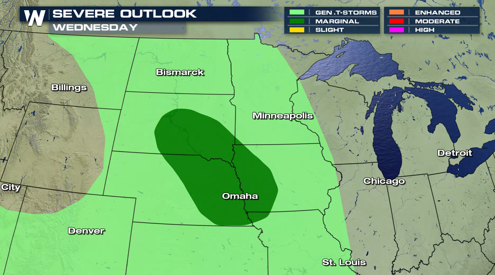
 The risk for severe thunderstorms diminishes for Tuesday and Wednesday, with a marginal risk posted both days from the Storm Prediction Center. The Northeast and Plains are the areas of concern.
 For WeatherNation: Meteorologist Mace Michaels
A few storms will pop-up throughout the afternoon, with storm coverage becoming more widespread in the later afternoon and evening. Intensity will increase as well, as heat and humidity continues to build throughout the day.
The risk for severe thunderstorms diminishes for Tuesday and Wednesday, with a marginal risk posted both days from the Storm Prediction Center. The Northeast and Plains are the areas of concern.
For WeatherNation: Meteorologist Mace Michaels
All Weather News
More
Fire Weather Continues This Weekend
Conditions have been really dry out west. We'
26 Jul 2026 10:40 AM

Heat Wave Grips Central, Western U.S.
Are you over the summer heat yet? The heat al
26 Jul 2026 10:35 AM

Tropics: Fausto Heads to Hawaii; Genevieve Will Become a Major Hurricane
Atlantic BasinBertha has dissipated after mov
26 Jul 2026 10:35 AM

Severe Storms Target the Midwest This Weekend
Extreme heat will be a big story this week ac
26 Jul 2026 10:30 AM

Southeast Flood Risk Lingers Near Stalled Front
A stalled boundary over the Southeast will ke
25 Jul 2026 10:55 AM

Another Round of Storms Targets the Northeast
Tuesday brought severe weather again across p
23 Jul 2026 1:15 AM

Another Round of Severe Weather for the Upper Midwest and Great Lakes
The upper-level low train continues to keep t
21 Jul 2026 1:45 AM