Ice, Snow and Rain for the Great Lakes

Top Stories
21 Nov 2023 2:30 PM
A messy system is hitting the Great Lakes and Midwest bringing the potential of heavy rain, snow, and a significant ice threat around northern and central Michigan (above). This will be a quick-moving system, producing snow and ice showers for the Great Lakes region today only. The storm system then pushes into the Northeast tonight into Wednesday with a drier and winder day expected by Wednesday
The heaviest snow will be for SW Wisconsin and the U.P. of Michigan with most other areas seeing rainfall.
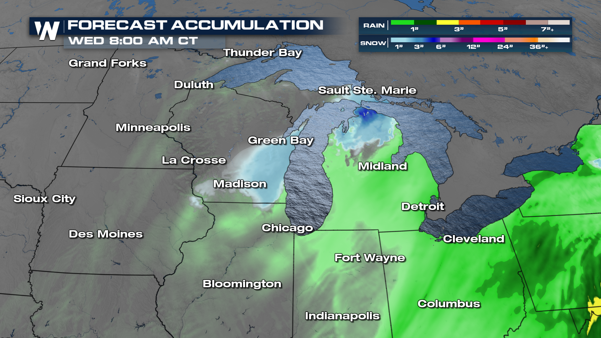
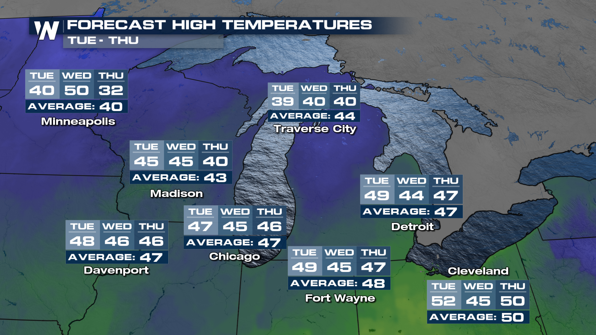
Temperatures will be cold enough to support snow and ice during the evening and overnight hours with daytime highs in the 30s and 40s, pretty typical for this time of year.
All Weather News
More
Wildfire Outbreak in the Pacific Northwest
SPOKANE, WA - On Saturday, August 1st, the Ol
3 Aug 2026 1:55 AM

More Storms for the East Through Monday
A low-pressure system that moved through the
3 Aug 2026 1:50 AM


After Reaching Category 5, Genevieve Weakens in the Pacific
PacificGenevieve formed last Friday south of
3 Aug 2026 12:30 AM

Flooding, Severe Storms Target the Midwest Again
After an active week of storms across the nor
1 Aug 2026 1:40 AM

Flooding Risk Increases as Heavy Rain Targets the Tri-State Area
Tuesday, heavy rainfall moved across the Nort
30 Jul 2026 12:25 AM

Severe Weather: Energy From the Midwest Now in the Southeast
UPPER MIDWEST - Through Monday, dangerous tor
29 Jul 2026 10:30 PM