La Nina Pattern Officially Over - ENSO Neutral in Place this Spring
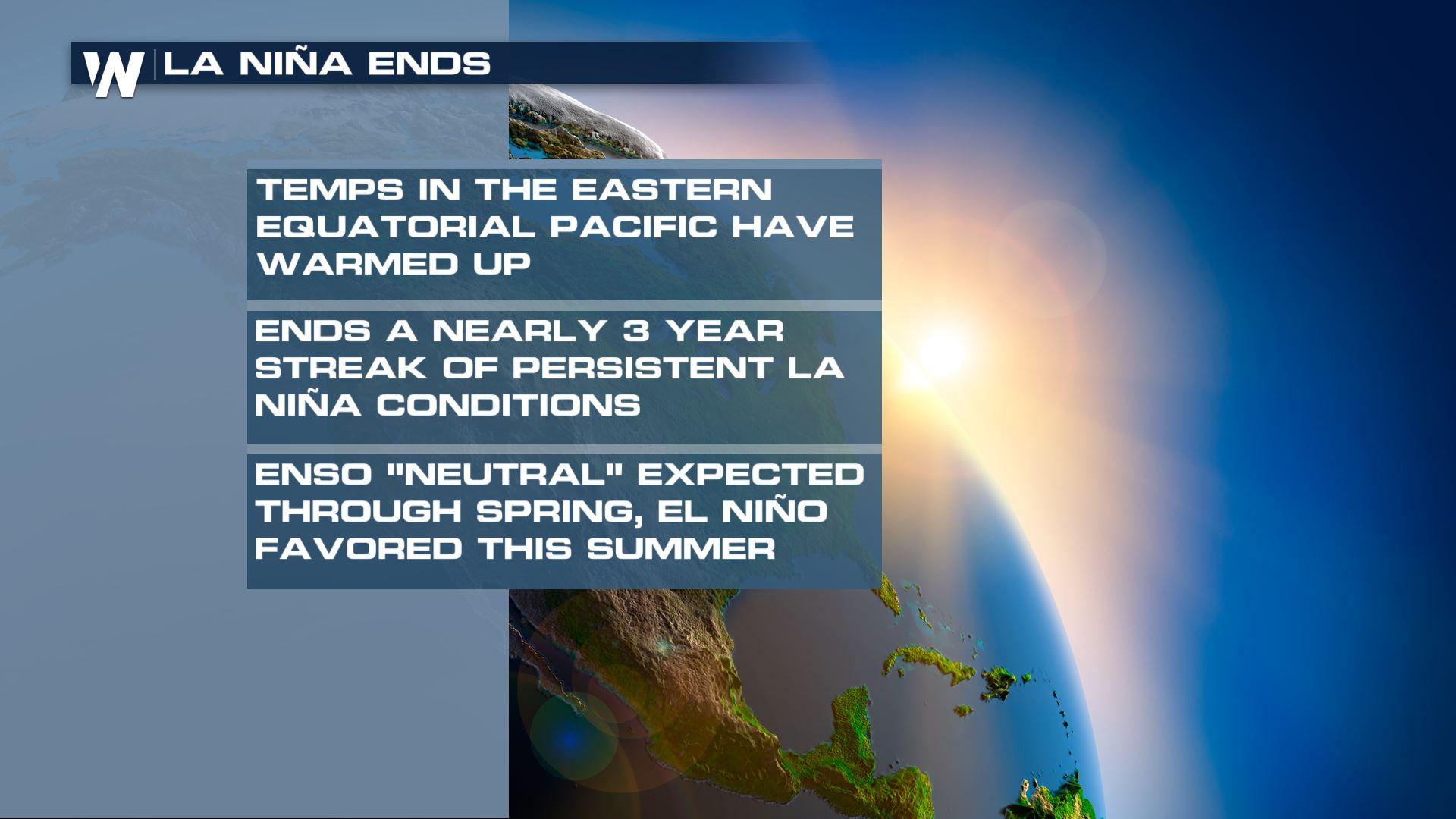
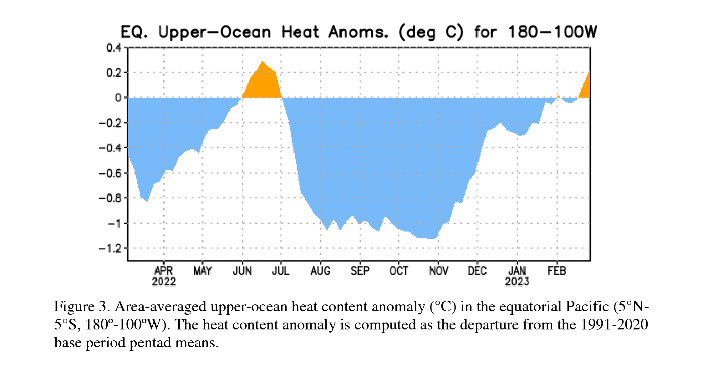
Consistent La Nina is officially over! According to the Climate Prediction Center (CPC), the La Nina pattern has ended and we are now into an "ENSO-neutral phase" which is expected to last into spring and early summer of this year. You can see the slight trend upwards in the surface temperatures over the last month compared to below average temperatures in this region of the ocean from the spring of 2022 to now. For the past year and a half we have seen cooler than average ocean temperatures in the Pacific which define a La Nina phase, in fact much of the last three years has been a La Nina with very small and short pockets of warming in the Pacific.
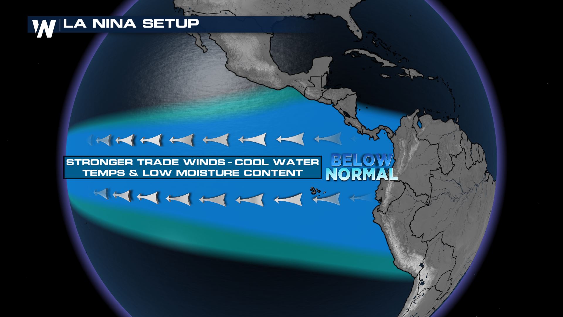
 Both of these are part of the El Nino Southern Oscillation (ENSO) global climate pattern, which is defined by temperatures in the equatorial pacific and the atmospheric interactions. Phases of ENSO have impacts on the jet stream and subsequent weather patterns in the United States. La Nina is defined by cooler than average temperatures in the Pacific which generally leads to a wetter NW, cooler central U.S. and drier than average Southeast in the United States winters. During the summer, La Nina contributes to an active Atlantic Hurricane season. The last three years have all been La Nina patterns.
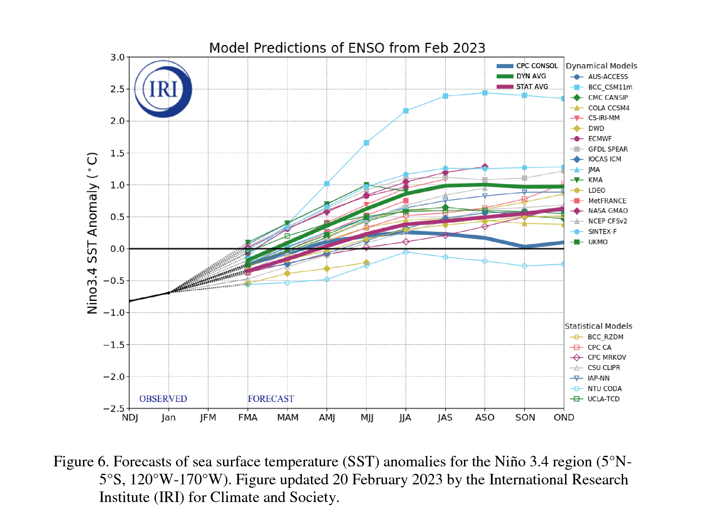
 Scientists at the CPC have found that in the most recent measurements sea surface temperatures in the central and eastern Pacific are warming slowly above average. Additionally, the atmosphere is lagging behind the ocean waters, displaying a typical ENSO neutral phase. Forecast models however, are pointing towards an ENSO neutral transitioning into the El Nino phase late summer and fall. Confidence in these forecasts is not as high as predictions in the Spring are less accurate, according to the CPC. All the lines are various forecast models and their predictions into the end of the year. Most are trending in warmer than average sea surface temperatures, but there is a wide spread on how much that anomaly will be and when it kicks in.
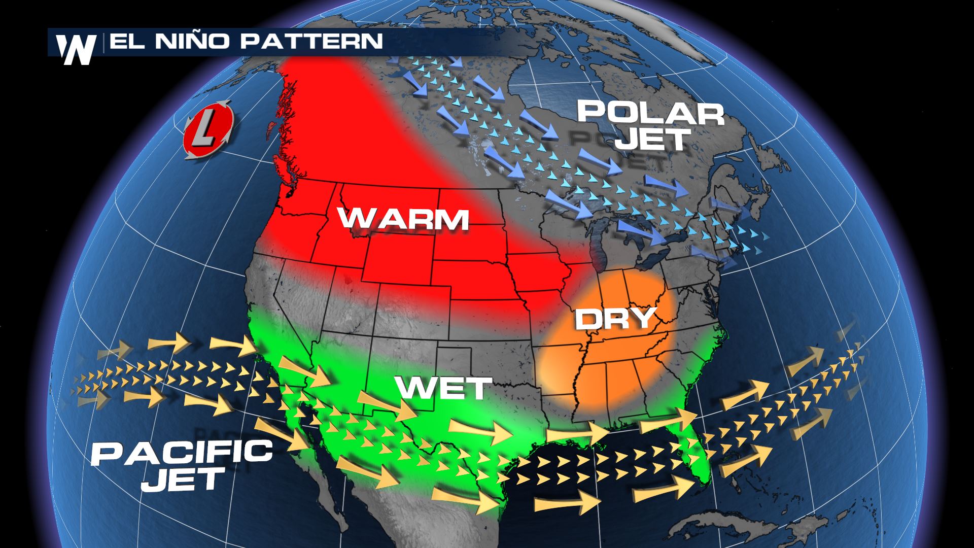
What does ENSO neutral and El Nino mean for our weather in the U.S.? During an ENSO neutral we anticipate, well, neutral conditions, with no real bias on the track of weather patterns. However, these phases are most pronounced during the winter months, so this Spring we shouldn't feel too many impacts or changes as a result of ENSO-neutral. If we transition into fall and winter in the El Nino pattern we expect to see a less active Atlantic Hurricane season due to more shear in the environment. On the flip side, the Eastern Pacific hurricane season tends to be more active. In the winter months we usually see a warmer than average northcentral & northwest U.S. with dry conditions into the Ohio and Mississippi valleys. El Nino leads to a more southern jet stream, bringing more storms into the Southwest/4 Corners and across the Deep South. Of course, these are historical trends, and not official forecasts as the weather depends greatly on additional global and smaller patterns.
More information can be found through the Climate Prediction Center and the ENSO Blog on climate .gov. For the latest weather conditions, join WeatherNation streaming 24/7.


