Lane Weakens to a Tropical Storm
Special Stories
24 Aug 2018 8:42 PM
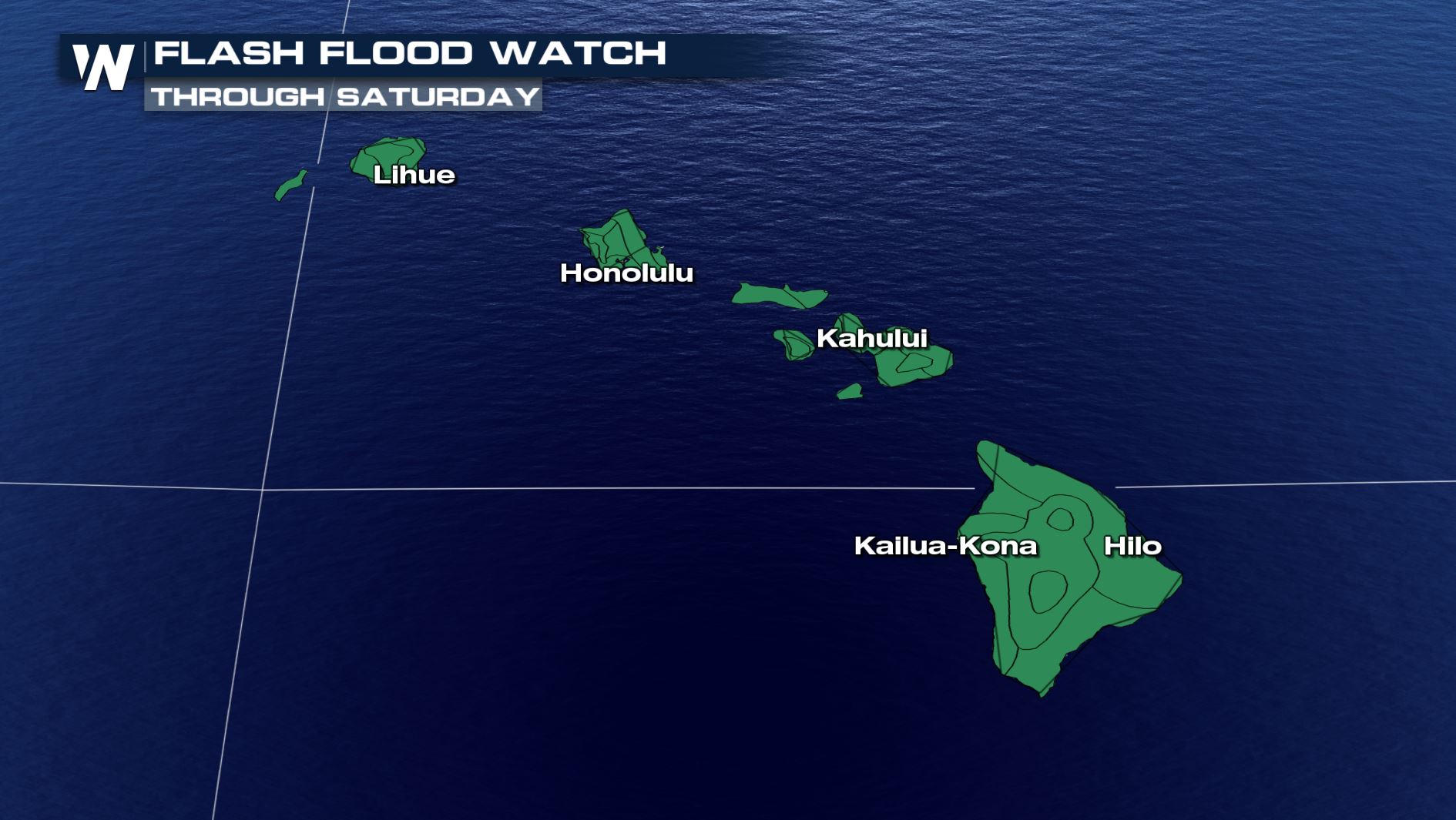
Lane may have weakened rapidly, but the hazards have not dropped off just yet. We must still be on alert for additional flooding rains, mud or landslides and dangerous surf.
 Lane's statistics as of 5 p.m. Hawaiian Time Friday, August 24
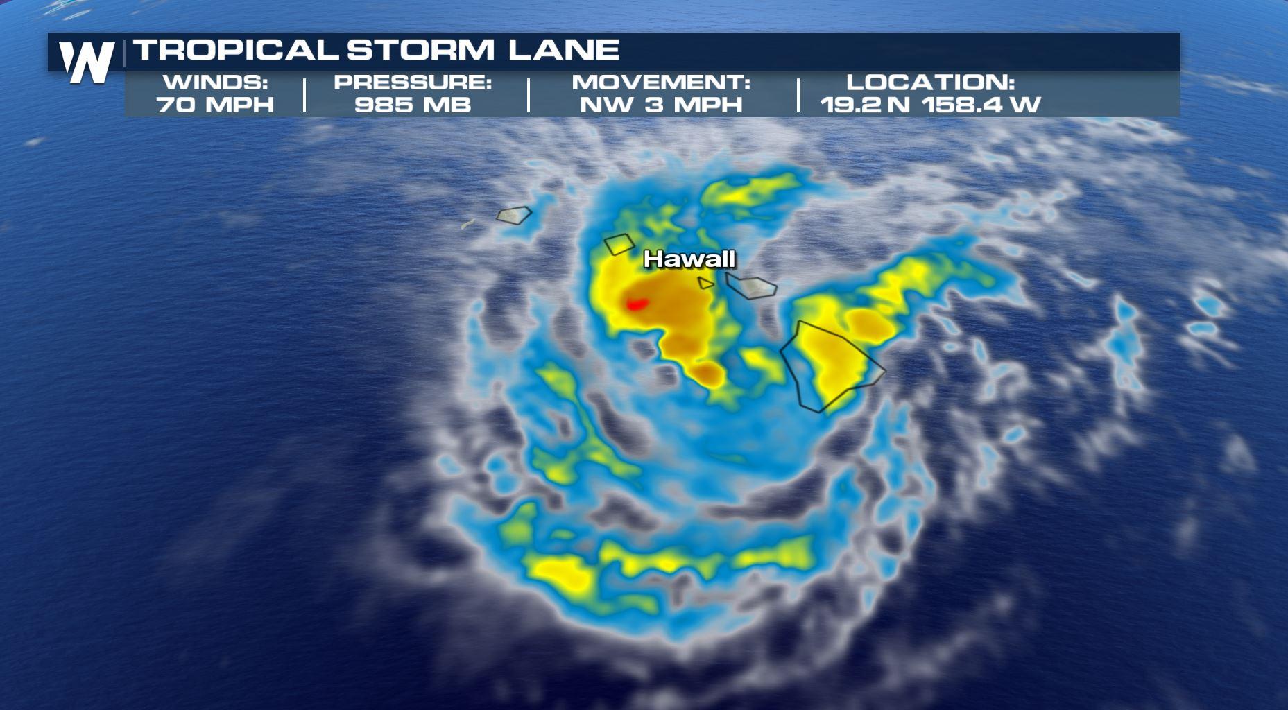
The National Hurricane Center's advisory as of 5 p.m. Hawaiian Time Friday pegged the maximum sustained winds at 70 mph and its movement to the northwest around 3 mph.
Lane's statistics as of 5 p.m. Hawaiian Time Friday, August 24
The National Hurricane Center's advisory as of 5 p.m. Hawaiian Time Friday pegged the maximum sustained winds at 70 mph and its movement to the northwest around 3 mph.
 Lane's forecast track Saturday-Sunday, August 25-26
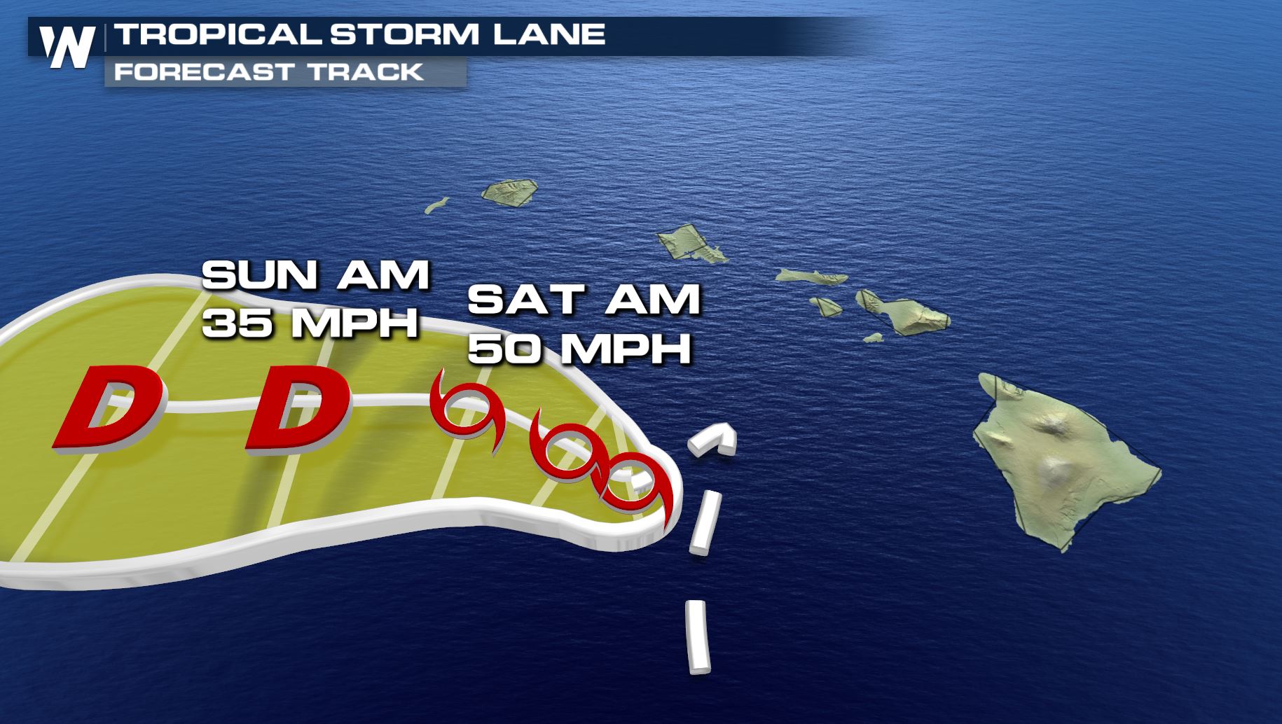
Lane was a major hurricane earlier in the day. As of the 2 a.m. HT Friday advisory, Lane had maximum sustained winds of 120 mph! The significant weakening was due to land interaction with the mountainous Hawaiian islands as well as intense atmospheric wind shear.
Lane's forecast track Saturday-Sunday, August 25-26
Lane was a major hurricane earlier in the day. As of the 2 a.m. HT Friday advisory, Lane had maximum sustained winds of 120 mph! The significant weakening was due to land interaction with the mountainous Hawaiian islands as well as intense atmospheric wind shear.
 Additional rainfall from Friday night through Sunday night, August 24-26
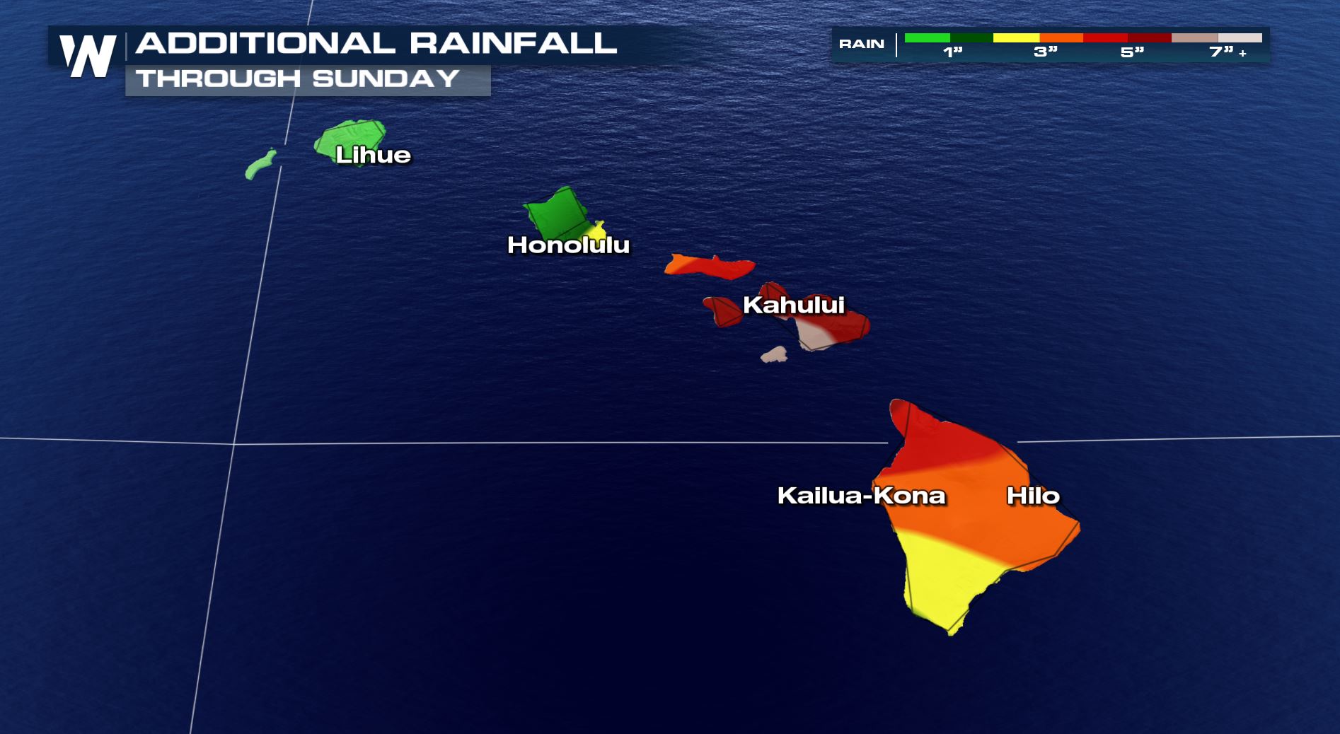
Continued weakening is expected through the weekend. However, we cannot let our guard down just yet! When hurricanes weaken to tropical storms, they can still produce dangerous flooding. This will be the possibility for Hawaii Saturday and Sunday. Up to 30 inches of rain has already fallen on the Big Island, while nearby islands remain soaked in spots. Additional rainfall may not need to accumulate that much to produce flooding or mudslides.
Continue to heed advice from local officials regarding the latest on Lane and what to do. We're not through with this system yet, as it will impact our weekend ahead. Continue to stay with WeatherNation as conditions slowly improve!
For WeatherNation, Meteorologist Steve Glazier
Additional rainfall from Friday night through Sunday night, August 24-26
Continued weakening is expected through the weekend. However, we cannot let our guard down just yet! When hurricanes weaken to tropical storms, they can still produce dangerous flooding. This will be the possibility for Hawaii Saturday and Sunday. Up to 30 inches of rain has already fallen on the Big Island, while nearby islands remain soaked in spots. Additional rainfall may not need to accumulate that much to produce flooding or mudslides.
Continue to heed advice from local officials regarding the latest on Lane and what to do. We're not through with this system yet, as it will impact our weekend ahead. Continue to stay with WeatherNation as conditions slowly improve!
For WeatherNation, Meteorologist Steve Glazier
Lane's statistics as of 5 p.m. Hawaiian Time Friday, August 24
The National Hurricane Center's advisory as of 5 p.m. Hawaiian Time Friday pegged the maximum sustained winds at 70 mph and its movement to the northwest around 3 mph.
Lane's forecast track Saturday-Sunday, August 25-26
Lane was a major hurricane earlier in the day. As of the 2 a.m. HT Friday advisory, Lane had maximum sustained winds of 120 mph! The significant weakening was due to land interaction with the mountainous Hawaiian islands as well as intense atmospheric wind shear.
Additional rainfall from Friday night through Sunday night, August 24-26
Continued weakening is expected through the weekend. However, we cannot let our guard down just yet! When hurricanes weaken to tropical storms, they can still produce dangerous flooding. This will be the possibility for Hawaii Saturday and Sunday. Up to 30 inches of rain has already fallen on the Big Island, while nearby islands remain soaked in spots. Additional rainfall may not need to accumulate that much to produce flooding or mudslides.
Continue to heed advice from local officials regarding the latest on Lane and what to do. We're not through with this system yet, as it will impact our weekend ahead. Continue to stay with WeatherNation as conditions slowly improve!
For WeatherNation, Meteorologist Steve GlazierAll Weather News
More
More Storms for the East Through Monday
A low-pressure system that moved through the
3 Aug 2026 12:20 PM


After Reaching Category 5, Genevieve Weakens in the Pacific
PacificGenevieve formed last Friday south of
3 Aug 2026 12:30 AM

Flooding, Severe Storms Target the Midwest Again
After an active week of storms across the nor
1 Aug 2026 1:40 AM

Flooding Risk Increases as Heavy Rain Targets the Tri-State Area
Tuesday, heavy rainfall moved across the Nort
30 Jul 2026 12:25 AM

Severe Weather: Energy From the Midwest Now in the Southeast
UPPER MIDWEST - Through Monday, dangerous tor
29 Jul 2026 10:30 PM