Let The Lake Effect Begin!
Special Stories
8 Nov 2019 9:10 AM
Headline video courtesy Instagram user Lee Bocklund
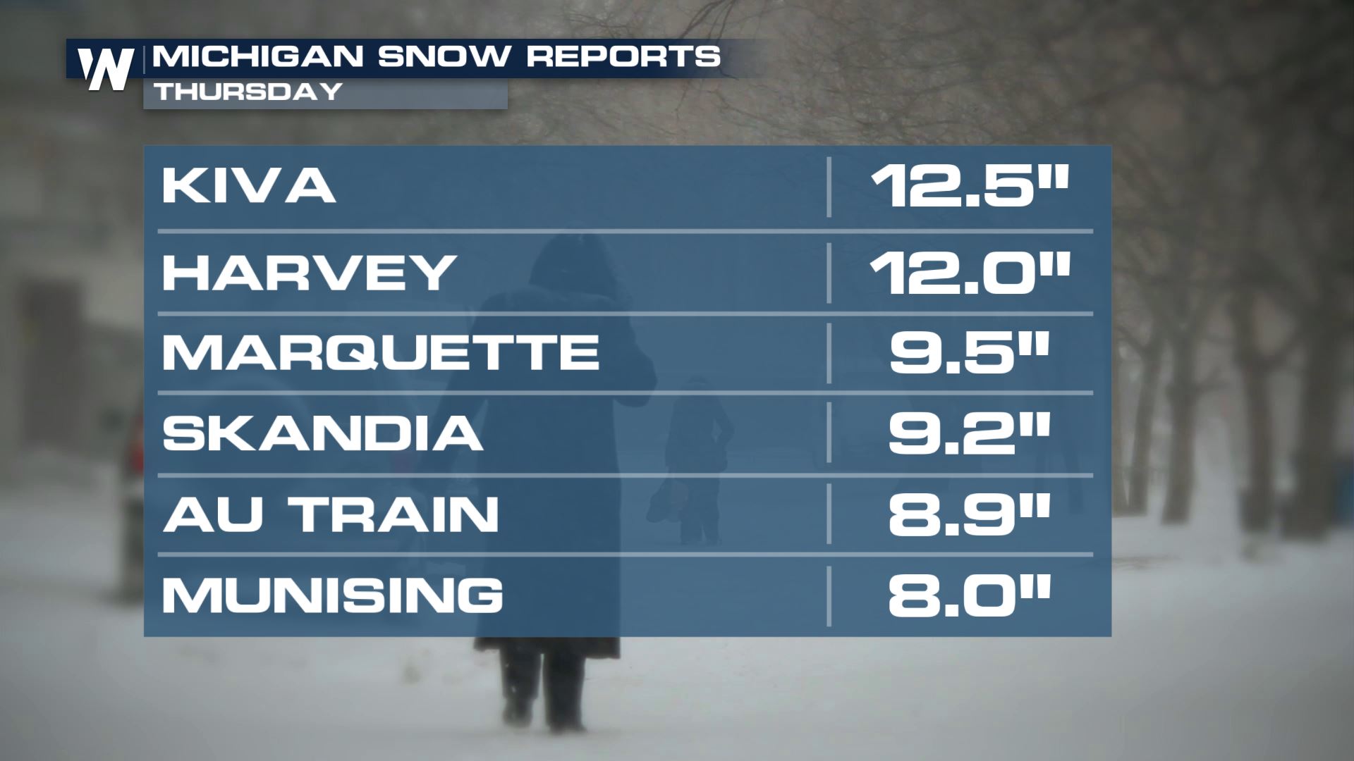
The lake effect snow season is off to a quick and heavy start across the state of Michigan. Marquette led some of the snow totals between Wednesday-Thursday, November 6-7 coming in with 9.5".
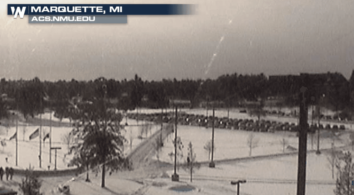
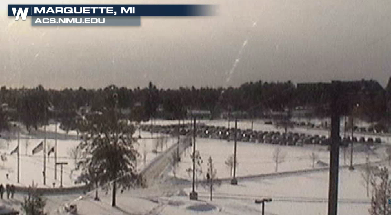
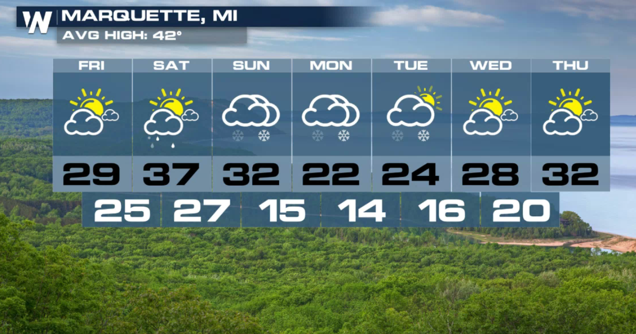
 The scene in Marquette was looking much more winter-like this morning (Friday).
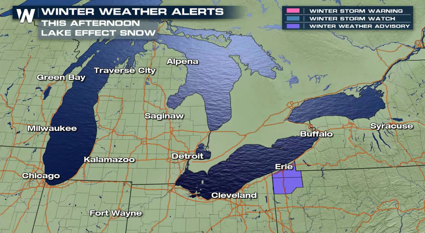
 Winter weather alerts continue near Erie, PA into this afternoon (Friday). A narrow band of snow will produce up to 3" of snowfall by this evening.
 The snow was very heavy Thursday due to the effect off of the lake. The lakes we are mentioning are Lake Superior and Lake Michigan. Snow bands set up Thursday with the help of strong winds and cold air to produce locally heavy snow bands.
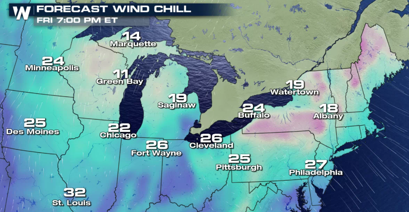 Those same winds will bring in colder air for all of the Great Lakes and Northeast regions into this weekend. Dress appropriately!
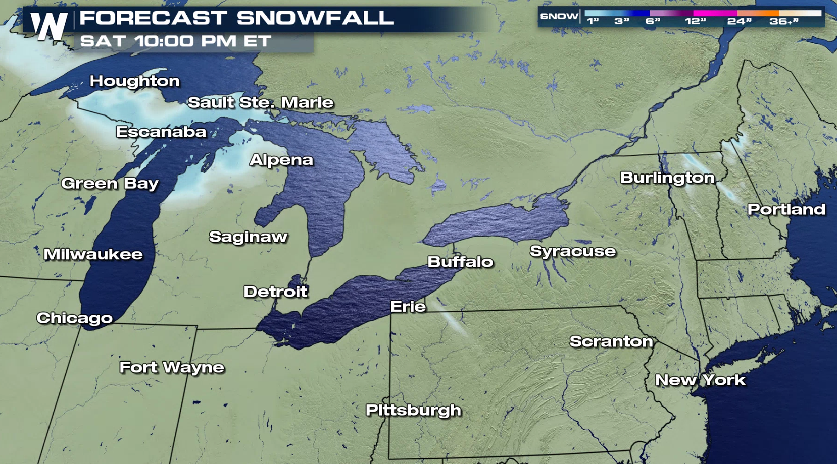
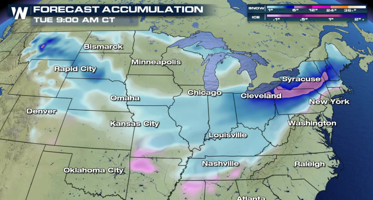
 Lake effect snow showers will end by tonight but not for long. Another low pressure system will bring widespread snow showers Saturday and Sunday, then heavy lake effect bands will be likely on Monday and Tuesday for the Great Lakes region.
 November is one of the months for the best conditions to create lake effect snow as the open waters are still relatively mild, plus there are more impulses of cold air from Canada. The result will be more frequent, heavy snow bands this month!
The scene in Marquette was looking much more winter-like this morning (Friday).
Winter weather alerts continue near Erie, PA into this afternoon (Friday). A narrow band of snow will produce up to 3" of snowfall by this evening.
The snow was very heavy Thursday due to the effect off of the lake. The lakes we are mentioning are Lake Superior and Lake Michigan. Snow bands set up Thursday with the help of strong winds and cold air to produce locally heavy snow bands.
Those same winds will bring in colder air for all of the Great Lakes and Northeast regions into this weekend. Dress appropriately!
Lake effect snow showers will end by tonight but not for long. Another low pressure system will bring widespread snow showers Saturday and Sunday, then heavy lake effect bands will be likely on Monday and Tuesday for the Great Lakes region.
November is one of the months for the best conditions to create lake effect snow as the open waters are still relatively mild, plus there are more impulses of cold air from Canada. The result will be more frequent, heavy snow bands this month!All Weather News
More
Tropics: Tropical Storm Bertha Forms In the Atlantic, Eastern Pacific Active
In the Atlantic basin, we are keeping a very
21 Jul 2026 2:00 AM

Another Round of Storms Targets the Northeast
Another cold front is dropping east and will
21 Jul 2026 2:00 AM

Another Round of Severe Weather for the Upper Midwest and Great Lakes
The upper-level low train continues to keep t
21 Jul 2026 1:45 AM

Severe Storm Threat Continues for North Carolina
A slow-moving front has one more day's worth
20 Jul 2026 10:35 PM

Air Quality Improvements in the Forecast
Wildfires burning in Northwestern Ontario, Ca
20 Jul 2026 7:20 PM

Monsoon Moisture Brings Weekend Flood Threat
The monsoon has returned to the southwestern
19 Jul 2026 1:30 AM

After Historic Flooding, Flood Risk Moves West Saturday
TEXAS HILL COUNTRY - Life-threatening floodin
18 Jul 2026 1:00 AM