Looking Back at Historic Hurricane Maria
Two years ago, Maria made landfall on Puerto Rico as a major category 4 hurricane. It is by far the most destructive hurricane to hit Puerto Rico in modern times. The NOAA estimate of damage in Puerto Rico and the U.S. Virgin Islands is 90 billion dollars, making Maria the third costliest hurricane in U.S. history.
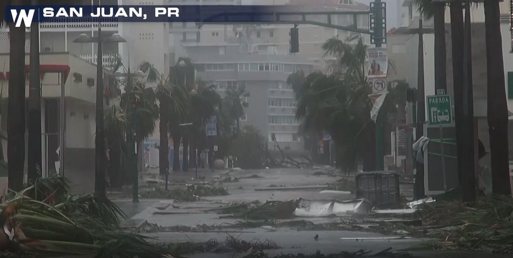
The devastating power of ferocious winds, storm surge, and wave action, combined to produce extensive damage to buildings, homes, and roads. Marinas and harbors were also severely damaged. River flooding was unprecedented in some areas, especially in the northern portion of the island. Maria knocked down 80 percent of Puerto Rico’s utility poles and all transmission lines, resulting in the loss of power to virtually all of the island’s 3.4 million residents. Practically all cell phone service was lost, and public water supplies were knocked out. 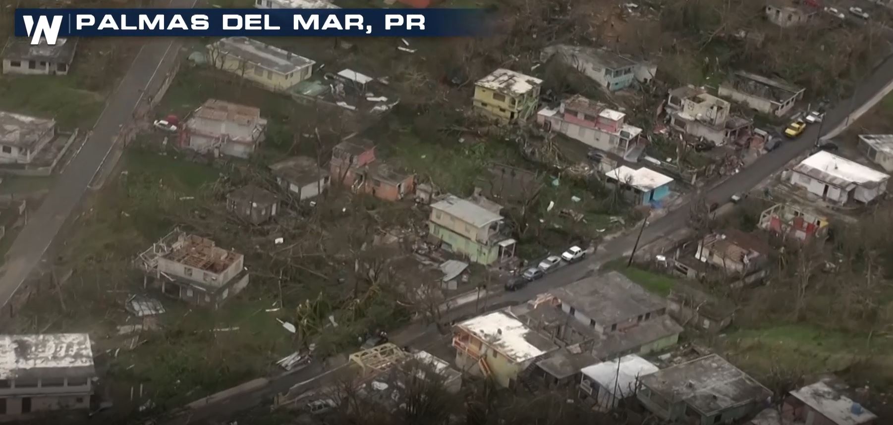
STORM PATH
Maria began as a well defined tropical wave, that moved off the west coast of Africa on September 12th, 2017. For the next several days, the system moved over warm tropical Atlantic waters, producing showers and thunderstorms, and becoming more organized. On September 16th, Tropical Storm Maria formed, and quickly intensified into a hurricane the following day. It then moved northwest toward the Lesser Antilles. On September 18th, Maria made landfall on Dominica as a Category 5 Hurricane. Damage on the island was catastrophic. Two days later, on September 20th, Maria made landfall in Puerto Rico as a Category 4 hurricane. Winds were measured at 155 mph, just 2 mph below category 5 strength. Maria's center crossed the southeast coast near Yabucoa. The center of the hurricane crossed the island diagonally, from southeast to northwest. 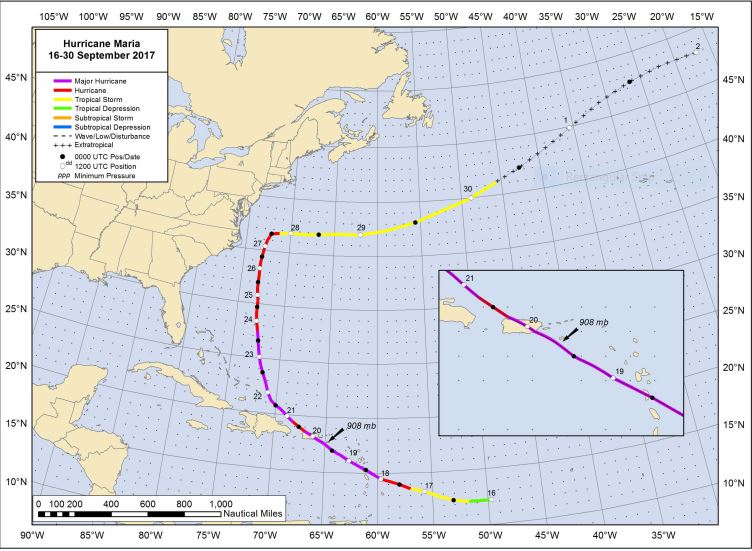 Credit: National Hurricane Center Here is the radar image from September 20th, just before landfall in southeastern Puerto Rico. You can see the dominant outer eye wall just offshore. This was the last image taken before the radar installation was destroyed.
 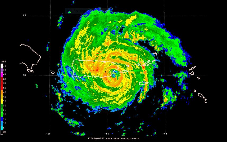 Credit: National Hurricane Center Below is a photo of the San Juan WSR-88D radar after the storm. While the tower is still standing, the doppler radar dome, and the radar itself, has been completely blown away.
 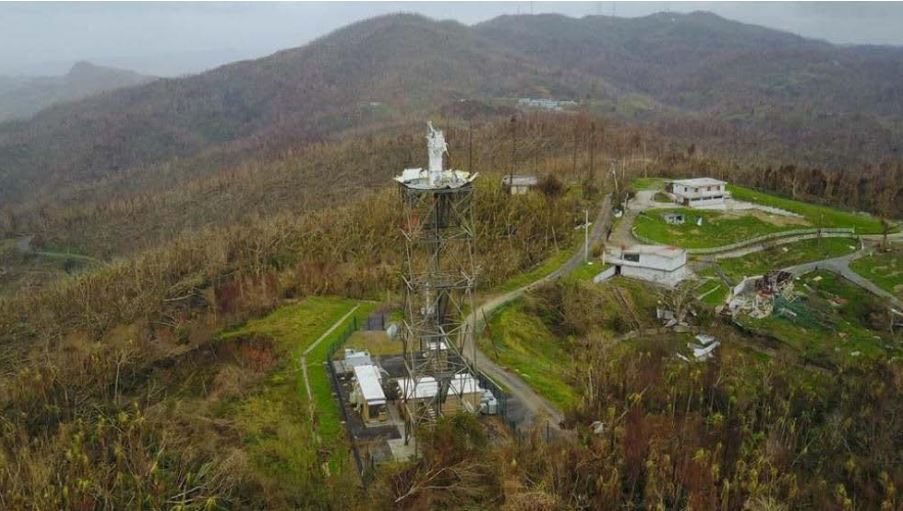 Credit: WFO San Juan STORM SURGE: One of the most devastating parts of a hurricane, is the storm surge. Winds from the storm caused sea levels to rise, and pushed the water inland. In southeastern Puerto Rico, the combined effect of the storm surge and tides, produced maximum inundation levels of 6 to 9 feet above ground level. The highest surge levels were to the north of Maria’s landfall, along the coasts of Humacao, Naguabo, and Ceiba municipalities in Puerto Rico. Storm surge levels were lower on the northern and western sides of the island, in the 1 to 4 foot range. The southern side of the island had surge levels in the 3 to 5 foot range.
 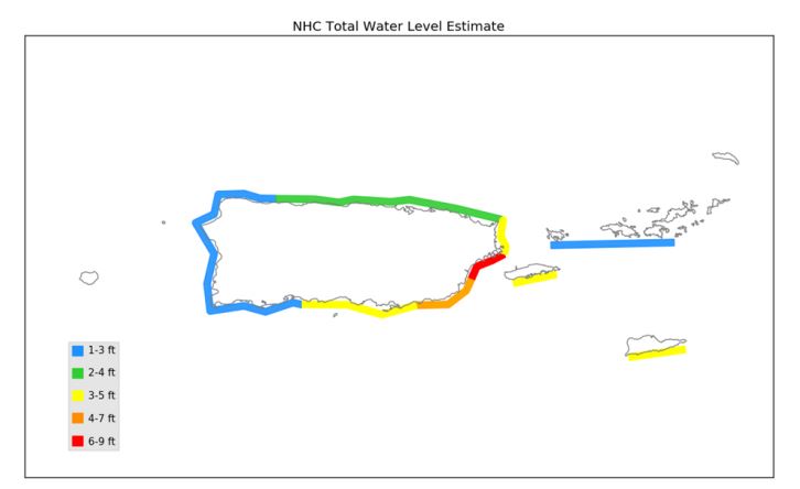 Credit: NHC Storm Surge Unit RAINFALL: Maria produced incredibly heavy rainfall. Much of the interior of the island received over 20 inches of rain. The town of Caguas received the most rain, 37.90 inches! The rain led to river levels that were at record or near-record heights in many locations. Severe flooding and mud slides affected most of the island. The most significant flooding occurred with the La Plata River.
 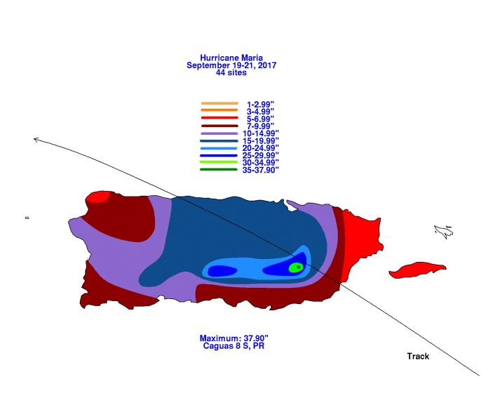 Credit: David Roth, NOAA Weather Prediction Center DEATH TOLL: Puerto Rico suffered tremendous damage to property and infrastructure. But the greatest tragedy was the loss of life. In Puerto Rico, the death toll is highly uncertain. The official number of fatalities stands at 65. This includes an unknown number of indirect deaths. However, hundreds of additional indirect deaths in Puerto Rico may eventually be attributed to Maria’s aftermath, pending the results of an official government review.


