Major Cooldown & Storms for the Plains Today
Top Stories
9 Sep 2022 3:59 PM
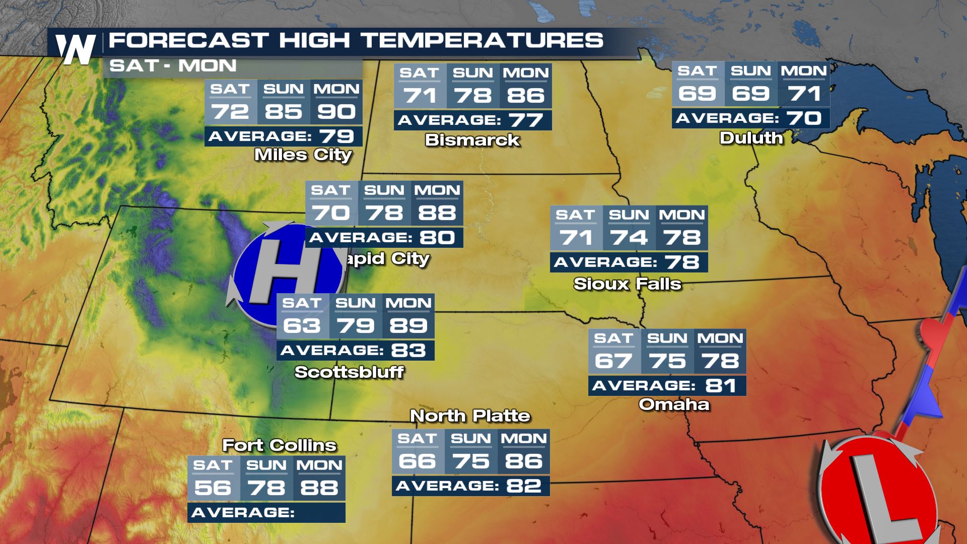
The powerful high pressure that brought so much heat to the Northwest is finally weakening! An area of low pressure will sneak over the ridge and bring back cooler weather - check out the highs for Rapid City, SD (above)! HUGE temperature drops are ahead for the region. Fall is arriving with quite the style across the northern Rockies! That cooler air will make it into the Dakotas and Minnesota today as the frontal boundary progresses across the country.
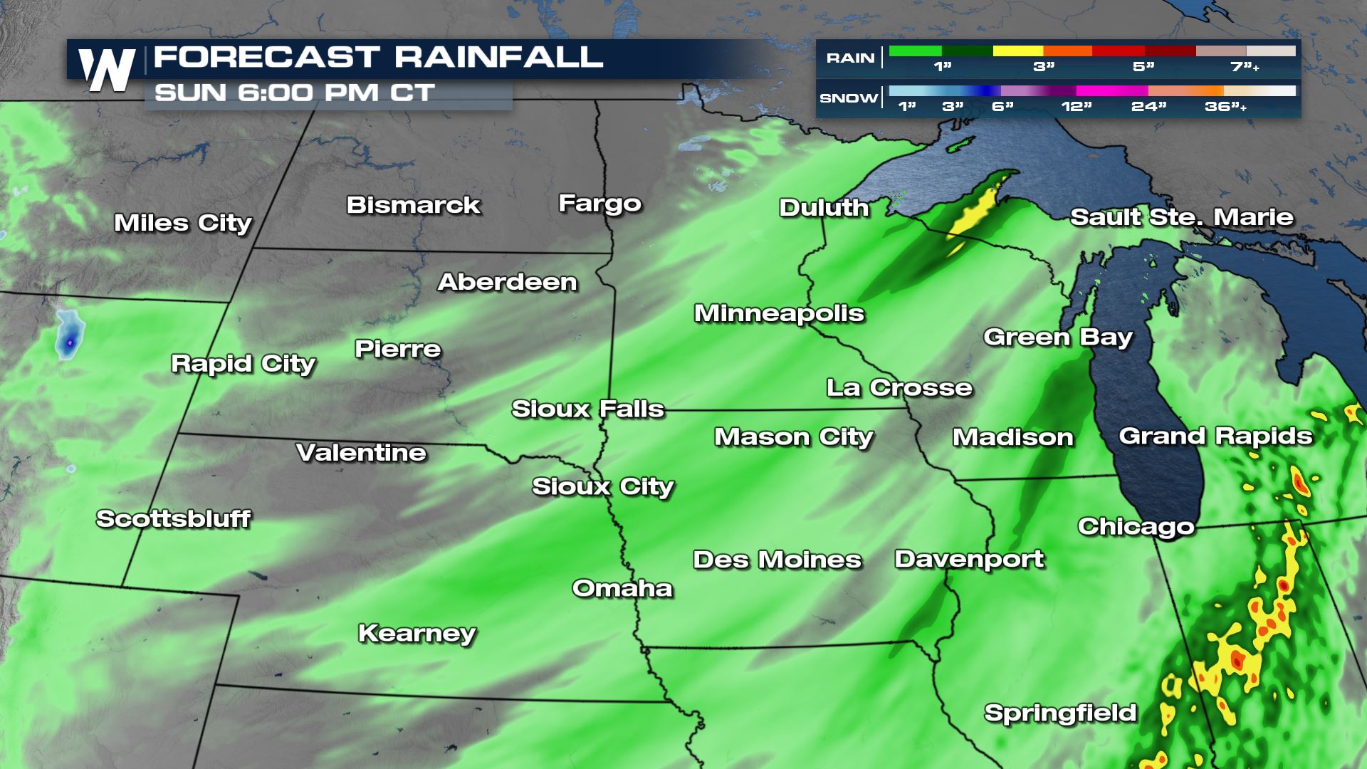
 Heavy rain will be the focus for most, along the entire frontal boundary this afternoon and evening with locally heavy rain creating flood concerns. This rainfall is desperately needed for the High Plains where drought conditions are expanding deep into the September.
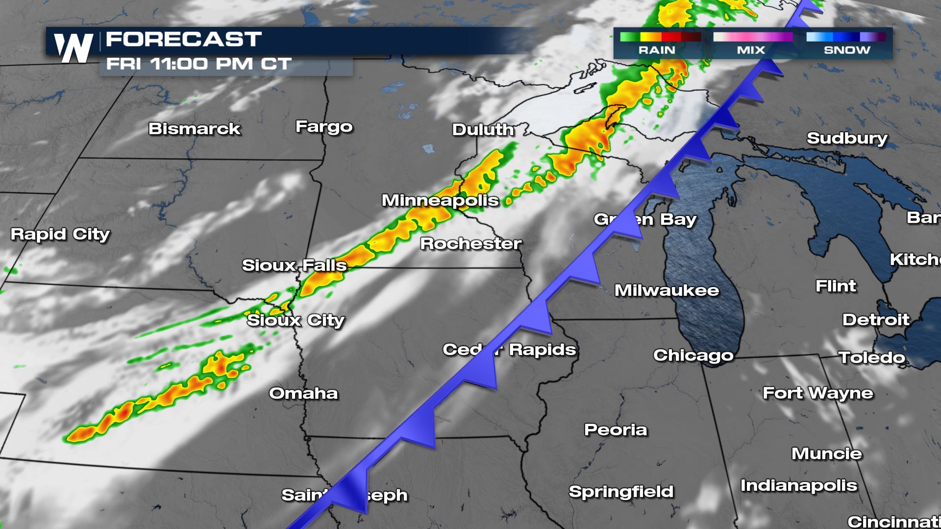
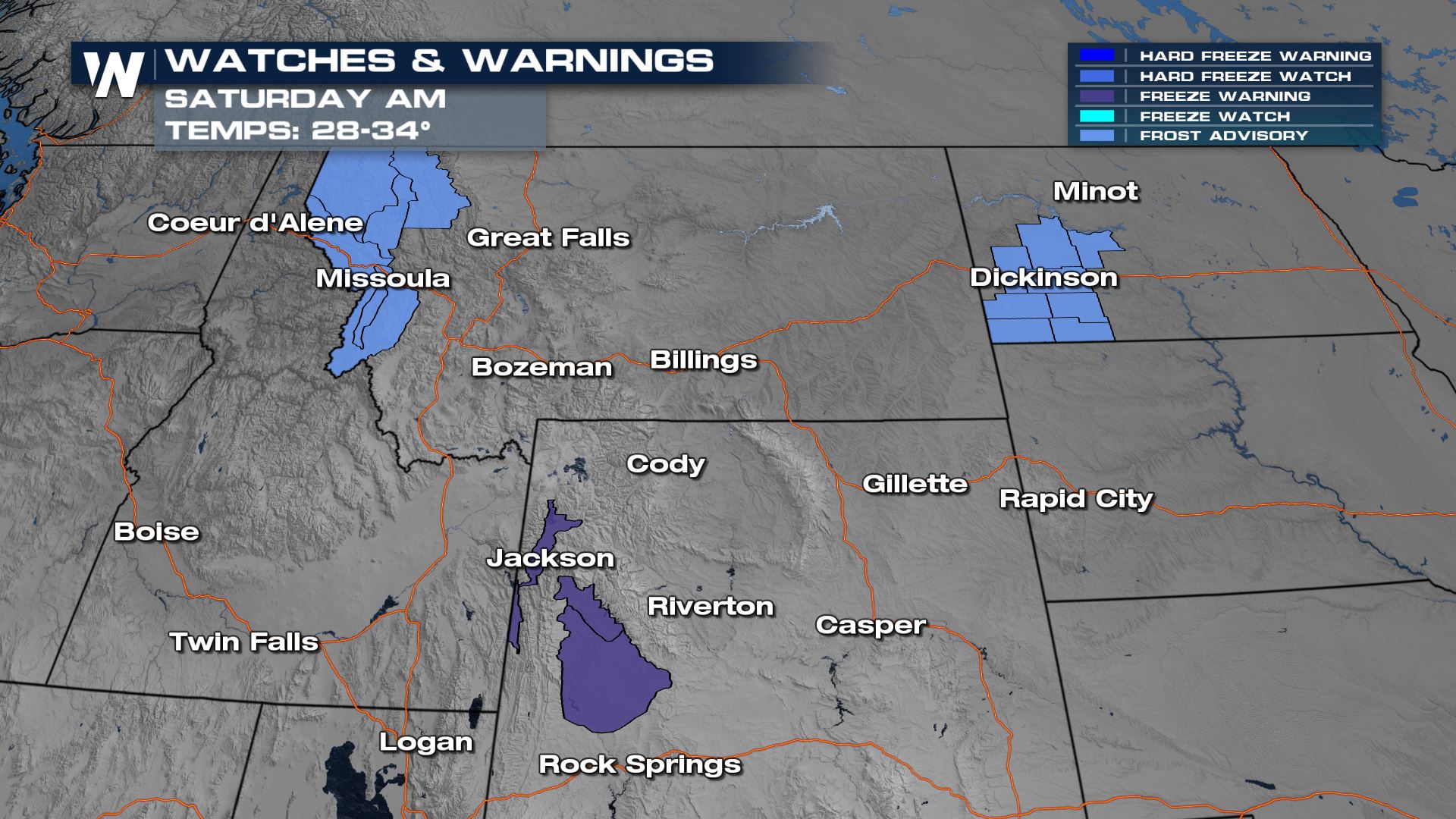
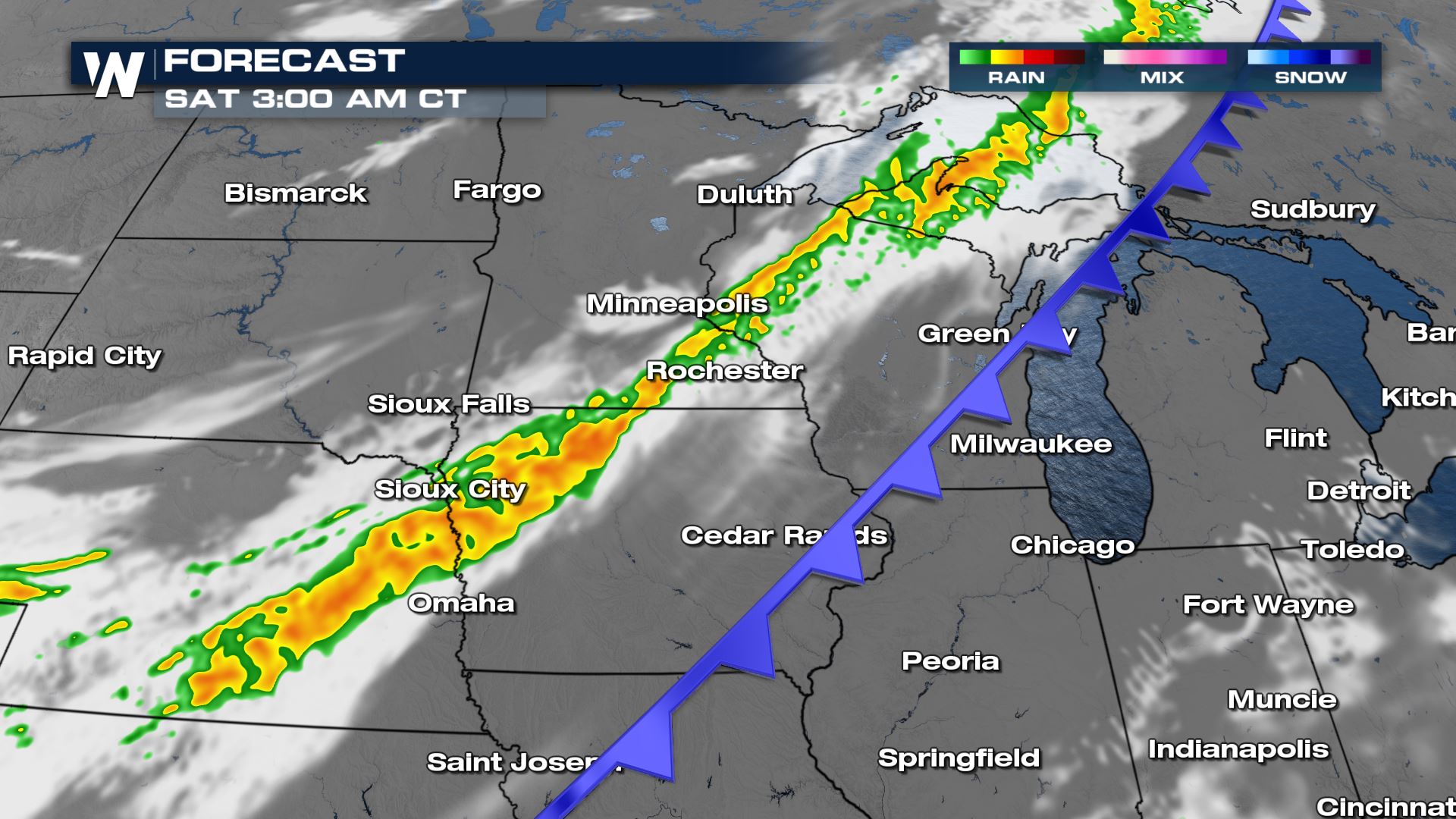 Some peeks of blue are even showing up in the higher peaks of Wyoming! A light dusting of snow can be seen in some of the showers on the cold side of the front overnight Friday in Saturday.
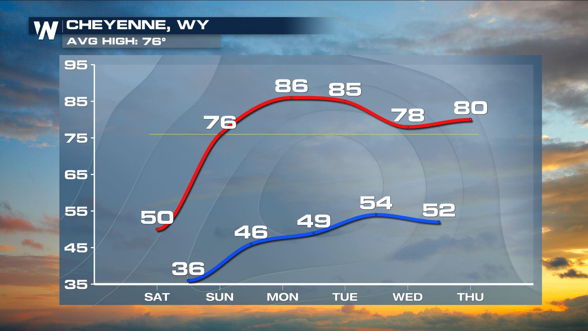
 Temps go so low overnight in Wyoming, Montana and North Dakota that a FREEZE alerts have been issued for the valleys and higher peaks! Jackson, WY could get as cold as 32°!
 For more on the temperature swing and the heavy rain concerns, join WeatherNation for your top weather headlines.
Severe Weather
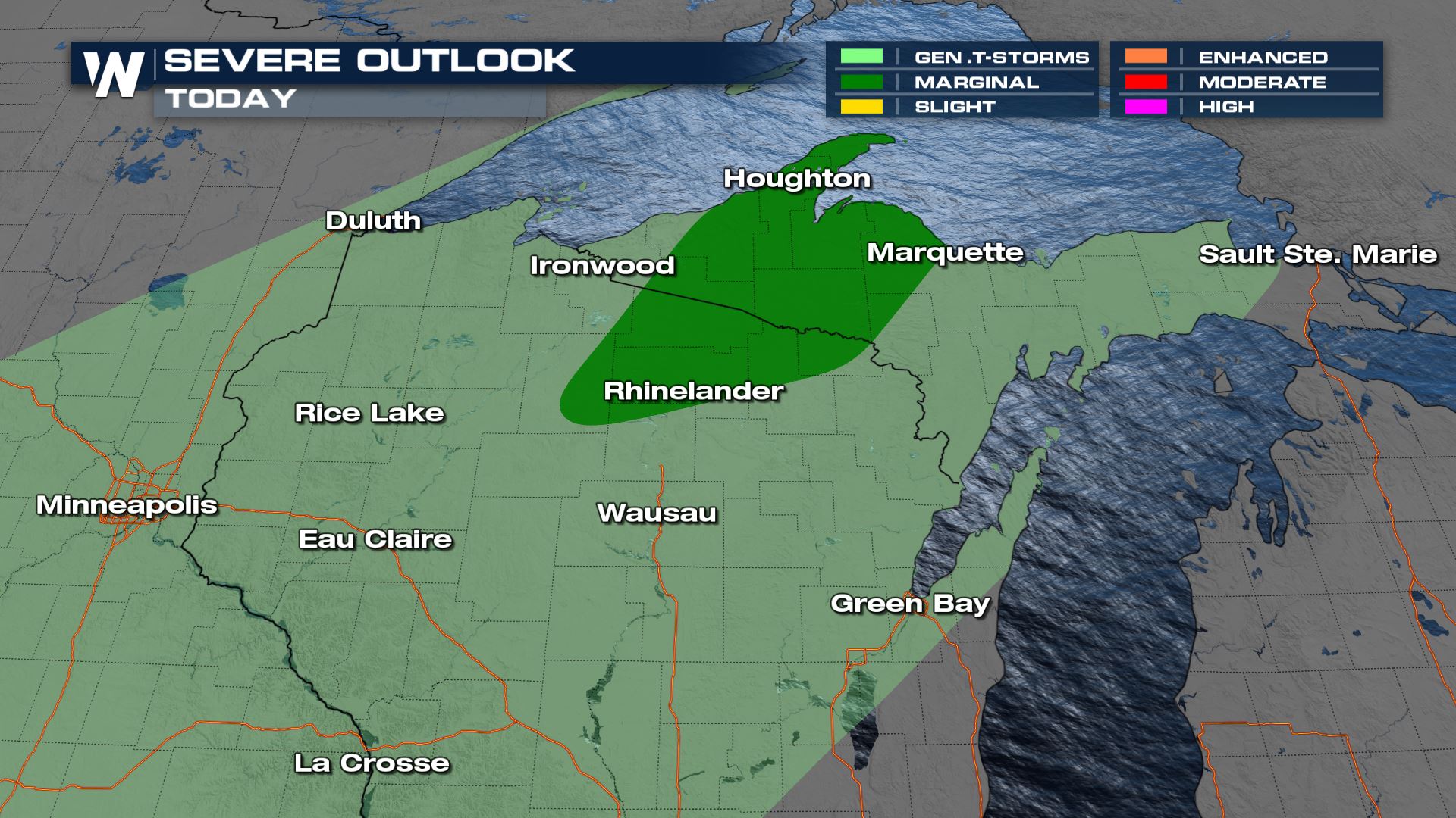
In addition to the temperature swing, will be heavy rain and the potential for severe weather, especially in the Northern Great Lakes. The Storm Prediction Center (SPC) has highlighted northern Wisconsin and Michigan for the potential for damaging winds later Friday afternoon and evening.
Heavy rain will be the focus for most, along the entire frontal boundary this afternoon and evening with locally heavy rain creating flood concerns. This rainfall is desperately needed for the High Plains where drought conditions are expanding deep into the September.
Some peeks of blue are even showing up in the higher peaks of Wyoming! A light dusting of snow can be seen in some of the showers on the cold side of the front overnight Friday in Saturday.
Temps
Most noticeable to everyone will be the temperatures and big cool off. Some of the coolest temperatures arrive today as the bottom drops out and the mercury dives 10-15 degrees BELOW average. Readings will start to climb in the High Plains and intermountain West later this weekend.
Temps go so low overnight in Wyoming, Montana and North Dakota that a FREEZE alerts have been issued for the valleys and higher peaks! Jackson, WY could get as cold as 32°!
For more on the temperature swing and the heavy rain concerns, join WeatherNation for your top weather headlines.All Weather News
More
Wildfire Outbreak in the Pacific Northwest
SPOKANE, WA - On Saturday, August 1st, the Ol
3 Aug 2026 1:55 AM

More Storms for the East Through Monday
A low-pressure system that moved through the
3 Aug 2026 1:50 AM


After Reaching Category 5, Genevieve Weakens in the Pacific
PacificGenevieve formed last Friday south of
3 Aug 2026 12:30 AM

Flooding, Severe Storms Target the Midwest Again
After an active week of storms across the nor
1 Aug 2026 1:40 AM

Flooding Risk Increases as Heavy Rain Targets the Tri-State Area
Tuesday, heavy rainfall moved across the Nort
30 Jul 2026 12:25 AM

Severe Weather: Energy From the Midwest Now in the Southeast
UPPER MIDWEST - Through Monday, dangerous tor
29 Jul 2026 10:30 PM