Major Pattern Change Coming to Desert Southwest
Special Stories
7 Feb 2018 6:33 PM
A major pattern shift for the Southwestern United States will result in rain chances returning to the area.
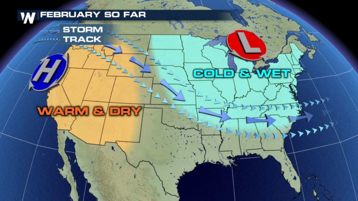 This year so far has been warm and dry across most of the Southwest. Numerous cities have broken daily record highs thanks to a persistent Santa Ana setup.
A ridge of high pressure has been parked across much of the West coast, leading to abnormally dry conditions so far this winter.
Los Angeles typically receives the most amount of rain (for the year) during the month of February, averaging nearly four inches.
Finally, a typical February pattern appears to be setting up as we enter next week.
This year so far has been warm and dry across most of the Southwest. Numerous cities have broken daily record highs thanks to a persistent Santa Ana setup.
A ridge of high pressure has been parked across much of the West coast, leading to abnormally dry conditions so far this winter.
Los Angeles typically receives the most amount of rain (for the year) during the month of February, averaging nearly four inches.
Finally, a typical February pattern appears to be setting up as we enter next week.
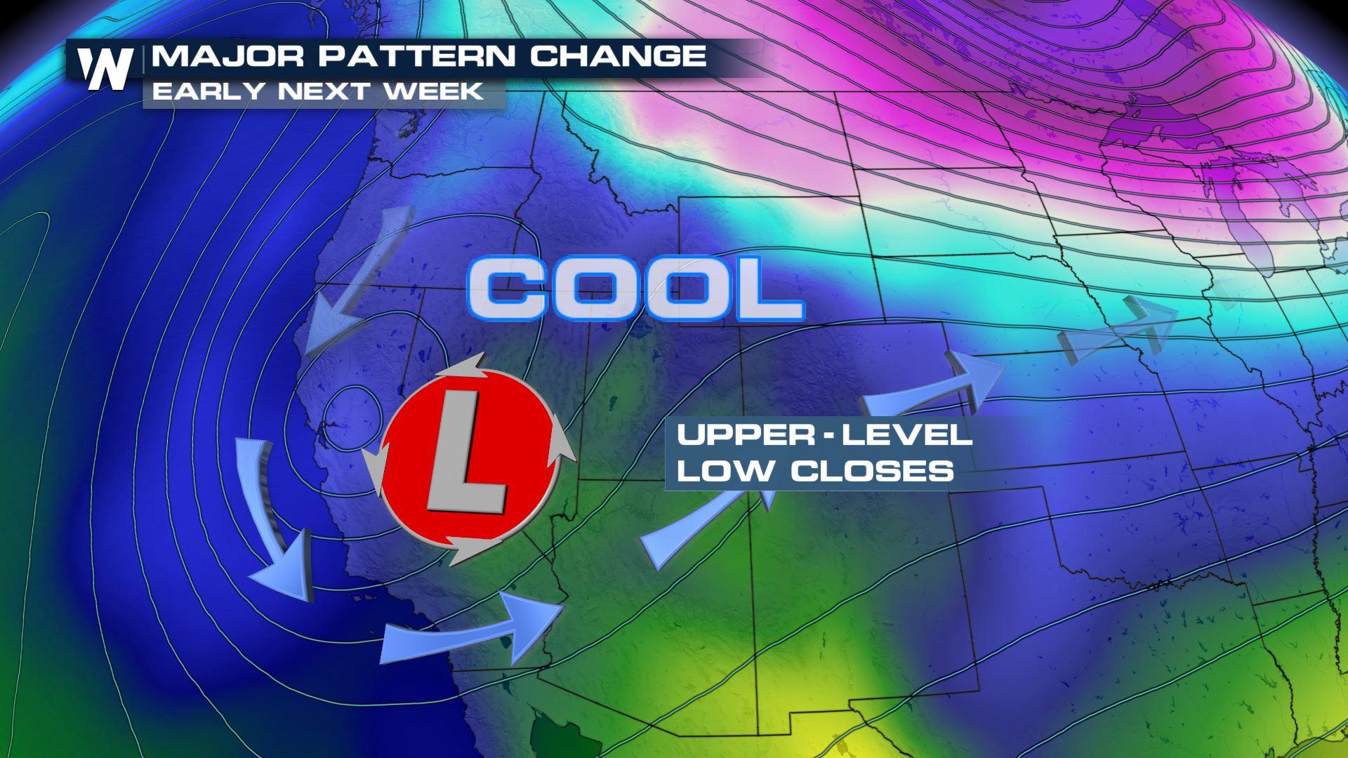
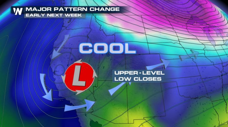 The area of high pressure begins to break down and low pressure takes over. We are expecting what's called a cut-off low over the desert southwest. This means several days of cloudy, cooler and unsettled weather.
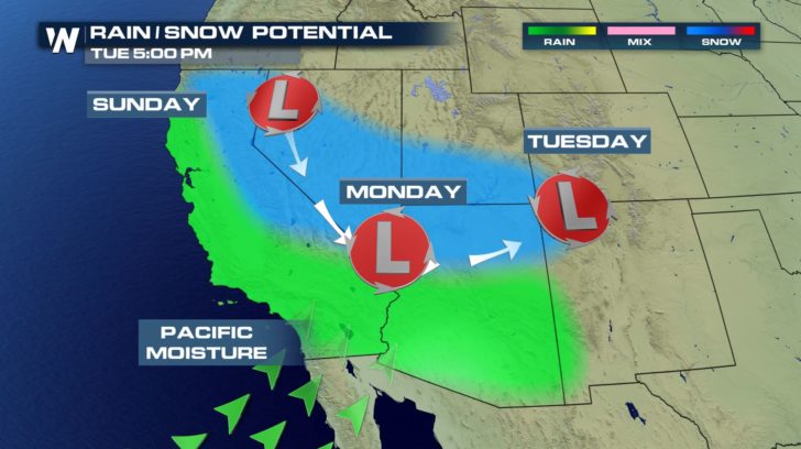 A storm center parked over the Southwestern United States typically results in an influx of Pacific moisture. This means areas of Southern California will soon see rain chances return to the area. Further to the north, snow chances develop early next week.
It doesn't look like any day will be a total washout for major cities across the Southwest, but it will be a notable difference when the clouds remain in place for quite a few days. This will help drought conditions and fire weather conditions that have persisted so far this year.
For WeatherNation, Meteorologist Nick Merianos
A storm center parked over the Southwestern United States typically results in an influx of Pacific moisture. This means areas of Southern California will soon see rain chances return to the area. Further to the north, snow chances develop early next week.
It doesn't look like any day will be a total washout for major cities across the Southwest, but it will be a notable difference when the clouds remain in place for quite a few days. This will help drought conditions and fire weather conditions that have persisted so far this year.
For WeatherNation, Meteorologist Nick Merianos
This year so far has been warm and dry across most of the Southwest. Numerous cities have broken daily record highs thanks to a persistent Santa Ana setup.
A ridge of high pressure has been parked across much of the West coast, leading to abnormally dry conditions so far this winter.
Los Angeles typically receives the most amount of rain (for the year) during the month of February, averaging nearly four inches.
Finally, a typical February pattern appears to be setting up as we enter next week.
The area of high pressure begins to break down and low pressure takes over. We are expecting what's called a cut-off low over the desert southwest. This means several days of cloudy, cooler and unsettled weather.
A storm center parked over the Southwestern United States typically results in an influx of Pacific moisture. This means areas of Southern California will soon see rain chances return to the area. Further to the north, snow chances develop early next week.
It doesn't look like any day will be a total washout for major cities across the Southwest, but it will be a notable difference when the clouds remain in place for quite a few days. This will help drought conditions and fire weather conditions that have persisted so far this year.
For WeatherNation, Meteorologist Nick MerianosAll Weather News
More
System Late Week Roars into the Northeast
It's getting to be that time of year! Systems
13 Oct 2026 6:15 PM

Cooler Air & Snow Invades The Rockies
A digging trough is bringing cooler temperatu
13 Oct 2026 6:09 PM

Hot Weather Baking the Heartland This Week, Cooler Air Incoming
More records were broken across the central p
13 Oct 2026 5:55 PM

Tropics: Pacific Stays Hyperactive, Atlantic Quiets Down
Isaias ended the late-season streak of no hur
13 Oct 2026 11:45 AM

Severe Storms and Flooding Return to the Plains & Midwest
Severe weather looks to return to parts of th
13 Oct 2026 11:30 AM

Rachel Spreading Moisture Across the Southwest
Rachel came ashore in far northwestern Mexico
13 Oct 2026 12:10 AM

Isaias Makes Landfall as A Category 2, Recapping it's Impacts
Hurricane Isaias made landfall near Destin, F
12 Oct 2026 11:00 PM